


April 30 Breaking Record Heat With Some Storms And More Rain This Weekend
Tuesday, April 30 Morning Report Baltimore set a new record on Monday with a High Temperature of 92ºF at BWI. This broke the old mark set in 1974 of 91ºF.…
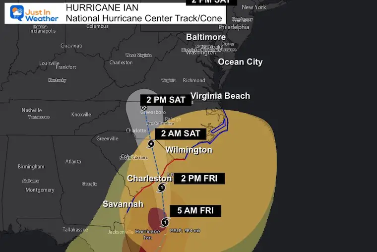
Friday Morning September 30, 2022
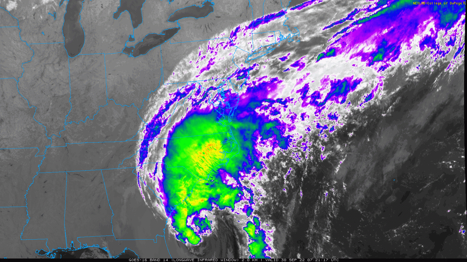
At 5 AM Hurricane Ian has shown a few things. The winds are stronger at 85 mph. However, the satellite image shows that it is losing its tropical characteristics, and is no longer symmetrical. The cloud and wind field has stretched out to the north as it interacts with land of the Eastern US and Canadian High Pressure. Tropical Storm Force Winds extend 485 miles away from the center. That is HUGE!
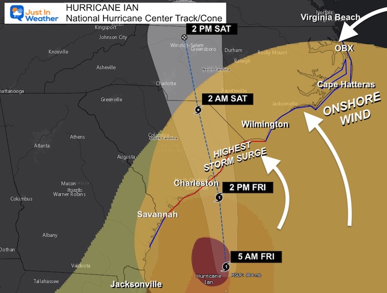
It is expected to make landfall at or just after noon today! The track has shifted just a little bit farther north of Charleston. This may help that town miss the worst of the storm surge. See the new map below.

The most destructive part of a landfalling hurricane is the storm surge. We just saw that in Florida (and I have included two videos on the pop out box here on this page).
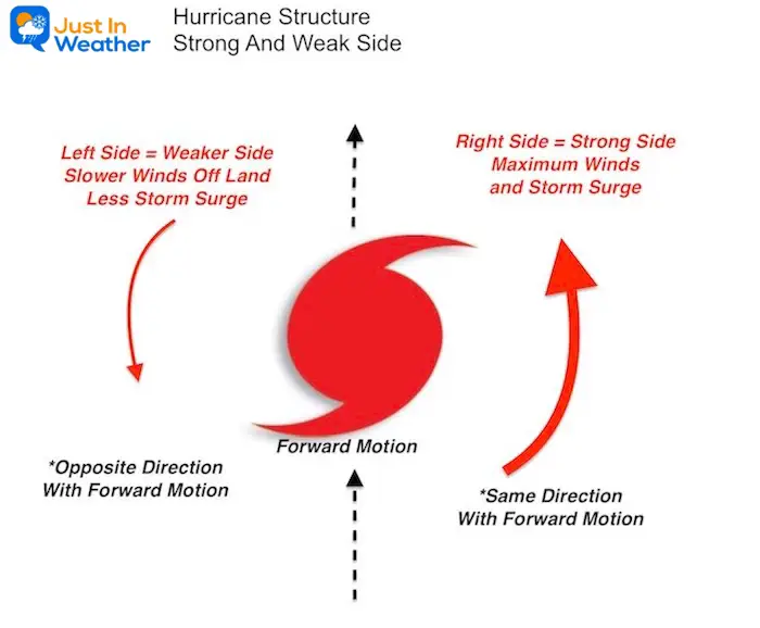
Here is a look at the forecast and IF landfall is just northeast Charleston SC… Who may get the strongest or weakest part of the storm.
This timing is about 1 to 2 hours slower than the European Model
A Hurricane Warning is in effect for…
* Savannah River to Cape Fear North Carolina
A Hurricane Watch is in effect for…
* East of Cape Fear to Surf City North Carolina
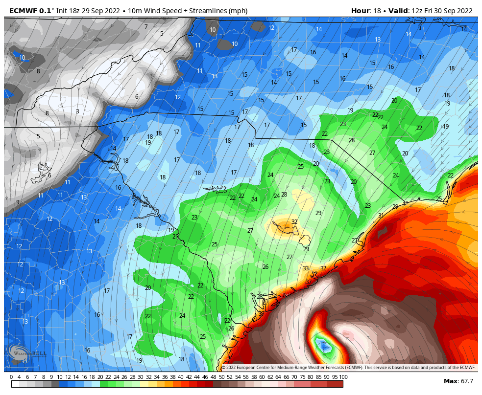
The right side is stronger due to winds moving onshore FROM the ocean or Onshore with the forward movement of the storm.
The left side is weaker with winds FROM the land or Offshore and opposite of the forward movement of the storm.
A Storm Surge Warning is in effect for…
* Flagler/Volusia County Line Florida to Cape Fear North Carolina
* Neuse River North Carolina
* St. Johns River Florida
A Storm Surge Watch is in effect for…
* North of Cape Fear to Duck North Carolina
* Pamlico River
* Cape Fear River
See how the Carolina Coastline was shaped by thousands of years of storms and how it can catch more or get protected further up the coast.
How Hurricanes Interact With Land And Helped Shape The US East Coast
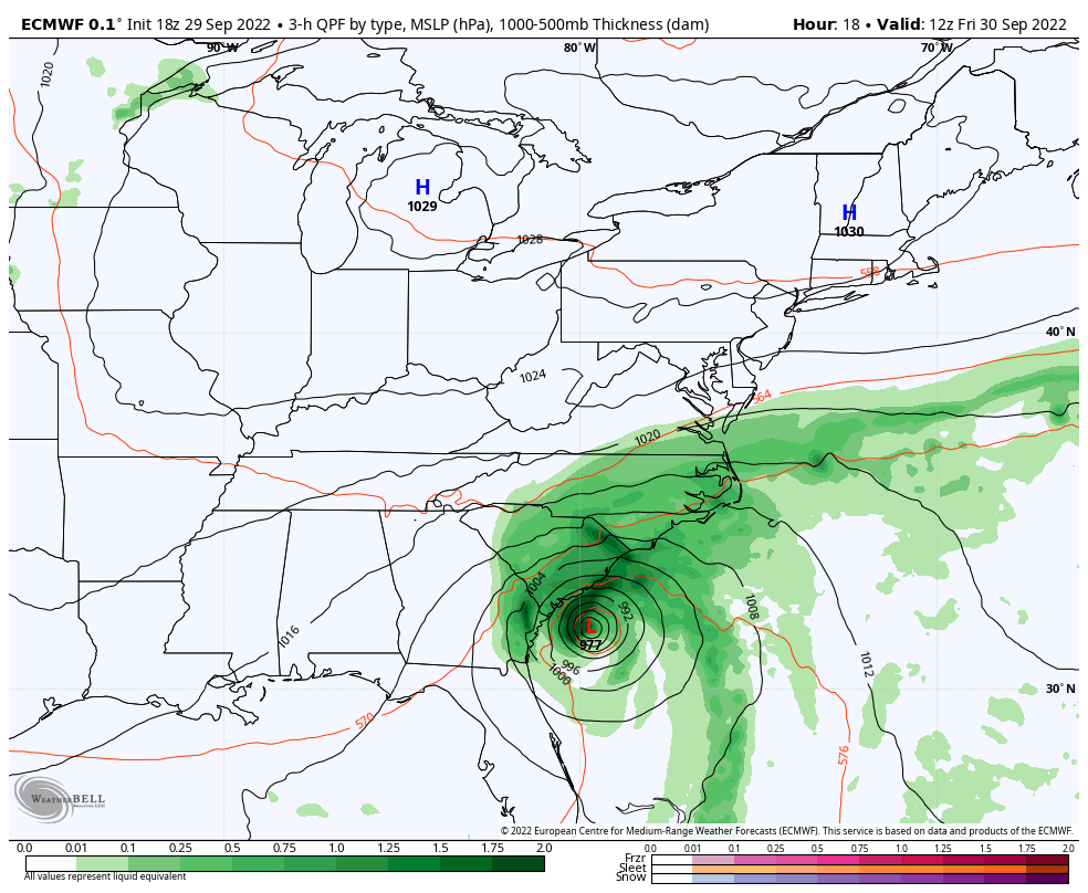
Forecast: Storm Simulation
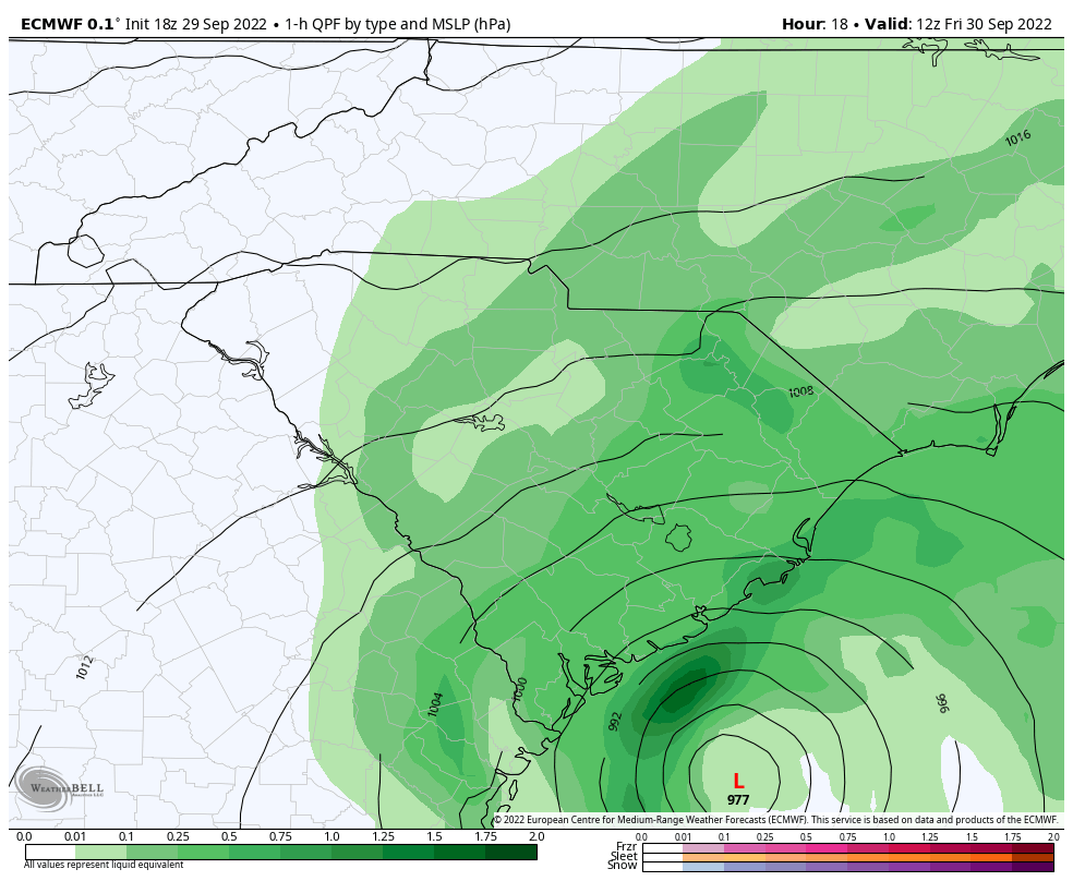
8 AM Friday to 8 Pm Sunday
Heavy rain spreads inland and reaches Maryland to start the weekend
(I will have a local look at the Mid Atlantic in my morning report)
185 mph in 1935 – Labor Day Day (unnamed)
175 mph in 1969 – Camile
165 mph in 1992 – Andrew
160 mph in 2018 – Michael
155 mph in 2023 – Ian
Since 1954, 94 storms have had their names retired.
I named storms are 13 of them.
Since 2000, 44 storm names were retired.
Of them, 11 began with the letter I. This is going to be number 12.
Hurricane Ian May Help Cooler Pattern Change: Monitor For Atmospheric Memory This Winter
If you want a snowy winter, this is what you might want to look for in the rest of the tropical season.
Record August For No Named Tropical Storms: Closer Look At Snow Following
NOAA 2022 Hurricane Forecast- Above Normal Again

NOAA Study: Reducing Air Pollution INCREASED Tropical Storms

Atlantic Tropical History: Maps of Origin Regions Every 10 Days


Click to see more and ‘Book’ a visit to your school
