


April 17 More Clouds And Cooler With A Return Of Rain And Thunderstorms
Wednesday, April 17 Morning Report The warm weather we have had continues to step backwards. After 80s on Monday and 70s yesterday, today many in our region can expect the…
Thursday Evening September 29
Did you see a spectacular sunset today? Clouds from Ian streamed about 1,000 miles up the East Coast of the US. This spectacular satellite loop below shows it well. This is actually a hint at the rain on the way behind it, which we will explore.
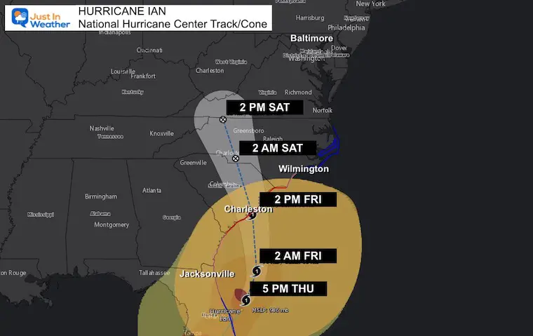
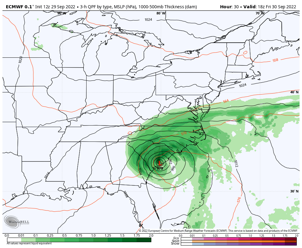
Ian became a hurricane again this afternoon as it traveled over the warmer water of the Gulf Stream. It has winds of 75 mph and is setting up for landfall near Charleston, SC on Friday afternoon.
This report has a quick update on the storm, but more focus on looking into the weekend for Maryland and the Mid Atlantic. I’ve been asked about two main events this weekend with concern for the rain: The Music Festival in Ocean City was to be all weekend, but was canceled. There is still a Michigan State at Maryland football game Saturday. We may get a break for a few hours Saturday afternoon, but overall a chilly and damp feel will be with us all weekend.
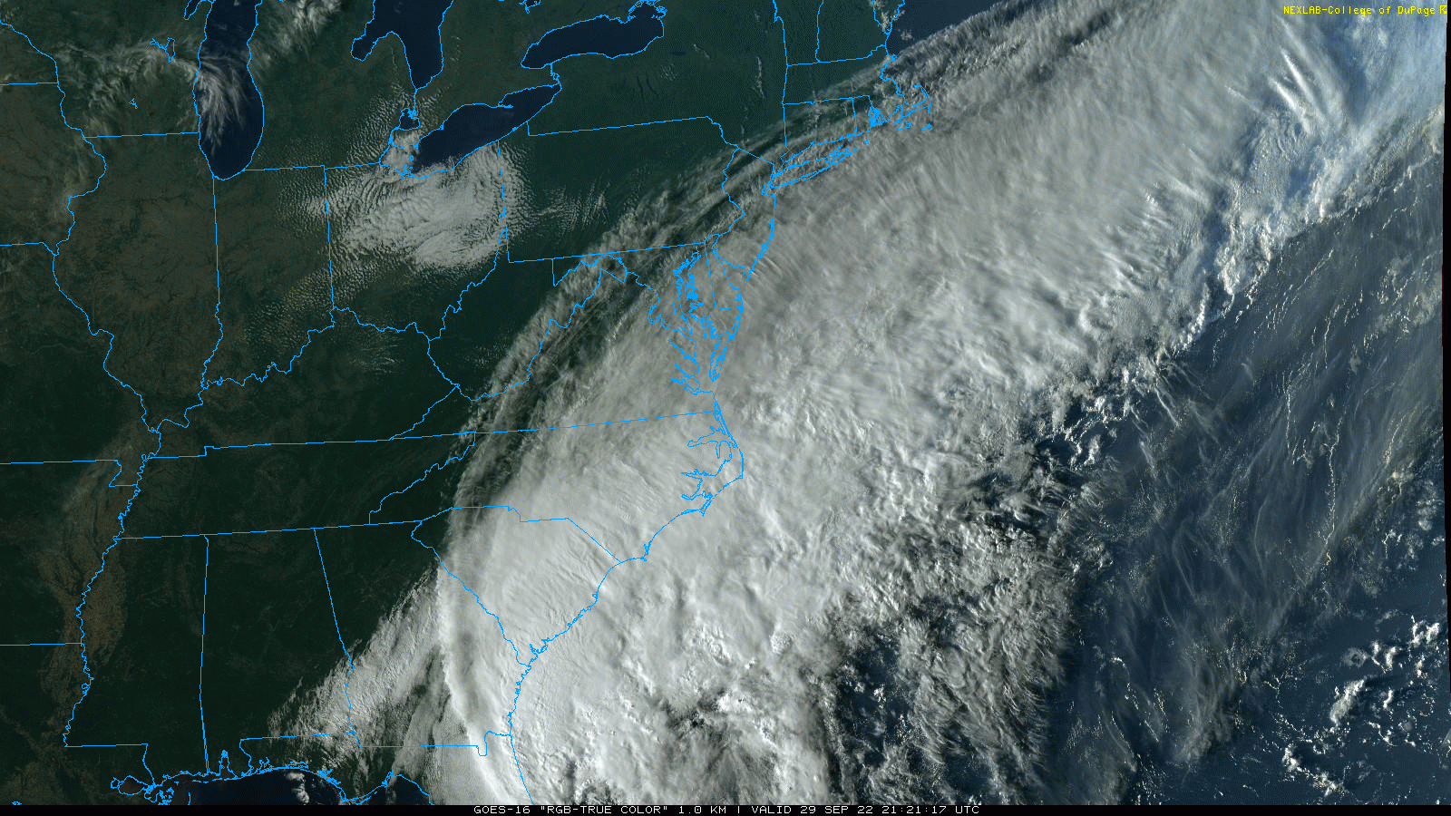
Those ripples were cirrus clouds overtaking the High Pressure in place. This shows that the moisture of Ian will eventually win.

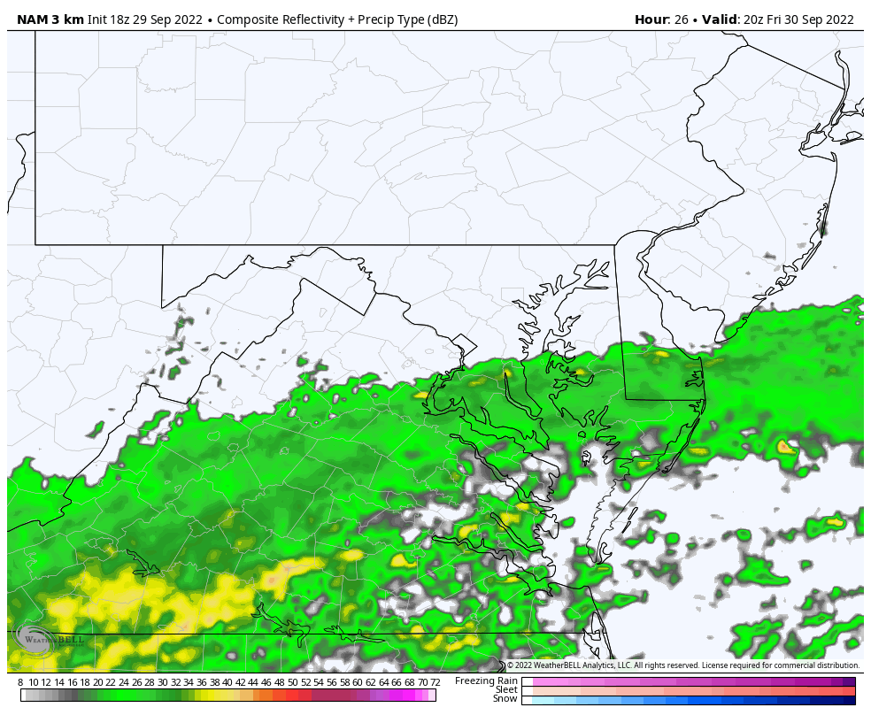
Evening Snapshot at 8 PM
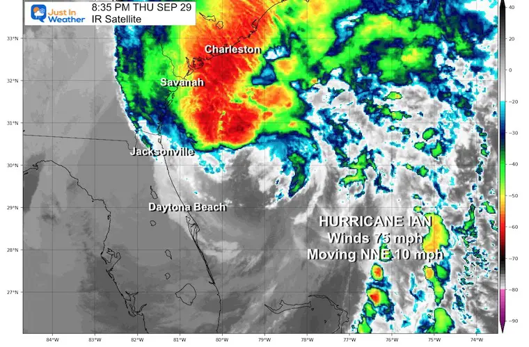
Quick Stats
See The Landfall: Click for the radar loop and two fascinating videos of opposite Storm Surges
Hurricane Ian Made Landfall On Captiva Florida: Doppler Radar And Amazing Surge Video
It will make landfall by Friday afternoon, then track inland. The rain will expand north all day and night.
Hurricane Ian Back to Category 1: Warning And Storm Surge Focus For South Carolina
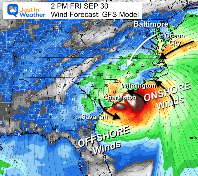
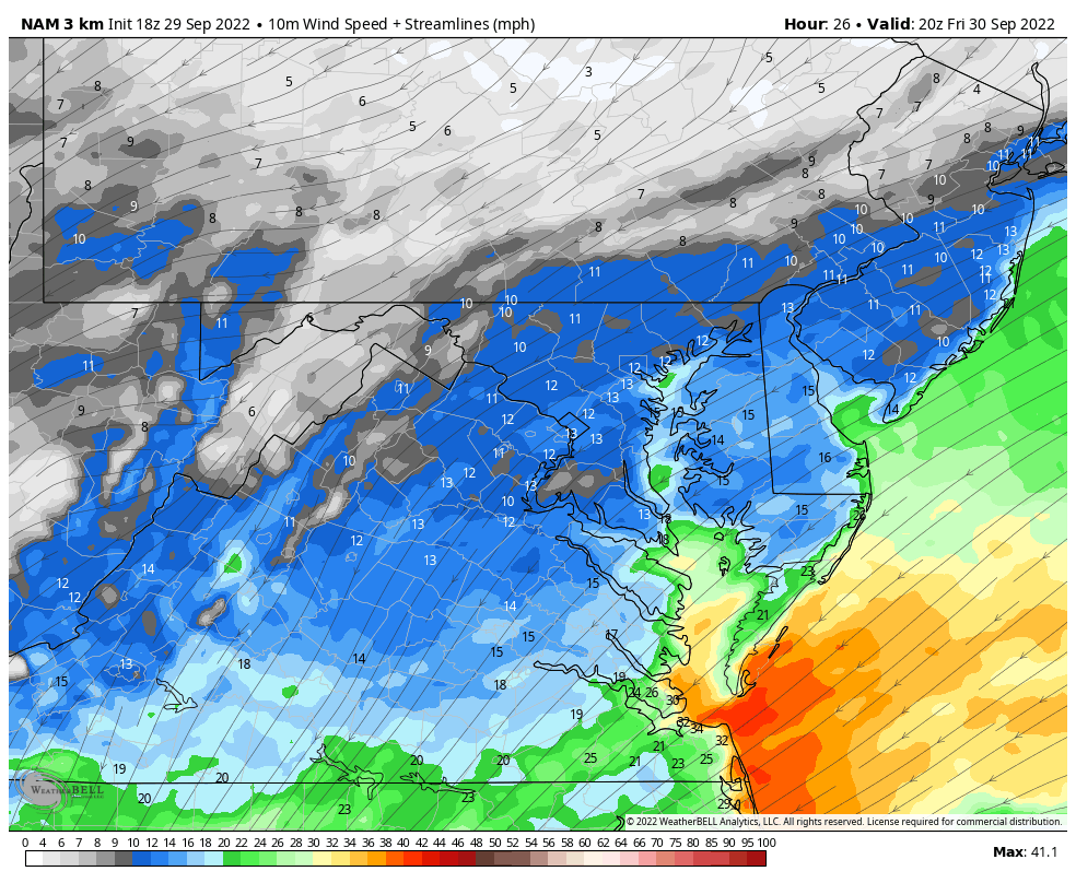
Let’s look at the wind first, then the rain.
It is important to note that landfall will be hundreds of miles away. The shape of the coastline protects Virginia and Delmarva from the surge.
How Hurricanes Interact With Land And Helped Shape The US East Coast
The Northeast Wind will steady and chilly. However it will be pushing water down the Bay.
Ocean City and the beaches will get some beach erosion like a Nor’easter.
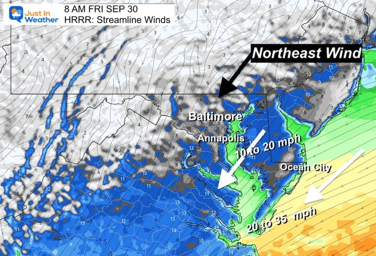
The wind will remain FROM the Northeast and increasing a little, but not to Tropical Storm Intensity. However, there my be some brief GUSTS 40 to 50 mph on the southern Bay and ocean coast.
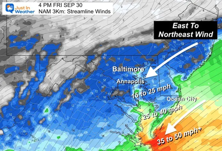
As we can see, the winds will remain steady overnight, but actually might ease a little on Saturday.
Rain will reach Ocean City during the morning and it will remain well there into Saturday.
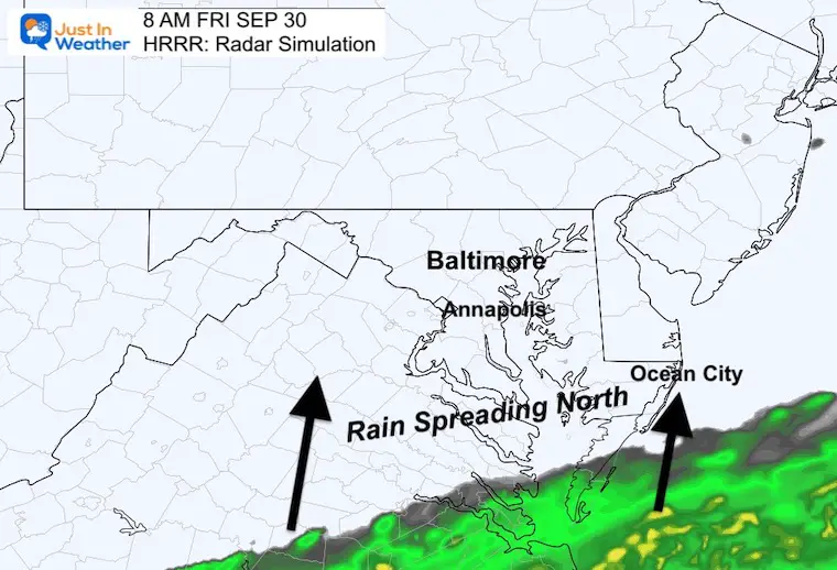
The rain will overspread our region from the south during Friday afternoon and evening.
Saturday Morning: Some pockets of heavy downpours and even rumbles of thunder possible.
Saturday Afternoon: This is when it gets tricky. The rain will split from the center Low and break up into showers.
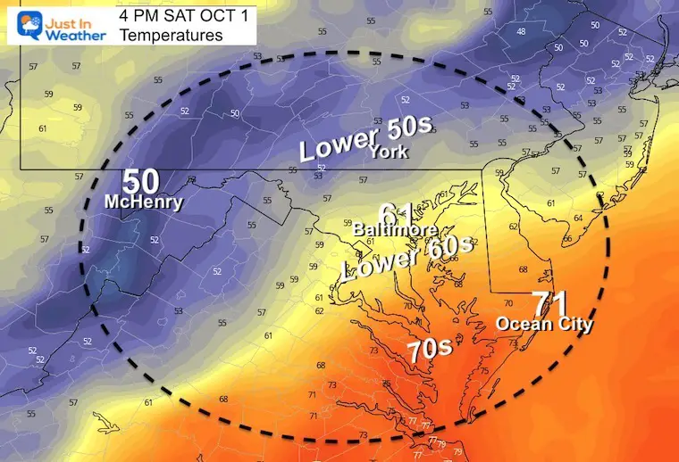
We may get a few dry hours, but it will still be chilly and damp.
Most of the region will be chilly.
The lower 70s on Delmarva will be thanks to winds off the ocean, however it will be damp and feel chilly!
Plotting the rain and circulation inland, we can see the rain split later Saturday, then redevelopment on Sunday.
The new Low Pressure trying to organize may pass through Maryland and off the coast keeping the risk of rain showers around through Tuesday.
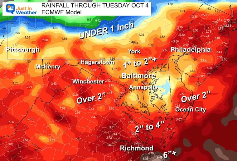
Rainfall Forecast:
Hurricane Ian May Help Cooler Pattern Change: Monitor For Atmospheric Memory This Winter
If you want a snowy winter, this is what you might want to look for in the rest of the tropical season.
Record August For No Named Tropical Storms: Closer Look At Snow Following
NOAA 2022 Hurricane Forecast- Above Normal Again

NOAA Study: Reducing Air Pollution INCREASED Tropical Storms

Atlantic Tropical History: Maps of Origin Regions Every 10 Days

Click to see more and ‘Book’ a visit to your school
