


May 12 Mothers Day Showers And Another Aurora Viewing Tonight May Be Better
Sunday May 12 Mother's Day Morning Report Today, we focus on the all-important Mother’s Day weather and the ongoing impact of the latest Solar Storm. We have been stuck in…
Sunday April 28
Morning Report
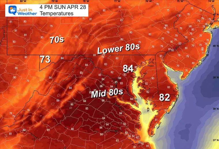
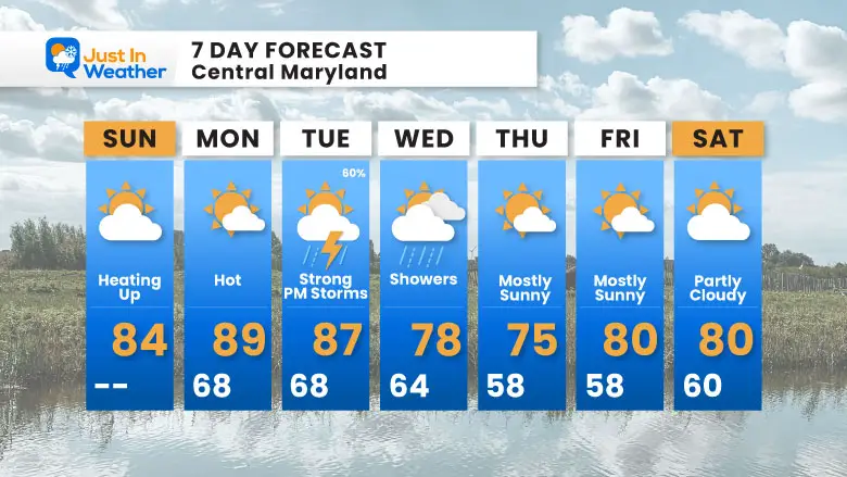
We start this day with thick fog and it might not seem like a change is on the way. A Dense Fog Advisory is in place until 9 AM, but it will burn off as sun and warmer air will take over. We will jump into the 80s!
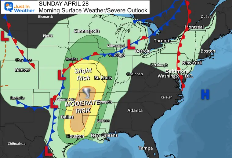
The central US has been dealing with extreme weather for a few days and once again it is expected today. We may have to watch how this energy will transfer when we get into the heat and storms in our area on Tuesday.
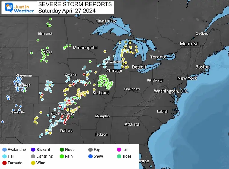
This has been a multi-day event with destructive storms. This is an example of what storm chasers have captured.
Storm Chaser Adam Lucio posted this on his Facebook Page.
This same area across the Southern Plains is in the risk area.
There has been some dense fog as the warm and humid air is pushing the chill away. This is common and will burn off. Once the sun breaks out, summer heat will surge in!
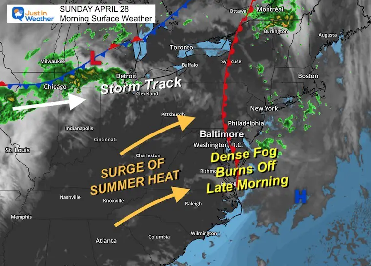
The breeze will not be strong, but as it will be from the South to Southwest it will that heat to flow in!
Sunrise at 6:13 AM
Sunset at 7:57 PM
Normal Low in Baltimore: 48ºF
Record 33ºF in 1998
Normal High in Baltimore: 71ºF
Record 90ºF 1957
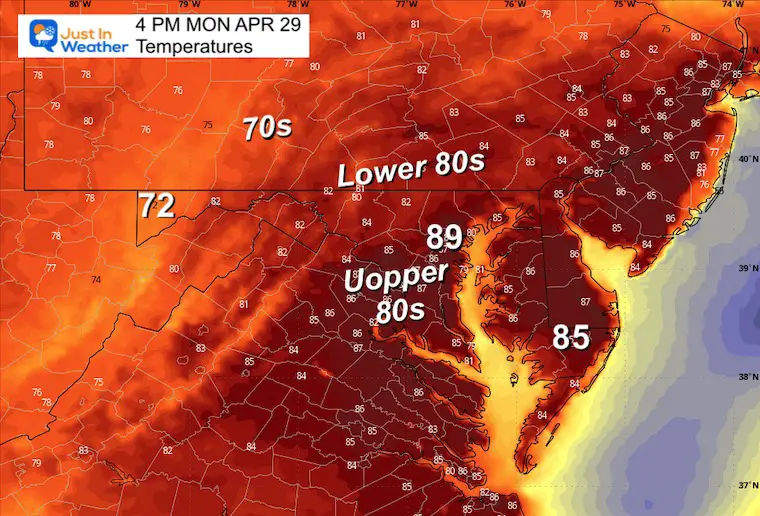
The best chance for storms that may turn strong to severe will be Tuesday afternoon and evening.
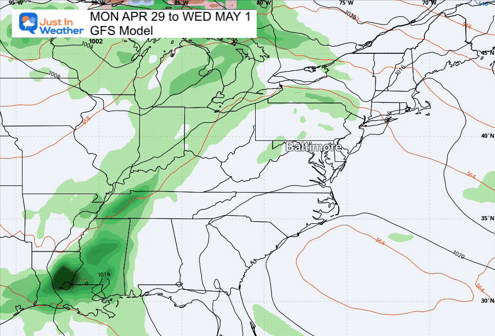
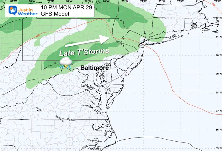
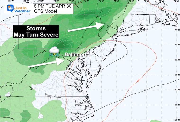
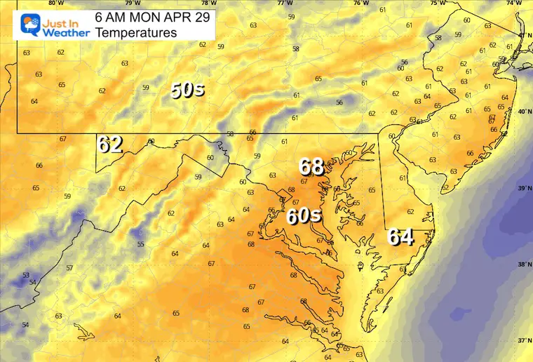
Our best chance for storms is Tuesday afternoon. Then, there will be a slight drop in the temperatures but remaining warm.
Click to see more and ‘Book’ a visit to your school

I am aware there are some spelling and grammar typos and occasional other glitches. I take responsibility for my mistakes and even the computer glitches I may miss. I have made a few public statements over the years, but if you are new here, you may have missed it: I have dyslexia and found out during my second year at Cornell University. It didn’t stop me from getting my meteorology degree and being the first to get the AMS CBM in the Baltimore/Washington region.
One of my professors told me that I had made it that far without knowing and to not let it be a crutch going forward. That was Mark Wysocki, and he was absolutely correct! I do miss my mistakes in my own proofreading. The autocorrect spell check on my computer sometimes does an injustice to make it worse. I also can make mistakes in forecasting. No one is perfect at predicting the future. All of the maps and information are accurate. The ‘wordy’ stuff can get sticky.
There has been no editor who can check my work while writing and to have it ready to send out in a newsworthy timeline. Barbara Werner is a member of the web team that helps me maintain this site. She has taken it upon herself to edit typos when she is available. That could be AFTER you read this. I accept this and perhaps proves what you read is really from me… It’s part of my charm. #FITF