September 16 Heating Up This Weekend Plus Tropical Storm Fiona Watch
September 16, 2022
Friday Morning Update
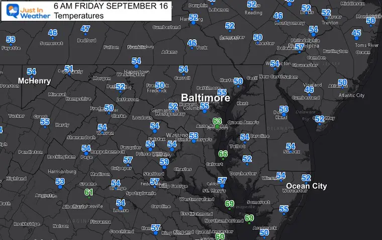
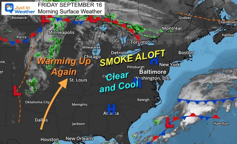
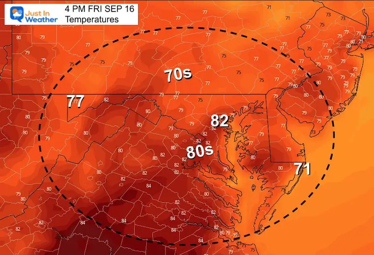
High Pressure is in control, which has allowed a clear sky and widespread cooling. Many thermometers are in the 50s this morning. We should recover this afternoon back to the lower 80s. The trend this weekend will be warming and then hot again into next week.
Temperatures
Smokey Sunrise Again?
Sunrise is 6:48 AM
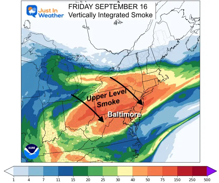
Wildfire smoke has made its way across the country and has reached us very high in the atmosphere. The model plots show the density of smoke in our region this morning.
Sunrise (smoke enhanced) From Thursday

Model Plot at 7 AM
This was the sunrise on Thursday in Maryland. The deep orange color was the result of the smoke helping to enhance the refraction of sunlight. We could see something similar this morning and again this weekend.
Morning Surface Weather
High Pressure is in control and will remain through the weekend. This will keep our weather dry, however there may be some clouds mixing in this afternoon.
Afternoon Temperatures:
Another Spectacular Day!
Tropical Storm Fiona
Winds are holding at 50 mph as Fiona has run into wind sheer. Yesterday this was seen on satellite when the surface circulation became separated from the main convection. This was Thursday afternoon:
Naked swirl alert #Fiona pic.twitter.com/X7QnEf0jlr
— Mike Ventrice (@MJVentrice) September 15, 2022
Snapshot
This demonstrates the problem the Atlantic has had generating storms all season. There is a lot of wind sheer. Stronger upper level winds are blowing from the west, cutting the top off the storm, exposing the center, and limiting further intensification.

This morning, the storm is trying hard to reorganize and wrap the convection back to the center. So heavy rain is still expected when this crosses the Leeward Islands, Virgin Islands, and Puerto Rico.
Rainfall Forecast: 4 to 6 inches with as much as 10 inches.
Forecast Track
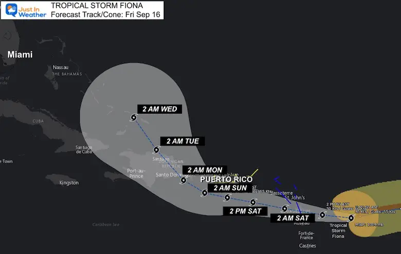
WATCHES AND WARNINGS
——————–
CHANGES WITH THIS ADVISORY:
None.
SUMMARY OF WATCHES AND WARNINGS IN EFFECT:
A Tropical Storm Warning is in effect for…
* Antigua, Barbuda, St. Kitts, Nevis, Montserrat, and Anguilla
* Saba and St. Eustatius
* St. Maarten
* Guadeloupe, St. Barthelemy, and St. Martin
A Tropical Storm Watch is in effect for…
* Puerto Rico, including Vieques and Culebra
* U.S. Virgin Islands
* British Virgin Islands
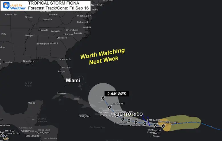
Watching Next: Week East Coast
CLIMATE DATA
TODAY September 16
Normal Low in Baltimore: 59ºF
Record 41ºF in 1873
Normal High in Baltimore: 80ºF
Record 98ºF 1991
Weather posts straight to your inbox
Sign up and be the first to know!
September Begins Meteorological Autumn
Climate Data/Weather Stats For The Month
Rainbow Ice Cave In Mt. Rainier A Very Rare Find: Photos And Video
STEM Assemblies/In School Fields Trips Are Back
Click to see more and ‘Book’ a visit to your school
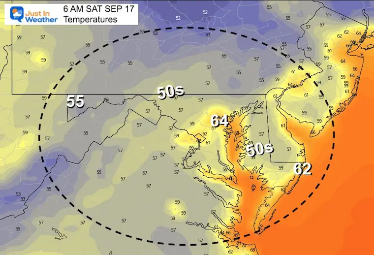
Saturday Temperatures
Morning
Afternoon

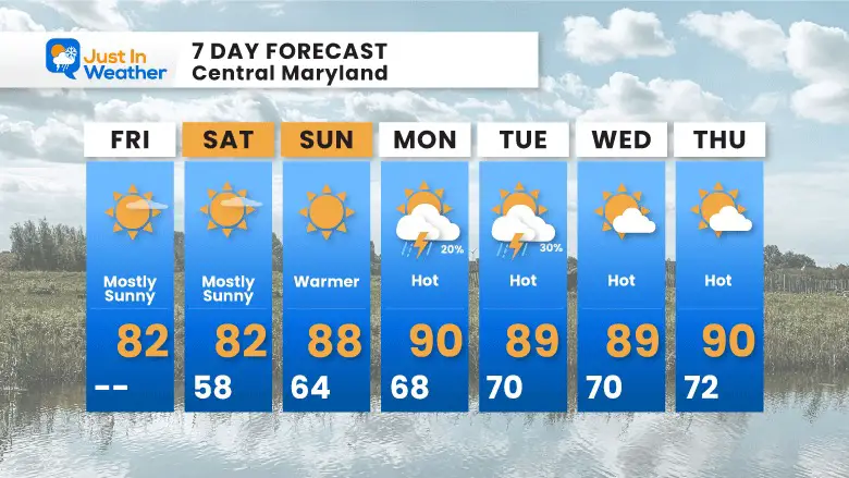
7 Day Forecast
Temps heat up for our ‘second summer’. The next chance for rain appears to be early next week, and that risk is low.
In Case You Missed It: Seem Early Winter Outlooks
COMPARE TO THE PAST
If you want a snowy winter, this is what you might want to look for in the rest of the tropical season.
Rainbow Ice Cave In Mt. Rainier A Very Rare Find: Photos And Video
Hurricane Season Forecast: June 1 Through November 30
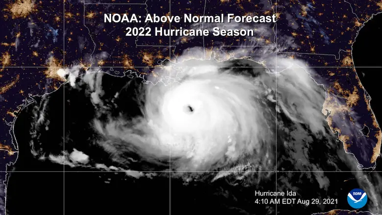
NOAA 2022 Hurricane Forecast- Above Normal Again
Forecast From Colorado State University
Related Posts
NOAA Study: Reducing Air Pollution INCREASED Tropical Storms
Atlantic Tropical History: Maps of Origin Regions Every 10 Days
Rainbow Ice Cave In Mt Rainier
Rainbow Ice Cave In Mt. Rainier A Very Rare Find: Photos And Video
Please share your thoughts, best weather pics/videos, or just keep in touch via social media
-
Facebook: Justin Berk, Meteorologist
-
Twitter: @JustinWeather
-
Instagram: justinweather


