Monday Night Update
September 5 2022
If your kids or those by you have not gone back to school yet, Tuesday should be the day all area back in session. This sets the tone for a return to ‘regular’ schedules and more importantly more traffic on the roads.
Now let’s combine that with the heaviest rain with this storm system and it maybe worth allowing some extra time. The good news is that the bulk of the rain should break up by noon. There may be some leftover rain, but scattered the rest of the day.
The other good news (for the optimist) is that you are not going to be missing pool time. A developing Low Pressure will nearly stall off of the Mid Atlantic coast much of this week. That will keep us under a cooler easterly wind with more showers on Wednesday.
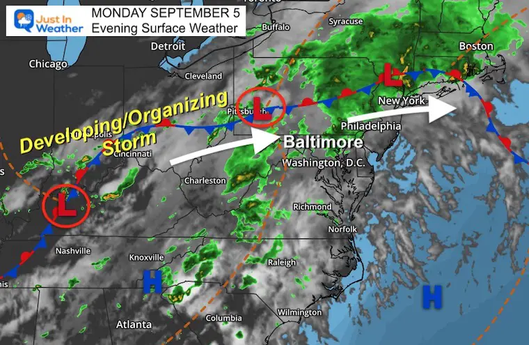
Monday Evening Surface Weather
The stationary front and scattered clusters of rain look disorganized, but this system will try to develop into Tuesday. That is what will enhance our rain early in the morning, then lead to a Low Pressure stalling off the coast much of this week.
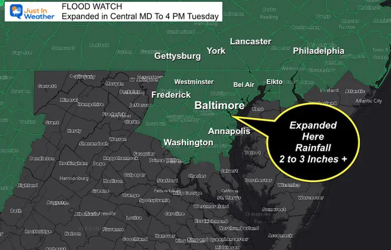
Flood Watch: Expanded Through Southern PA
UPDATED: NWS Finally added Central Maryland to the Flood Watch (Through Tuesday afternoon).
Rainfall between 2 to 3 inches with locally higher amounts possible. Some dry ground may not be able to absorb this fast enough. See the demo video below…
Demo Video: Rain Soaking In The Soil
Too much of a good thing? Getting needed rainfall does not necessarily mean the heaviest or all at once. In fact, a light rain for many hours is the best thing for parched soil. This is because it needs time to prepare for absorbing the water.
Check out this demonstration from a meteorologist at the University of Reading…
Live Radar Widget
Compare to the Model Simulations Below
MODEL SIMULATION
Note: The model bias continues to be a little slow and underplaying rain events. Please consider the timeframes may verify 1 hour earlier and rain intensity may cover more areas than shown here.
Sunrise ‘Suggested’ Snapshot
Sunrise
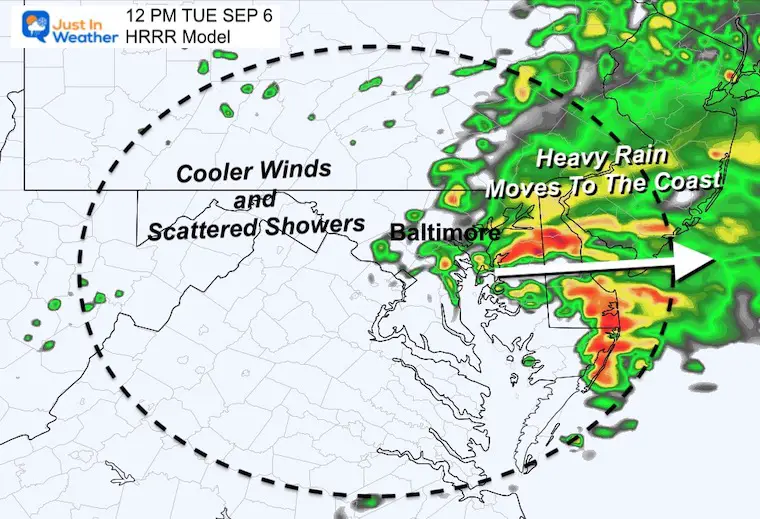
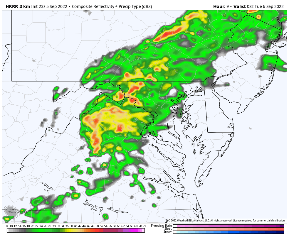
The HRRR Model suggest that 6 AM will bring the heaviest rain through Central Maryland. This will include metro Washington, Baltimore, and York to Lancaster in PA.

Noon
Keeping in mind that the model bias may be slow, the bulk of the rain should be to the east of Baltimore before lunchtime.
HRRR Model Animation 4 AM to 1 PM
This helps show the enhanced rainfall as Low Pressure develops in the morning. The back edge of the main event should move to the east by Noon.
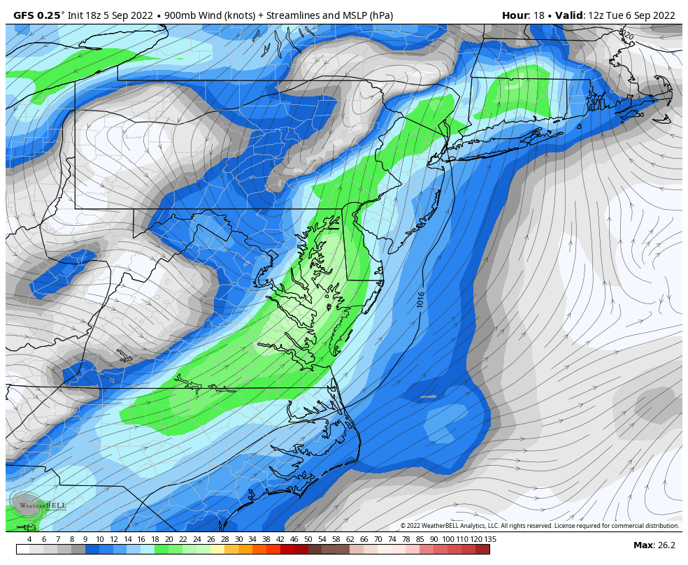
Wind Forecast Snapshots
See the animation below illustrating how this is expected to nearly stall for a few days.
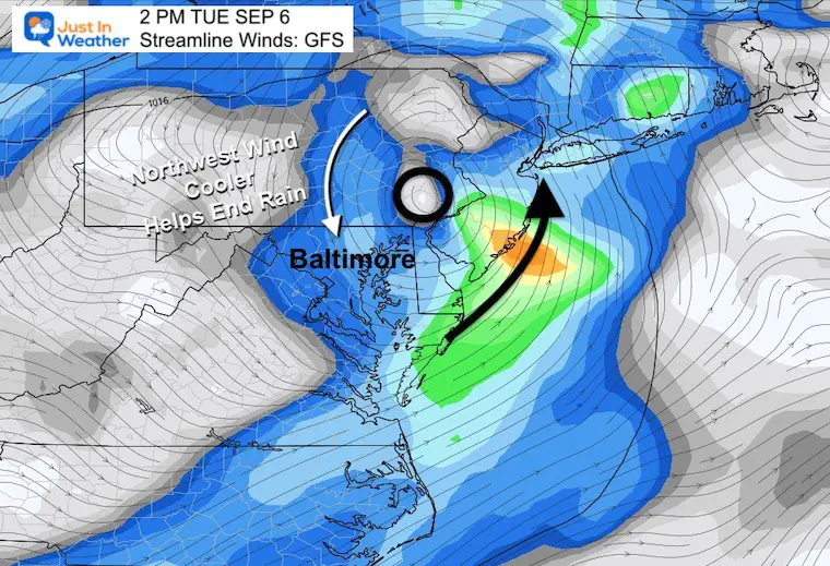
Tuesday Afternoon
Just above the surface, Low Pressure circulation should be forming cross southeastern PA. The wind shift to the North will help to push out the rain.
Wednesday Afternoon
A sturgeon Easterly wind will bring in moisture from the Atlantic. That will increase cloud cover and rain showers while keeping temps cooler.

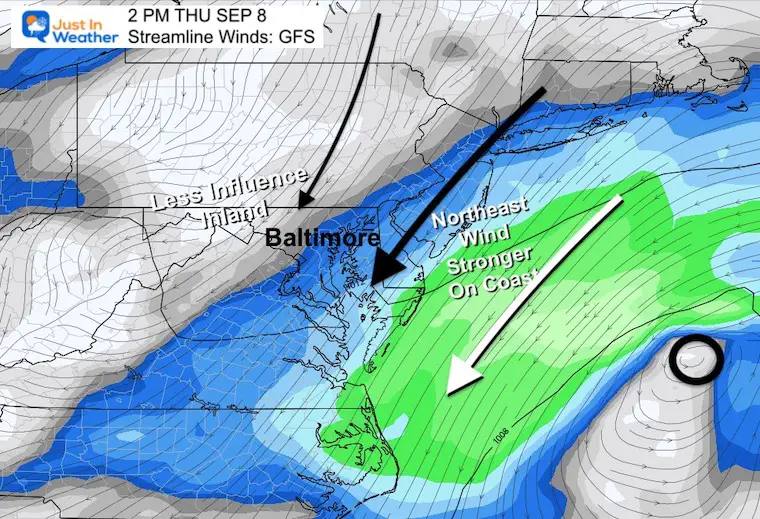
Thursday Afternoon
By this point the circulation off the coast should be moving far enough away to lose influence inland. That is why the sky should turn more sunny.
Strong winds along the beaches however will keep it cool with rough waves and rip currents.
Wind Forecast Animation 8 AM Tuesday to 2 PM Friday
My Notes:
Tuesday: For most of us the rain will be a morning thing, then dry but cooler winds in the afternoon. Some showers will refire inland during the afternoon.
Wednesday: Strong east winds will keep temps in the upper 60s to lower 70s. The air will be unstable and help develop widely scattered showers. Our chance of rain is around 40%.
Thursday: Strong, cool winds will last on the coast, but lose their influence inland. That is when clouds should break while the north flow will be pleasant and like early fall.
My morning report will have more details. I will aim to get that posted between 6 AM and 6:30 AM
September Begins Meteorological Autumn
Climate Data/Weather Stats For The Month
Rainbow Ice Cave In Mt. Rainier A Very Rare Find: Photos And Video
STEM Assemblies/In School Fields Trips Are Back
Click to see more and ‘Book’ a visit to your school

COMPARE TO THE PAST
If you want a snowy winter, this is why you might want to look for in the rest of the tropical season.
Rainbow Ice Cave In Mt. Rainier A Very Rare Find: Photos And Video
Hurricane Season Forecast: June 1 Through November 30
NOAA 2022 Hurricane Forecast- Above Normal Again

Forecast From Colorado State University
Atlantic Hurricane Forecast

Related Posts
NOAA Study: Reducing Air Pollution INCREASED Tropical Storms

Atlantic Tropical History: Maps of Origin Regions Every 10 Days


Rainbow Ice Cave In Mt Rainier
Rainbow Ice Cave In Mt. Rainier A Very Rare Find: Photos And Video
Please share your thoughts, best weather pics/videos, or just keep in touch via social media


