Hurricane Danielle Upgrade Matches Other Years With Record Quiet August
September 2 2022
That escalated quickly! Then again, what is happening in the Atlantic may have been expected. This past month tied the record in the Atlantic Ocean with an August that had no named tropical storms. What followed almost immediately in those other two years is what is happening now.
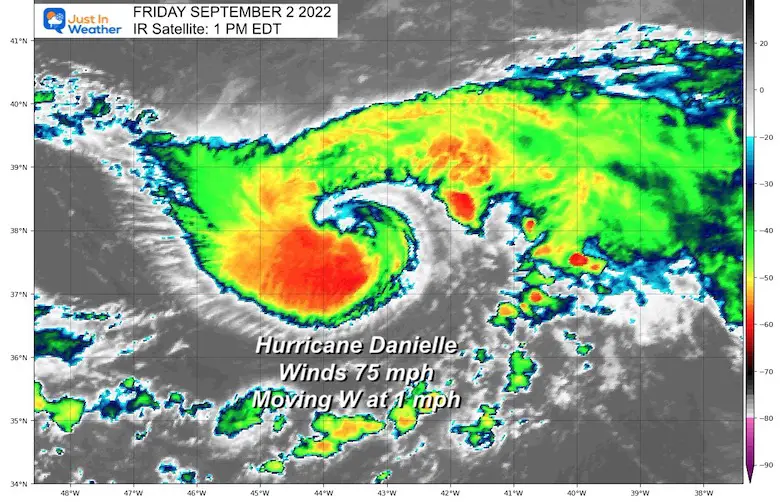
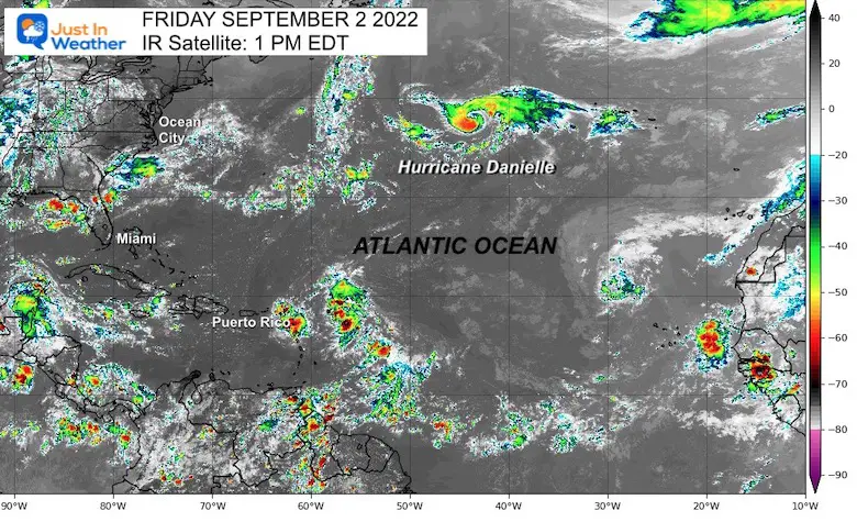
Currently we have the first storm named in two months and within two days it has reached hurriance intensity. It should be noted that this is well out in the open water and nowhere near land.
Hurricane Danielle IR Satellite
Full update and forecast maps below.
Comparing Record Years:
Augusts With No Named Tropical Storms
- 1961
- 1997
- 2022
The other two years BOTH had a named storms within the first few days of September.
Both of them reached Major Hurricane Intensity (Category 3 or higher)
1961- Tropical Season
Prior To August: This year started very quiet and only had 1 named storm (Anna).
Starting September:
September 2 was the next name and it got busy in a hurry! The second named storm was Betsy – This reached Category 4, but remained in the open ocean not making landfall.
1997- Tropical Season
Prior to August: This was a busier year with 4 Named Storms, one subtropical storm and one tropical depression.
Starting September:
September 3 was another quick return when Erika was named. This also became a Major Hurricane, reaching Category 3.
EXPLORE MORE
See the rest of the other record seasons (animation and chart) plus the following winter snowfall. There was a distinct difference:
Rainbow Ice Cave In Mt. Rainier A Very Rare Find: Photos And Video
National Hurricane Center Update
SUMMARY OF 300 PM GMT…1500 UTC…INFORMATION
———————————————-
LOCATION…37.9N 43.3W
ABOUT 885 MI…1425 KM W OF THE AZORES
MAXIMUM SUSTAINED WINDS…75 MPH…120 KM/H
PRESENT MOVEMENT…W OR 260 DEGREES AT 1 MPH…2 KM/H
MINIMUM CENTRAL PRESSURE…992 MB…29.30 INCHES
This is NOT close to land
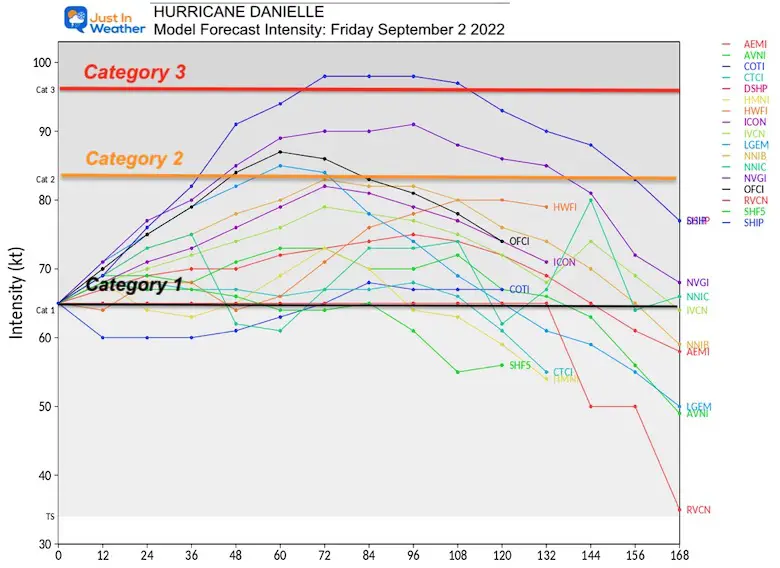
Forecast Intensity
The latest model guidance shows a good chance this will reached Category 2, but only a 1 in 17 chance to reach that Major Hurricane Intensity at Category 3.
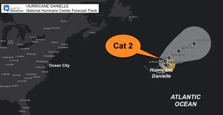
Forecast Track: National Hurricane Center
The reason this may not get to that Cat 3 is in part due to the nearly stalled movement this weekend. Danielle is currently moving only at 1 mph, which stirs colder water with upwelling, and limits the warm water fueling.
Once this gets moving, it will pass to the northeast where the water temperatures are not warmer.
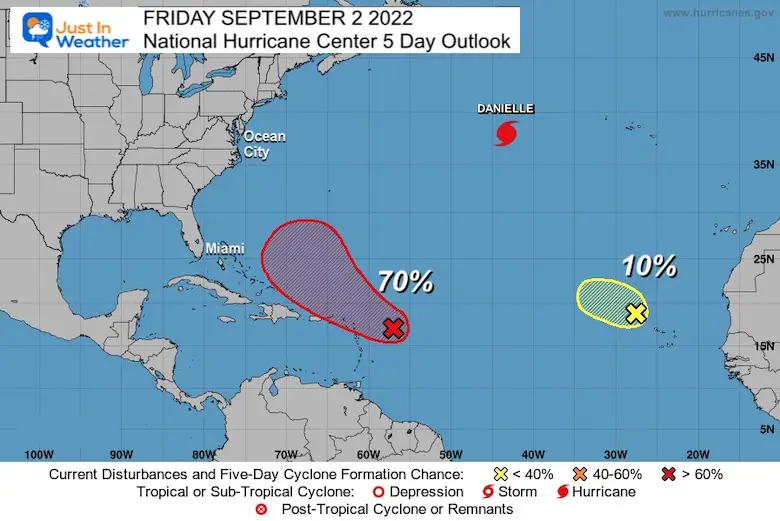
NOAA Outlook: 5 Days
The tropics are waking up, but of the few systems being watched it looks like the one closer to the Caribbean is the only one with a chance to develop.
The odds however keep getting pushed back farther with upper level wind sheer hindering development, but this will move closer to the US coast and needs to be watched into next week.
STEM Assemblies/In School Fields Trips Are Back
Click to see more and ‘Book’ a visit to your school
ALSO SEE
September Begins Meteorological Autumn
Climate Data/Weather Stats For The Month
Hurricane Season Forecast: June 1 Through November 30
NOAA 2022 Hurricane Forecast- Above Normal Again
Forecast From Colorado State University
Related Posts
NOAA Study: Reducing Air Pollution INCREASED Tropical Storms
Atlantic Tropical History: Maps of Origin Regions Every 10 Days
Rainbow Ice Cave In Mt Rainier
Rainbow Ice Cave In Mt. Rainier A Very Rare Find: Photos And Video
Please share your thoughts, best weather pics/videos, or just keep in touch via social media
-
Facebook: Justin Berk, Meteorologist
-
Twitter: @JustinWeather
-
Instagram: justinweather


