August 25 2022
Thursday Morning Update
Late summer heat is going to be the theme for a while. I hope your AC is working, and definitely hope its working in most Maryland schools that will be starting next week. Within these patterns there are subtle impulses that will determine the risk of showers and thunderstorms each day (mostly late in the day).
Today there will be the influence of the stormy southeastern US to spread clouds our way. The chance of late storms will be small and scattered.
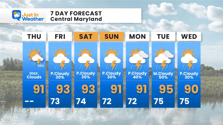
The outlook for storms over the next week will be just about every day. It is nearly impossible to state with precision where and when other than ‘later in the day’. It’s just something we will need to address with odds each day.
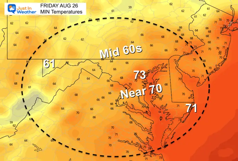
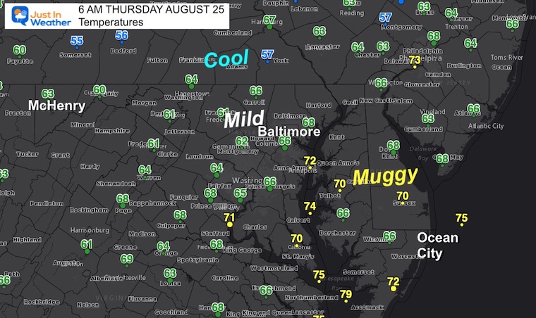
Morning Temperatures
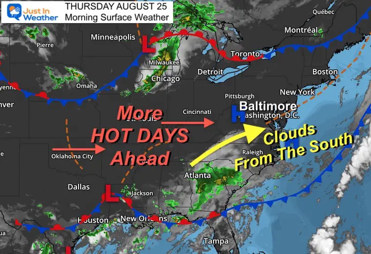
Morning Surface Weather
Clouds will move in from that southern storm system, but most of the rain will stay to our south.
A large dome of heat will continue to influence our weather into next week.
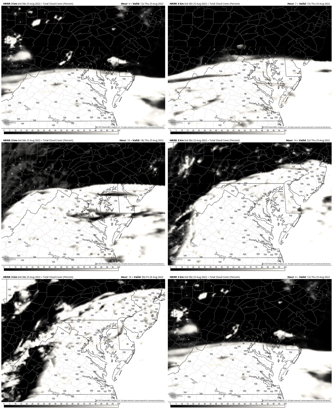
Cloud Forecast:
Satellite Simulation 8 AM to 8 PM
Clouds will be increasing from the south, dimming the sun then overcast by later in the day. This includes the beaches turning cloudy.
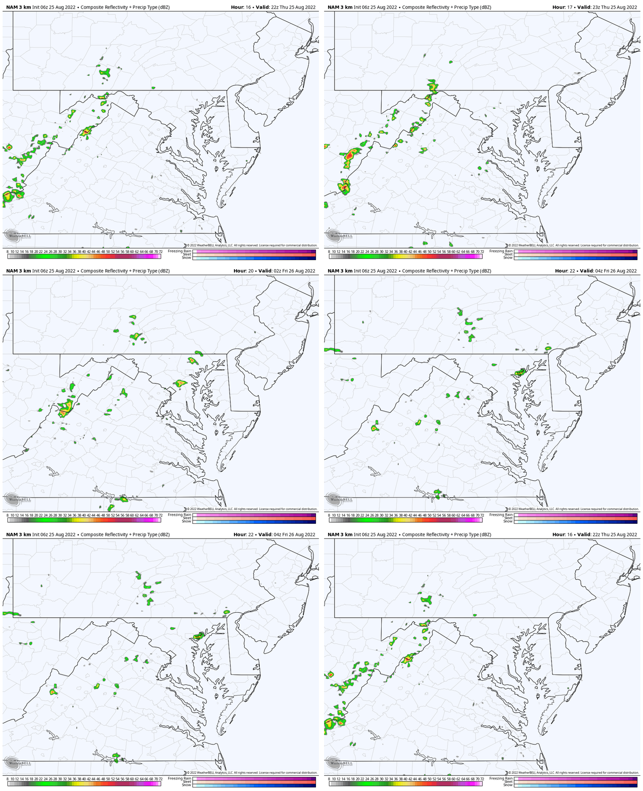
Radar Simulation 6 PM to Midnight
The chance of seeing a storm will be about 20%.
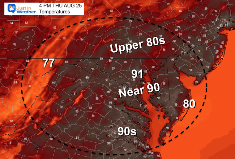
Afternoon Temperatures
Hottest temps will be in urban areas reaching the lower 90s.
ALSO SEE:
Tropical Atlantic Nearing A Record Low For Activity
CLIMATE DATA
TODAY August 25
Normal Low in Baltimore: 65ºF
Record 51ºF in 1952, 1963
Normal High in Baltimore: 86ºF
Record 97ºF 1936, 1948, 1963
Weather posts straight to your inbox
Sign up and be the first to know!
Friday Temperatures
Morning
A bit muggy in the metro and bay areas. Cooler inland.
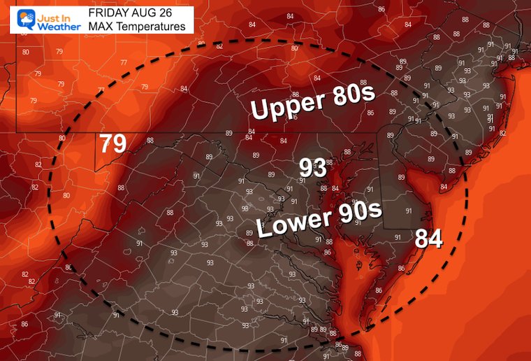
Afternoon
Many more days ahead in the 90s.
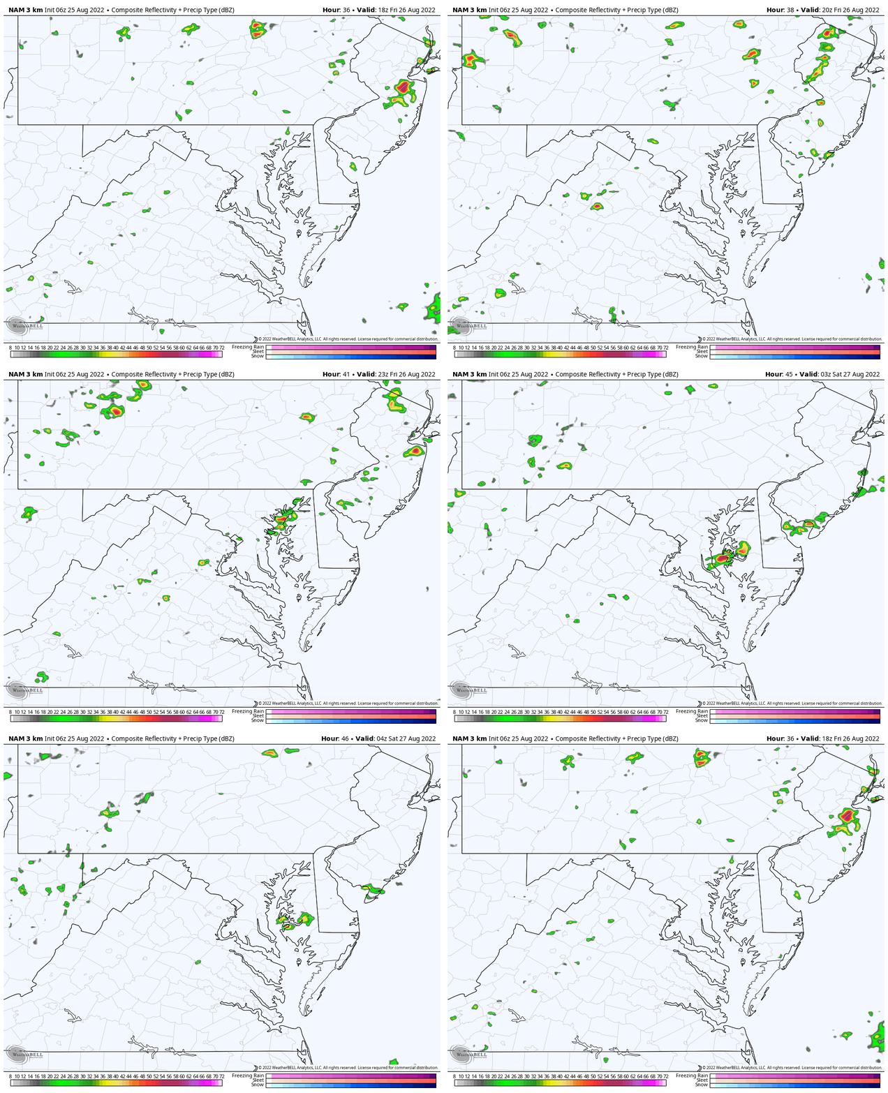
Radar Simulation 2 PM to Midnight
We may see a line of thunderstorms develop late in the afternoon and evening crossing central Maryland and the Chesapeake Bay.
7 Day Forecast
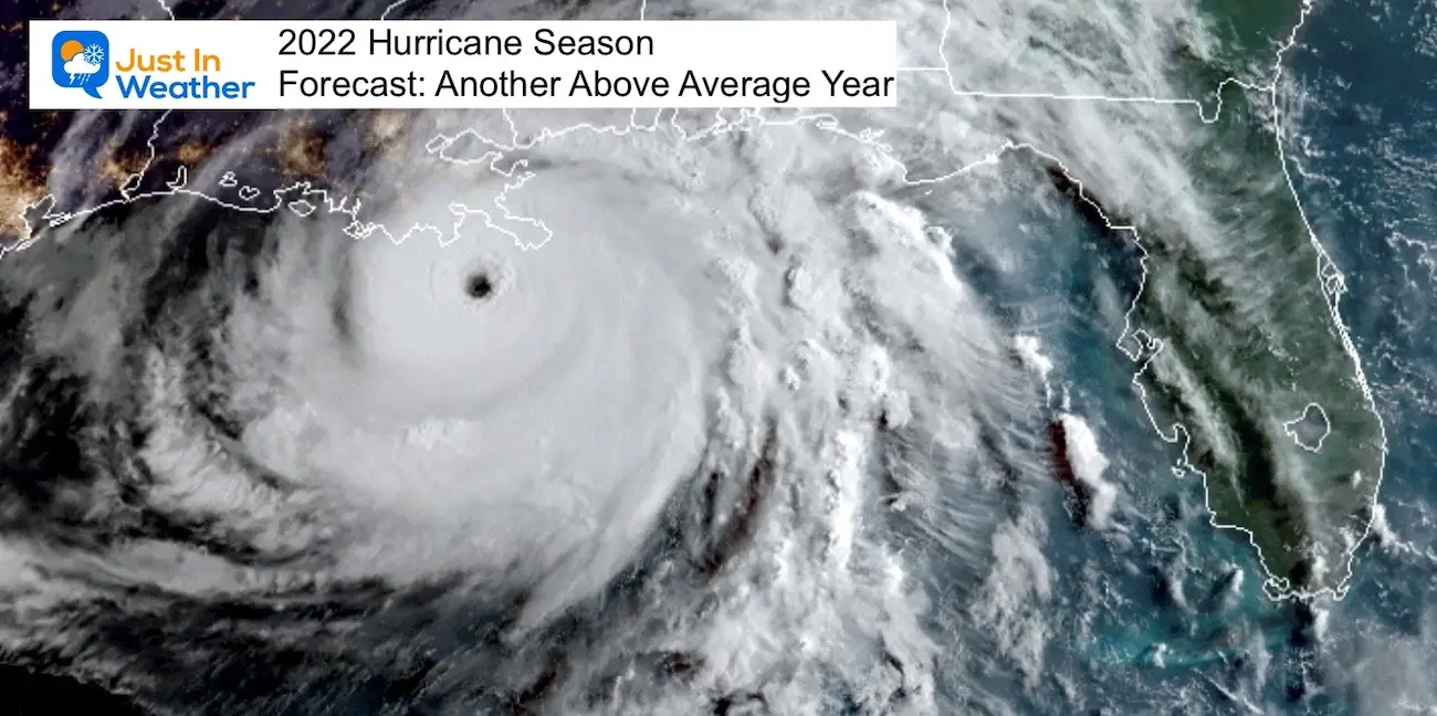
Hurricane Season Forecast: June 1 Through November 30
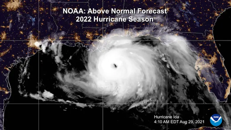
NOAA 2022 Hurricane Forecast- Above Normal Again
Forecast From Colorado State University
Related Posts
NOAA Study: Reducing Air Pollution INCREASED Tropical Storms
Atlantic Tropical History: Maps of Origin Regions Every 10 Days
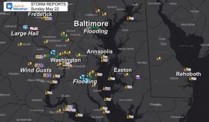
Recent Storm Reports
May 16 Large Hail Videos And Storm Tracking Map
Please share your thoughts, best weather pics/videos, or just keep in touch via social media
Facebook: Justin Berk, Meteorologist
Twitter: @JustinWeather
Instagram: justinweather
Cancer Can Succit- THE SHIRT
By Popular Demand and Supporting Just In Power Kids
This is the shirt that Power Kid James and his family has embraced… They even surprised us with this sign during our Kids Trek Too event.
It is now available!
Connect With A Health Coach
From My Maryland Trek Team
Click the image or here for more info
*Disclaimer due to frequent questions:
I am aware there are some spelling and grammar typos. I have made a few public statements over the years, but if you are new here you may have missed it:
I have dyslexia, and found out at my second year at Cornell. It didn’t stop me from getting my meteorology degree, and being first to get the AMS CBM in the Baltimore/Washington region.
I do miss mistakes in my own proofreading. The autocorrect spell check on my computer sometimes does an injustice to make it worse.
All of the maps and information are accurate. The ‘wordy’ stuff can get sticky.
There is no editor that can check my work when I need it and have it ready to send out in a newsworthy timeline.
I accept this and perhaps proves what you read is really from me…
It’s part of my charm.


