August 17 Nor’easter Brings Beach Rip Currents And Showers Inland
August 17 2022
Wednesday Morning Update
We have a nice start to the day and a storm well off the coast. However, the reach will be wider, even as it moves farther away. No tropical activity in the Atlantic, but this summer Nor’easter will be a nuisance for those at the beaches. Winds along the coast are responsible for high waves and rip currents. I have an Ocean City focused forecast below. Wrap around showers are expected to develop in central Pennsylvania and drop into parts of central Maryland this afternoon.
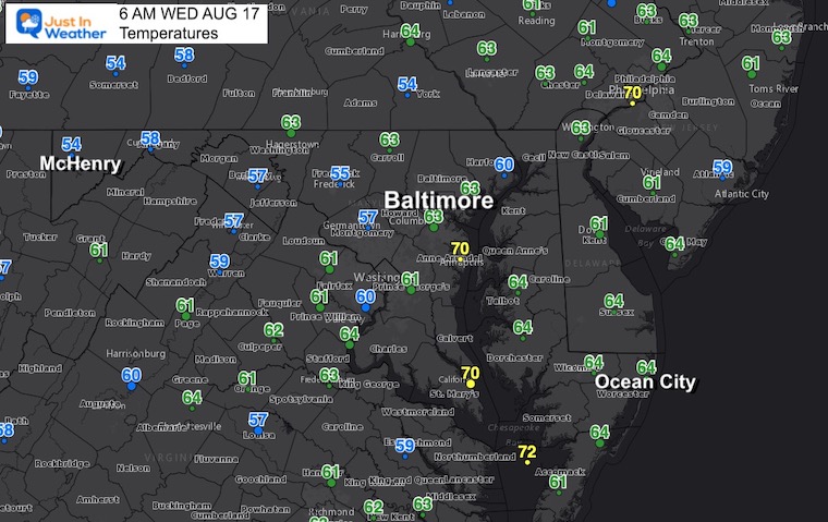
Morning Temperatures
Morning Surface Weather
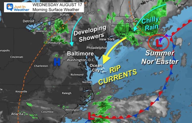
Tracking The Nor’easter
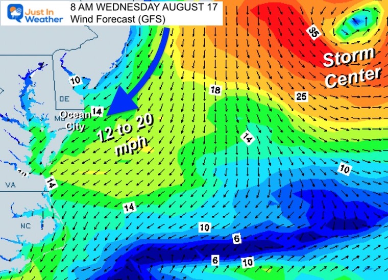
Wind Forecast
8 AM Wednesday to 8 AM Thursday
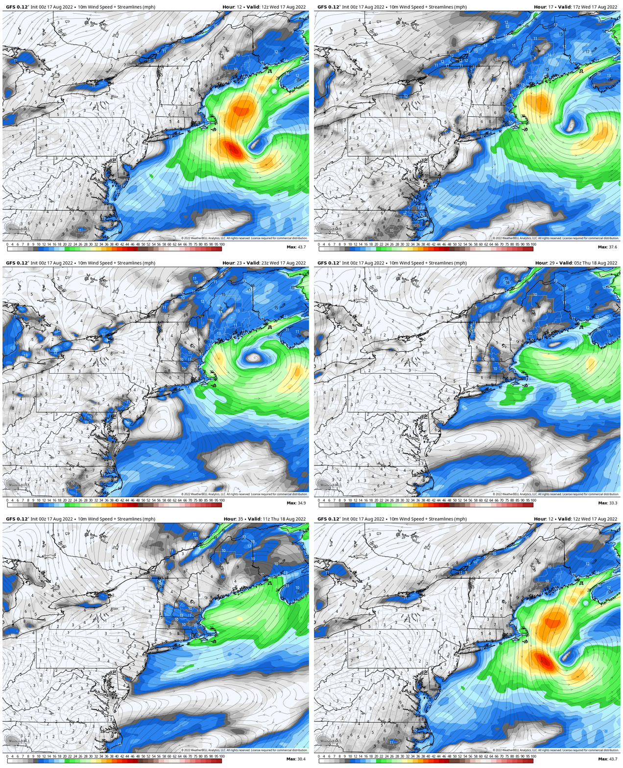
Local Look
8 AM
The strongest winds and highest waves along the coast will be this morning.
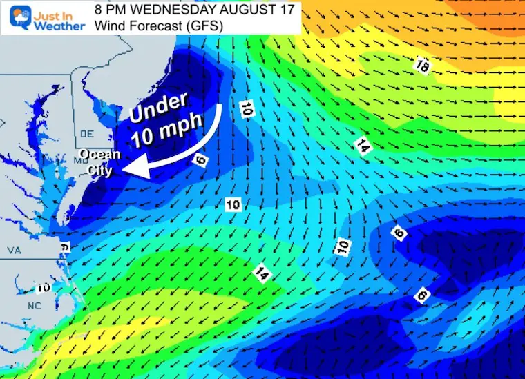
8 PM
The winds will ease, but there is latent wave memory that will take longer to settle down.
Ocean City Beach Forecast
(Phone friendly mode)

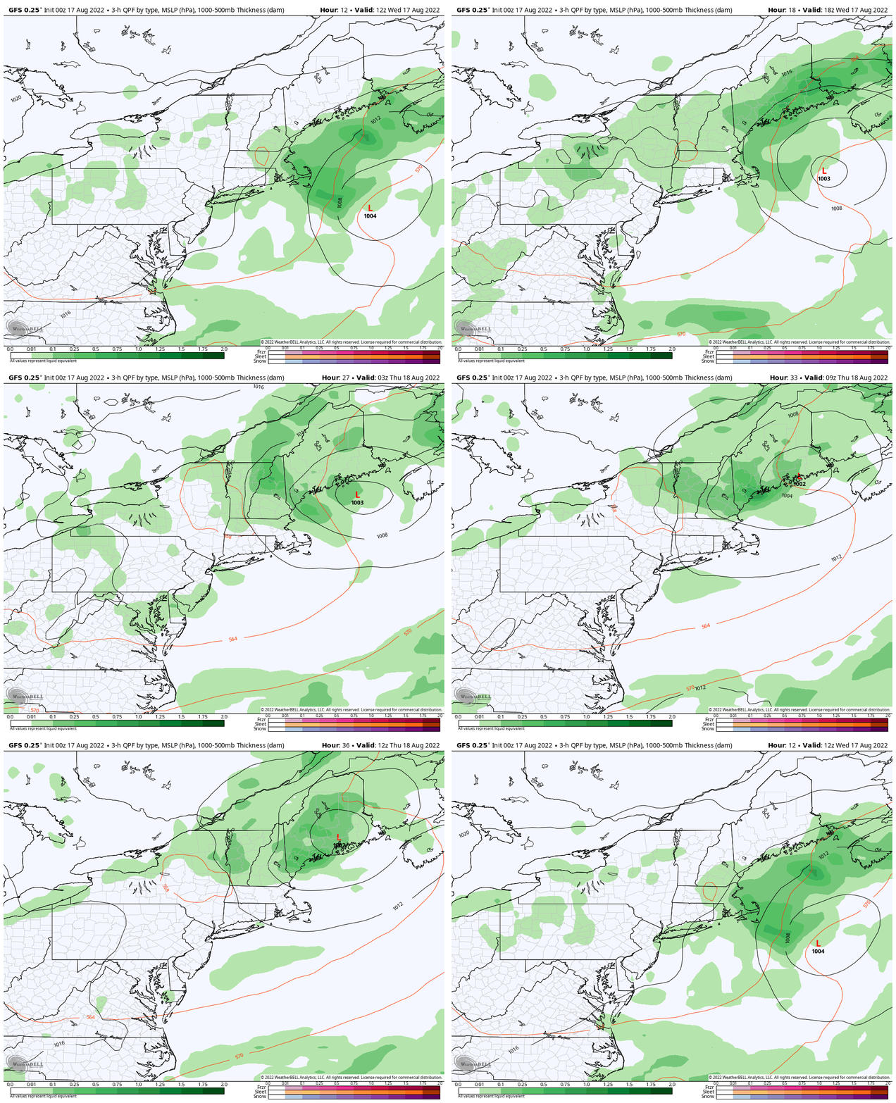
Storm Forecast
8 AM Wed to 8 AM Thu
As we watch the storm head to Maine, the showers developing in the wrap around in Pennsylvania to Maryland will be scattered this afternoon, then fade tonight.
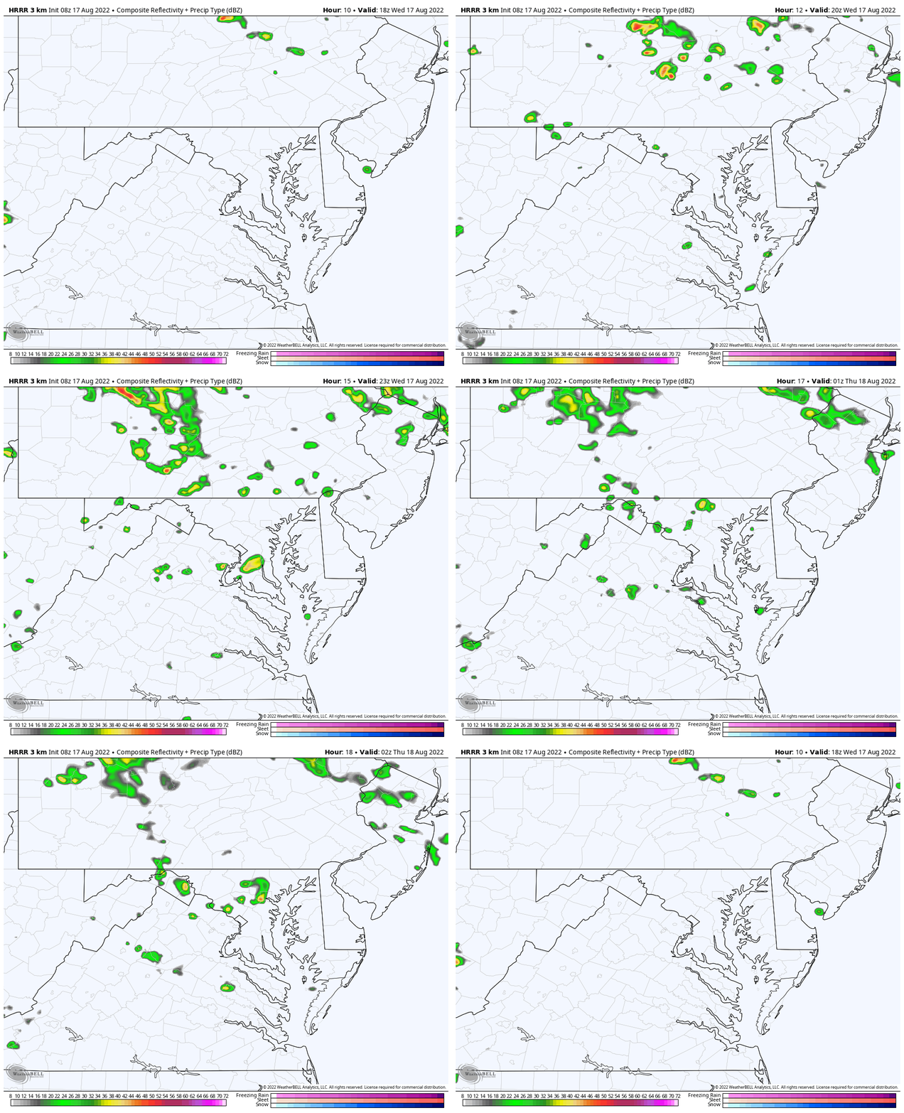
Local Look: NAM 3 Km 2 PM to 10 PM
This simulation product has been underperforming, showing less activity and slower than verifying.
I would plan for any showers AFTER 2 PM. I’ve bumped the chances near and north of Baltimore to 40%.
Much less likely to get rain south and east.
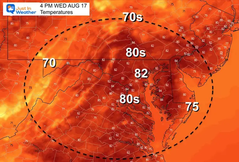
Afternoon Temperatures
These temps will be before the clouds and showers develop. Temps will be cooler with the winds at the beaches.
CLIMATE DATA
TODAY August 17
Normal Low in Baltimore: 66ºF
Record 53ºF in 1979
Normal High in Baltimore: 87ºF
Record 100ºF 1997
Cancer Can Succit- THE SHIRT
By Popular Demand and Supporting Just In Power Kids
This is the shirt that Power Kid James and his family has embraced… They even surprised us with this sign during our Kids Trek Too event.
It is now available!
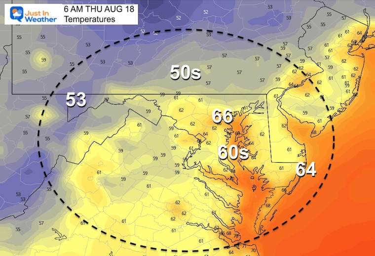
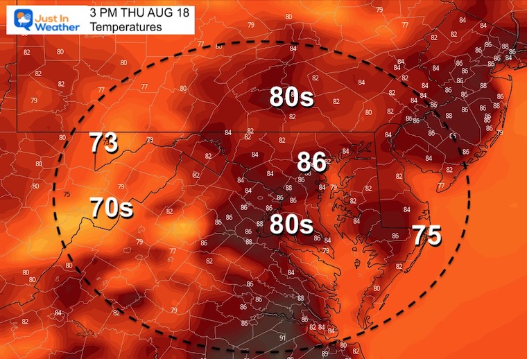
Thursday Temperatures
Morning
Afternoon
Looking Ahead
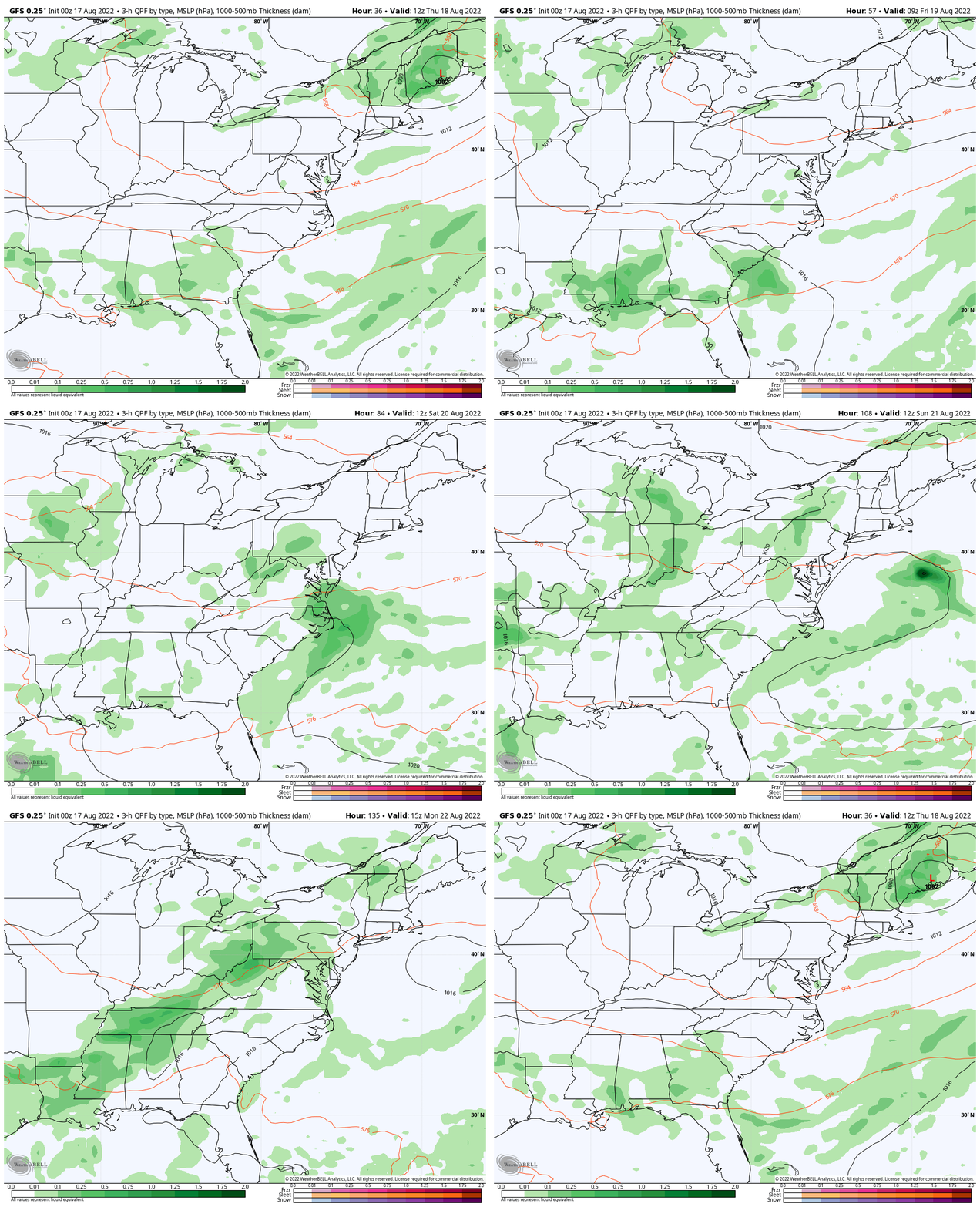
Animation: Thursday Morning To Monday Evening
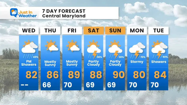
As the storm reaches Maine, we will improve on Thursday and Friday.
This weekend we need to watch for a return of heat and humidity that may bring afternoon showers.
The next stormy day for the region may be Monday.
7 Day Forecast
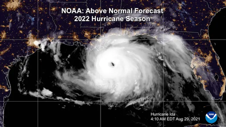
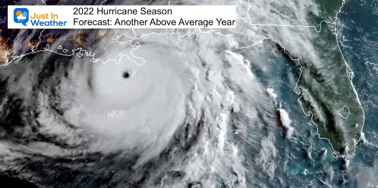
Hurricane Season Forecast: June 1 Through November 30
NOAA 2022 Hurricane Forecast- Above Normal Again
Forecast From Colorado State University
Related Posts
NOAA Study: Reducing Air Pollution INCREASED Tropical Storms
Atlantic Tropical History: Maps of Origin Regions Every 10 Days
Recent Storm Reports
May 16 Large Hail Videos And Storm Tracking Map
Please share your thoughts, best weather pics/videos, or just keep in touch via social media
Facebook: Justin Berk, Meteorologist
Twitter: @JustinWeather
Instagram: justinweather
Connect With A Health Coach
From My Maryland Trek Team
Click the image or here for more info
*Disclaimer due to frequent questions:
I am aware there are some spelling and grammar typos. I have made a few public statements over the years, but if you are new here you may have missed it:
I have dyslexia, and found out at my second year at Cornell. It didn’t stop me from getting my meteorology degree, and being first to get the AMS CBM in the Baltimore/Washington region.
I do miss mistakes in my own proofreading. The autocorrect spell check on my computer sometimes does an injustice to make it worse.
All of the maps and information are accurate. The ‘wordy’ stuff can get sticky.
There is no editor that can check my work when I need it and have it ready to send out in a newsworthy timeline.
I accept this and perhaps proves what you read is really from me…
It’s part of my charm.


