Tuesday Night Update
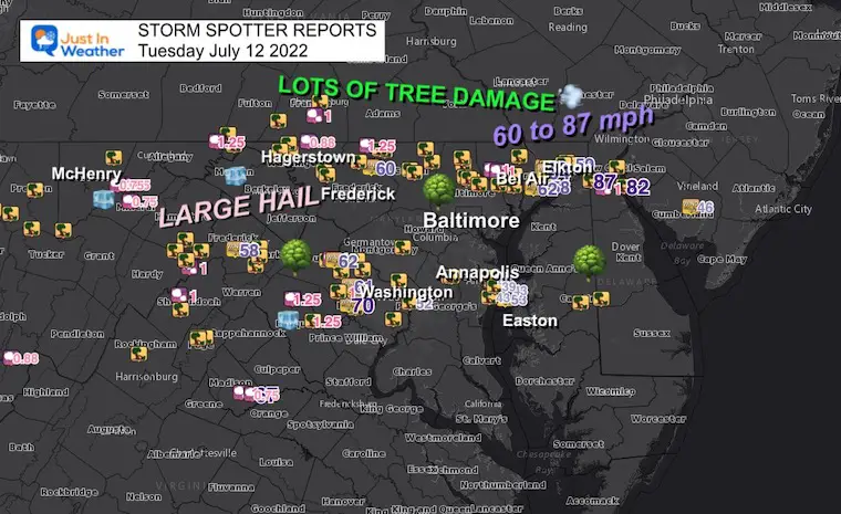
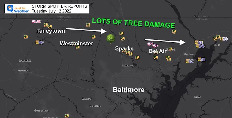
The heightened anticipation of severe storms for Central Maryland today lived up to expectations. A large path of storm reports with a trail of tree damage stretches across a large area.
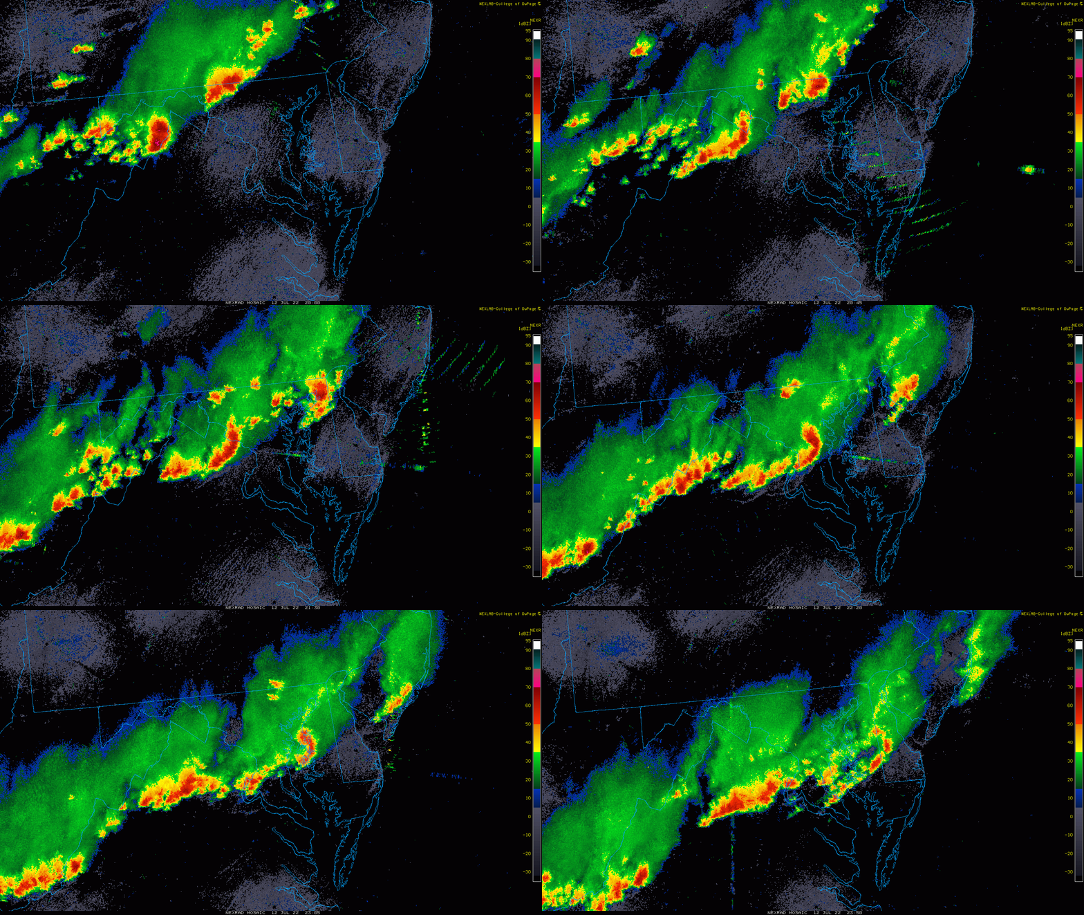
What I noticed were two distinct storm damage tracks. If you were following my reports, this fit close to the NAM 3Km Model simulation.
There have been so many reports, it has been overwhelming to document, but I wanted to share what I could this evening, especially with over 150,000 customers who lost power in our region.
In this report you will see the radar recap, storm report maps and lists by county. I have also included a few videos and new storm photos to help show an idea of how this affected the region. There were may who believe a tornado blew through. I can not confirm that until The National Weather Service conducts a site survey. That is up to their discretion.
Storm Damage Maps
Closer maps can be seen below
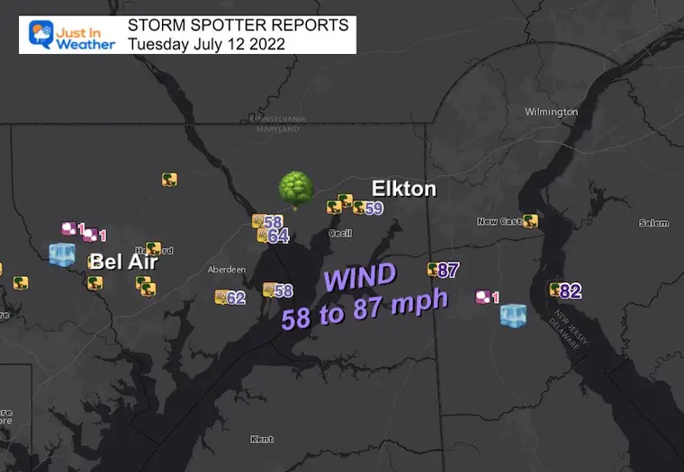
Widespread reports from large hail, tree damage, and wind speed up to 87 mph (in Delaware).
Radar Loop: 4 PM to 7:50 PM
That is the size limit I could share here.
Storm Damage
What’s new? This is one of the most compelling photos I got as I was preparing this report!
WOW! 😮 That’s a winner! This tree ended up on a power line far from its base https://t.co/A0GDhmB3II
— Justin Berk (@JustinWeather) July 13, 2022
Storm Videos
There has been a lot of documentation of this event. If you missed my Facebook updates, I will start with that. There are more below.
Montage Videos
Trees Coming Down!
This escalated quickly and you can hear the urgency from Holden Young
MORE PHOTOS BELOW
STORM REPORT MAPS AND LISTS
To make this easy, I plotted closer maps of the region with the list of reports by county in Maryland below.
Between Aberdeen and Northern Delaware winds gusted between 58 and 87 mph!
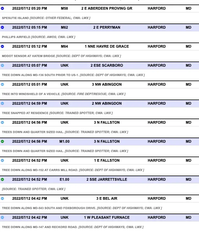
Hail around 1 inch near Fallston.
Northern Maryland
Tracking Storm Cell 1 across northern Maryland
Pockets of hail over 1 inch with extensive wind damage.
Washington to Annapolis Maryland
Tracking Storm Cell 2 across central Maryland

Annapolis/Kent Island
Winds gusted 40 to 53 mph

Storm Report Lists By County
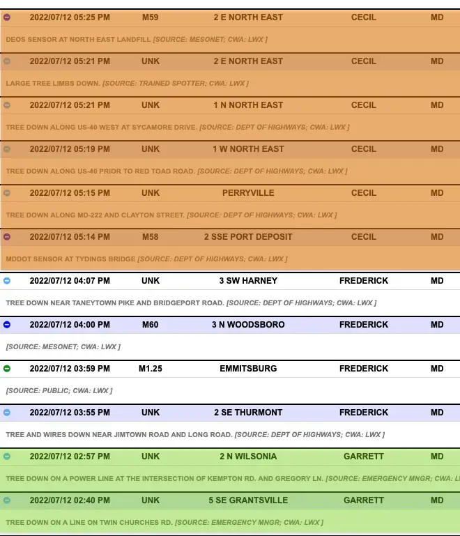
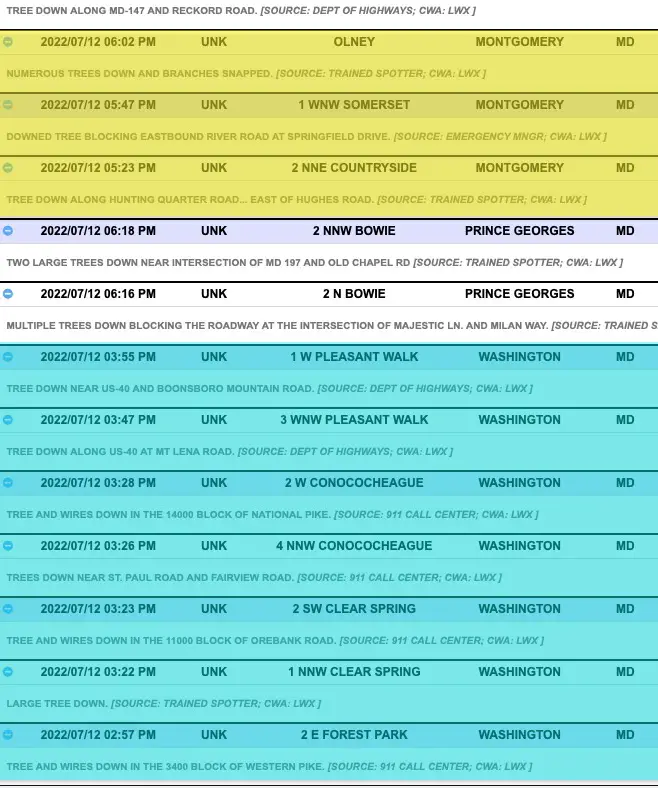
These are alphabetical and are color coded simply to separate the counties.
Allegany to Carroll Counties

Cecil to Garrett Counties
Harford County: They had a lot!
Montgomery to Washington Counties
Check On Regional Power Outages
Click to see the interactive map
More Photos
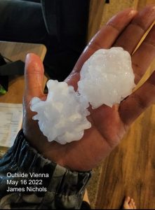
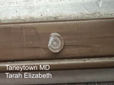
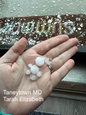
Taneytown Hail
The layers show how many trips were made up and down the clouds a they grew.
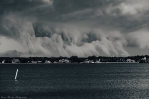
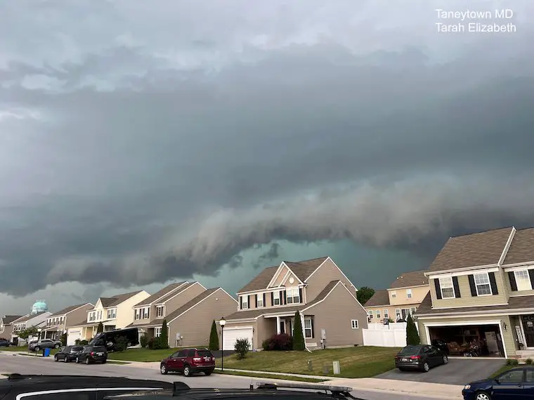
Taneytown Shelf Cloud
Lightning at National Harbor

Power Line Damage Eldersburg
One of the many problems with storm damage today https://t.co/XxRz3JVPZD
— Justin Berk (@JustinWeather) July 12, 2022
Tree Damage in Baltimore County Sparks/Hunt Valley
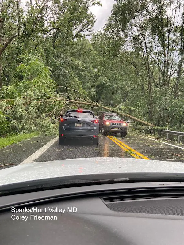
Tree Damage in Jarrettsville/Harford County

Shelf Cloud- Northeast/Cecil County
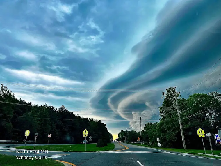
Shelf Cloud- Elkton/Cecil County

Weather posts straight to your inbox
Sign up and be the first to know!
Plan Your Kayaking Day Now
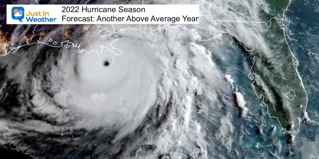
Hurricane Season Forecast: June 1 Through November 30
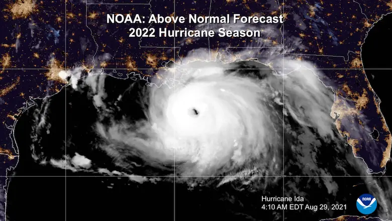
NOAA 2022 Hurricane Forecast- Above Normal Again
Forecast From Colorado State University
Related Posts
NOAA Study: Reducing Air Pollution INCREASED Tropical Storms
Atlantic Tropical History: Maps of Origin Regions Every 10 Days
Recent Storm Reports
May 16 Large Hail Videos And Storm Tracking Map
Please share your thoughts, best weather pics/video, or just keep in touch via social media
Facebook: Justin Berk, Meteorologist
Twitter: @JustinWeather
Instagram: justinweather
*Disclaimer due to frequent questions:
I am aware there are some spelling and grammar typos. I have made a few public statements over the years, but if you are new here you may have missed it:
I have dyslexia, and found out at my second year at Cornell. I didn’t stop me from getting my meteorology degree, and being first to get the AMS CBM in the Baltimore/Washington region.
I do miss my mistakes in my own proofreading. The autocorrect spell check on my computer sometimes does an injustice to make it worse.
All of the maps and information are accurate. The ‘wordy’ stuff can get sticky.
There is no editor that can check my work when I need it and have it ready to send out in a newsworthy timeline.
I accept this and perhaps proves what you read is really from me…
It’s part of my charm.


