


Soggy Saturday Update: Rain Timeline Through Preakness In Baltimore
Friday, May 17, 2024 As we approach another weekend, we have yet another weather system bringing us rain. This will make 16 of 20 weekends this year with some wet…
Friday Night July 8 Update
There trend with this weather system has been increasing the potential rainfall with each pass. The computer model guidance did suggest some high end totals, we have also seen many occasions over the past few months when they under performed.
The National Weather Service has also caught on the to the potential here with some bold messages today. More on that below.
Some rain showers are moving in tonight, but the main event will develop after midnight through Saturday morning.
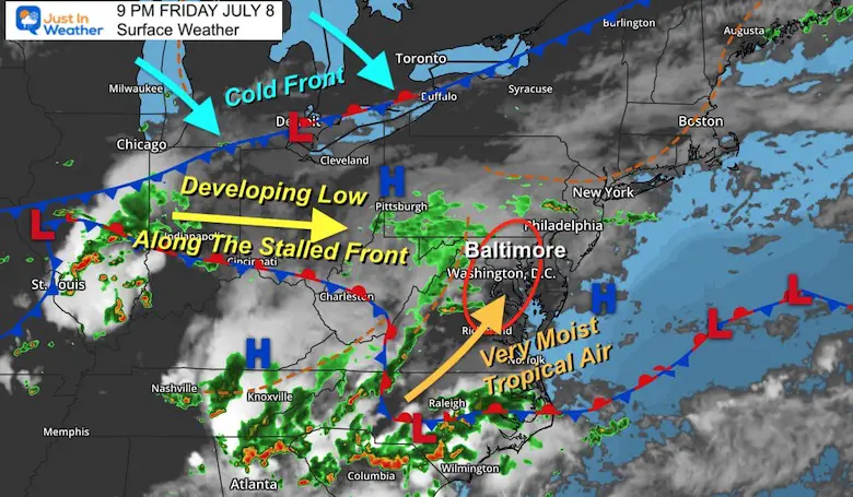
Developing Low Pressure In Illinois will move to the east along a stationary frontal boundary.
Very humid tropical moisture in the Carolinas and Virginia are getting pulled north to meet with the storm over central Maryland.
A cold front slipping to the south will enhance it all, then slowly push the rain south during the day.
The red shaded area is the Moderate Risk. This means there is a greater than 40% chance for enough rainfall to produce flooding.
The yellow shaded area is the Slight Risk. This means there is a great than 15% chance for enough rainfall to produce flooding here.
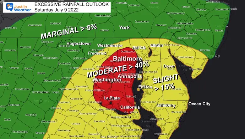
The greater Washington/Baltimore metropolitan area has been upgraded to a Moderate Risk of Excessive Rainfall through Saturday.
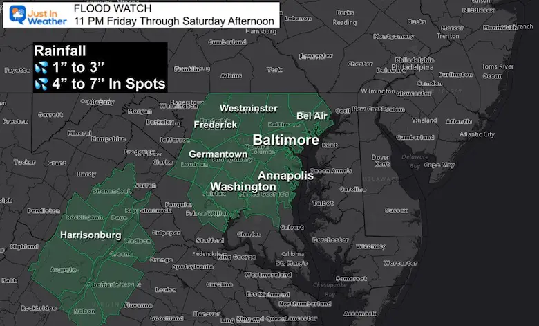
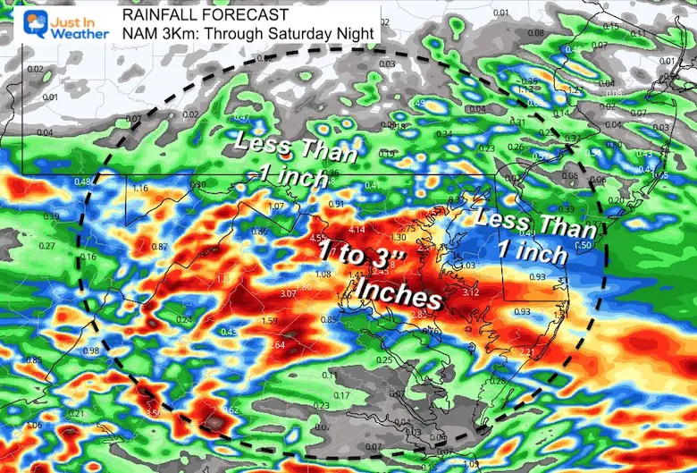
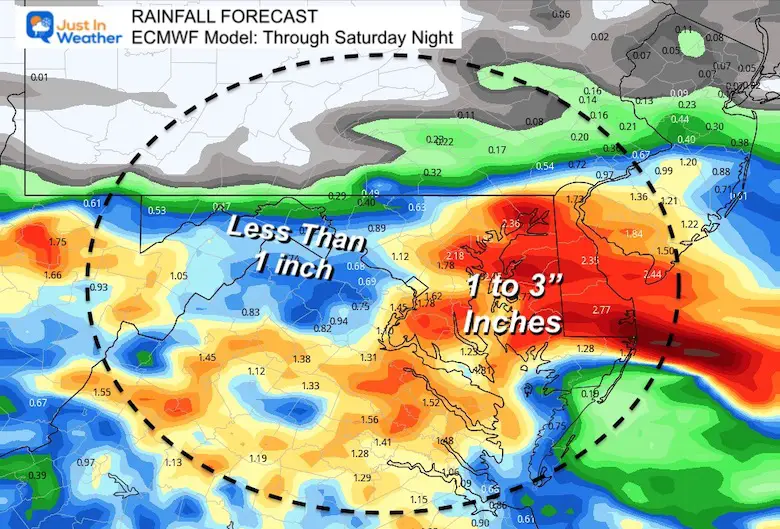
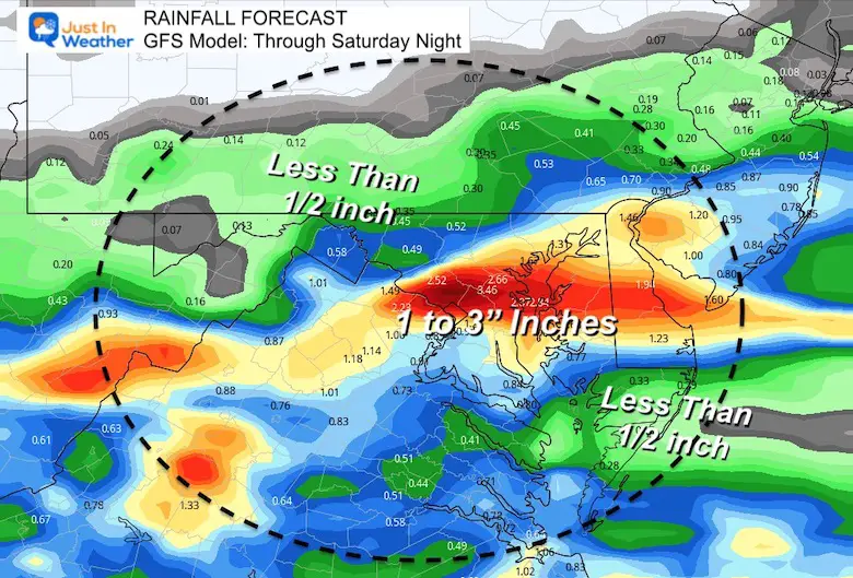
Average rainfall totals of 2-4 inches, locally as high as 8 inches, may lead to multiple instances of flash flooding, especially in urban areas.
I made this map with the earlier forecast of up to 7 inches. However, that may end up higher in a few spots.
It is impossible at this point to highlight where specifically may be hit hardest. I know the anxiety is highest over Ellicott City. I will have the most details I can find in my full morning report.
Reminder that this means ‘potential’ but not a promise. If and when the rain lines up to produce flooding, then a Warning will be issued. Be alert for that to happen on Saturday.
Click the link or see it on the Home Page to see ALL Local Alert (Watches and Warnings) will be posted on this page. You can click on each weather element for the details as flooding and even some severe storms may be tracked.

Compare to the simulation forecast animations below
Rain will be developing over the mountains and into the western/northern suburbs this evening.
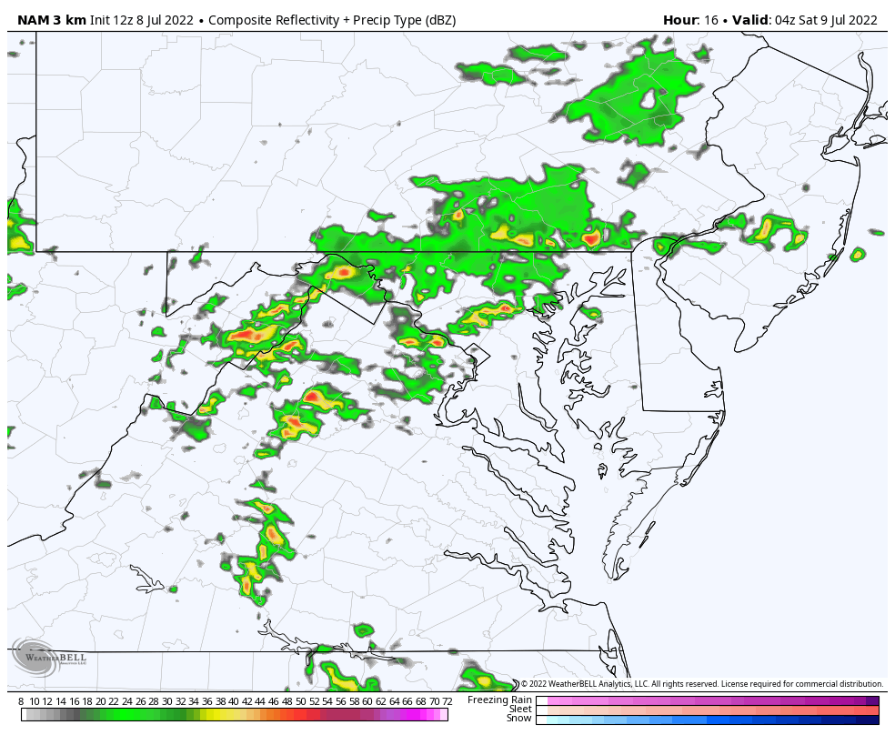
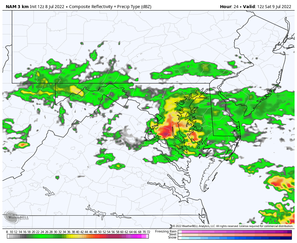
I broke down this time frame to show the heavy rain developing overnight and sitting over Baltimore, Annapolis, and Washington at day break!
Here we can see the heaviest band of rain crossing the Bay to Delmarva by noon.
Mid Day may add in some flooding between Salisbury, Dover, and the beaches through the afternoon.
Showers may linger around Baltimore through 4 PM, with a chance to dry out to the north and west. More showers and steady rain will continue to the south.
Comparing the NAM, European Model ECMWF, and GFS Models we can see a converging similarity of the heaviest rain from Central Maryland to Delmarva. The models are not perfect, especially with a unique situation like this one. So higher amounts are possible beyond what may be shown here.

NOAA 2022 Hurricane Forecast- Above Normal Again


NOAA Study: Reducing Air Pollution INCREASED Tropical Storms

Atlantic Tropical History: Maps of Origin Regions Every 10 Days


May 16 Large Hail Videos And Storm Tracking Map


*Disclaimer due to frequent questions:
I am aware there are some spelling and grammar typos. I have made a few public statements over the years, but if you are new here you may have missed it:
I have dyslexia, and found out at my second year at Cornell. I didn’t stop me from getting my meteorology degree, and being first to get the AMS CBM in the Baltimore/Washington region.
I do miss my mistakes in my own proofreading. The autocorrect spell check on my computer sometimes does an injustice to make it worse.
All of the maps and information are accurate. The ‘wordy’ stuff can get sticky.
There is no editor that can check my work when I need it and have it ready to send out in a newsworthy timeline.
I accept this and perhaps proves what you read is really from me…
It’s part of my charm.