


May 19 Weather Sunday Starts Foggy The Warming With Sun And Summer Heat On The Way
Sunday May 19 Morning Report The aftermath of the rainy Saturday is plenty of leftover moisture. This has left us with a bit of humidity and areas of thick fog…
June 30 2022
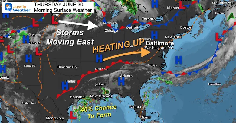
Thursday Morning Update
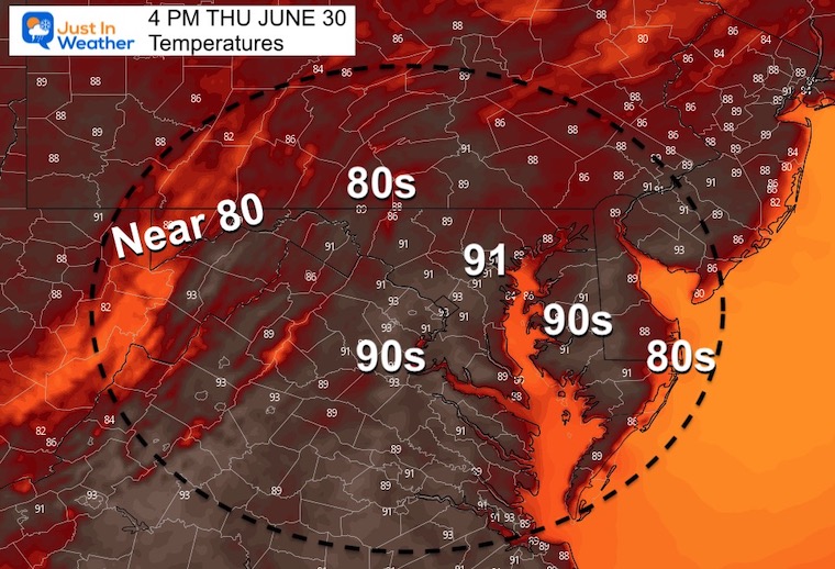
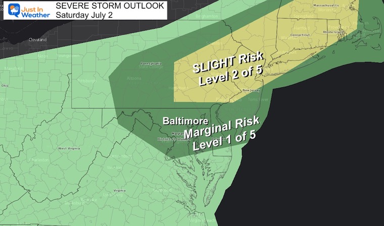
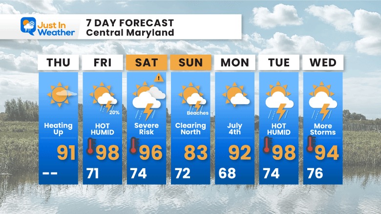
Today we turn the het back up. Many areas get back to the 90s, then climb higher with increased humidity tomorrow and Saturday. The storm risk may turn severe this weekend, from inland areas Saturday afternoon then lasting into Sunday by the beaches.
July 4th outlook is good, followed by more heat next week.
As for the tropics, below is the morning update as Aruba now appears to be safely in the clear.
High Pressure pump in the heat today. Storms start to return tomorrow.
Gulf Coast concerns linger, but that system off of the Texas coast has a 40% chance to develop, however may be onshore before it has a chance.
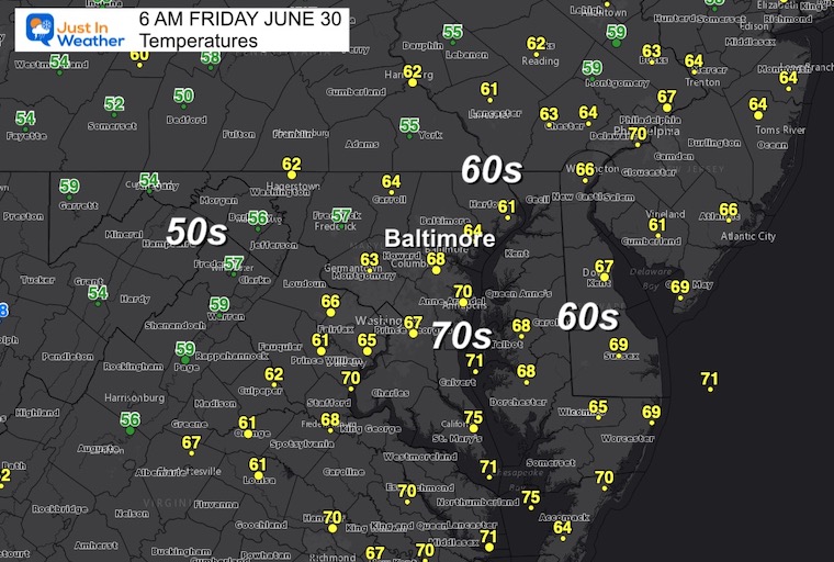
Normal Low in Baltimore: 66ºF
Record 52ºF in 1988
Normal High in Baltimore: 87ºF
Record 100ºF 1959
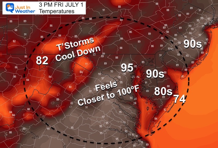
Here comes the heat and humidity cranking up.
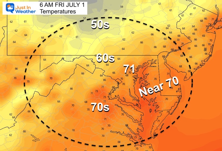
It will feel like close to 100ºF
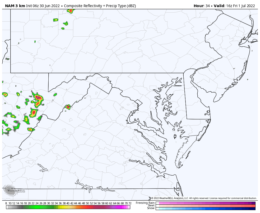
Scattered storms will pop up during the afternoon. I would not take this product at face value… Simply the suggestion storms will form, but a more specific idea of time and location will be better plotted as we get closer.

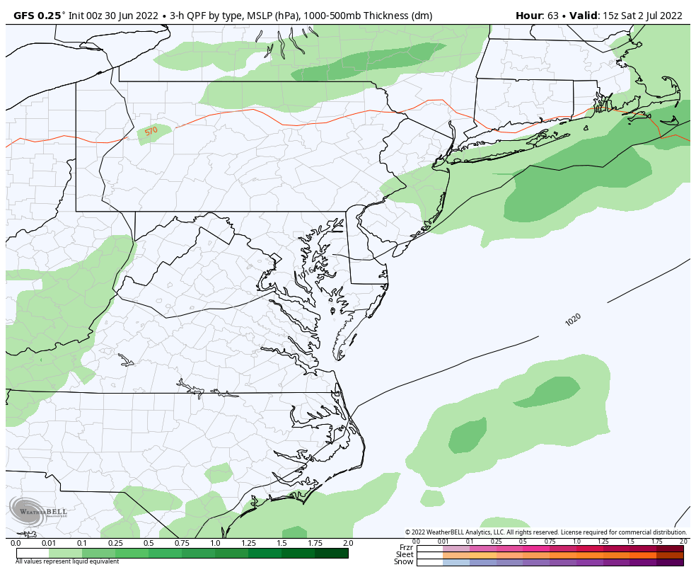
Storms may turn severe on Saturday, with lingering rain on Sunday at the beaches.
As of now, July 4th is looking good!
Aruba is in the clear! The storm not yet named does have 40 mph winds, and was moving faster, meaning it passed by Aruba sooner.
It is still expected to intensify, with the next sight on the border of Costa Rica and Nicaragua where a Hurricane Watch is in place.
National Hurricane Center Morning Advisory
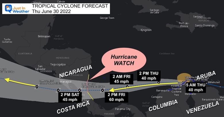
...EXPECTED TO BECOME A TROPICAL STORM TODAY AND STRENGTHEN WHILE
APPROACHING NICARAGUA AND COSTA RICA...


SUMMARY OF 500 AM EDT...0900 UTC...INFORMATION
----------------------------------------------
LOCATION...12.0N 72.4W
ABOUT 65 MI...105 KM WSW OF NTHRN TIP OF GUAJIRA PNSULA COLOMBIA
ABOUT 770 MI...1240 KM E OF BLUEFIELDS NICARAGUA
MAXIMUM SUSTAINED WINDS...40 MPH...65 KM/H
PRESENT MOVEMENT...W OR 270 DEGREES AT 20 MPH...31 KM/H
MINIMUM CENTRAL PRESSURE...1009 MB...29.80 INCHES
A Hurricane Watch is in effect for...
* Nicaragua/Costa Rica border to Laguna de Perlas Nicaragua

A Tropical Storm Warning is in effect for...
* Coast of Venezuela from the Peninsula de Paraguana westward to the
Colombia/Venezuela border including the Gulf of Venezuela
* Coast of Colombia from the Colombia/Venezuela border westward to
Santa Marta
* San Andres Colombia

A Tropical Storm Watch is in effect for...
* Limon Costa Rica northward to the Nicaragua/Costa Rica border
* North of Laguna de Perlas to Sandy Bay Sirpi Nicaragua
The peak heat will be Friday and Saturday, along with a risk for sever storms.
Those may linger by the beaches on Sunday.
July 4th looks good or the region…
Then heat returns next week.
NOAA 2022 Hurricane Forecast- Above Normal Again


NOAA Study: Reducing Air Pollution INCREASED Tropical Storms

Atlantic Tropical History: Maps of Origin Regions Every 10 Days


May 16 Large Hail Videos And Storm Tracking Map


*Disclaimer due to frequent questions:
I am aware there are some spelling and grammar typos. I have made a few public statements over the years, but if you are new here you may have missed it:
I have dyslexia, and found out at my second year at Cornell. I didn’t stop me from getting my meteorology degree, and being first to get the AMS CBM in the Baltimore/Washington region.
I do miss my mistakes in my own proofreading. The autocorrect spell check on my computer sometimes does an injustice to make it worse.
All of the maps and information are accurate. The ‘wordy’ stuff can get sticky.
There is no editor that can check my work when I need it and have it ready to send out in a newsworthy timeline.
I accept this and perhaps proves what you read is really from me…
It’s part of my charm.