


Winter Weather Advisory Sunday As Snowfall In Two Parts Affecting Two Different Areas
Saturday Evening Update January 17 2026 One thing I carry after all of my years of forecasting: If one model does a really good job in an active pattern, then…
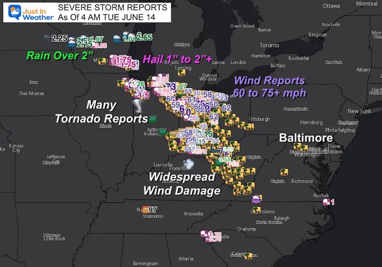
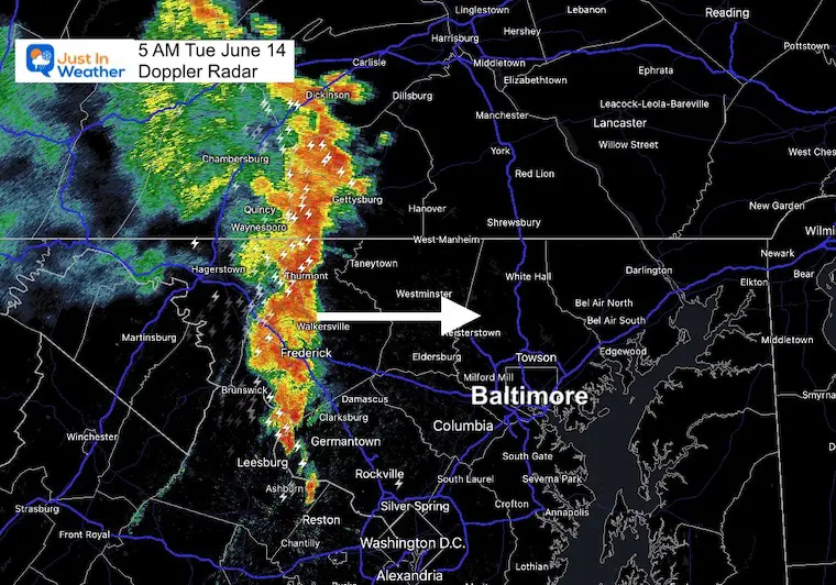
5 AM June 14 2022
Tuesday Morning Update
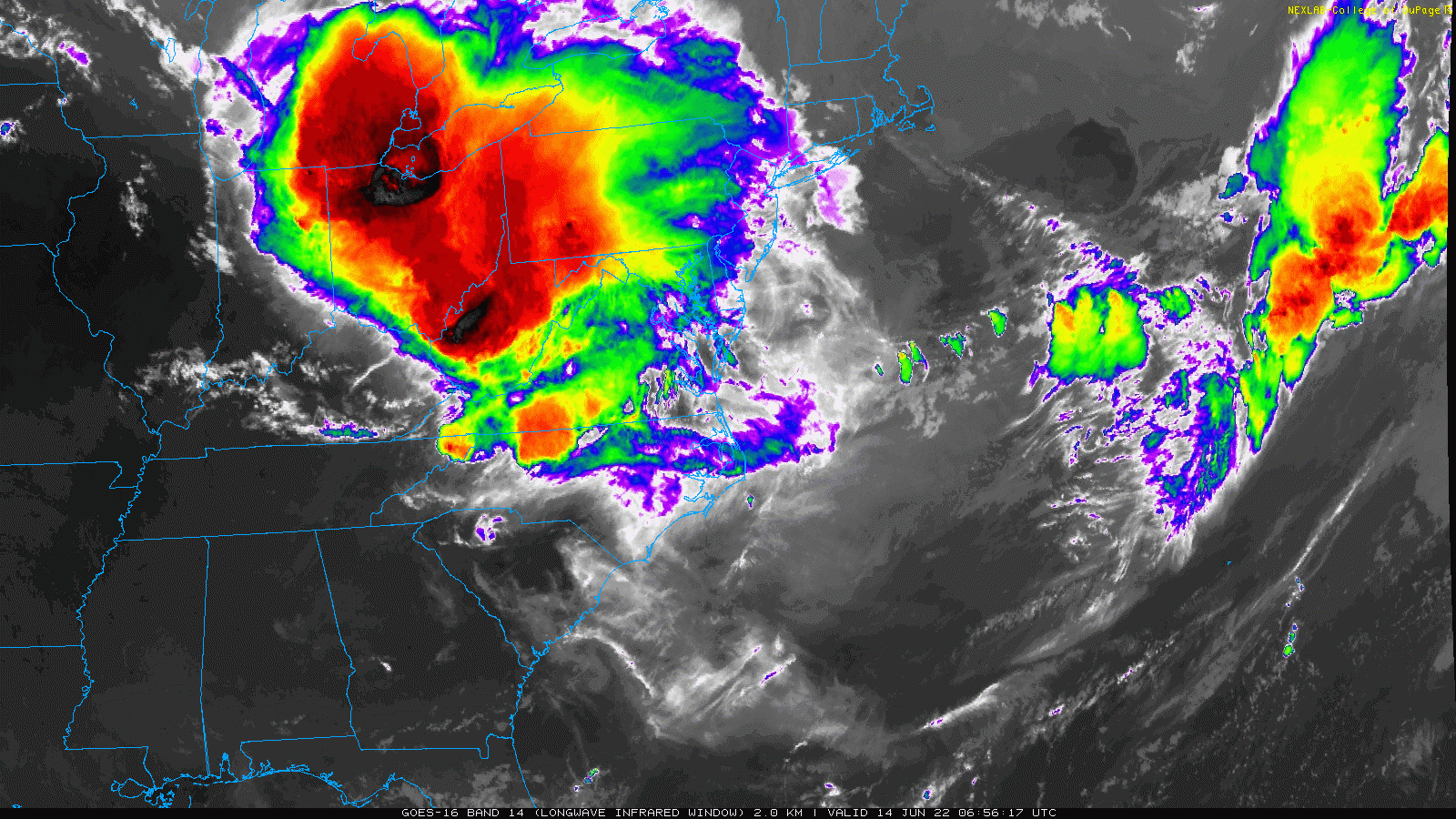
This is going to be a very fluid morning, so please keep checking back for updates. The Mesoscale Convective Complex that tore through the Great Lakes and Midwest last night is arriving in the Mid Atlantic… A FEW HOURS EARLY!
See the live interactive radar and lightning below!
Weather Headlines:
This does suggest we have a derecho in progress. I hesitate to use that term until absolutely certain due to the history of what our region has experienced. That are not all the same, so it does not promise a repeat of that 2012 event.
My report last night had the HRRR Model showing metro Baltimore and Washington getting this between 8 AM and 10 AM. But I woke up and saw this already reaching Hagerstown at 4 AM.
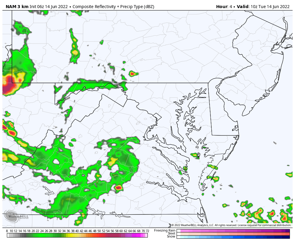
Here’s the Problem…. The Short Range Modeling still did not have this here yet…

That severe storm entering Washington County was missing…
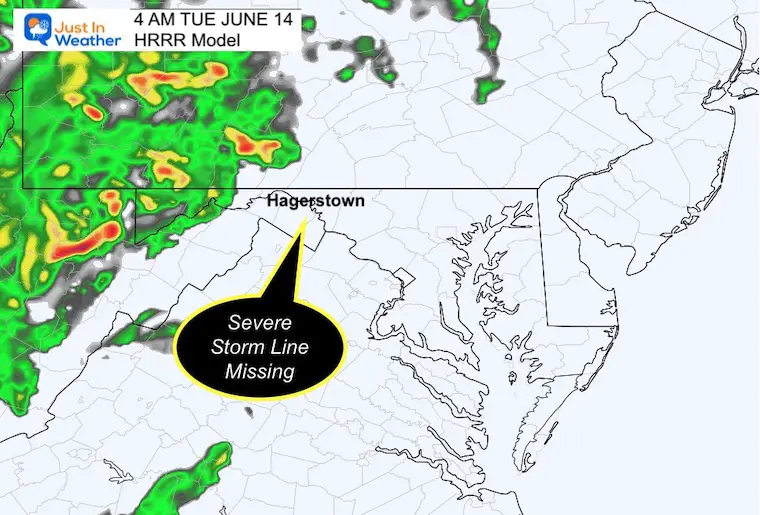

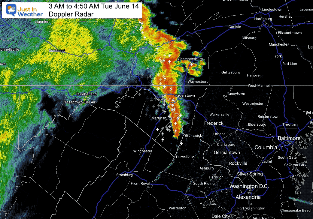
This will reach Baltimore’s Beltway by 6 AM and may prompt warnings to be issued.
Since the HRRR is not handling this well, we switch to the NAM 3Km, but this is also not perfect…
6 AM to 4 PM
This is rough gauge, but I believe the activity will be faster and more widespread than shown…
Is This A Derecho?
Not necessarily, and there is no such thing as a Derecho Watch. It is a term that classifies a rare event, and is a buzz word that gets a lot of attention.
We can have an MCC complex produce lots of damage without being labeled a Derecho- which is classified when 240 miles of continuous wind damage path, 60 miles wide, with a minimum of 58 mph winds. Often exceeding 70 mph. These produce straight line winds over a large area rather than a confined tornado path.
I will aim to get a new update and timeline posted around 6:30 AM Tuesday to stay ahead of any adjustments to the timing and track.
Sign up and be the first to know!

NOAA 2022 Hurricane Forecast- Above Normal Again


NOAA Study: Reducing Air Pollution INCREASED Tropical Storms

Atlantic Tropical History: Maps of Origin Regions Every 10 Days


May 16 Large Hail Videos And Storm Tracking Map


*Disclaimer due to frequent questions:
I am aware there are some spelling and grammar typos. I have made a few public statements over the years, but if you are new here you may have missed it:
I have dyslexia, and found out at my second year at Cornell. I didn’t stop me from getting my meteorology degree, and being first to get the AMS CBM in the Baltimore/Washington region.
I do miss my mistakes in my own proofreading. The autocorrect spell check on my computer sometimes does an injustice to make it worse.
All of the maps and information are accurate. The ‘wordy’ stuff can get sticky.
There is no editor that can check my work when I need it and have it ready to send out in a newsworthy timeline.
I accept this and perhaps proves what you read is really from me…
It’s part of my charm.