May 31 2022
Tuesday Morning Report
It does seem like we turned the corner to summer. The heat is on this week, at least for a few days as we head back to work and school. Temperatures will soar into the 90s, while air quality will be reduced in urban areas.
Some relief from isolated storms, then the main storm day expedited later this week to break the head and bring on a beautiful weekend.
Morning Set Up
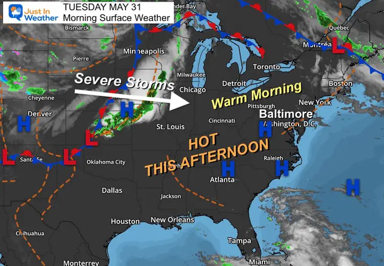
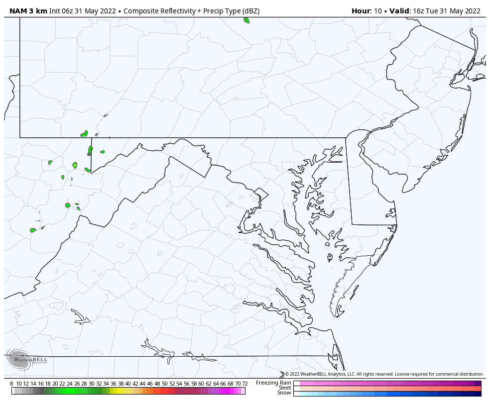
Surface Weather
High Pressure in control for the eastern US. This will allow the afternoon to turn hot again, while a line of strong to severe storms will cross the Midwest. That will reach us by Thursday.
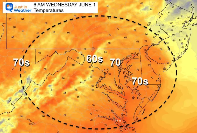
Temperatures
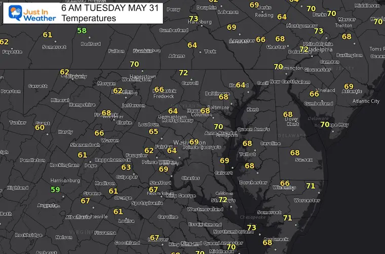
Morning
A warm start already today…
Pollen Reports- Morning Numbers Are Ready
Keep this link handy… I’ll post the latest info as soon as I get it on this page.
Click here for
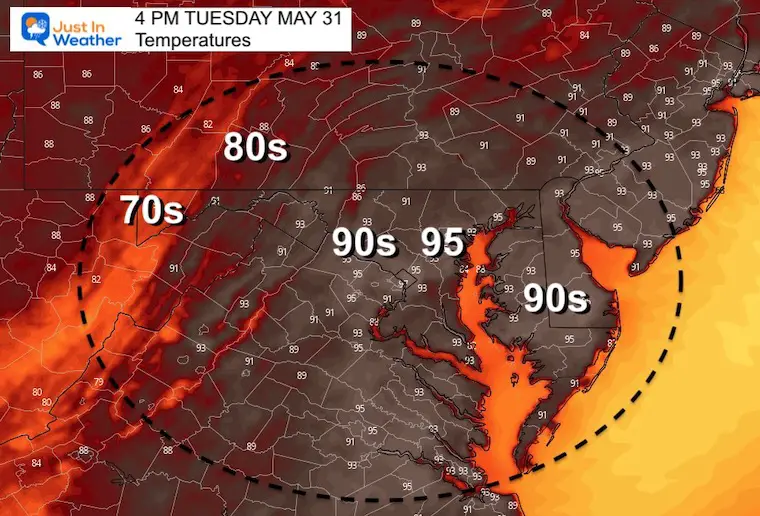
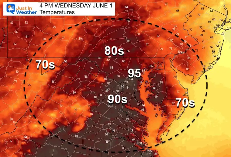
Afternoon
Another HOT afternoon. The corners will be cooler in the mountains and by the ocean.
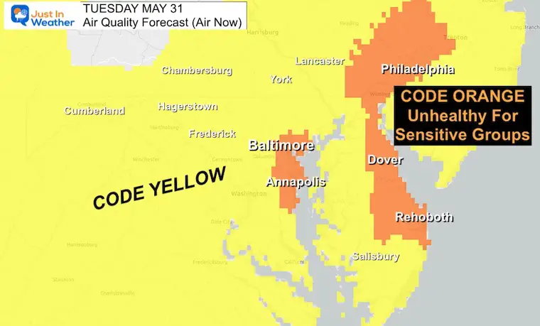
Air Quality Forecast
Code Orange for Baltimore/Annapolis and from Philadelphia does through Delaware.
This is unhealthy for sensitive groups, mainly in the afternoon heat. Also suggested to reduce outdoor activities like mowing the lawn and excessive exercise.
Storm Forecast:
We may see a cluster of thunderstorms form in the mountains and track through the evening to the east.
CLIMATE DATA
TODAY May 31st
Normal Low in Baltimore: 57ºF
Record 40ºF in 1996
Normal High in Baltimore: 78ºF
Record 97ºF 2011
Wednesday
Morning
Another warm start…
Afternoon
Another HOT afternoon, with higher humidity and heat index.
FLIP-FLOP ARMY
This shirt is for my wife Shannon.
B.O.D.O. Buy One and we will Donate One to a kid or family member of our Just In Power Kids Pediatric Oncology Community

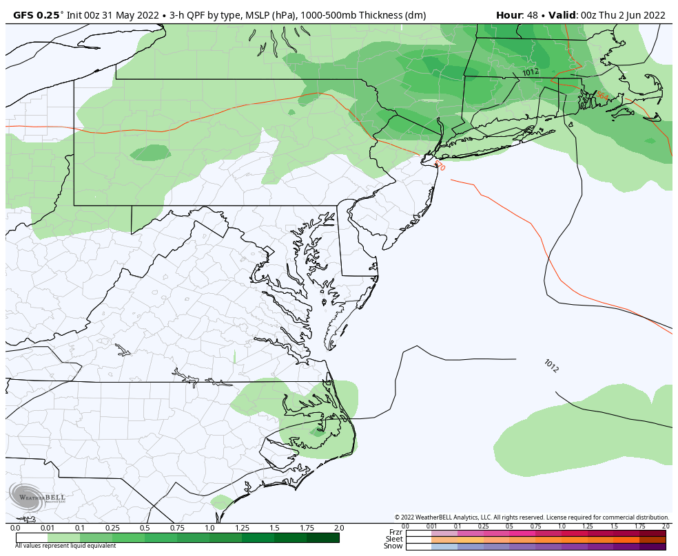
Looking Ahead: Wednesday Through Friday
The only active weather system will be this cold front on Thursday. That will break the heat wave and get us back to pleasant weather next weekend.
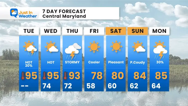
7 Day Forecast
We may get lucky with the timing of that cold front. Another spectacular looking air mass set for this weekend.
Recent Storm Reports
May 22 Hail And Wind Damage

May 16 Large Hail Videos And Storm Tracking Map


In Case You Missed It..
NOAA 2022 Hurricane Forecast- Above Normal Again

Tropical Season Begins June 1
Atlantic Hurricane Forecast

Related Posts
NOAA Study: Reducing Air Pollution INCREASED Tropical Storms

Atlantic Tropical History: Maps of Origin Regions Every 10 Days


Please share your thoughts, best weather pics/video, or just keep in touch via social media
*Disclaimer due to frequent questions:
I am aware there are some spelling and grammar typos. I have made a few public statements over the years, but if you are new here you may have missed it:
I have dyslexia, and found out at my second year at Cornell. I didn’t stop me from getting my meteorology degree, and being first to get the AMS CBM in the Baltimore/Washington region.
I do miss my mistakes in my own proofreading. The autocorrect spell check on my computer sometimes does an injustice to make it worse.
All of the maps and information are accurate. The ‘wordy’ stuff can get sticky.
There is no editor that can check my work when I need it and have it ready to send out in a newsworthy timeline.
I accept this and perhaps proves what you read is really from me…
It’s part of my charm.


