


May 9 Cooler With Rain And Severe Storm Risk Tonight South
Thursday May 9 Morning Report Today is the first day of the year with sunrise before 6 AM in Baltimore, but we won’t see it. After a high temperature of…
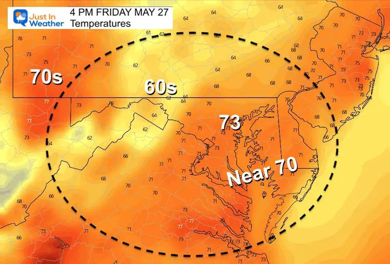
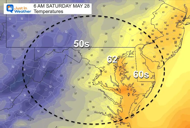
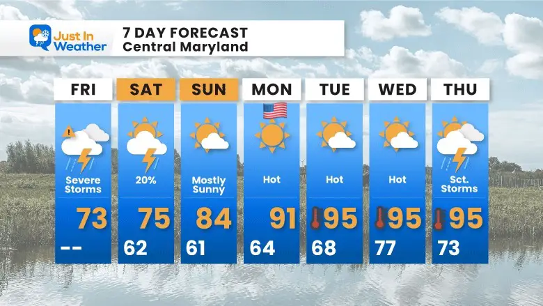
Friday May 27 2022
Updated Report
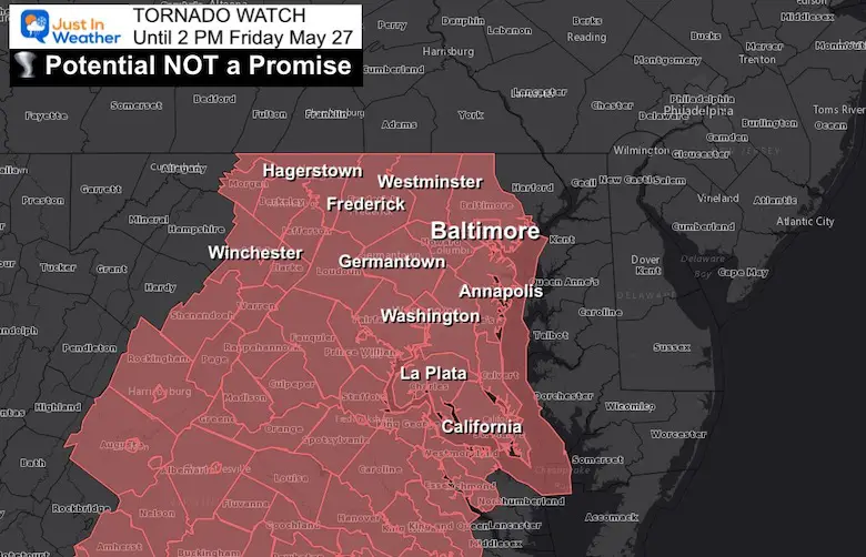
A Tornado Watch has been issued until 2 PM today. Storms may turn severe and can produce isolated tornado. This is a potential not a promise.
THE DISTRICT OF COLUMBIA
IN MARYLAND THIS WATCH INCLUDES 12 COUNTIES
ANNE ARUNDEL, HOWARD, MONTGOMERY
PRINCE GEORGES
CARROLL, FREDERICK, WASHINGTON
BALTIMORE, BALTIMORE CITY
CALVERT, CHARLES, and ST. MARYS
Reminder that a Watch means conditions are favorable. If your areas gets issued a Warning, that means a storm is being tracked AND seek cover immediately!
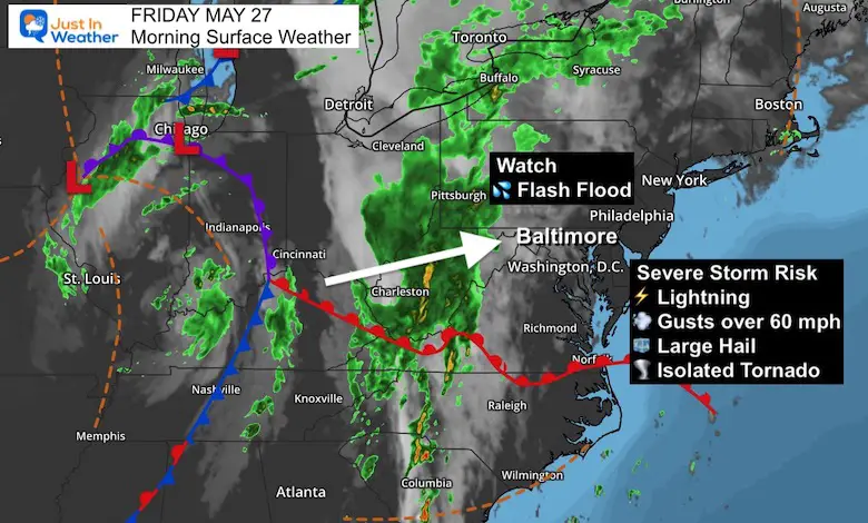
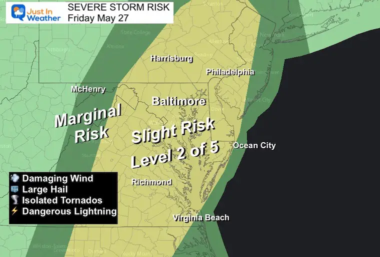
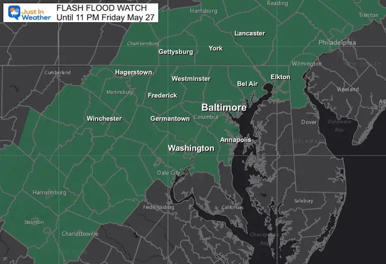
Today will be our big storm day. The main circulation is over Illinois, with the pump of tropical moisture and wind sheer well ahead of that moving over our region today. We have a high chance for rain and storms. Of them, there is a slight risk for cells to turn severe that may produce damaging winds, large hail, isolated tornados and flash flooding.
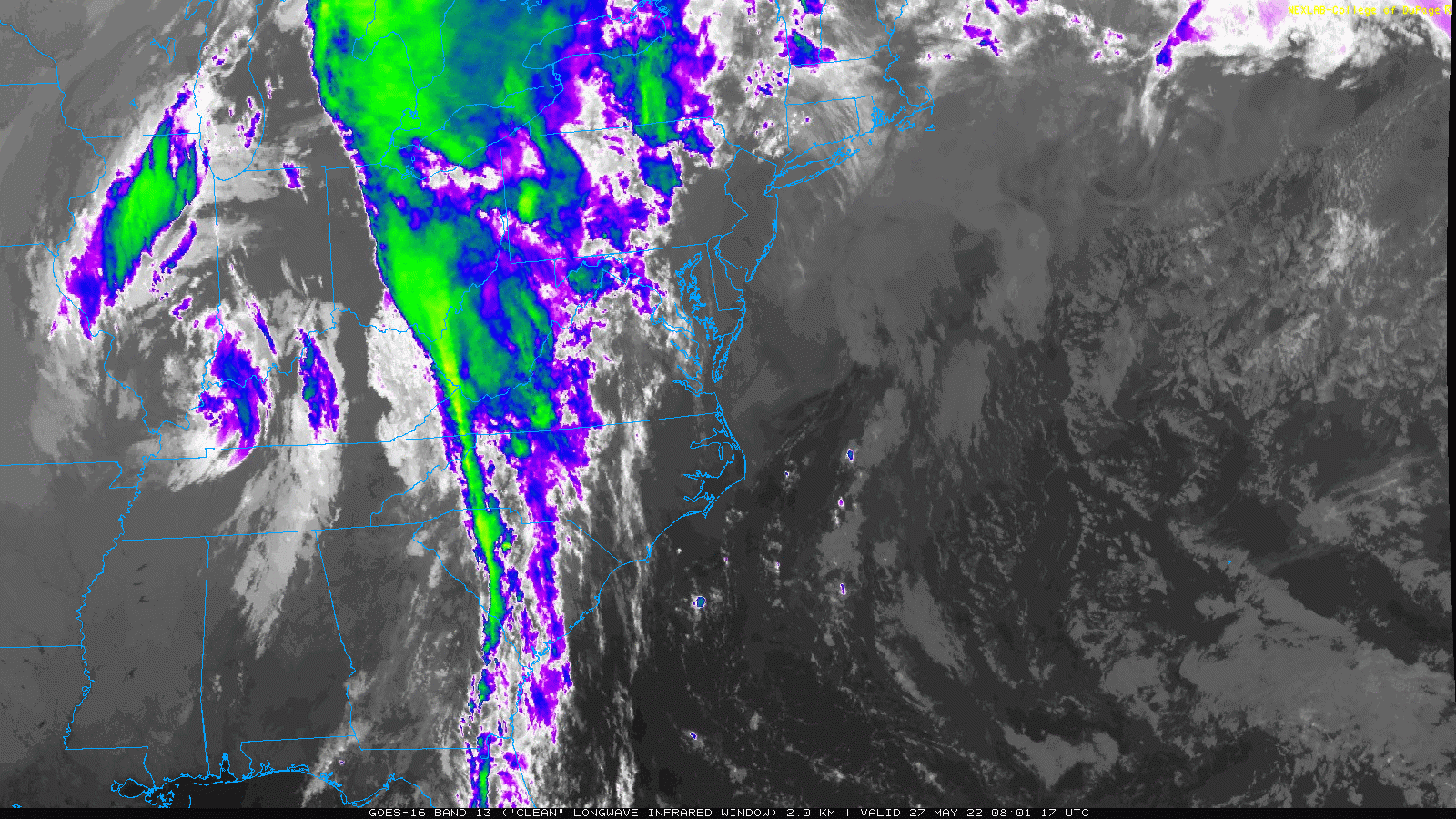
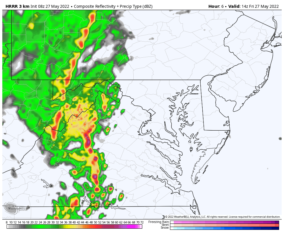
Storms are likely to begin this morning, with a few waves through midnight. The radar simulation I show here is not perfect, but a suggestion of how and when this may develop for your area.
Heavy rain for most of the I-95 corridor and the Mid Atlantic mountains.
The main point is that this will be widespread for many traveling today. My suggestion is to take your patience, or if you can simply wait until early Saturday to avoid extra traffic due to the weather.
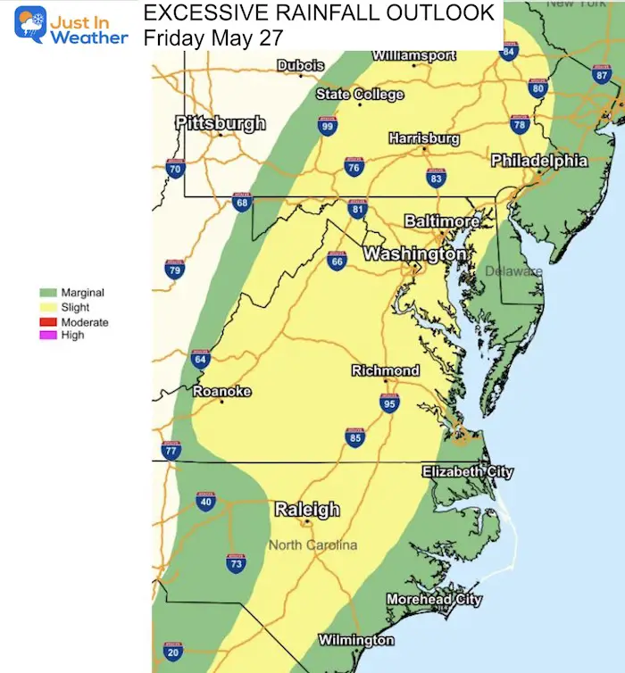
Local downpours may result in between 1 and 3 inches of rain locally today.
The focus is west and north of the Bay Bridge… Less is expected on Delmarva.
Multiple bands of rain will be advancing to the east-northeast.


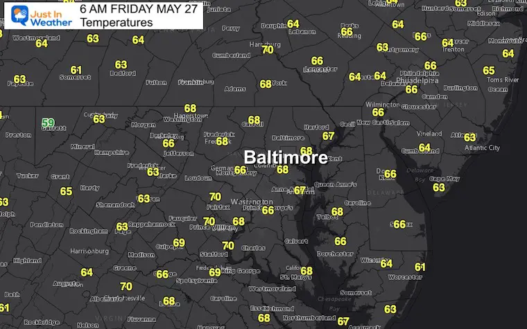
Normal Low in Baltimore: 56ºF
Record 43ºF in 1961
Keep this link handy… I’ll post the latest info as soon as I get it on this page.
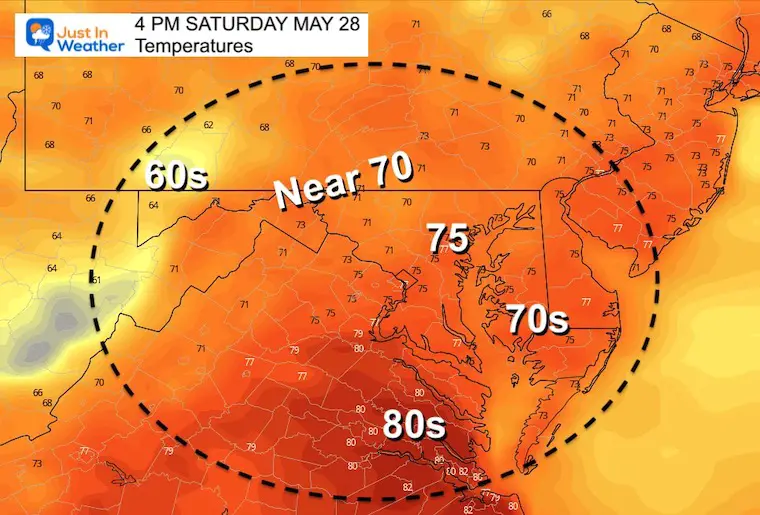
The back end of the Memorial Day Weekend begins our heat wave that will extend into next week.

May 16 Large Hail Videos And Storm Tracking Map


NOAA Study: Reducing Air Pollution INCREASED Tropical Storms

Atlantic Tropical History: Maps of Origin Regions Every 10 Days


*Disclaimer due to frequent questions:
I am aware there are some spelling and grammar typos. I have made a few public statements over the years, but if you are new here you may have missed it:
I have dyslexia, and found out at my second year at Cornell. I didn’t stop me from getting my meteorology degree, and being first to get the AMS CBM in the Baltimore/Washington region.
I do miss my mistakes in my own proofreading. The autocorrect spell check on my computer sometimes does an injustice to make it worse.
All of the maps and information are accurate. The ‘wordy’ stuff can get sticky.
There is no editor that can check my work when I need it and have it ready to send out in a newsworthy timeline.
I accept this and perhaps proves what you read is really from me…
It’s part of my charm.