December 31, 2023
Sunday Morning Update
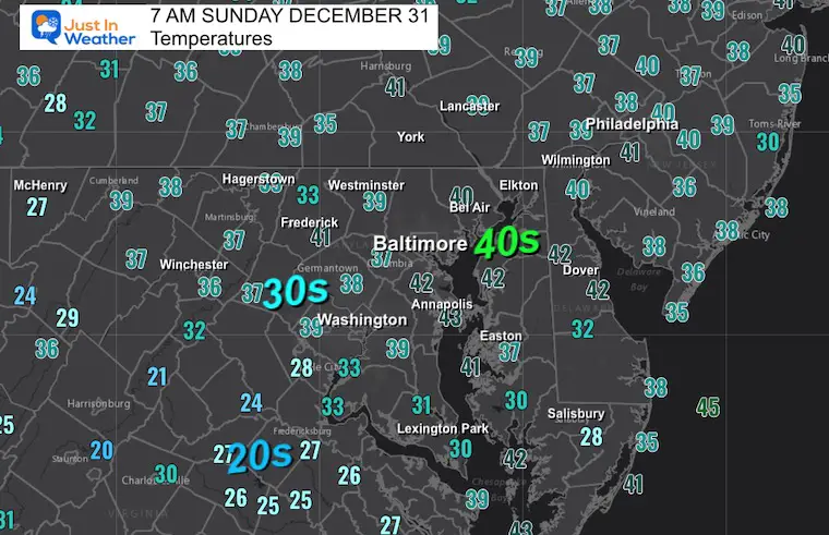
As we close out 2023, the temperatures have settled back closer to seasonally normal levels. The weather pattern does appear quiet, but we have a weak disturbance that will bring some showers tonight to ring in the new year.
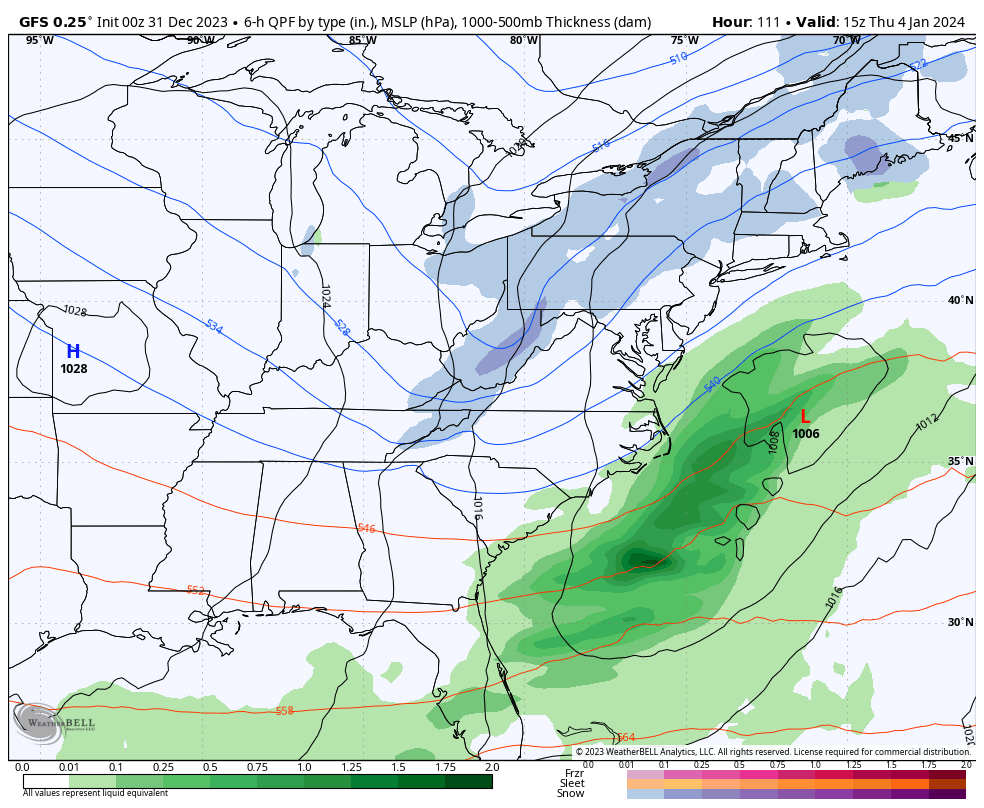
The chill will remain, then we look far ahead for the first signal of a winter storm. I will NOT hype; however, you may have already seen this blasted on many social media accounts. As of now, we see the potential for snow (inland) next Sunday. That is 8 days away and out of my comfort zone with the current modeling guidance. I will show the maps below with caution. Often, the first glance this far out is not the final result. However, we will have something to watch in the new year.
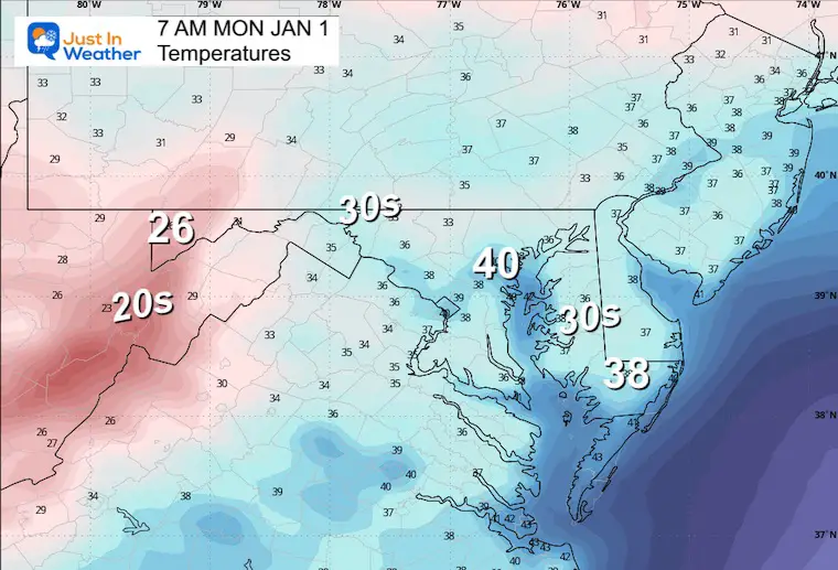
Morning Temperatures
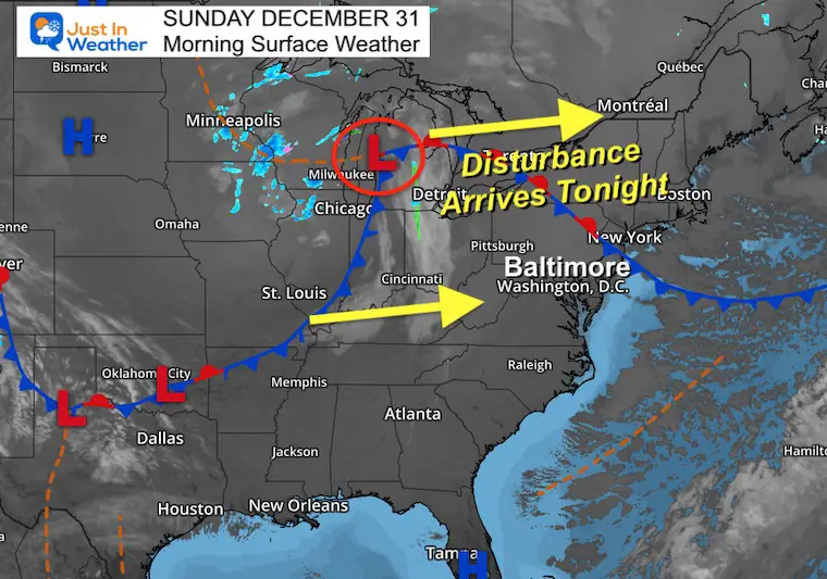
Morning Surface Weather
Seemingly quiet and uneventful. This disturbance will be arriving tonight and gaining a little more moisture to work with. That is the band of mountain snow and then rain showers into metro areas we will track tonight.
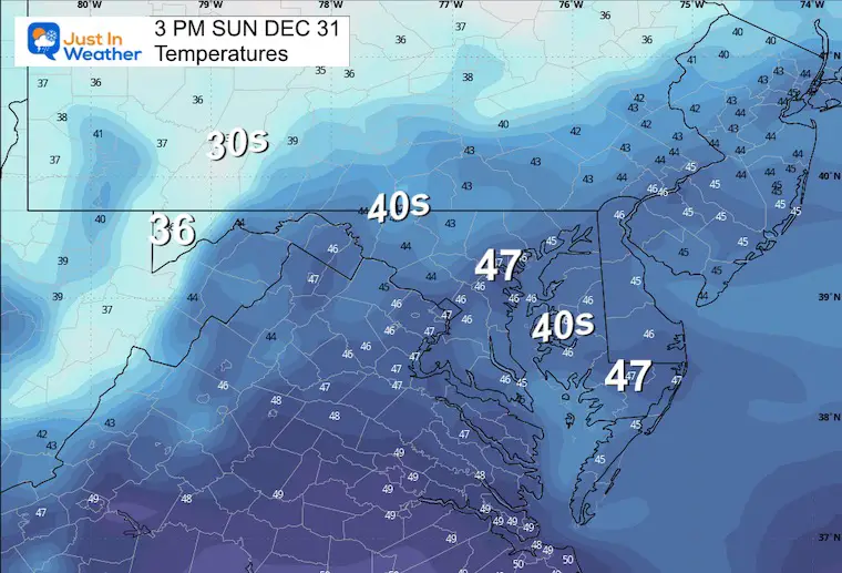
Afternoon Temperatures
Seasonably cool and dry for the Ravens Game.
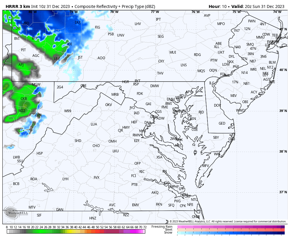
Radar Simulation 3 PM to Midnight
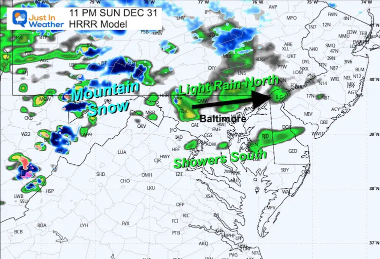
Snapshot at 11 PM
A band of showers will be reaching central Maryland and PA this evening.
Rain is more likely north of Baltimore, but some showers may reach the Inner Harbor and South.
Snow showers will persist in the mountains AND could mix in near York and Lancaster in PA.
CLIMATE DATA: Baltimore
TODAY December 31
Sunrise at 7:26 AM
Sunset at 4:53 PM
Normal Low in Baltimore: 27ºF
Record -1ºF in 1880
Normal High in Baltimore: 44ºF
Record 72ºF 1992
New Year’s Day Weather
Morning Temperatures
Afternoon Temperatures
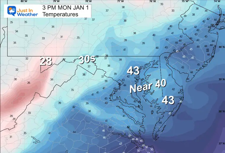
Weather Forecast
10 AM Thursday, January 4
The New Year will begin with a cooler pattern that brings us back to seasonal expectations.
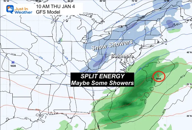
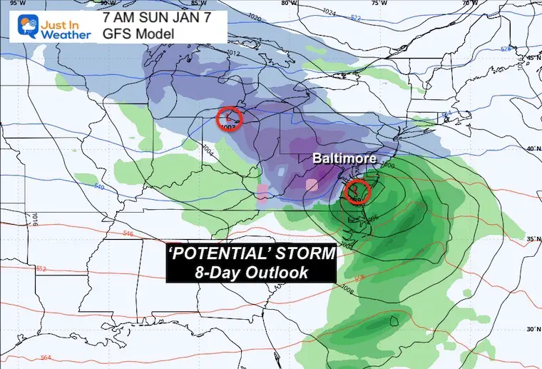
Animation Thu Jan 4 to Sun Jan 7
The first event as of now, appears to not team up… with the coastal energy being too far away. However, I need to see the chance for rain or snow showers on Thursday.
The weekend storm is 8 days away but does have the alignment of energy to produce a coastal winter storm.
Snapshot Sunday, January 7
This is 8 days away. That is important because I do NOT trust the model accuracy at this time. A lot of ingredients have to come together at the right time and location for it to happen, and a lot can change between now and then.
I am showing this for posterity. It is more important to highlight trends each day along the way… and I will reference this plot to compare.
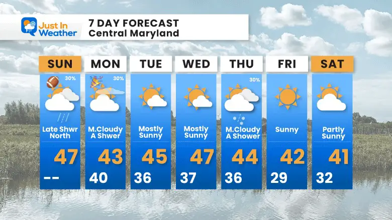
7 Day Forecast
Seasonably cool, or we can call it ‘near normal’ for the week ahead.
There is a chance for some rain/snow showers on Thursday. Then, the carrot hanging just out of reach in the form of a coastal storm next Sunday. It is not on this 7-day graphic, so it is just a ‘thought’ for now.
Subscribe for eMail Alerts
RECENT Winter Outlook Reports:

El Niño Winter Updates

Computer Models Support East Coast Storm Track

El Niño Advisory
The latest NOAA report is confident in a Very Strong event. Possibly HISTORIC! This refers to the temperatures in the Pacific, with impacts on the US Winter Storm Track.

Winter Weather Folklore: Top 20 and more signals from nature for snow.
NOAA’s Winter Outlook 2024
Winter Outlook 2024 From Two Farmers Almanacs Return to Cold and Snow
Explore More
Maryland Snow Climate History And Other Winter Pages

Faith in the Flakes Gear

STEM Assemblies/In School Fields Trips Are Back
Click to see more and ‘Book’ a visit to your school

Please share your thoughts and best weather pics/videos, or just keep in touch via social media
RESTATING MY MESSAGE ABOUT DYSLEXIA
I am aware there are some spelling and grammar typos and occasional other glitches. I take responsibility for my mistakes and even the computer glitches I may miss. I have made a few public statements over the years, but if you are new here, you may have missed it: I have dyslexia and found out during my second year at Cornell University. It didn’t stop me from getting my meteorology degree and being the first to get the AMS CBM in the Baltimore/Washington region. One of my professors told me that I had made it that far without knowing and to not let it be a crutch going forward. That was Mark Wysocki, and he was absolutely correct! I do miss my mistakes in my own proofreading. The autocorrect spell check on my computer sometimes does an injustice to make it worse. I also can make mistakes in forecasting. No one is perfect at predicting the future. All of the maps and information are accurate. The ‘wordy’ stuff can get sticky. There has been no editor who can check my work when I need it and have it ready to send out in a newsworthy timeline. Barbara Werner is a member of the web team that helps me maintain this site. She has taken it upon herself to edit typos when she is available. That could be AFTER you read this. I accept this and perhaps proves what you read is really from me… It’s part of my charm.
#FITF


