December 18, 2023
Monday Evening Update
The reinforcement of cold air tonight will include a disturbance that is swinging through Ohio now. This is an upper-level wind shift and not an organized storm. So, any discussion of snow is not well organized. This is not like the event we saw last week, however, it may provide a burst of flurries and snow showers after midnight into Tuesday morning.
It has already begun with a round of accumulating snow in the high mountains of western Maryland and West Virginia to support the ski areas that have opened (Wisp to Snowshoe).
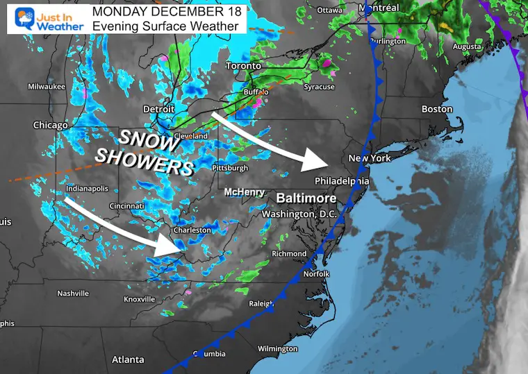
Set Up: Monday Evening Surface Weather
The snow showers have reached the nearby mountains.
The trough with the wind shift has been plotted across Ohio. This will reach metro areas before sunrise.
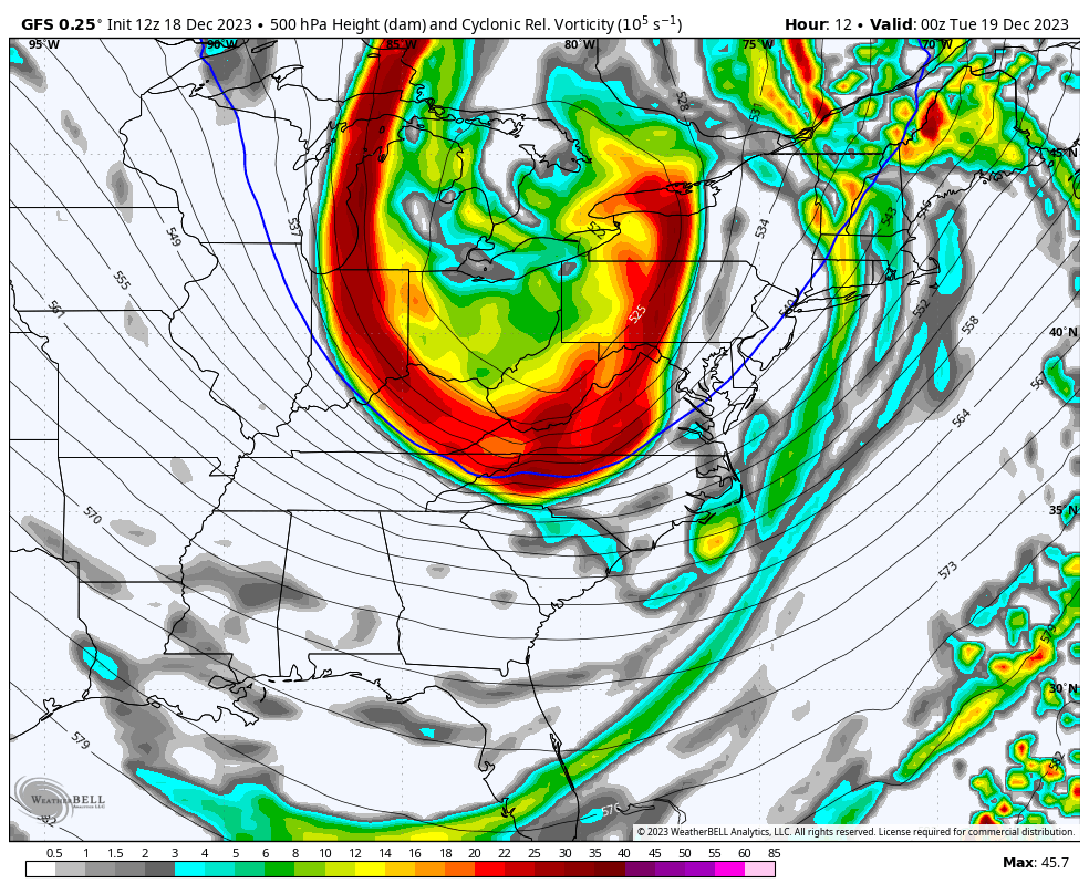
Forecast Animation: Jet Stream Vorticity
7 PM Monday to 7 PM Tuesday
This is the spin or instability around 18,000 Ft which can help develop showers that will survive over the mountains.
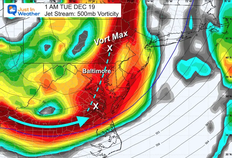
1 AM Tuesday
The energy will be with this trough. However, the main spin aloft will be North near Lancaster, PA, and exiting from Southeast VA.
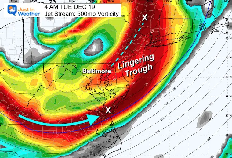
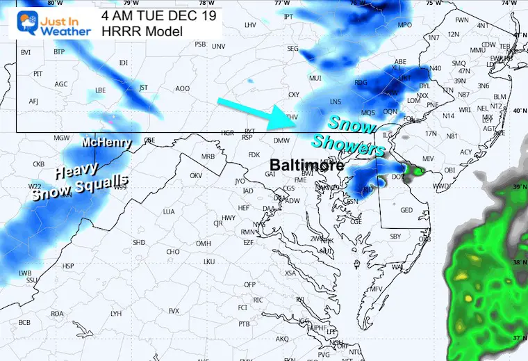
4 AM Tuesday
As the Vort Max moves into New York, the trailing trough may still support more flurries or snow showers.
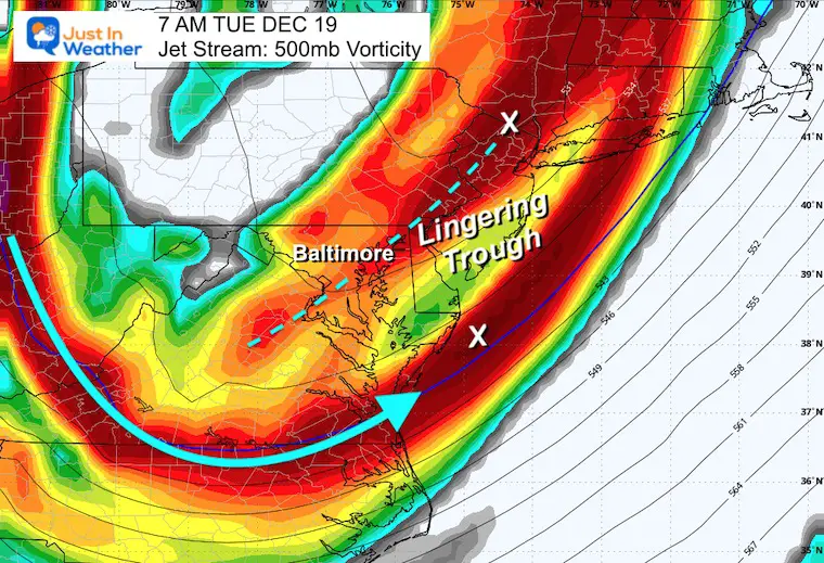
7 AM Tuesday
The trailing trough may linger along I-95 for a few hours with flurries and snow showers.
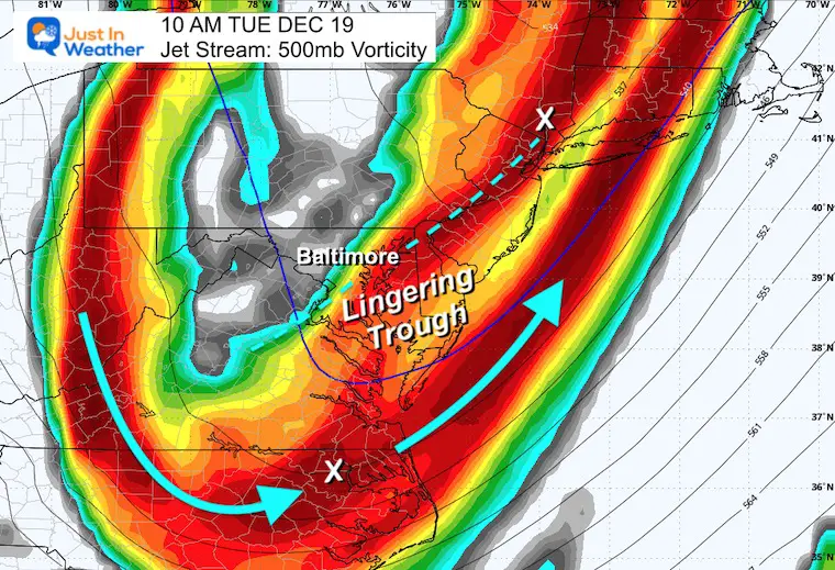
10 AM Tuesday
This trough will linger and finally move out later in the morning.
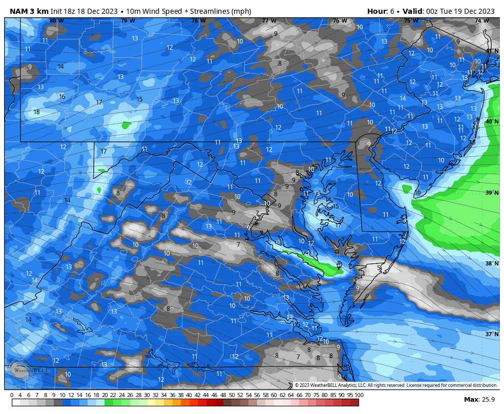
Wind Forecast: 7 AM to 7 PM
Winds will gust to 30 mph.
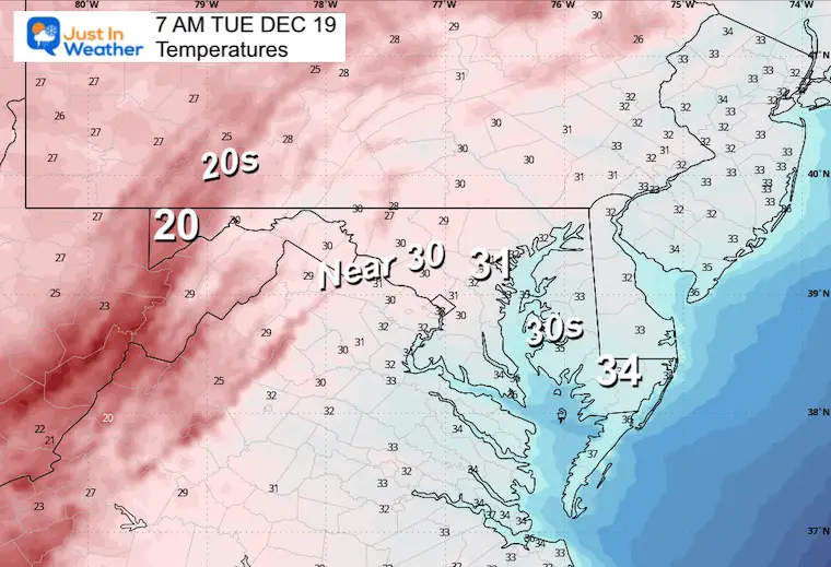
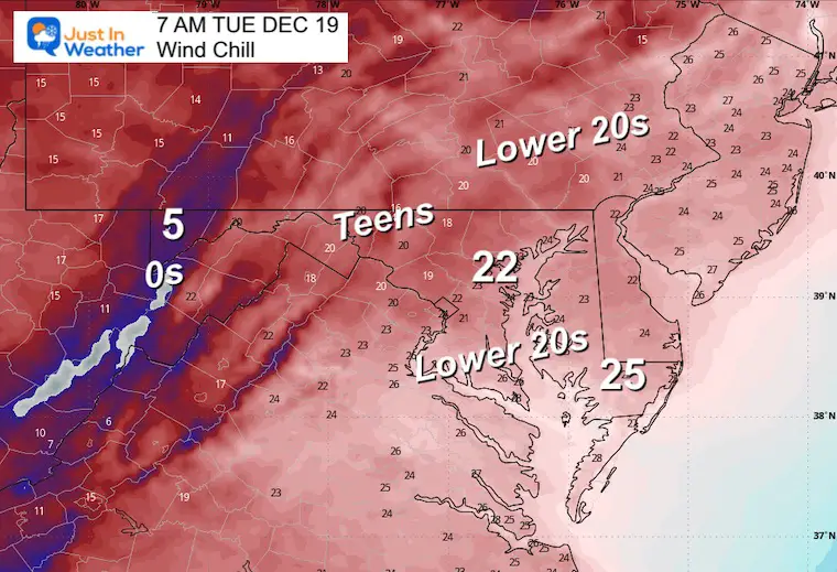
Temperatures
Wind Chill
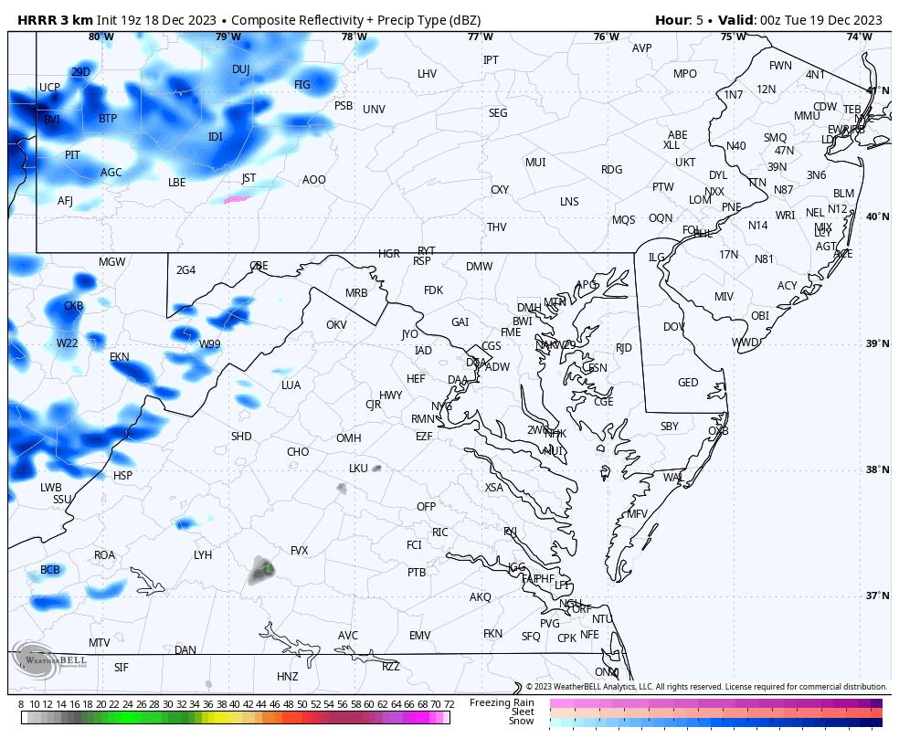
Radar Simulation: 7 PM Mon to 7 AM Tue
Disclaimer: This product often UNDER ESTIMATES snow showers in setups like this. We may see more flakes in Central Maryland than shown here. It will happen after midnight and last until daybreak.
Snapshots
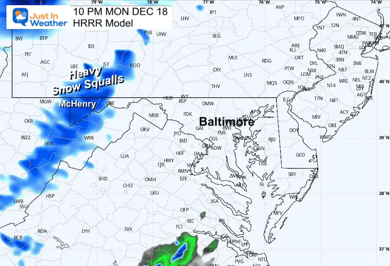
10 PM Monday
The main snow band will be locked up on the high mountains to our west. Snow may fall at the rate of 1 to 2 inches per hour with winds over 35 mph. Those are near blizzard conditions.
3 AM Tuesday
Snow showers and flurries may extend from York and Baltimore counties to perhaps some places around the Beltway.
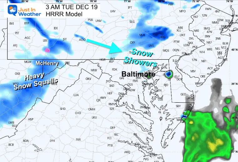
4 AM Tuesday
There has been some support for a brief snow shower or squall to cross the Northern Chesapeake Bay. It may include Kent and Cecil Counties.
Snow Forecast Maps
From the National Weather Service
I am skipping the model maps this time simply because this is a minimal event locally. However, there is a suggestion that may have matched some of your weather apps.
Maryland
The expectation of snow in Garrett County has been lowered, but still a potent accumulation of 5 to 8 inches around Deep Creek Lake.
Pockets of snow showers may drop a brief coating in North Central Maryland… and perhaps Kent and Cecil Counties on Delmarva.
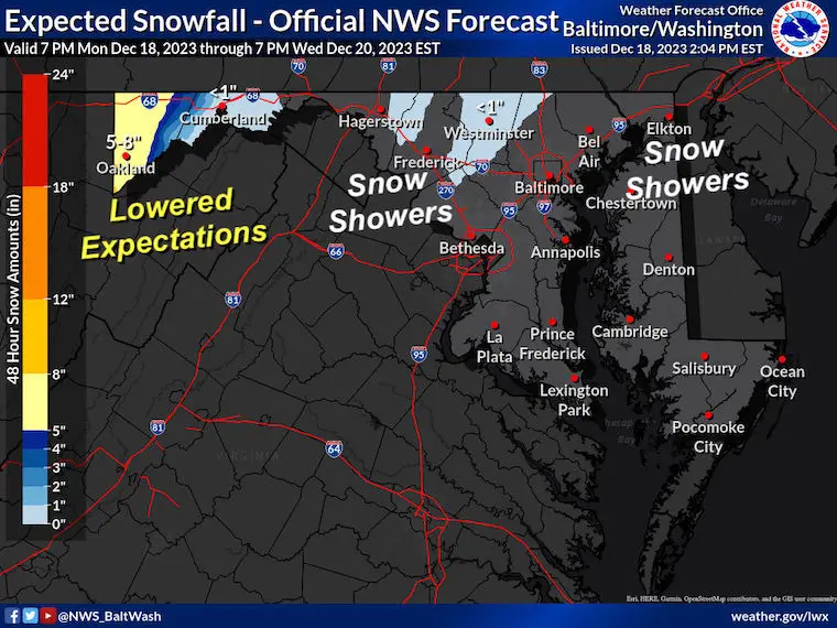
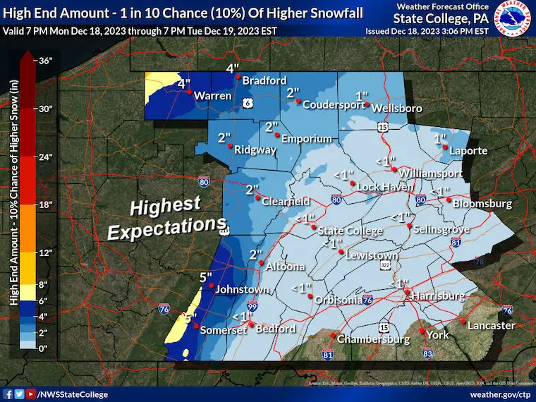
Pennsylvania
This does not look impressive for our border counties. But perhaps a brief coating on the grass is possible there as well.
Subscribe for eMail Alerts
RECENT Winter Outlook Reports:

El Niño Winter Updates

Computer Models Support East Coast Storm Track

El Niño Advisory
The latest NOAA report is confident in a Very Strong event. Possibly HISTORIC! This refers to the temperatures in the Pacific, with impacts on the US Winter Storm Track.

Winter Weather Folklore: Top 20 and more signals from nature for snow.
NOAA’s Winter Outlook 2024
Winter Outlook 2024 From Two Farmers Almanacs Return to Cold and Snow
Explore More
Maryland Snow Climate History And Other Winter Pages

Faith in the Flakes Gear

STEM Assemblies/In School Fields Trips Are Back
Click to see more and ‘Book’ a visit to your school

Please share your thoughts and best weather pics/videos, or just keep in touch via social media
RESTATING MY MESSAGE ABOUT DYSLEXIA
I am aware there are some spelling and grammar typos and occasional other glitches. I take responsibility for my mistakes and even the computer glitches I may miss. I have made a few public statements over the years, but if you are new here, you may have missed it: I have dyslexia and found out during my second year at Cornell University. It didn’t stop me from getting my meteorology degree and being the first to get the AMS CBM in the Baltimore/Washington region. One of my professors told me that I had made it that far without knowing and to not let it be a crutch going forward. That was Mark Wysocki, and he was absolutely correct! I do miss my mistakes in my own proofreading. The autocorrect spell check on my computer sometimes does an injustice to make it worse. I also can make mistakes in forecasting. No one is perfect at predicting the future. All of the maps and information are accurate. The ‘wordy’ stuff can get sticky. There has been no editor who can check my work when I need it and have it ready to send out in a newsworthy timeline. Barbara Werner is a member of the web team that helps me maintain this site. She has taken it upon herself to edit typos when she is available. That could be AFTER you read this. I accept this and perhaps proves what you read is really from me… It’s part of my charm.
#FITF


