September 28 Ghost of Ophelia Brings Back Clouds With Drizzle Low Temps And Higher Tides
September 28, 2023
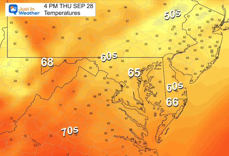
Thursday Morning Update
Here we go again. It was a nice break of sun yesterday, but the Ghost of Ophelia continues to spin and bring moisture in. It is a little stronger and as a result, we will get the clouds returning along with drizzle, showers, and higher tides.
We will have one more push of rain on Thursday and Friday. Then payback with dry air this weekend and a warming trend into next week… Just as October begins.
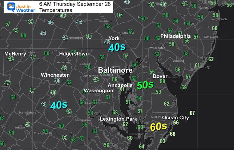
Temperatures
Morning Surface Weather
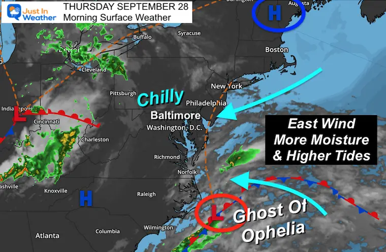
The remnant Low (ghost) of Ophelia has gained a little more strength. This is working with High Pressure in New England to funnel a little more wind and water FROM THE EAST.
Wind Forecasts
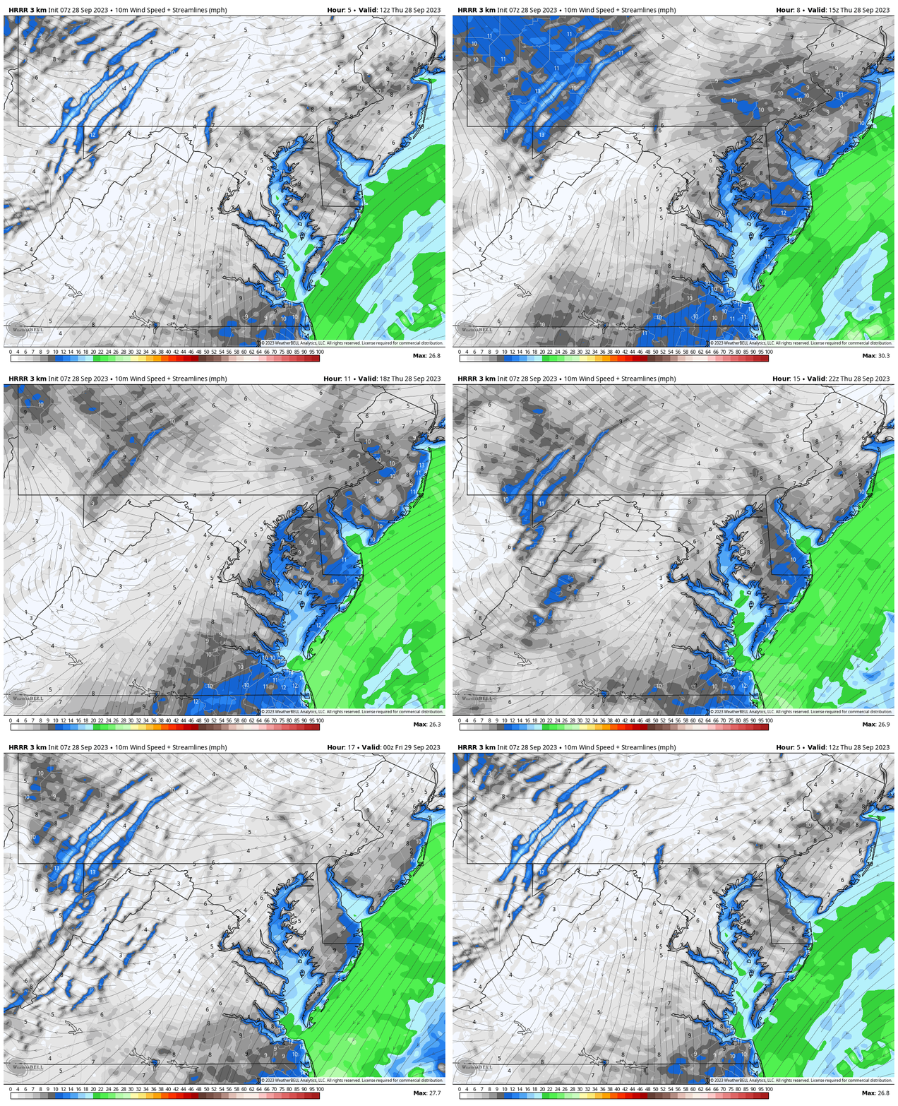
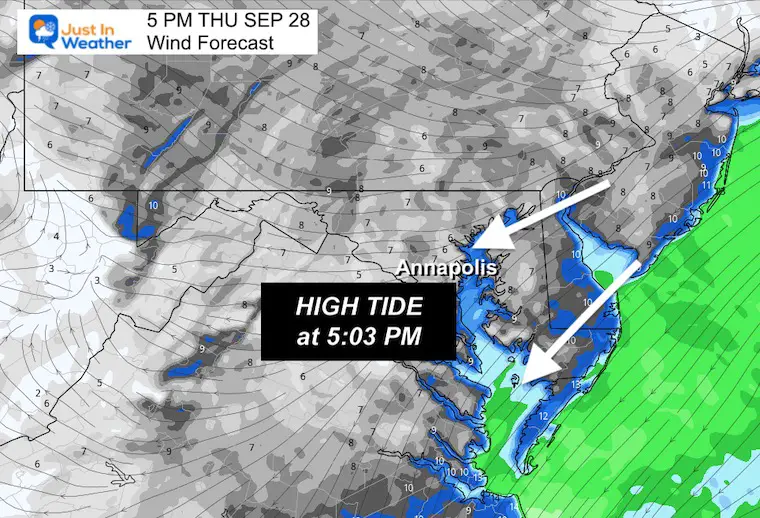
The winds will not be very strong, just persistent. This direction will work with the higher tides along the entire coast and slosh to the Western Side of the Bay.
Animation 8 AM to 8 PM
Snapshot at 5 PM
This will be around the high tide for Annapolis.
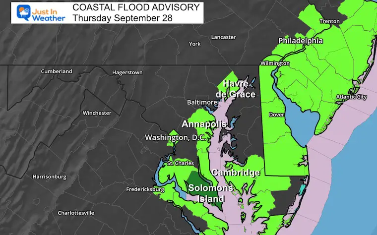
Coastal Flood Advisory
This is in effect for today and Friday. I got an email from Mike Mitchell who said this morning’s high tide was higher than last weekend. With the Super Moon turning Full Friday morning, that may be when we see the highest water level.
High Tides In Annapolis
Today
- 5:03 PM
Friday
- 5:29 AM
- 5:57 PM
Find More Locations at Salt Water Tide Charts for Maryland
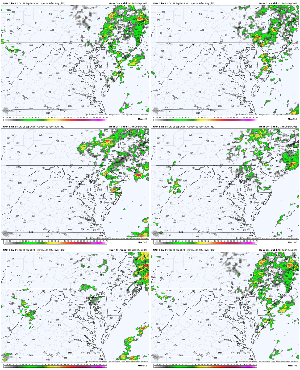
Radar Simulation
With the steady easterly wind flow, drizzle may not show up on radar. However, added moisture will develop some more noticeable rain showers.
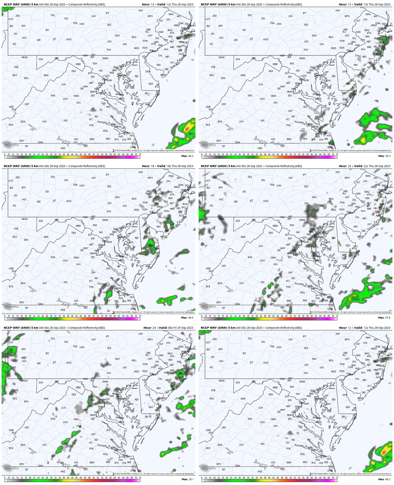
Snapshot at 4 PM
RE5PECT – Shirts and Hoodies
In case you missed it, my friends helped me make this tribute to Brooks Robinson. Proceeds will go to Boys and Girls Clubs of America. He played Little League with them in Little Rock before moving to Baltimore.
Click here or the image to get yours:
Sizes: T’s in Kids, Ladies(District), Unisex(Next Level), plus Hoodies (SportTek)!
CLIMATE DATA: Baltimore
TODAY September 28
Sunrise at 7:00 AM
Sunset at 6:54 PM
Normal Low in Baltimore: 54ºF
Record 40ºF in 1957
Normal High in Baltimore: 77ºF
Record 91ºF 1886
New Reports:
El Niño Advisory: First Look At NOAA’s Winter Outlook Expectations
Winter Outlook 2024 From Two Farmers Almanacs
Return to Cold and Snow
Subscribe for eMail Alerts
Weather posts straight to your inbox
Sign up and be the first to know!
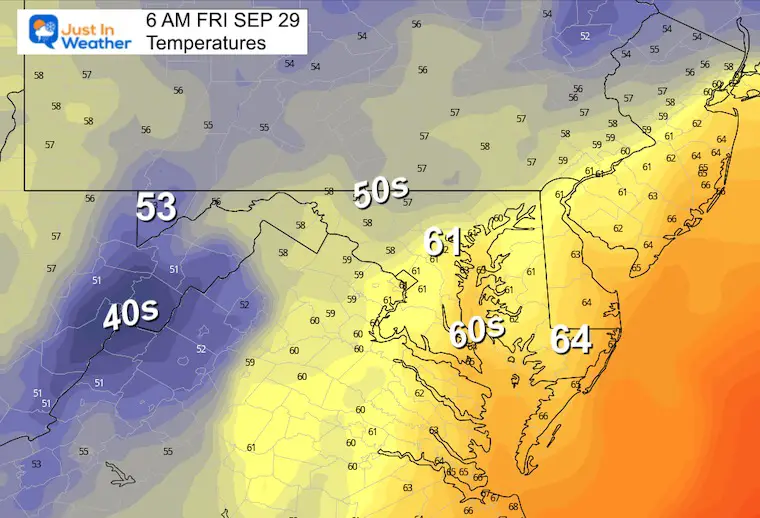
Friday
Low clouds and moisture continue to push in from the East. This means it will be cool and damp across most of our area.
Radar Simulation 6 AM to 8 PM
That east wind brings back drizzle, sprinkles, and scattered rain showers.
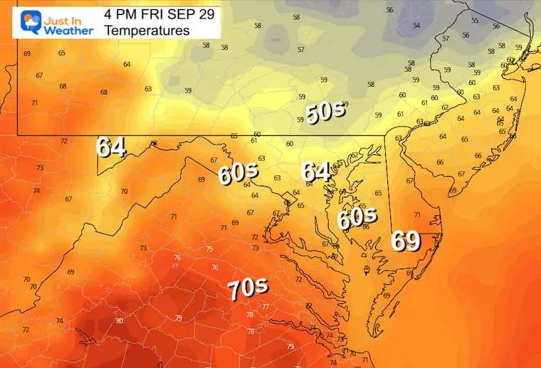
Temperatures
Not much movement on the thermometers with low clouds and moisture.
Morning
Afternoon
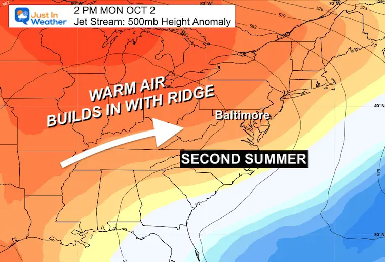
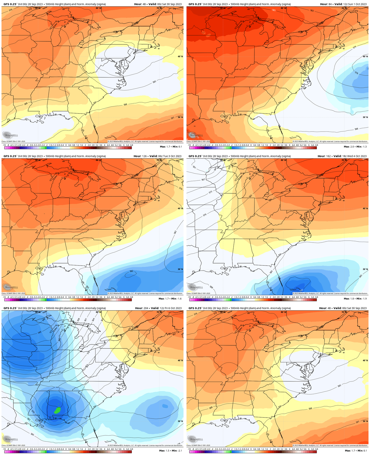
Looking Ahead: Jet Stream
Snapshot Monday, October 2
The Ridge of High Pressure is what will bring in a warmer air mass for much of next week. It will lock in on Monday.
Jet Stream Animation
Friday to Next Friday
Watch the warming trend shift in over the weekend and last most of next week. There will be an end in sight, and possibly a flip back to cooler rain… but for now, I want to focus on how long this warming trend will last.
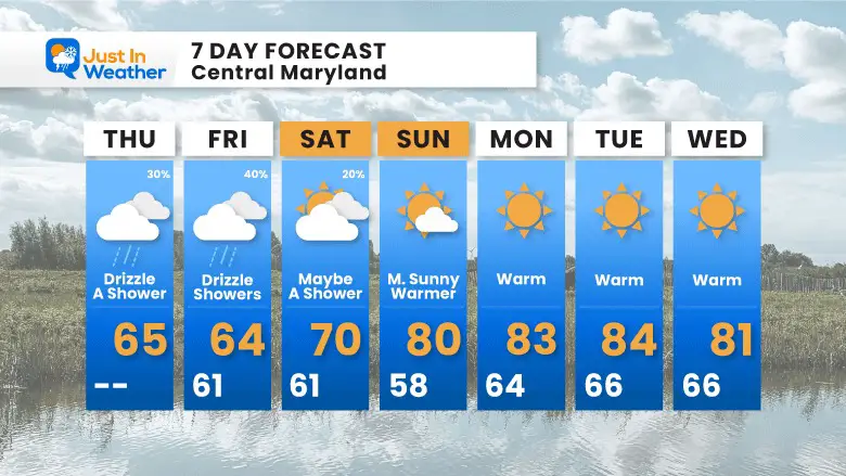
7 Day Forecast
The ghost of Ophelia will finally start to move away on Saturday and definitely by Sunday.
Then we get that SECOND SUMMER into the start of October as temps will reach the 80s much of next week.
Subscribe for eMail Alerts
Weather posts straight to your inbox
Sign up and be the first to know!
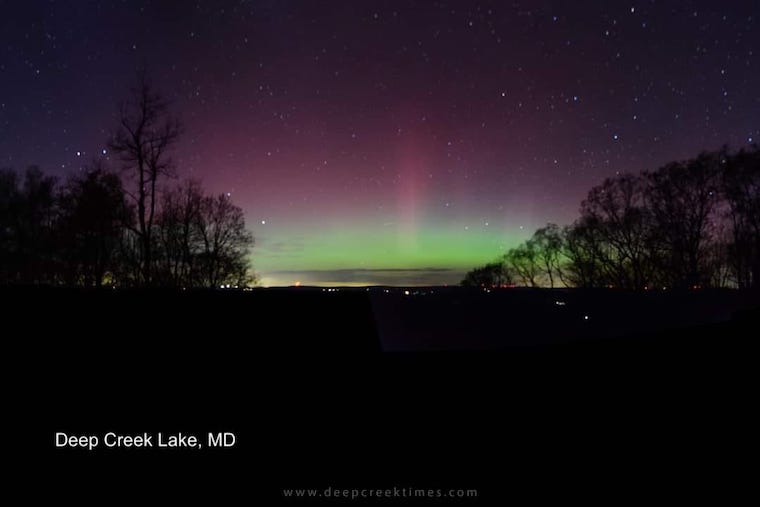
Aurora Photos From Maryland, Delaware, and Virginia
Please share your thoughts and best weather pics/videos, or just keep in touch via social media
-
Facebook: Justin Berk, Meteorologist
-
Twitter
-
Instagram
RESTATING MY MESSAGE ABOUT DYSLEXIA
I am aware there are some spelling and grammar typos and occasional other glitches. I take responsibility for my mistakes and even the computer glitches I may miss. I have made a few public statements over the years, but if you are new here, you may have missed it: I have dyslexia and found out during my second year at Cornell University. It didn’t stop me from getting my meteorology degree and being the first to get the AMS CBM in the Baltimore/Washington region. One of my professors told me that I had made it that far without knowing and to not let it be a crutch going forward. That was Mark Wysocki, and he was absolutely correct! I do miss my mistakes in my own proofreading. The autocorrect spell check on my computer sometimes does an injustice to make it worse. I also can make mistakes in forecasting. No one is perfect at predicting the future. All of the maps and information are accurate. The ‘wordy’ stuff can get sticky. There has been no editor who can check my work when I need it and have it ready to send out in a newsworthy timeline. Barbara Werner is a member of the web team that helps me maintain this site. She has taken it upon herself to edit typos when she is available. That could be AFTER you read this. I accept this and perhaps proves what you read is really from me… It’s part of my charm.
#FITF


