September 26, 2023
Tuesday Morning Update
It may be hard to believe that just two weeks ago we had a record-breaking heat wave. Now under the blanket of low clouds and lingering drizzle, our afternoon temps are running close to 15 degrees cooler than normal.
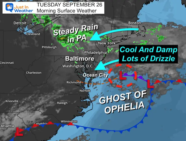
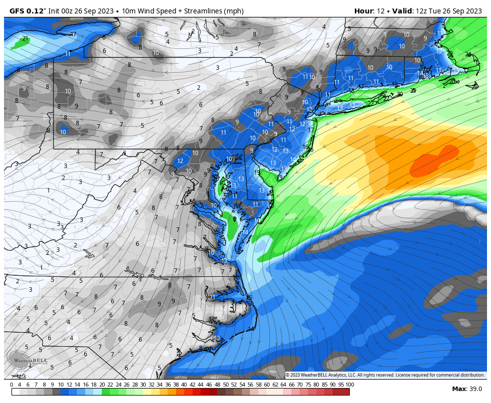
The ghost of Ophelia continues to linger off the coast. This will keep the steady light wind from the East. So more of the same for a few days: Drizzle, some showers, and temps staying nearly the same from morning to afternoon.
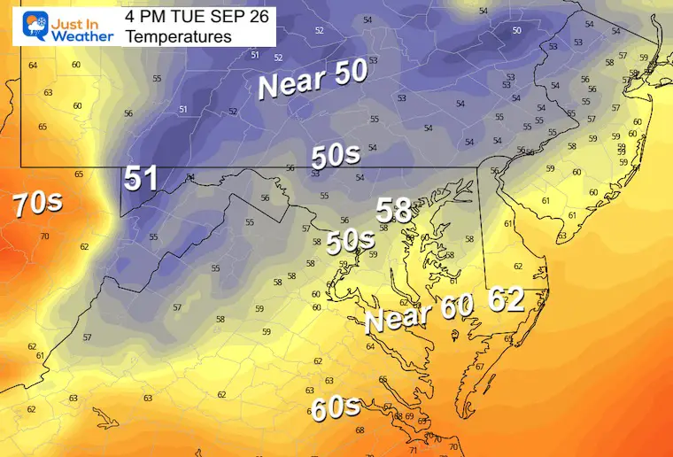
Temperatures
When we see very little spread in the morning, it is often due to cloud cover or precipitation. Here we see mid 50s to lower 60s in metro areas.

Live Radar: Interactive Widget
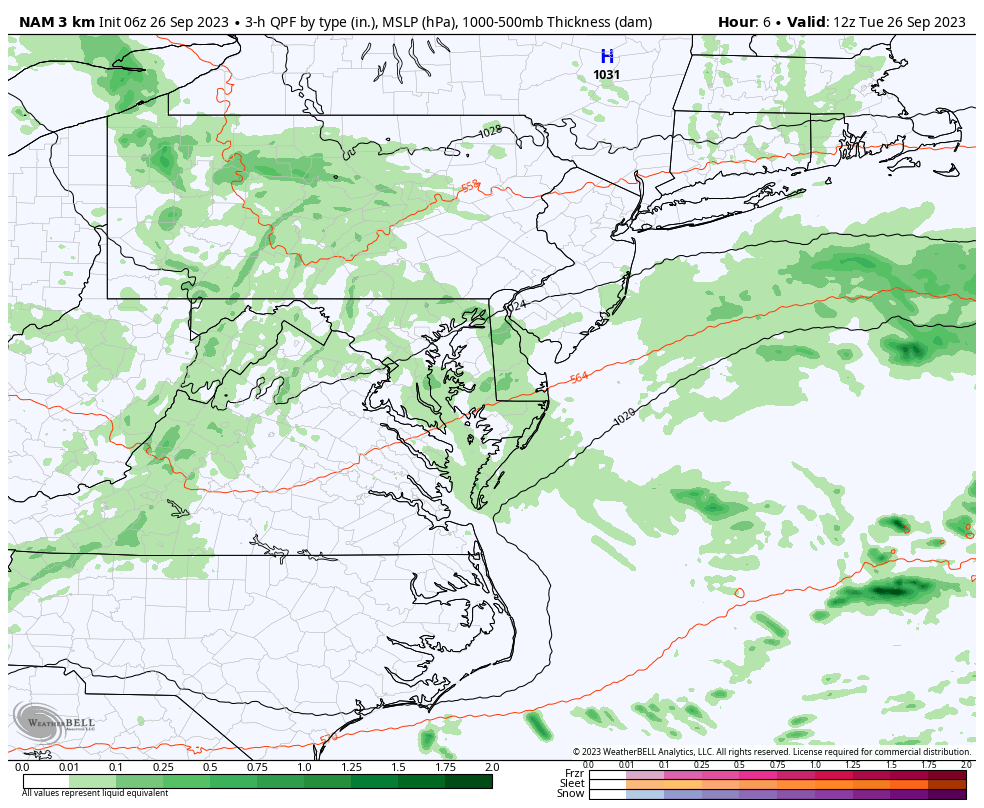
There is plenty of drizzle that may not show up on Radar. So use this with some discretion.
Steadier rain has been falling across central Pennsylvania. This is all in response to the ghost of Ophelia off the coast sending in an easterly wind.
Morning Surface Weather
The remnant Low of Ophelia is located off the East Coast. This will slowly drift southward and continue a persistent onshore flow. That means more of the same: Low clouds, drizzle, and some showers.
This also puts pressure on the coastlines for higher tides.
The Western Shore of the Chesapeake Bay may see additional flooding. Below is a look at the next few high tides in Annapolis for potential flooding.
Next High Tides In Annapolis
Today
Wednesday
Find More Locations at Salt Water Tide Charts for Maryland
Forecast Maps
Radar Simulation Today Through Thursday
The ghost of Ophelia will linger off the coast keeping the same onshore flow for a few days.
This will keep pockets of drizzle and a few additional showers.
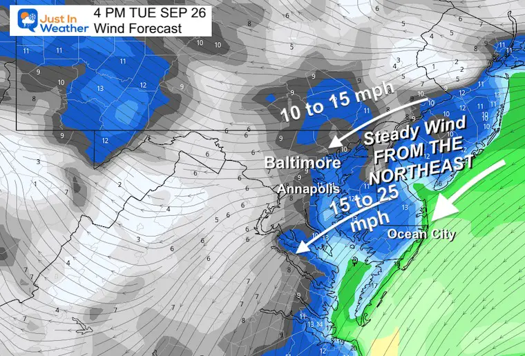
Wind Forecast 8 AM to midnight
A steady wind from the Northeast will continue around the Ghost of Ophelia.
Snapshot at 4 PM
Winds will range from 10 to 25 mph. Stronger on the water and across Delmarva.
Temperatures will barely move with the clouds and drizzle.
It is possible BWI ends up a little higher than this suggestion. I have metro Baltimore ‘Near 60ºF’.
Orioles Game Weather
Plan for it to be cool and damp. There may be lingering drizzle with temps ‘near’ 60ºF. The game should go on schedule.
CLIMATE DATA: Baltimore
TODAY September 26
Sunrise at 6:58 AM
Sunset at 6:58 PM
Normal Low in Baltimore: 55ºF
Record 40ºF in 1879
Normal High in Baltimore: 76ºF
Record 95ºF 1970
New Reports:
Subscribe for eMail Alerts
Wednesday
The continuing issue will be the onshore winds from the Northeast. Not strong, but keeping the drizzle and some showers (more east) in place.
Coastal Flooding may also be a routine at high tide on the Western Shore of the Bay and Ocean coastline.
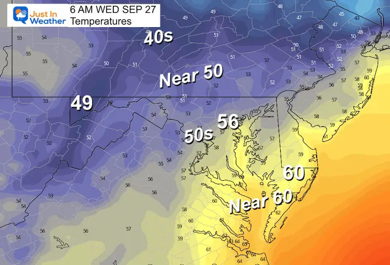
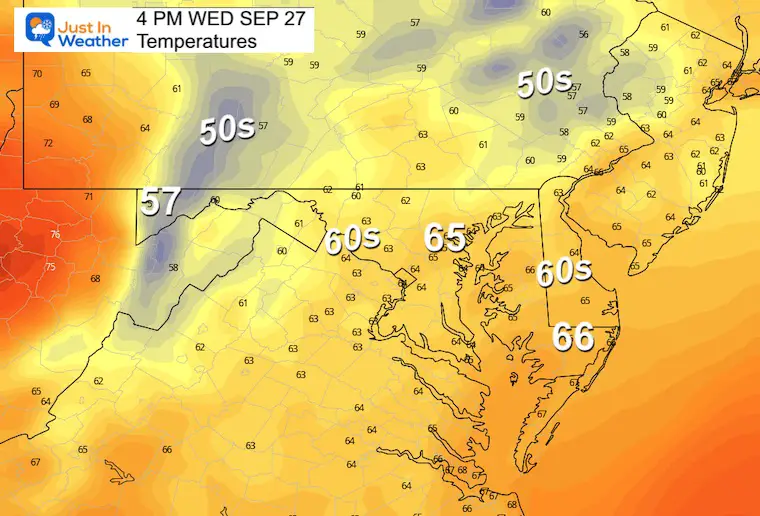
Temperatures
Once again there will be very little movement with the clouds and high moisture content in the air.
Morning
Afternoon
Looking Ahead: Wednesday through Tuesday
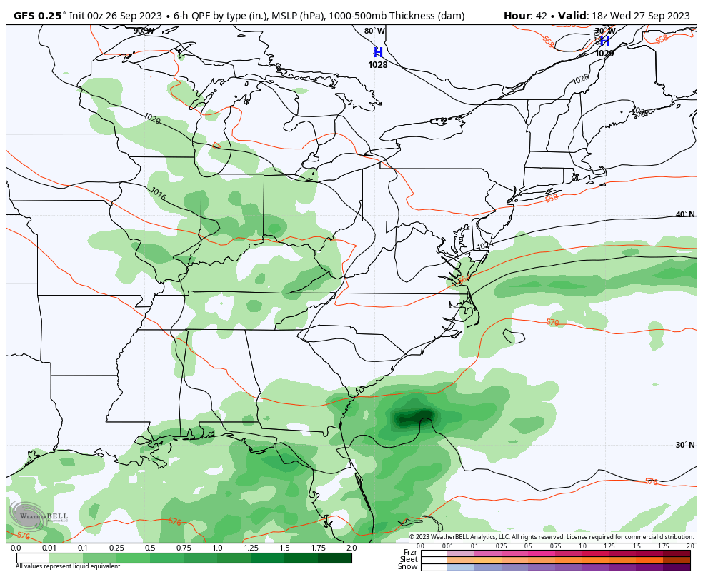
Surface Simulation
Lingering drizzle and showers will be hard to see on the radar and in this simulation. However, they will be there for a few days.
A new system may provide more showers later Thursday into Friday which should kick this pattern out of here. That will allow gradual clearing over the weekend into early next week.
Tropical Weather
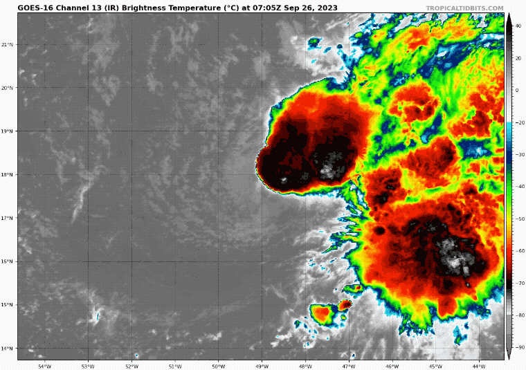
The newest storm in the Atlantic is Tropical Storm Philippe. This is in the central Atlantic and in my humble opinion is not going to be much more than a rainmaker for some of the Eastern Caribbean Islands.
Winds are at 50 mph and it is moving to the west but will interact with upper-level winds that will enhance sheer and degrade this over the next 5 days. This is more common with an El Niño set up in the Pacific.
Tropical Storm Philippe Satellite Loop
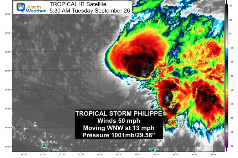
National Hurricane Center Update 5 AM
- LOCATION…17.7N 49.0W
- ABOUT 925 MI…1490 KM E OF THE NORTHERN LEEWARD ISLANDS
- MAXIMUM SUSTAINED WINDS…50 MPH…85 KM/H
- PRESENT MOVEMENT…WNW OR 285 DEGREES AT 13 MPH…20 KM/H
- MINIMUM CENTRAL PRESSURE…1001 MB…29.56 INCHES
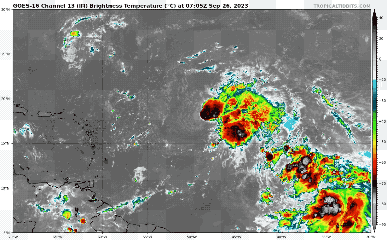
Wider Satellite Loop
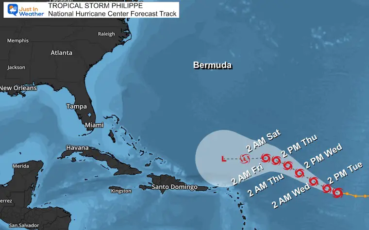
National Hurricane Center Forecast Track
Here we see it remaining a Tropical Storm, then downgraded to a Depression as it gets closer and passes North of the Caribbean. I need to point out that this remnant Low may end up in the same region where both Franklin and Idalia passed.
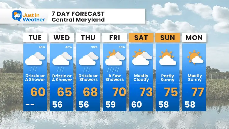
7 Day Forecast
While stuck under this pattern and the onshore East wind from the Ghost of Ophelia, we remain mostly cloudy with drizzle or showers through Thursday.
Subscribe for eMail Alerts

Please share your thoughts and best weather pics/videos, or just keep in touch via social media
RESTATING MY MESSAGE ABOUT DYSLEXIA
I am aware there are some spelling and grammar typos and occasional other glitches. I take responsibility for my mistakes and even the computer glitches I may miss. I have made a few public statements over the years, but if you are new here, you may have missed it: I have dyslexia and found out during my second year at Cornell University. It didn’t stop me from getting my meteorology degree and being the first to get the AMS CBM in the Baltimore/Washington region. One of my professors told me that I had made it that far without knowing and to not let it be a crutch going forward. That was Mark Wysocki, and he was absolutely correct! I do miss my mistakes in my own proofreading. The autocorrect spell check on my computer sometimes does an injustice to make it worse. I also can make mistakes in forecasting. No one is perfect at predicting the future. All of the maps and information are accurate. The ‘wordy’ stuff can get sticky. There has been no editor who can check my work when I need it and have it ready to send out in a newsworthy timeline. Barbara Werner is a member of the web team that helps me maintain this site. She has taken it upon herself to edit typos when she is available. That could be AFTER you read this. I accept this and perhaps proves what you read is really from me… It’s part of my charm.
#FITF


