September 2 Turning Hot Labor Day Weekend Worsening Drought
September 2, 2023
Saturday Morning Update
We really are in for a rude awakening. Overall this summer for the Mid Atlantic has been relatively comfortable and even cool at times. These last few mornings have been a sample of that. However, a large heat dome has dominated the middle of the nation and we can’t avoid it forever.
There will be a surge of heat starting tomorrow and lasting all of the week ahead. This may be a welcome end to summer for some, but not all, as local schools will be in full swing.
The one silver lining (to the clouds we may not see for a few days), is that the humidity will be low for the start of this heat wave. We can tell that as dew points remain in the 50s to near 60ºF, but they will turn more uncomfortable during the week.
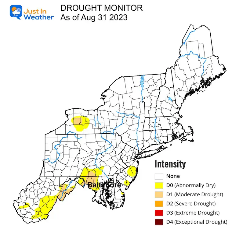
The other problem we face is the moderate drought. It may be confined to some areas at the last check but is likely to expand with many sunny days of no rain on top of the heat.
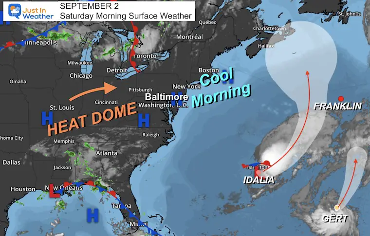
Morning Surface Weather
High Pressure is overhead, resulting in sinking air and little to no cloud cover for hundreds of miles.
The tropics look lively, but Idalia has lost its characteristics and Franklin has faded. Both are moving farther into the Atlantic. Gert is a storm that regenerated and is also no threat to the US.
So we look WEST for the dominant weather pattern and our building Heat Wave!
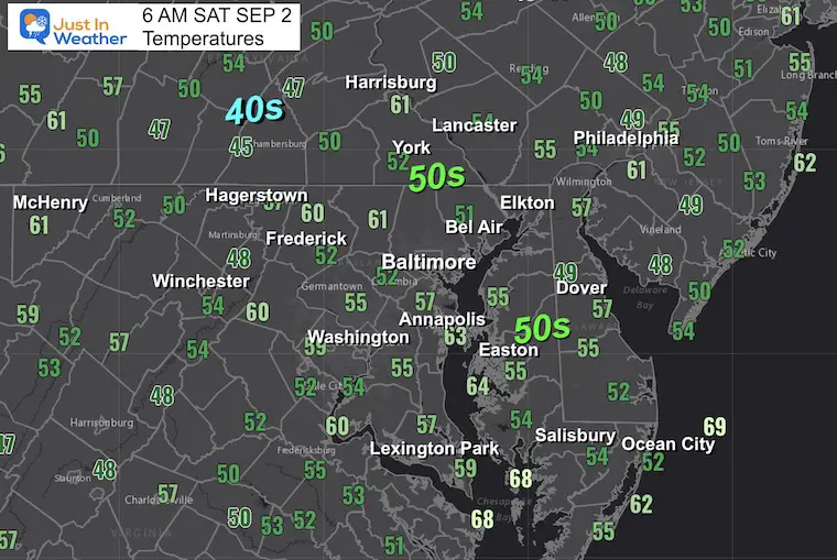
Morning Temperatures
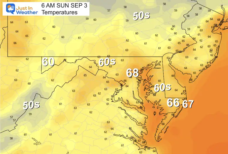
The last morning of a comfortable chill. I hope you enjoyed these 50s across much of the region, even 40s in some inland areas….
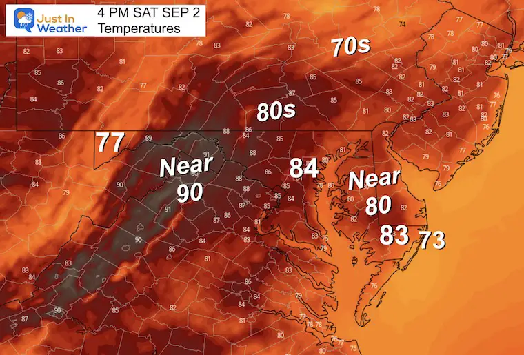
Afternoon Forecast
The warm-up will bring us back closer to average. Enjoy this afternoon of comfort.
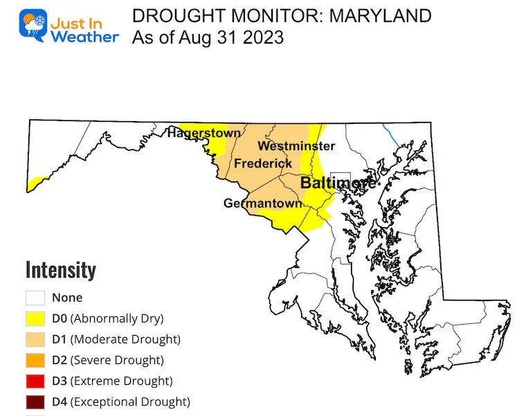
Drought Monitor
I will have a more detailed report shortly.
Maryland
A Moderate Drought is in place for much of Carroll, Frederick, and parts of Howard, Montgomery, and Washington Counties.
Northeast US
CLIMATE DATA: Baltimore
TODAY September 2
Sunrise at 6:36 AM
Sunset at 7:36 PM
Normal Low in Baltimore: 63ºF
Record 50ºF in 1892
Normal High in Baltimore: 84ºF
Record 99ºF 1953
Subscribe for eMail Alerts
Weather posts straight to your inbox
Sign up and be the first to know!
Jet Stream Forecast
ECMWF Saturday to Next Monday, Sep 11
Watch the Ridge of High Pressure and heat build in most of this week. Cooler weather will return next weekend.
Local Weather: Temperature Forecast
Sunday Morning
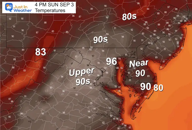
Sunday Afternoon
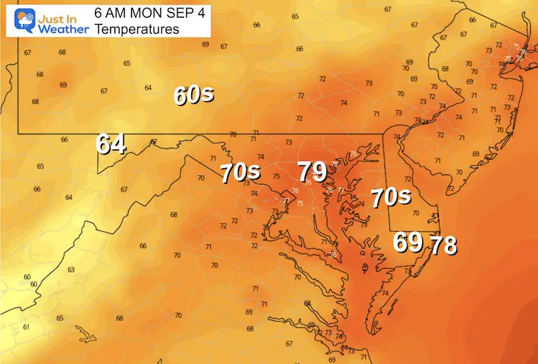
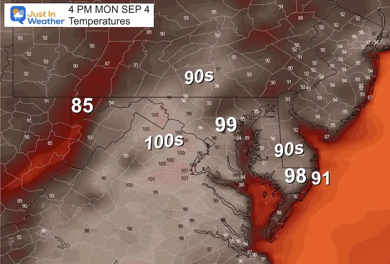
Labor Day Monday
Morning
Afternoon
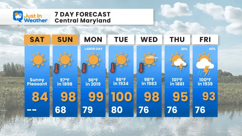
Record Highs For Baltimore
These are numbers that may be challenged over the next week.
- (Sun) Sept 3 = 97ºF in 1898
- (Mon) Sept 4 = 96ºF in 2019+
- (Tue) Sept 5 = 96ºF in 1954
- (Wed) Sept 6 = 98ºF in 1983
- (Thu) Sept 7 = 101ºF in 1881
- (Fri) Sept 8 = 100ºF in 1939
7 Day Forecast
We will get into the 90s as soon as Sunday and all of next week. The approach to 100ºF may happen a few more days than I noted below, yet most days may reach or set a new record high (as shown).
It should be noted that often we get heat waves to last longer than first suggested, so we could challenge records later in the week as well… especially if the risk of rain is diminished or pushed back.
EXPLORE MORE
2023 Hurricane Season Forecast With An El Niño Watch
EARLIER THIS MONTH: Maryland Trek 10 For These Kids
I will have a follow-up and recap on our amazing week shortly.
Subscribe for eMail Alerts
Weather posts straight to your inbox
Sign up and be the first to know!
La Niña Has Ended. El Niño May Return By Fall
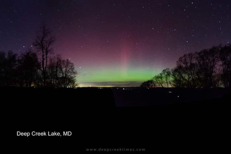
Aurora Photos From Maryland, Delaware, and Virginia
Please share your thoughts and best weather pics/videos, or just keep in touch via social media
-
Facebook: Justin Berk, Meteorologist
-
Twitter
-
Instagram
RESTATING MY MESSAGE ABOUT DYSLEXIA
I am aware there are some spelling and grammar typos and occasional other glitches. I take responsibility for my mistakes and even the computer glitches I may miss. I have made a few public statements over the years, but if you are new here, you may have missed it: I have dyslexia and found out during my second year at Cornell University. It didn’t stop me from getting my meteorology degree and being the first to get the AMS CBM in the Baltimore/Washington region. One of my professors told me that I had made it that far without knowing and to not let it be a crutch going forward. That was Mark Wysocki, and he was absolutely correct! I do miss my mistakes in my own proofreading. The autocorrect spell check on my computer sometimes does an injustice to make it worse. I also can make mistakes in forecasting. No one is perfect at predicting the future. All of the maps and information are accurate. The ‘wordy’ stuff can get sticky. There has been no editor who can check my work when I need it and have it ready to send out in a newsworthy timeline. Barbara Werner is a member of the web team that helps me maintain this site. She has taken it upon herself to edit typos when she is available. That could be AFTER you read this. I accept this and perhaps proves what you read is really from me… It’s part of my charm.
#FITF


