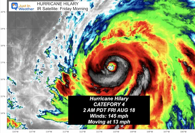
Major Hurricane Hilary: Category 4 With 145 mph Winds Friday Morning
Friday Morning Update August 18, 2023
Extremely powerful Major Hurricane Hilary is now Category 4. Overnight the explosive development that was expected brought the sustained winds around the eye wall to 145 mph! It should be noted that this is an El Niño year when higher activity is expected in the Pacific Ocean. This however is on the high level of extreme.
Hilary may have a little more strengthening to go, but will eventually run into colder water as it moves north along the Baja California Peninsula of Mexico.
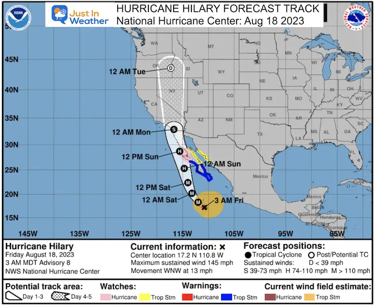
The latest forecast track does show a landfall near Southern California in a weakened phase. It may be a tropical storm or depression at that point, so the wind will not be a concern. There will still be very heavy rainfall which is trouble for the desert Southwest. A widespread 3 to 6 inches with up to 10 inches of rainfall could lead to flash flooding in places that are not prepared for this kind of rain.
History of Tropical Landfalls In Southern California:
- Since 1900 there have been 2
- 1939 – The last landfall, 86 years ago!
Hurricane Hilary IR Satellite
The colder colors are colored brighter and represent higher cloud cover.
A very well defined EYE and EYE WALL structure shows an extremely powerful storm.
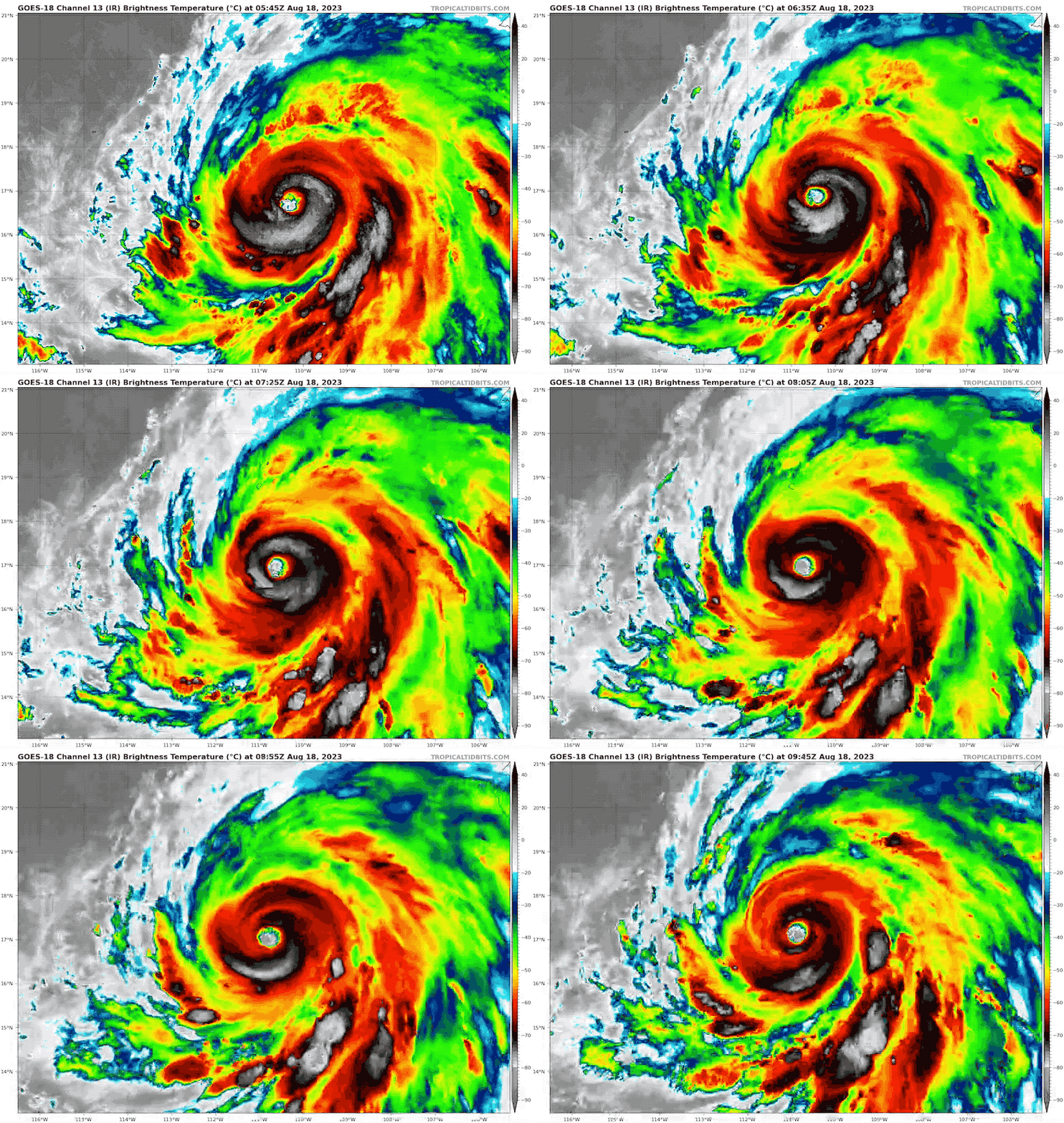
Satellite Snapshot
Hurricane Force Winds Extend: 45 miles from the center
Tropical Storm Force Winds Extend: 290 miles from the center
Official Status Report: 2 AM PDT (5 AM EDT) Advisory
LOCATION…17.2N 110.8W
ABOUT 110 MI…180 KM S OF SOCORRO ISLAND
ABOUT 400 MI…640 KM S OF CABO SAN LUCAS MEXICO
MAXIMUM SUSTAINED WINDS…145 MPH…230 KM/H
PRESENT MOVEMENT…WNW OR 300 DEGREES AT 13 MPH…20 KM/H
MINIMUM CENTRAL PRESSURE…942 MB…27.82 INCHES
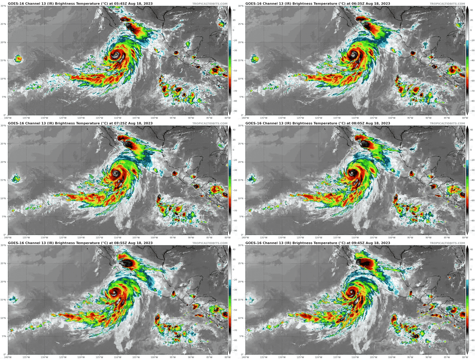
Wide Satellite
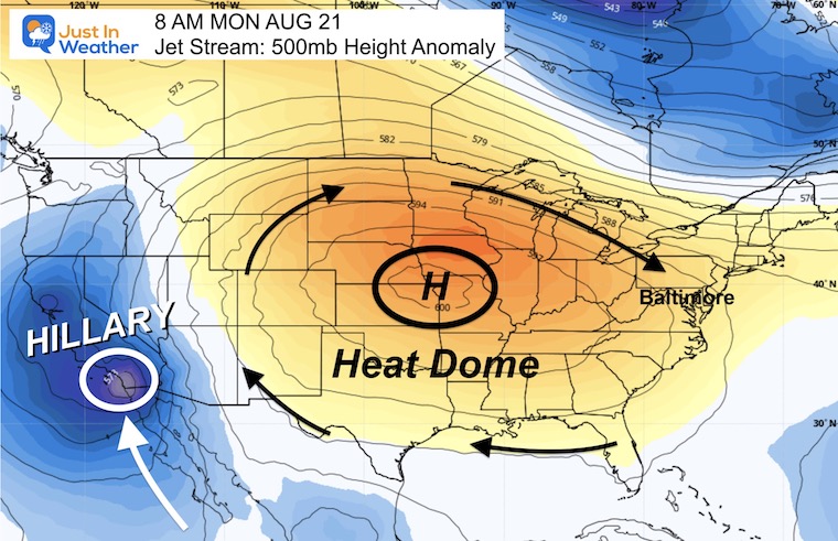
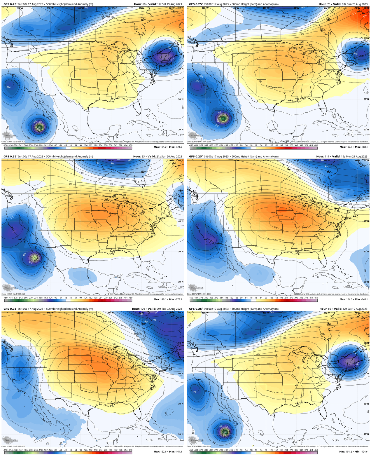
Upper Level Pattern
Snapshot Monday Morning
The large Heat Dome in the central US will help to steer Hilary into Southern California and continue North!
Jet Stream Animation
Saturday Morning to Tuesday Morning
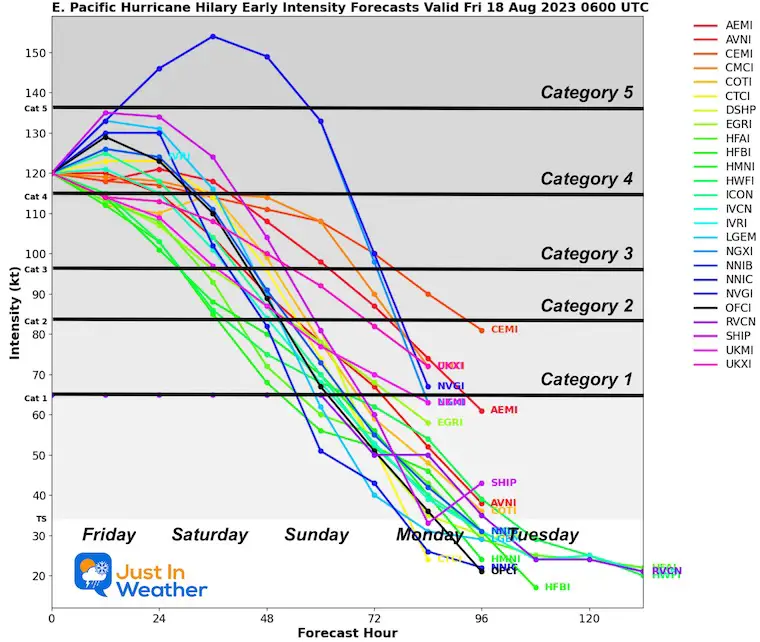
Hurricane Hilary Forecast Intensity
Intensity may maintain or get a little stronger today, then is expected to weaken as it moves over colder water.
National Hurricane Center Forecast Map
(Compare to model maps below)
Note that this track turns Hilary almost due north and skirts just off the Baja California of Mexico.
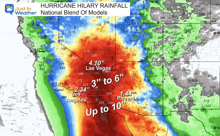
Forecast Focus
RAINFALL:
Hilary is expected to produce rainfall amounts of 3 to 6 inches, with isolated maximum amounts of up to 10 inches, across portions of the Baja California Peninsula through Sunday night.
Flash flooding, locally significant, will be possible.
Heavy rainfall in association with Hilary is expected to impact the Southwestern United States through next Wednesday, peaking on Sunday and Monday. Rainfall amounts of 3 to 6 inches, with isolated amounts of 10 inches, are expected across portions of southern California and southern Nevada, which would lead to significant and rare impacts. Elsewhere across portions of the Western United States, rainfall totals of 1 to 3 inches are expected.
Rainfall Forecast:
GFS Model Through Tuesday
Tropical Model Plots
Compare this Live Windy Widget to Forecast Model Animations Below
Live Windy Widget
Use the controls to scroll through the timeline or zoom in closer.
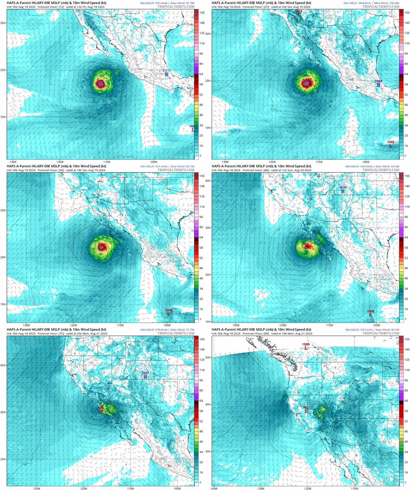
HAFS-A Model Forecast
Friday Morning to Monday Afternoon
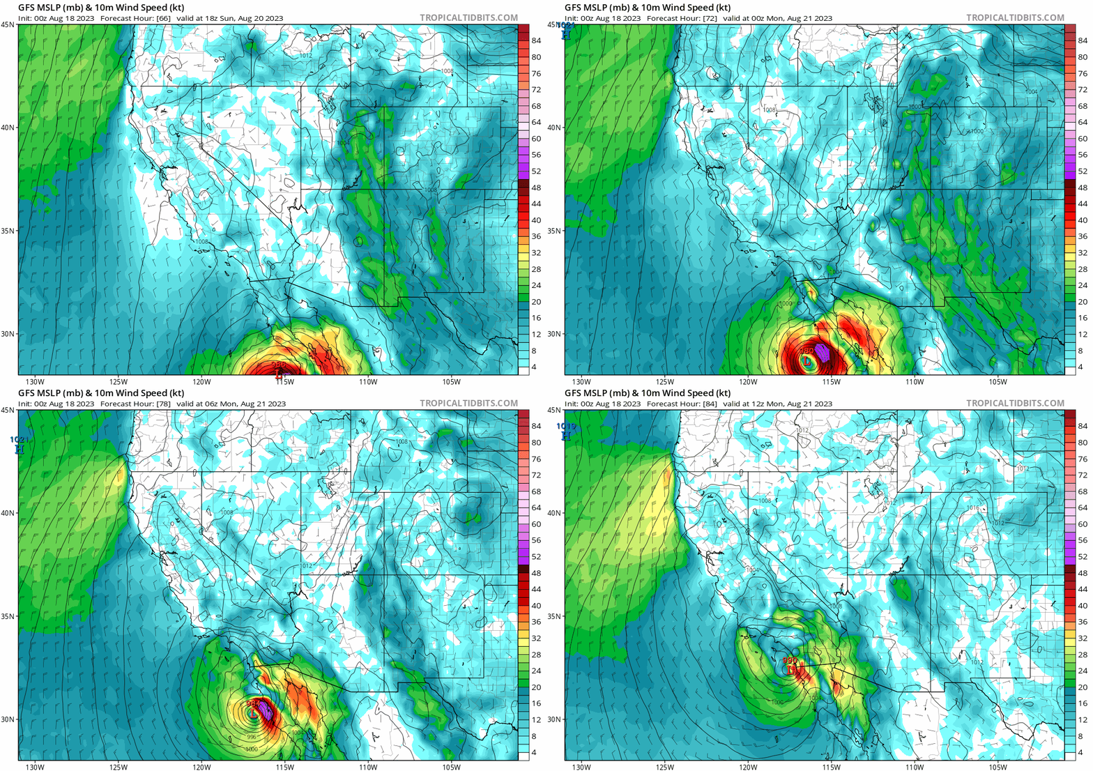
GFS Model
Sunday Afternoon to Monday Morning
EXPLORE MORE
2023 Hurricane Season Forecast With An El Niño Watch
La Niña Has Ended. El Niño May Return By Fall
LAST WEEK: Maryland Trek 10 For These Kids
I will have a follow-up and recap on our amazing week shortly.
Subscribe for eMail Alerts
Weather posts straight to your inbox
Sign up and be the first to know!
Aurora Photos From Maryland, Delaware, and Virginia
Please share your thoughts, and best weather pics/videos, or just keep in touch via social media
-
Facebook: Justin Berk, Meteorologist
-
Twitter
-
Instagram
RESTATING MY MESSAGE ABOUT DYSLEXIA
I am aware there are some spelling and grammar typos and occasional other glitches. I take responsibility for my mistakes and even the computer glitches I may miss. I have made a few public statements over the years, but if you are new here you may have missed it: I have dyslexia, and found out during my second year at Cornell University. It didn’t stop me from getting my meteorology degree and being the first to get the AMS CBM in the Baltimore/Washington region. One of my professors told me that I had made it that far without knowing and to not let it be a crutch going forward. That was Mark Wysocki, and he was absolutely correct! I do miss my mistakes in my own proofreading. The autocorrect spell check on my computer sometimes does an injustice to make it worse. I also can make mistakes in forecasting. No one is perfect at predicting the future. All of the maps and information are accurate. The ‘wordy’ stuff can get sticky. There has been no editor that can check my work when I need it and have it ready to send out in a newsworthy timeline. Barbara Werner is a member of the web team that helps me maintain this site. She has taken it upon herself to edit typos when she is available. That could be AFTER you read this. I accept this and perhaps proves what you read is really from me… It’s part of my charm.
#FITF


