July 9 Flood Watch AND NOAA Severe Storm Risk Today
July 9, 2023
Sunday Morning Update
The setup today in the simplest terms is humid and unstable. There is a cold front that will move through mid to late afternoon. Ahead of it, there are ripples of energy in the atmosphere that will help enhance the rising air allowing storms to start forming early.
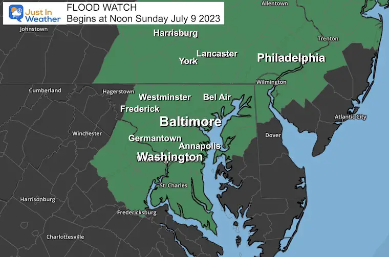
The concern is mainly for slow-moving, heavy rain-producing storms. That is why there is a Moderate Outlook for Excessive Rainfall. This means there is a 40%+ chance Flood Warnings will be issued. In the meantime, we have a Flood Watch that goes into effect at Noon.
Severe Weather Alerts:
A Watch is issued when there is ‘potential’ for that weather. We have one for Flooding at noon. There may be more Watches later for Severe Thunderstorms or even a Tornado, but I think that risk is low today.
A Warning is issued when the conditions are occurring. So when there is heavy rain in a location, a Flash Flood Warning will be posted with specific locations. This may happen for severe storms at times later today.
Flood Watch
Sunday Beginning at 12 PM
Slow-moving and or multiple storms may produce a quick 1 inch of rain, however, like this past week some areas could get 3 to 5 inches of rain!
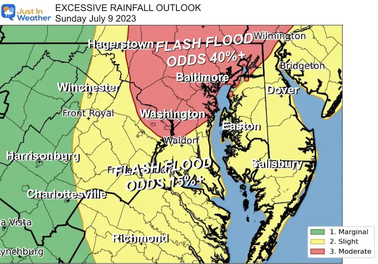
Excessive Rainfall Outlook
NOAA’s Storm Prediction Center issued a Moderate Risk (in red) for our region on Sunday. This includes Washington, Baltimore, York, and central Pennsylvania where there is a GREATER THAN 40% Chance Flash Flood Warnings will be issued.
The potential is for local storms that can easily drop 1 to 3 inches of rain in a hurry. But as we have seen in the past week, some storms can drop over 5 inches of rainfall enhancing the risk of flash flooding.
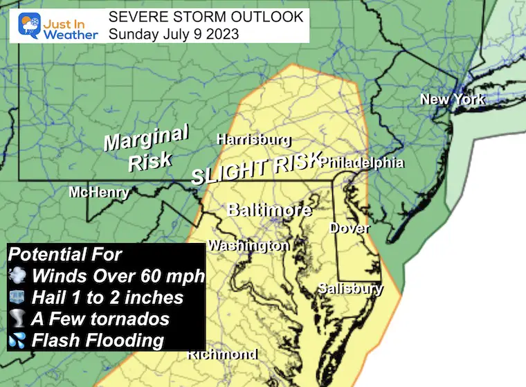
NOAA Severe Storm Risk
There may be showers in the morning, but the main event will be with the cold front later afternoon.
‘Slight Risk’ means a higher chance for storms to produce:
- Damaging winds over 60 mph
- Hail over 1 inch in diameter.
- A few tornadoes
- Flash Flooding
Morning Surface Weather
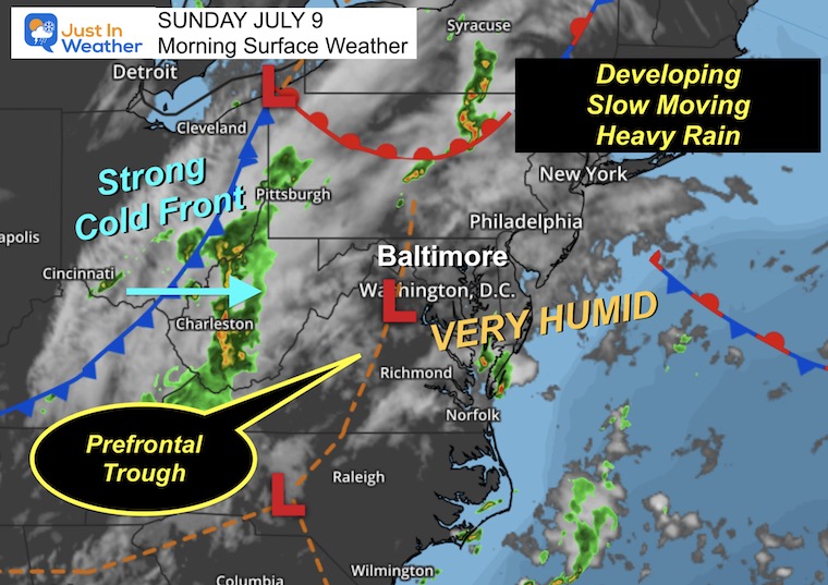
The atmosphere is CHARGED and ready to ignite. The humidity will work with building heat and the prefrontal trough to develop spotty showers this morning. The cold front will approach this afternoon, adding to the lift and resulting in heavy rain-producing storms.
The slow movement is the concern, meaning storms may last for many hours over some locations. This will dramatically increase the rainfall totals.
Live Radar and Lightning Widget
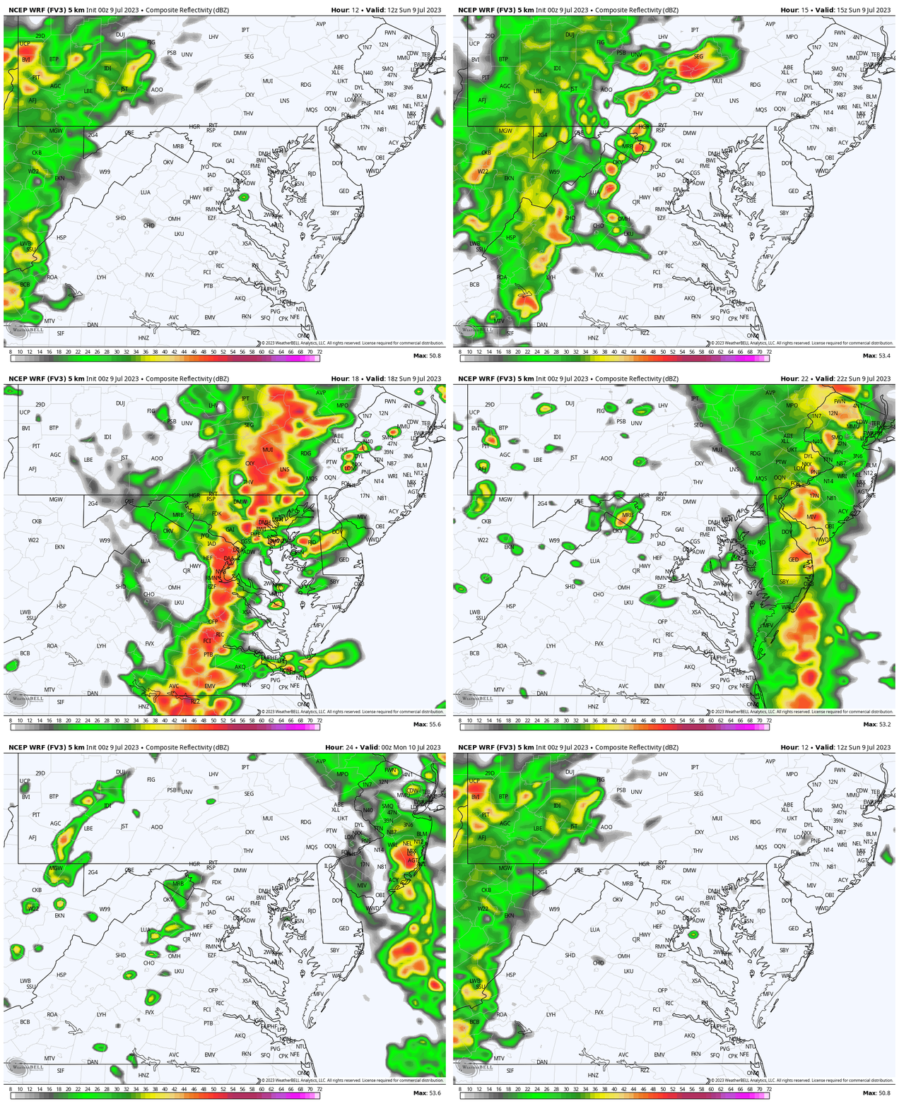
Some showers will develop later this morning through noon. This afternoon will have the most action. Compare to the forecast maps below.
Radar Simulation
WRF Model 8 AM to 8 PM
Hourly Snapshots
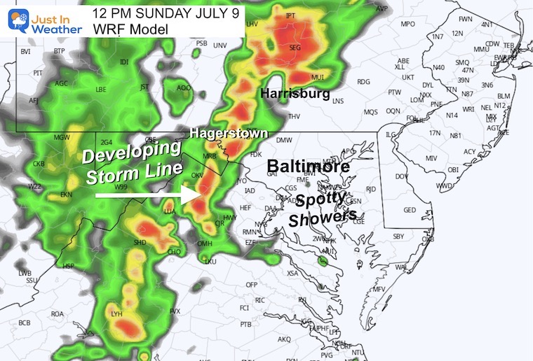
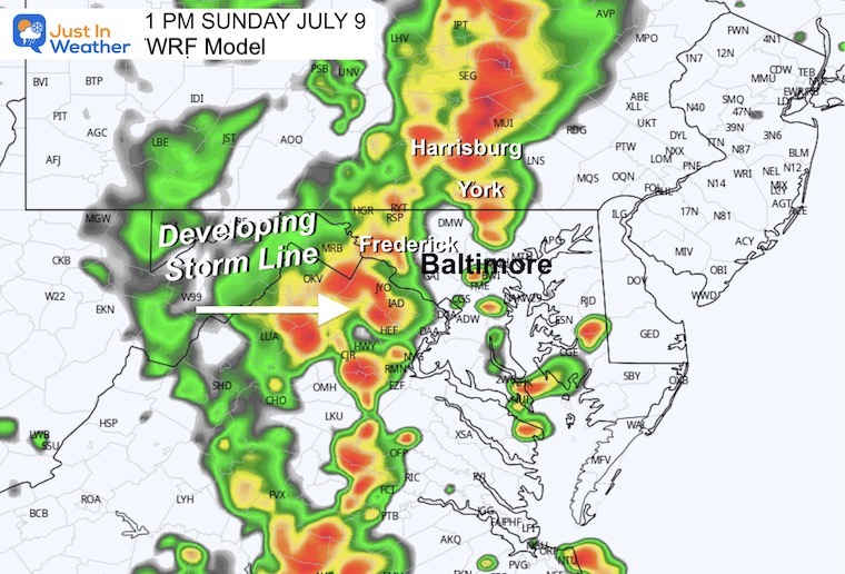
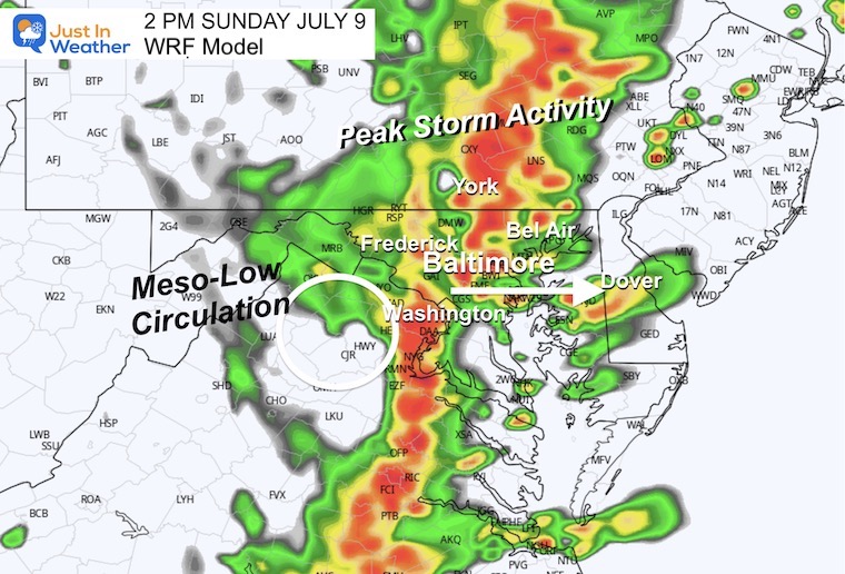
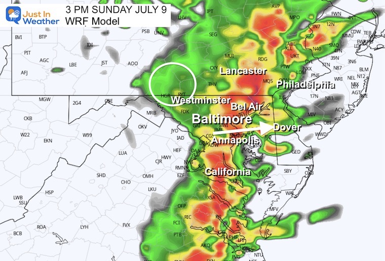
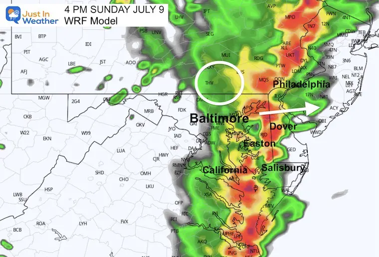
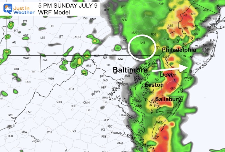
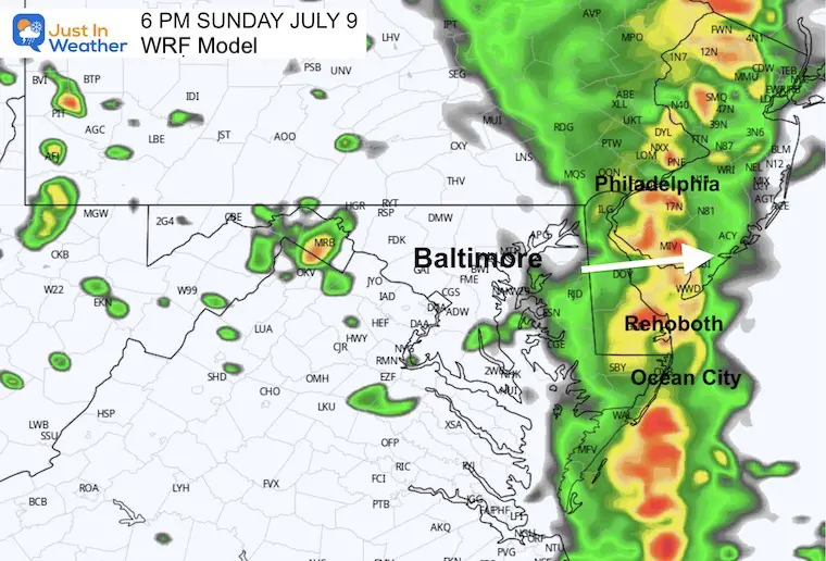
These are still timeframes from the model above. Please remember this is a suggestion, not a promise. This is the model I deemed to be performing the best. There is a consistency with all models I’ve reviewed to bring the peak activity to central Maryland between 2 PM and 6 PM. A little later, late afternoon and evening for Delmarva to the beaches.
12 PM Snapshot
1 PM Snapshot
2 PM Snapshot
3 PM Snapshot
4 PM Snapshot
5 PM Snapshot
6 PM Snapshot
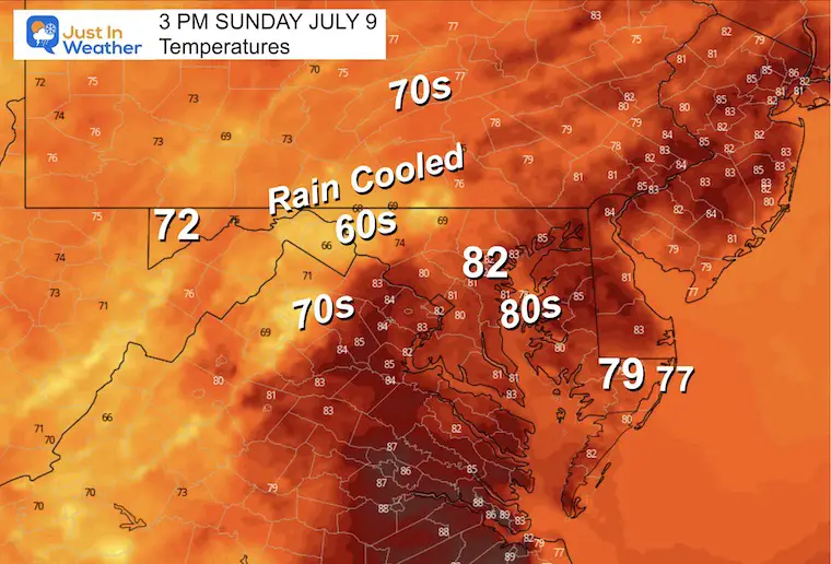
Afternoon Temperatures
While very humid, the actual high temperatures will stay in the lower to middle 80s. Then with the rain, cool into the 70s and even 60s in the heaviest rain.
EXPLORE MORE
2023 Hurricane Season Forecast With An El Niño Watch
Subscribe for eMail Alerts
Weather posts straight to your inbox
Sign up and be the first to know!
CLIMATE DATA
TODAY July 9
Normal Low in Baltimore: 68ºF
Record 54ºF in 1984
Normal High in Baltimore: 89ºF
Record 103ºF 1936
Monday Weather
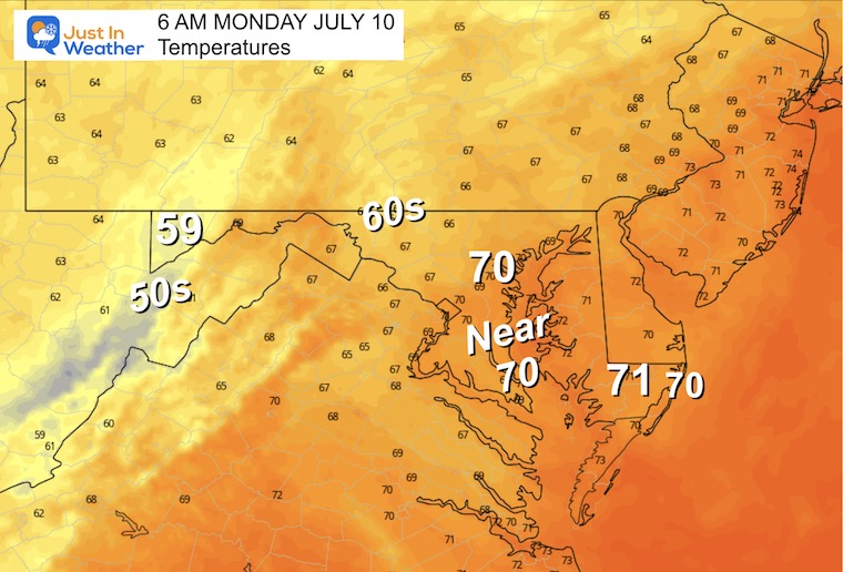
Morning Temperatures
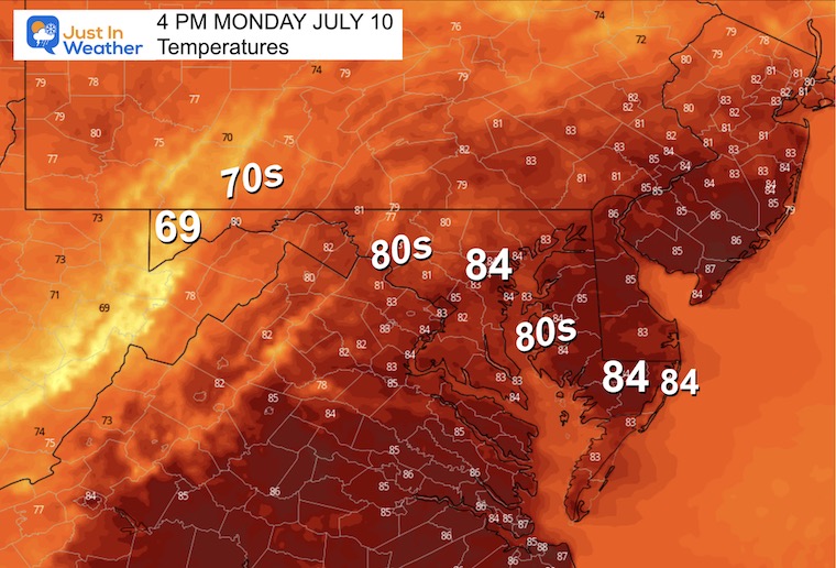
Afternoon Temperatures
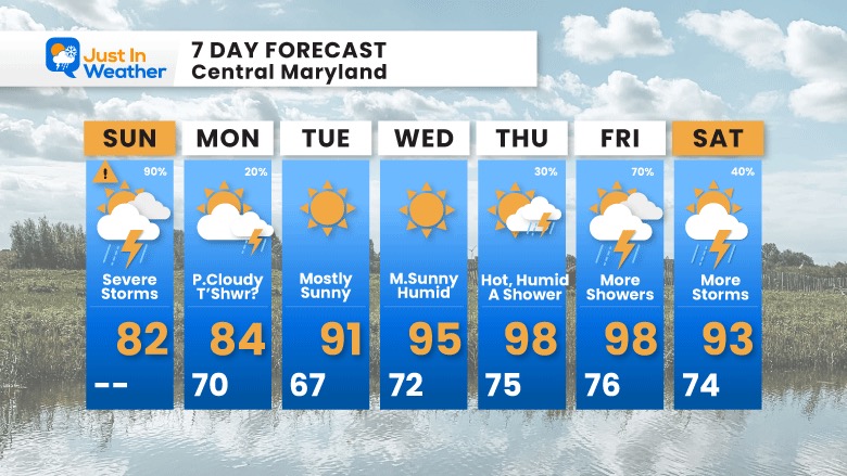
7 Day Forecast
After the storms today, we will get a break in the week ahead. The next cycle of weather will gradually build the temperatures to eventually crank full heat later in the week: Mid to Upper 90s after Wednesday!
The next round of strong to severe storms may set up for Friday and Saturday.
Subscribe for eMail Alerts
Weather posts straight to your inbox
Sign up and be the first to know!
EXPLORE MORE
2023 Hurricane Season Forecast With An El Niño Watch
La Niña Has Ended. El Niño May Return By Fall
Aurora Photos From Maryland, Delaware, and Virginia
Please share your thoughts, and best weather pics/videos, or just keep in touch via social media
-
Facebook: Justin Berk, Meteorologist
-
Twitter
-
Instagram
RESTATING MY MESSAGE ABOUT DYSLEXIA
I am aware there are some spelling and grammar typos and occasional other glitches. I take responsibility for my mistakes, and even the computer glitches I may miss. I have made a few public statements over the years, but if you are new here you may have missed it: I have dyslexia, and found out during my second year at Cornell University. It didn’t stop me from getting my meteorology degree, and being the first to get the AMS CBM in the Baltimore/Washington region. One of my professors told me that I had made it that far without knowing, and to not let it be a crutch going forward. That was Mark Wysocki and he was absolutely correct! I do miss my mistakes in my own proofreading. The autocorrect spell check on my computer sometimes does an injustice to make it worse. I also can make mistakes in forecasting. No one is perfect predicting the future. All of the maps and information are accurate. The ‘wordy’ stuff can get sticky. There has been no editor that can check my work when I needed it and have it ready to send out in a newsworthy timeline. Barbara Werner is a member of the web team that helps me maintain this site. She has taken it upon herself to edit typos, when she is able. That could be AFTER you read this. I accept this and perhaps proves what you read is really from me… It’s part of my charm.
#FITF


