July 1 Severe Storm Recap From Friday And Risk This Weekend
July 1, 2023
Saturday Morning Update
We finally cleared out a lot of that smoke, but it came with an eruption of storms in central Maryland. We have seen short-range models having trouble simulating storms as reality keeps producing more than forecast. This morning we have some storms, including a line moving across Delmarva. I’ve included the Live Radar below.
Backing up for a moment to Friday, I believe the smoke particles acted as additional condensation nuclei to enhance the rainfall. The result did top 2 inches in some spots, but many still missed out.
More storms will occur this weekend with an increasing Severe Storm Risk through Sunday. More below.
Friday Afternoon Storm Recap
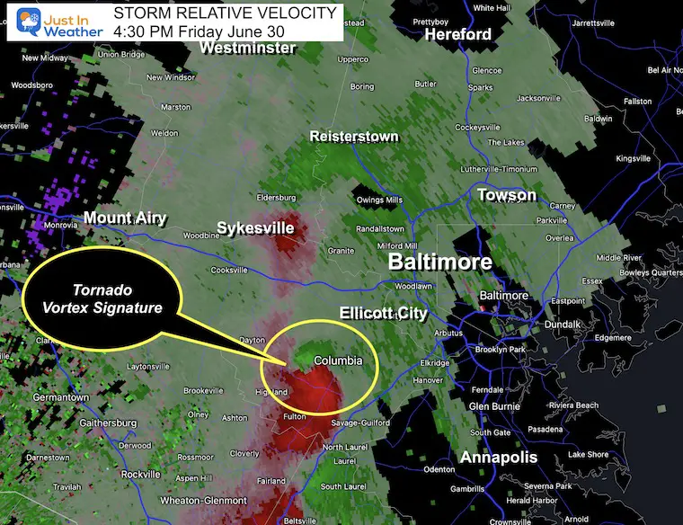
There Was A Tornado Warning at 4:30 PM
Wind Profile
The Relative Velocity Scan suggested a Tornado Vortex Signature in Howard County. This spin aloft could have resulted in a full cloud.
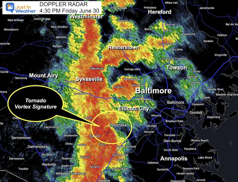
Doppler Radar Snapshot
This line of very heavy rain on the west side of Baltimore produced a blinding rainfall from Carroll, western Baltimore, into Howard Counties. This approached and affected traffic on I-83 to I-95.
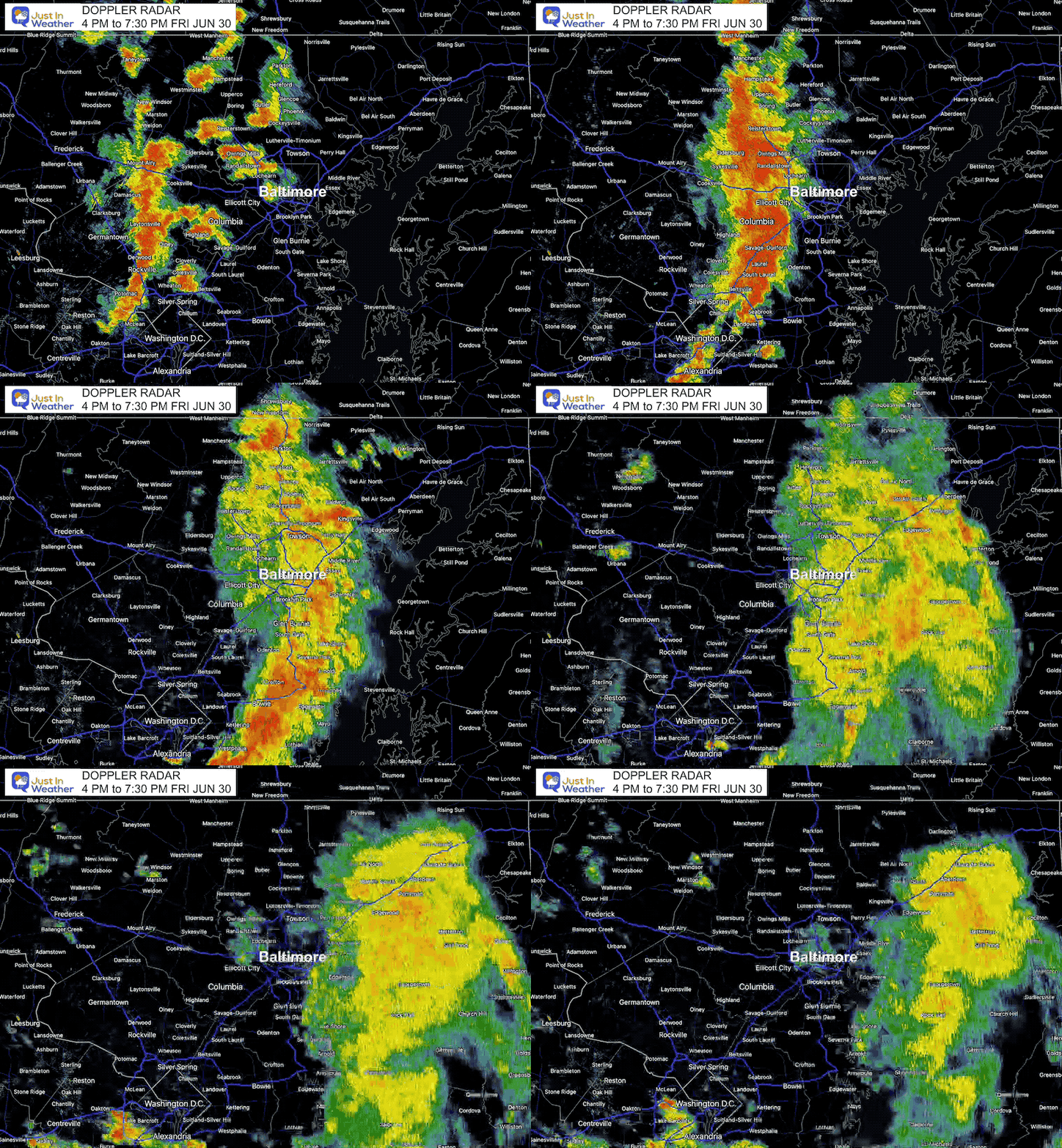
Doppler Radar Loop
4 PM to 7:30 PM
Storm Video
This was the Gully Washer in Eldersburg, MD
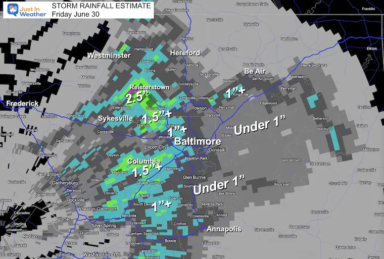
Rainfall Estimate
The bulk of this produced over 1 inch west of Baltimore, with over 2 inches around Reisterstown. It missed Frederick to the west AND faded east of Baltimore.
TODAY
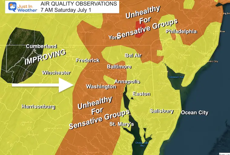
Morning Air Quality
It is still poor, but already an improvement. The west wind will bring in healthier air during the day.
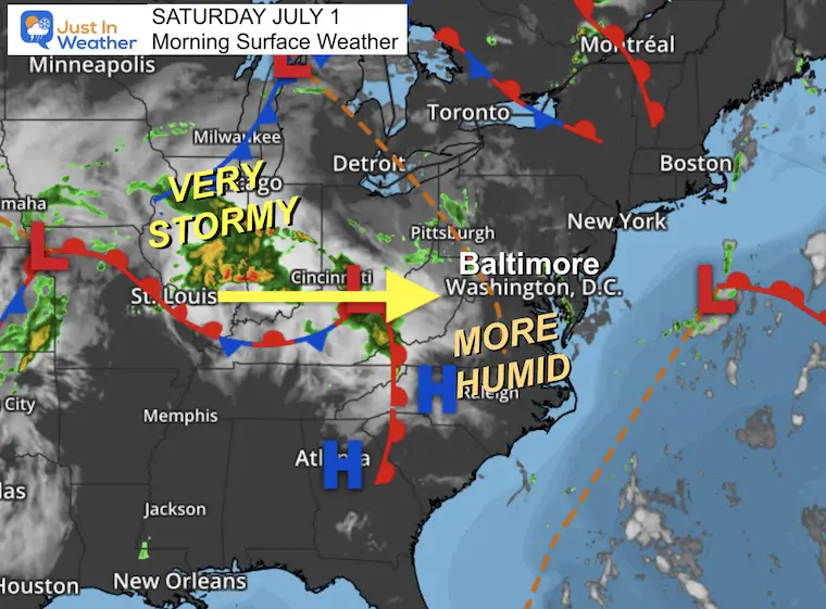
Morning Surface Weather
The active storms in the MidWest will be shifting our way this weekend. Today we trade the smoke for more humidity and a few more storms. The really bumpy part of the weekend will be tomorrow.
Live Radar and Lightning Widget
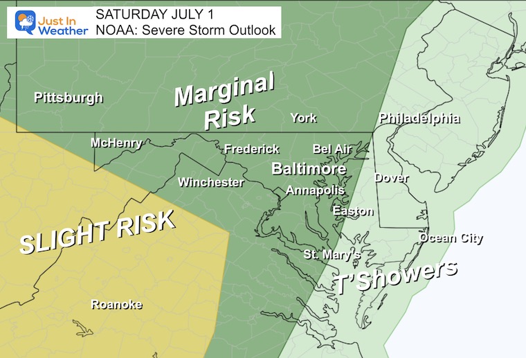
Severe Storm Risk From NOAA
Marginal Risk for severe storms now includes central Maryland to include the Chesapeake Bay.
A greater chance in the Slight Risk zone includes western Virginia and West Virginia.
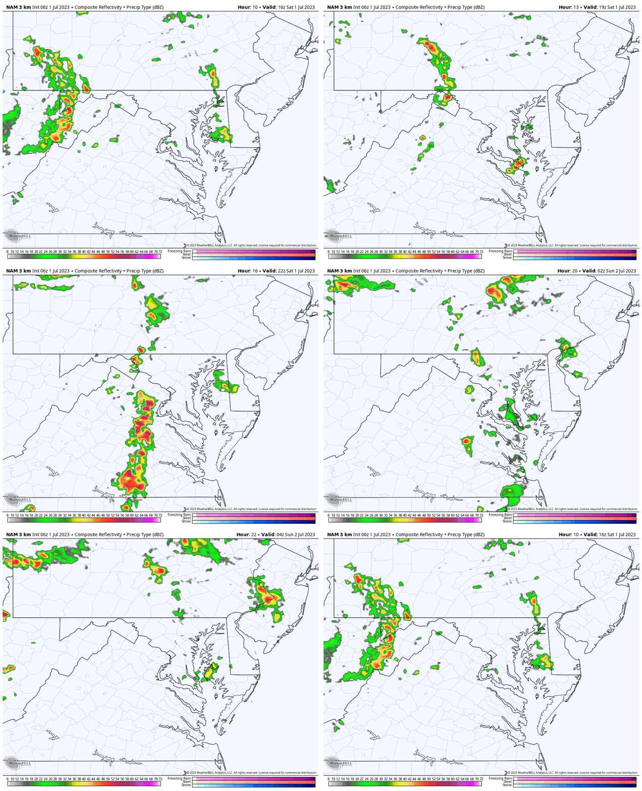
Radar Simulation
NAM 3 Km Model Noon to Midnight
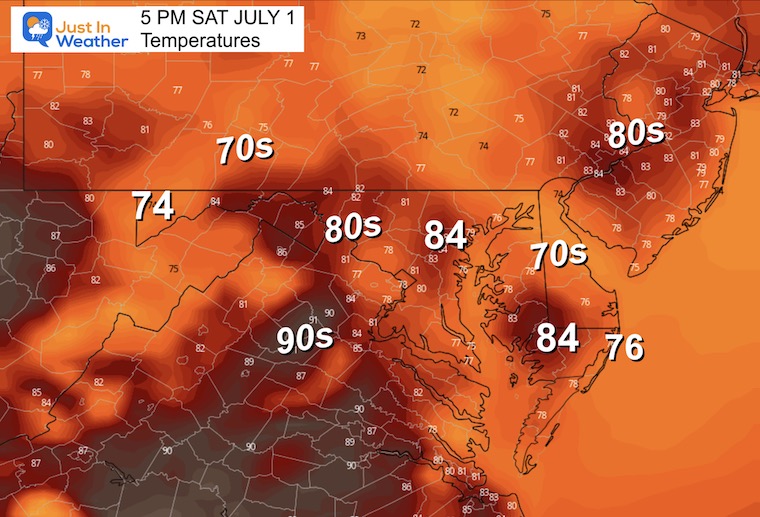
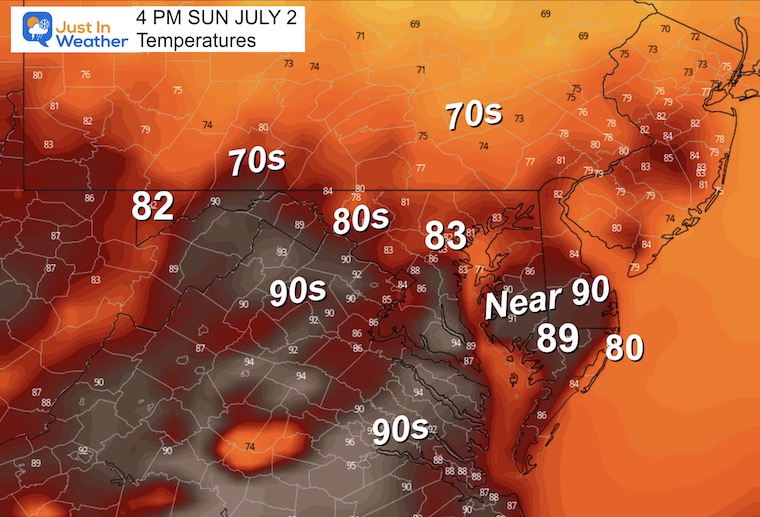
Afternoon Temperatures
EXPLORE MORE
2023 Hurricane Season Forecast With An El Niño Watch
Drought Watch Updated June 15
Subscribe for eMail Alerts
Weather posts straight to your inbox
Sign up and be the first to know!
CLIMATE DATA
TODAY July 1
Normal Low in Baltimore: 67ºF
Record 50ºF in 1988
Normal High in Baltimore: 88ºF
Record 103ºF 1901
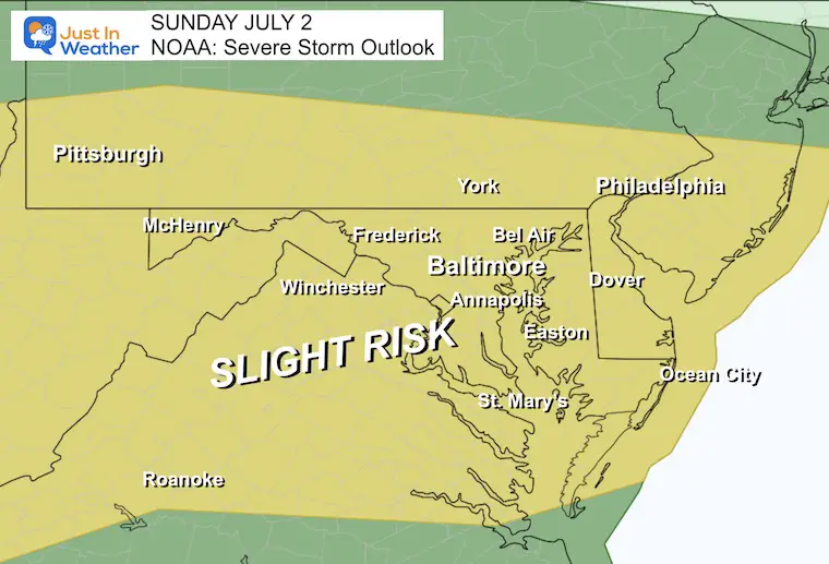
Sunday Severe Storm Risk From NOAA
There will be more storms. Not all, but a few will carry the risk for:
- Damaging Winds
- Large Hail over 1 inch diameter
- Isolated Tornadoes
- Flash Flooding
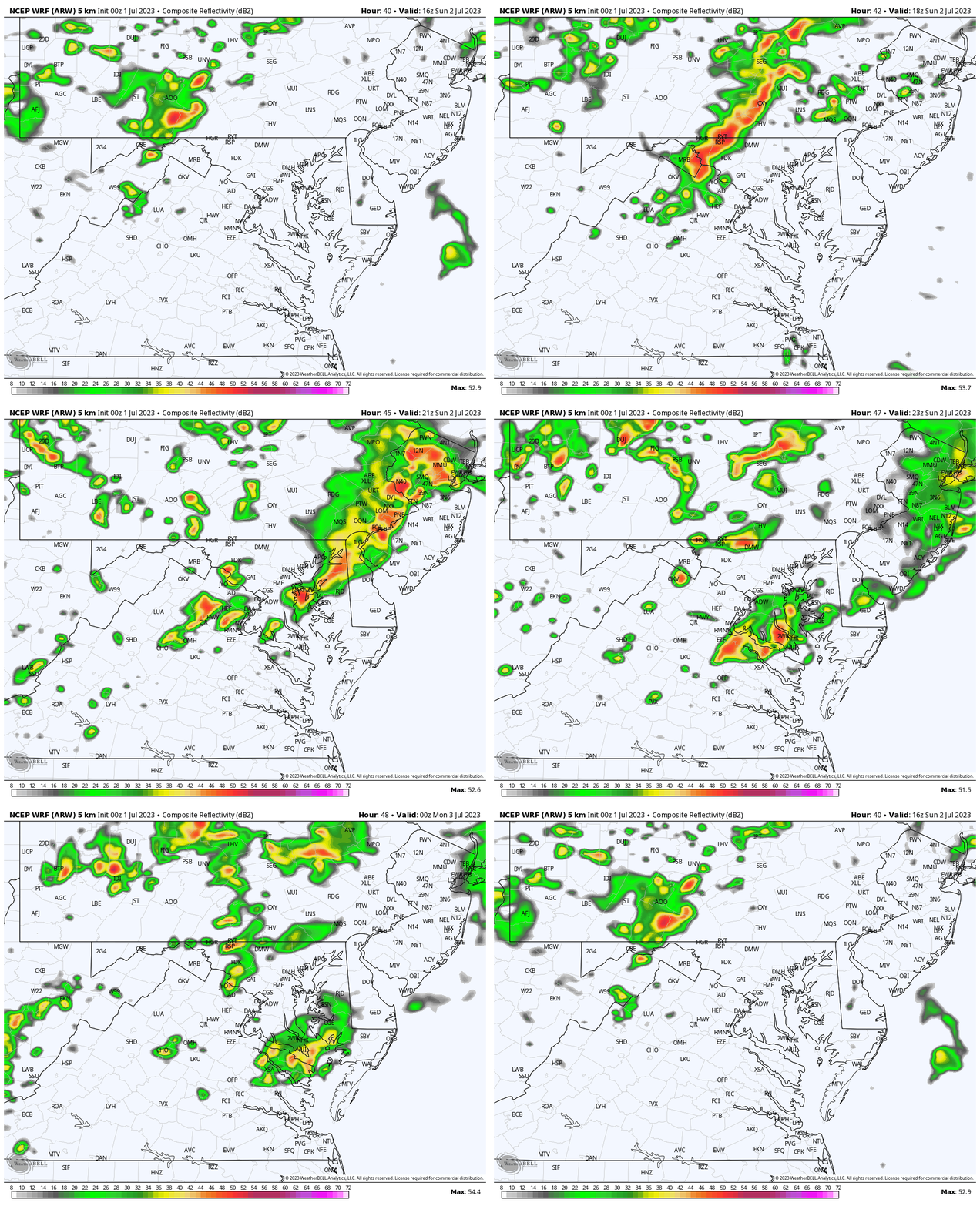
Sunday Radar Simulation
WRF Model: Noon to 8 PM
This looks like a mid-afternoon time frame. I would watch out in central Maryland any time between 2 PM and 6 PM.
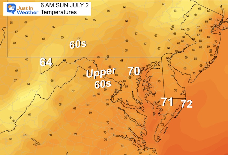
Temperatures
Morning
Afternoon
7 Day Forecast
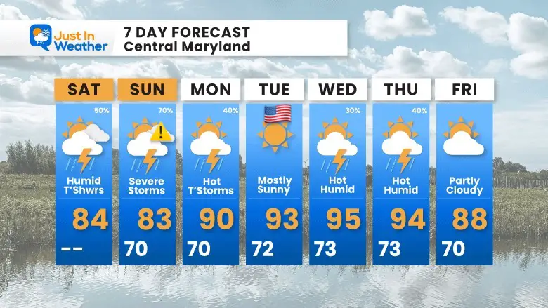
This weekend does have improved air quality but there will be more strong to severe storms. The more active day will be Sunday.
July 4th looks sunny and hot, followed by more heat and humidity.
Subscribe for eMail Alerts
Weather posts straight to your inbox
Sign up and be the first to know!
EXPLORE MORE
2023 Hurricane Season Forecast With An El Niño Watch
La Niña Has Ended. El Niño May Return By Fall
Aurora Photos From Maryland, Delaware, and Virginia
Please share your thoughts, and best weather pics/videos, or just keep in touch via social media
-
Facebook: Justin Berk, Meteorologist
-
Twitter
-
Instagram
RESTATING MY MESSAGE ABOUT DYSLEXIA
I am aware there are some spelling and grammar typos, and occasional other glitches. I take responsibility for my mistakes, and even the computer glitches I may miss. I have made a few public statements over the years, but if you are new here you may have missed it: I have dyslexia, and found out during my second year at Cornell University. It didn’t stop me from getting my meteorology degree, and being first to get the AMS CBM in the Baltimore/Washington region. One of my professors told me that I had made it that far without knowing, and to not let it be a crutch going forward. That was Mark Wysocki and he was absolutely correct! I do miss my mistakes in my own proofreading. The autocorrect spell check on my computer sometimes does an injustice to make it worse. I also can make mistakes in forecasting. No one is perfect predicting the future. All of the maps and information are accurate. The ‘wordy’ stuff can get sticky. There has been no editor that can check my work when I needed it and have it ready to send out in a newsworthy timeline. Barbara Werner is a member of the web team that helps me maintain this site. She has taken it upon herself to edit typos, when she is able. That could be AFTER you read this. I accept this and perhaps proves what you read is really from me… It’s part of my charm.
#FITF


