June 30 Code Red Smokey Air: Weekend Trade For Severe Storms
June 30, 2023
Friday Morning Update
Things are about to shake up a little. The poor air quality is still with us as we begin today with Code Red Observations. This should be the last day of this stretch as winds will shift AND some showers will help to move the air.
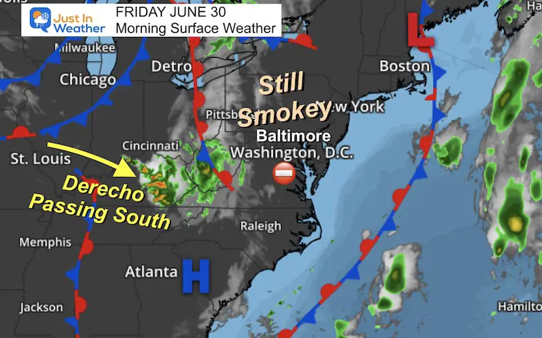
A Derecho hit the midwest yesterday, on the anniversary of our big event 11 years ago. This one is fading and passing to our south but may bring some clouds this morning. A new line of thunderstorms will flare up later today but may have trouble crossing the Bay.
This weekend will move the smoke out as humidity moves in. Storm Risk turns Severe on Sunday!
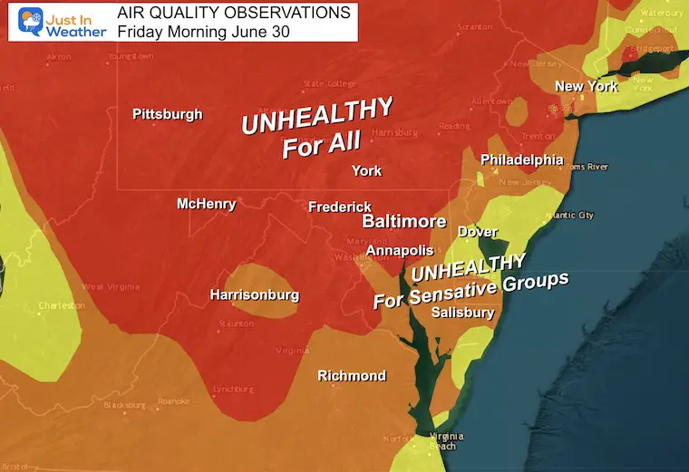
Morning Air Quality
Code Red for most of our region, with some improvement on The Lower Eastern Shore and Beaches.
Morning Surface Weather
This should be the last day with thick smoke, but it is still here.
The energy or ‘ripple’ in the atmosphere from that Derecho will spin new storms later this afternoon and evening. See the radar forecast below.
Behind that system will be more heat and humidity.
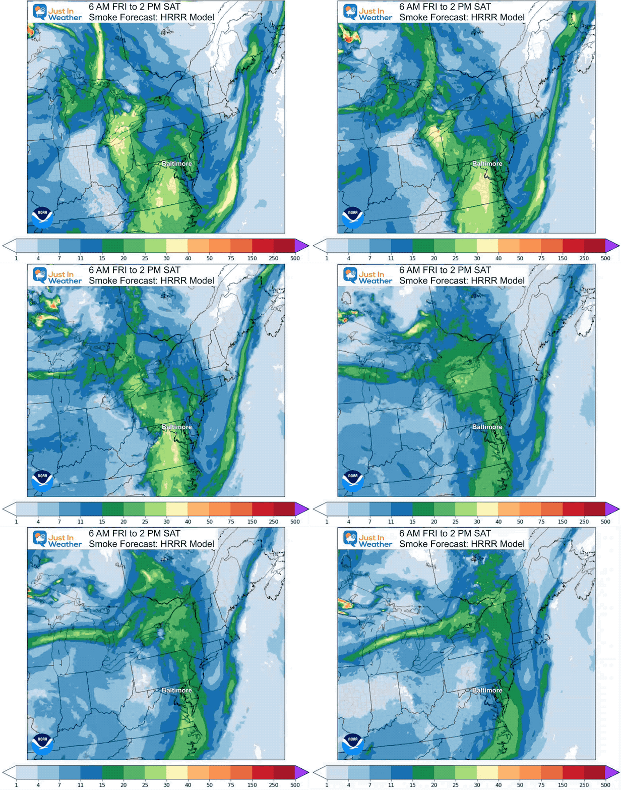
Smoke Forecast
Friday Morning to Saturday Afternoon
The plume today will spread move east and disperse tomorrow.
Click here to see the full Smoke Report
Radar Simulation:
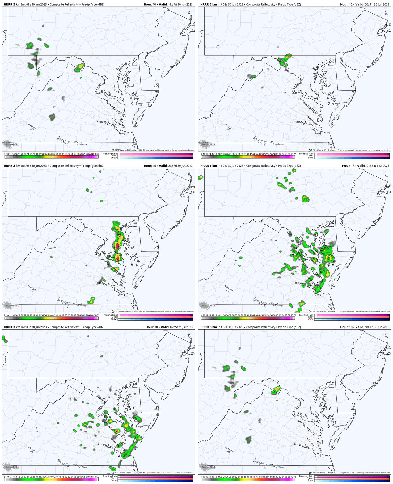
HRRR Model 2 PM to 10 PM
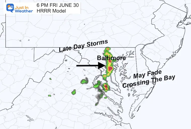
The late day storms will run into a block and may fizzle crossing the bay.
Snapshot at 6 PM
The line of storms is expected to reach metro Baltimore between 5 PM and 7 PM.
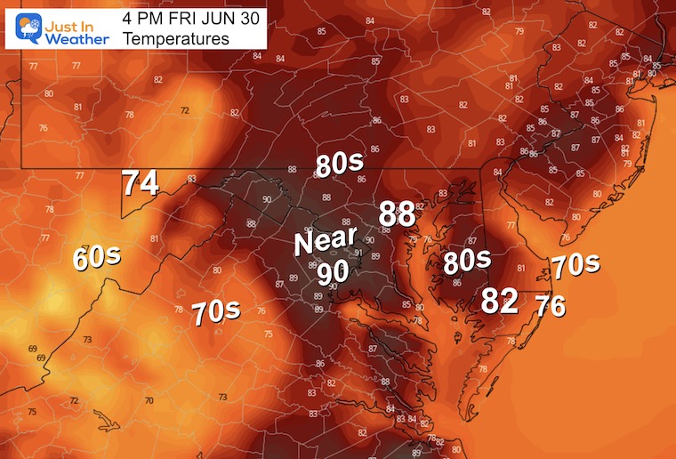
Afternoon Temperatures
Another Cool Month!
This is the first time in 3 Years we will close out with back-to-back months of below normal temperatures.
First time in 3 years
BACK TO BACK MONTHS
🌡️ COOLER THAN NORMAL https://t.co/ws0MXycFJg— Justin Berk (@JustinWeather) June 30, 2023
EXPLORE MORE
2023 Hurricane Season Forecast With An El Niño Watch
Drought Watch Updated June 15
Subscribe for eMail Alerts
Weather posts straight to your inbox
Sign up and be the first to know!
CLIMATE DATA
TODAY June 30
Normal Low in Baltimore: 66ºF
Record 52ºF in 1988
Normal High in Baltimore: 88ºF
Record 100ºF 1959
Saturday Weather
Morning Temperatures
A little break from the smoke is on the way.
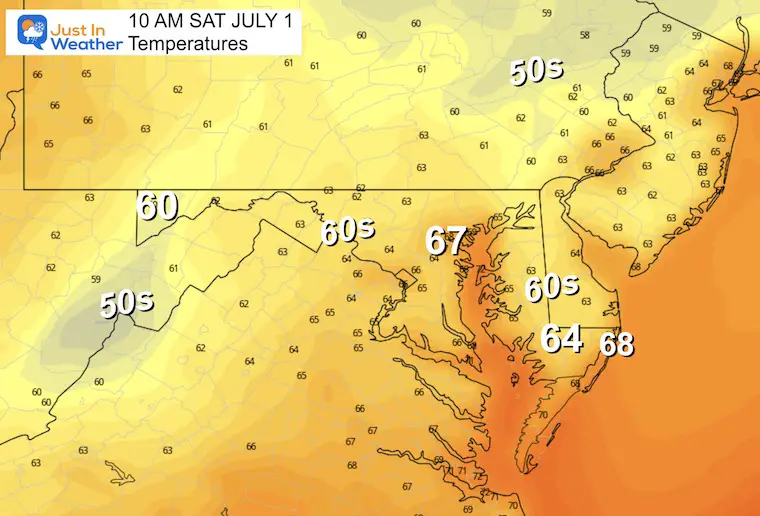
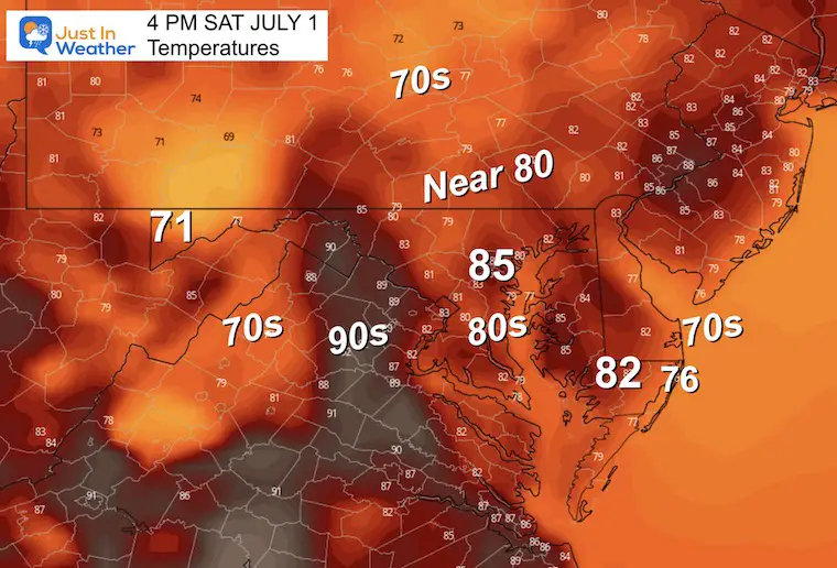
Afternoon Temperatures
One cool day before the heat and humidity builds in.
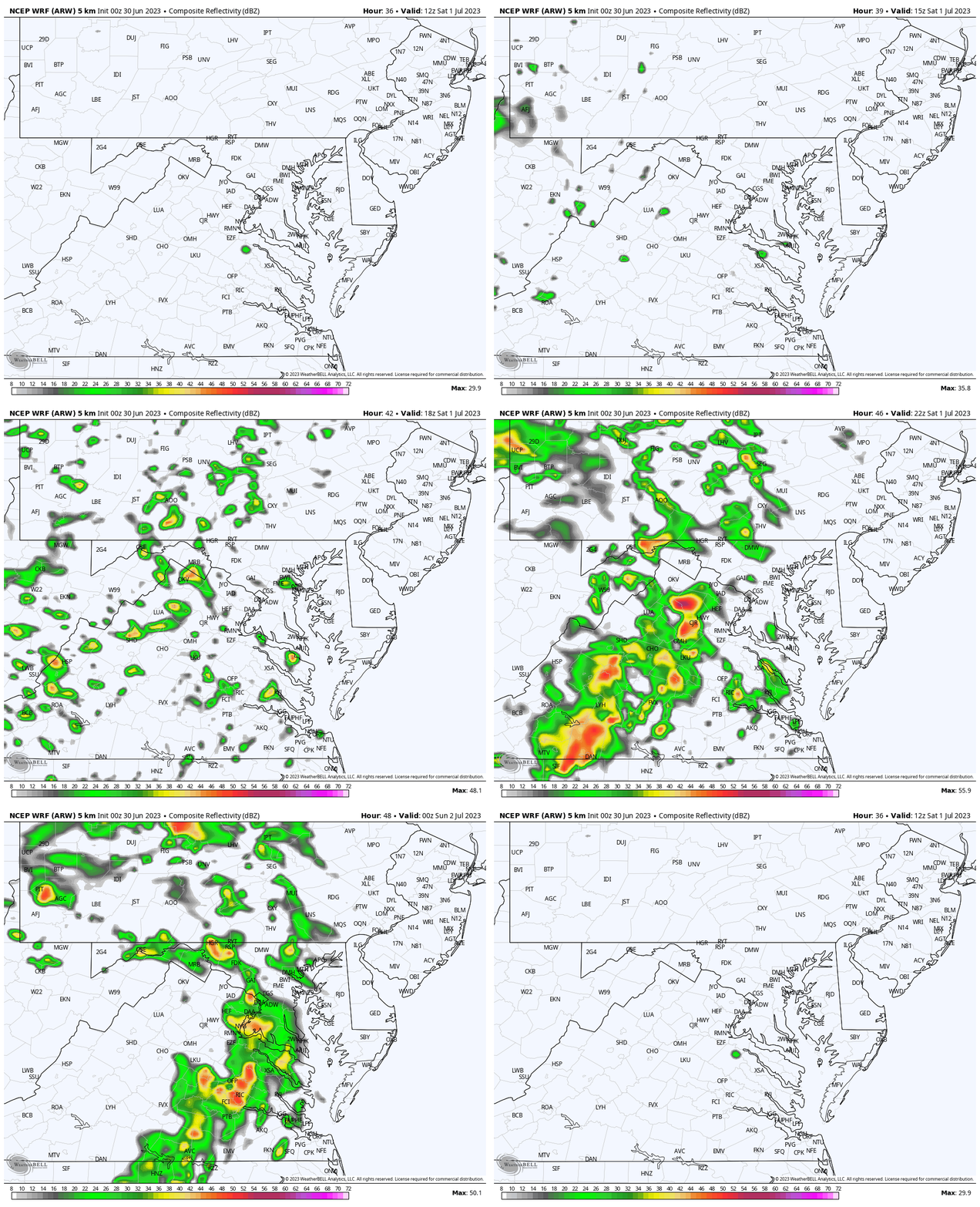
Radar Simulation
WRF Model 8 AM to 8 PM
Watching for showers and thunderstorms to develop in the afternoon and evening… Mainly WEST of the Chesapeake Bay.
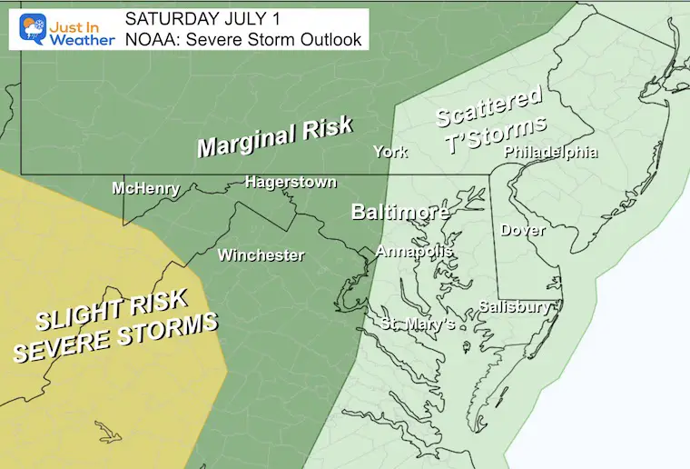
NOAA Severe Storm Risk
We will watch the active storm threat shift east this weekend.
Saturday
Marginal Risk for severe storms WEST of the big cities.
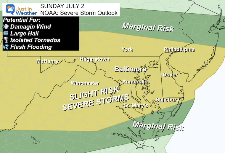
Sunday
Increase to Slight Risk for much of our area.
This is a higher potential for damaging winds, large hail, a tornado, and flash flooding.
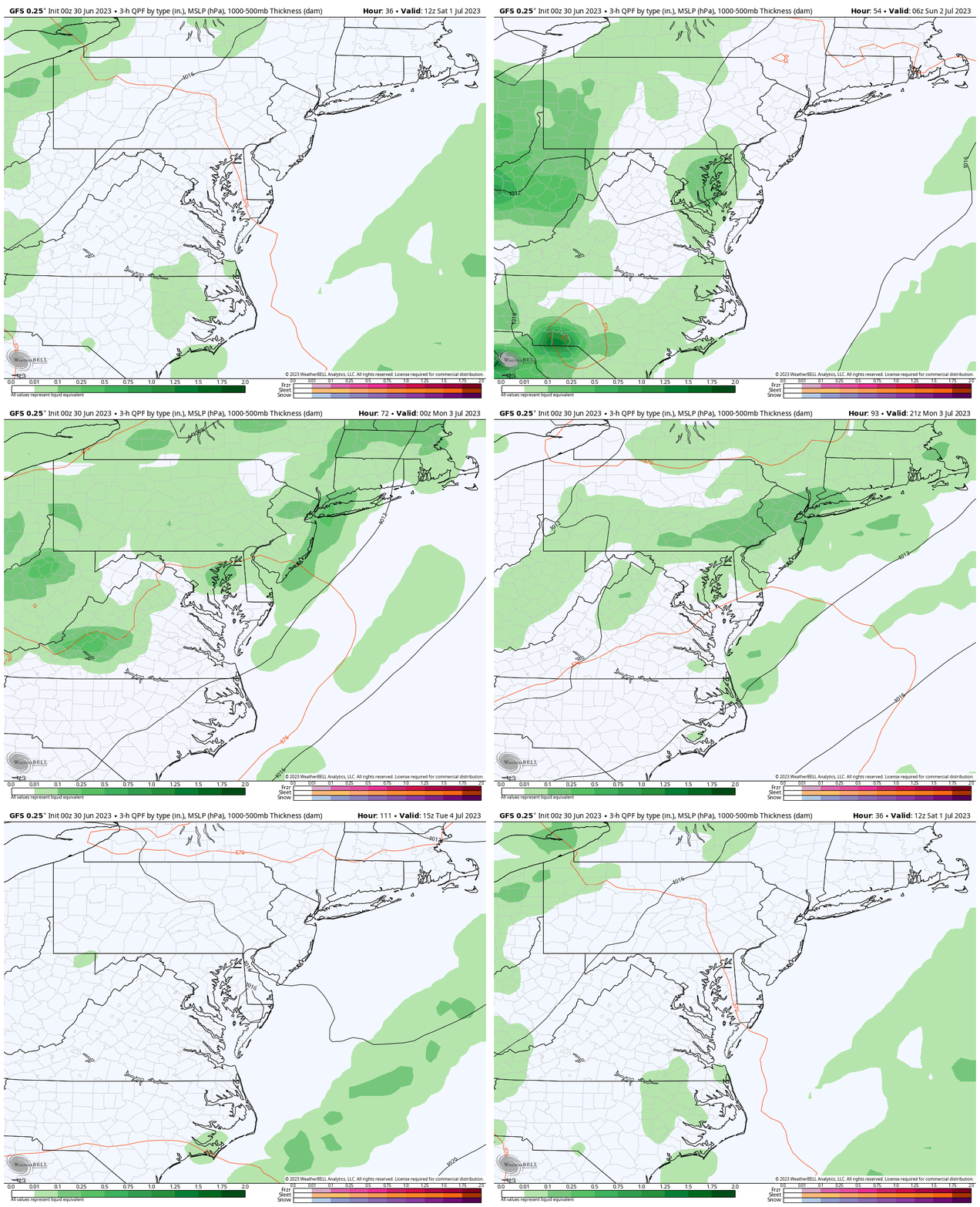
Rain Forecast Through Tuesday
The increased storm activity over the weekend will fade on Monday. Right now we expect a dry 4th of July.
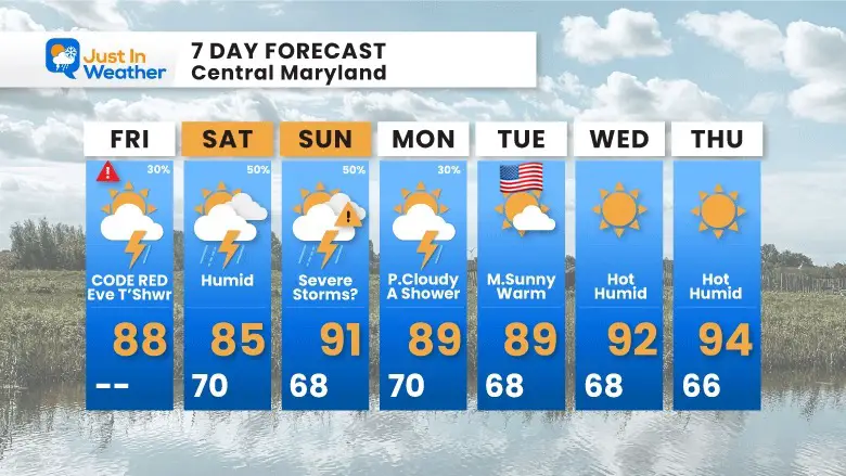
7 Day Forecast
The shift of winds will move the smoke away and bring in higher heat and humidity. This will bring us summer days with afternoon and evening storms this weekend. These are not washouts, they will be hit or miss storms. Some may contain heavy downpours.
Subscribe for eMail Alerts
Weather posts straight to your inbox
Sign up and be the first to know!
EXPLORE MORE
2023 Hurricane Season Forecast With An El Niño Watch
La Niña Has Ended. El Niño May Return By Fall
Aurora Photos From Maryland, Delaware, and Virginia
Please share your thoughts, and best weather pics/videos, or just keep in touch via social media
-
Facebook: Justin Berk, Meteorologist
-
Twitter
-
Instagram
RESTATING MY MESSAGE ABOUT DYSLEXIA
I am aware there are some spelling and grammar typos, and occasional other glitches. I take responsibility for my mistakes, and even the computer glitches I may miss. I have made a few public statements over the years, but if you are new here you may have missed it: I have dyslexia, and found out during my second year at Cornell University. It didn’t stop me from getting my meteorology degree, and being first to get the AMS CBM in the Baltimore/Washington region. One of my professors told me that I had made it that far without knowing, and to not let it be a crutch going forward. That was Mark Wysocki and he was absolutely correct! I do miss my mistakes in my own proofreading. The autocorrect spell check on my computer sometimes does an injustice to make it worse. I also can make mistakes in forecasting. No one is perfect predicting the future. All of the maps and information are accurate. The ‘wordy’ stuff can get sticky. There has been no editor that can check my work when I needed it and have it ready to send out in a newsworthy timeline. Barbara Werner is a member of the web team that helps me maintain this site. She has taken it upon herself to edit typos, when she is able. That could be AFTER you read this. I accept this and perhaps proves what you read is really from me… It’s part of my charm.
#FITF


