May 25 Weather Cooler And Turning Wet Later On Memorial Weekend
May 25, 2023
Thursday Morning Update
A cooler breeze today will mark a pleasant day. A cold front passed through last night, and with the new air mass, we should notice the upper-level smoke clearing from our sky.
This will allow the sun to be complimented by a blue sky we have not seen for a long time.
This cooler trend will be below average through the holiday weekend. The wrinkle will be the wind shifting FROM the East, which will bring in more cloud cover. Then we also watch a storm slowly move up the coast to influence us later in the weekend.
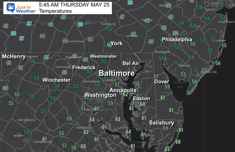
Temperatures at 6 AM
We may still cool a little more this morning, before a slow return. Winds from the North and Northeast will contrast the return of sunshine.
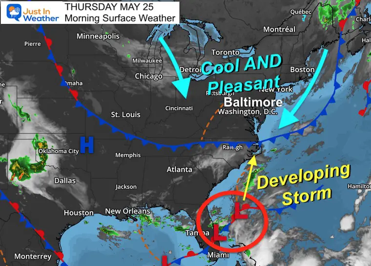
Morning Surface Weather
A truly pleasant air mass is building in with winds from the North and Northeast. The main focus for this holiday weekend will be a developing storm off the coast of Florida that will move up toward the Carolinas. The track and speed of this will determine if and when we get rain in the Mid-Atlantic.
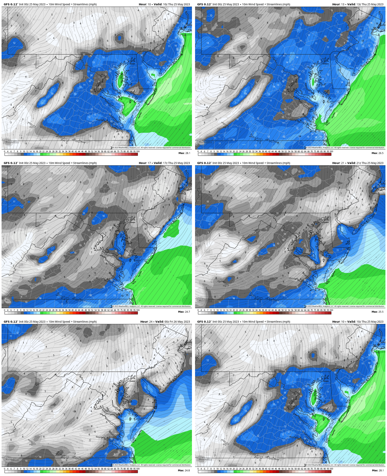
Wind Forecast
A cooler wind from the North and Northeast will be stronger this morning, then ease this afternoon and evening.
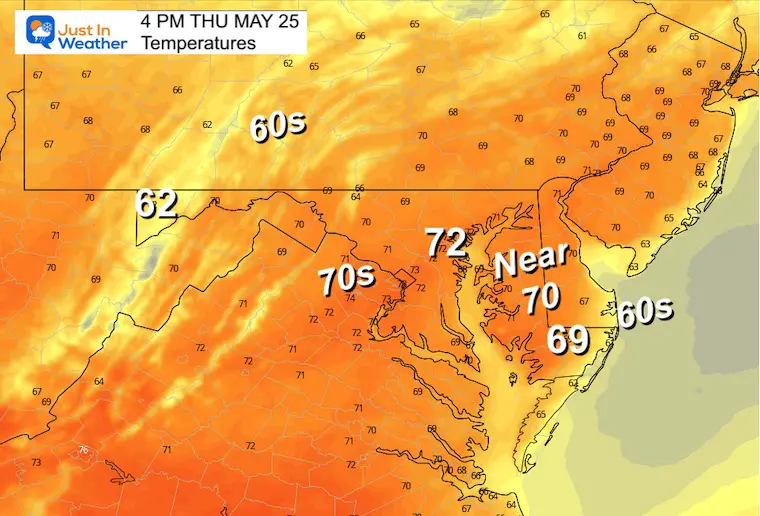
Afternoon Temperatures
Most of the region will remain in the 60s, with low 70s in metro areas.
Subscribe for eMail Alerts
Weather posts straight to your inbox
Sign up and be the first to know!
CLIMATE DATA
TODAY May 25
Normal Low in Baltimore: 56ºF
Record 38ºF in 1956
Normal High in Baltimore: 78ºF
Record 94ºF 1991
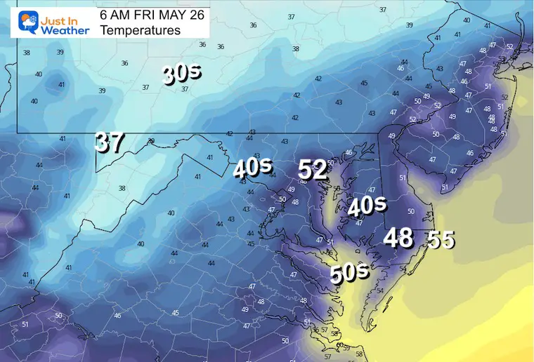
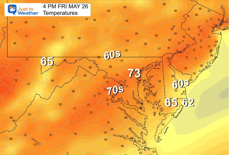
Friday Weather
We continue with a feel more like earlier in spring.
Temperatures
Morning
Afternoon
Wet Holiday Weekend?
Friday to Sunday
The coastal storm forming in the Southeast US will be slowly moving up the coast. Strong High Pressure from the North will suppress that storm.
This will do two things:
Increase our cooler wind from the East.
Delay the rain arrival until Sunday.
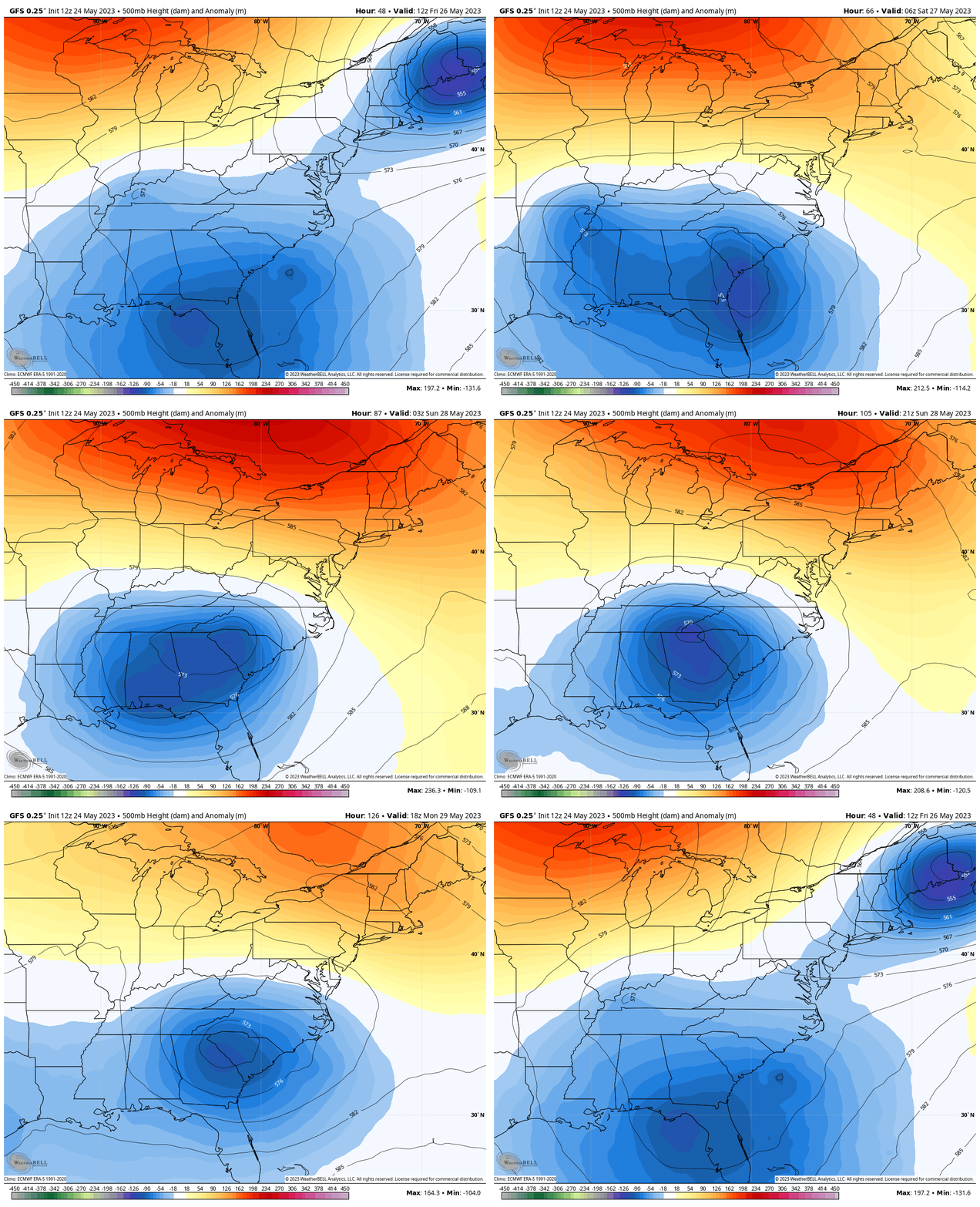
Jet Stream Forecast:
Friday to Memorial Monday
A large cool pool of air trapped under this trough in the Eastern US will aid in wrapping around the Storm… This will pull in around the storm early in the weekend, then slowly move our way Sunday and Monday.
Storm Forecast:
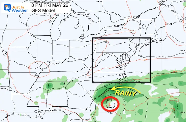
Friday Night
I want to start with this snapshot to show how confined the storm is expected to be off the South Carolina coast.
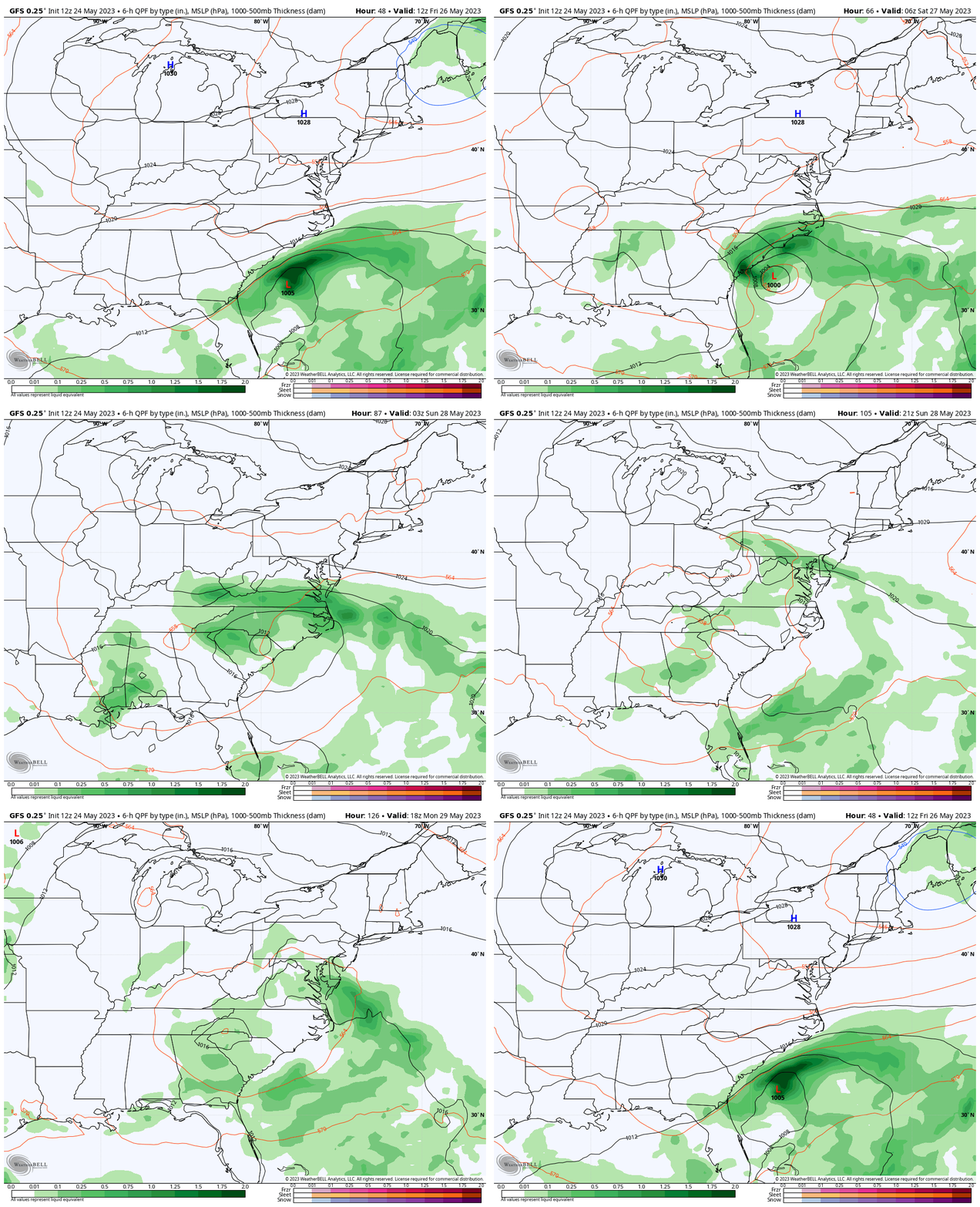
Forecast Animation: Friday to Monday
For our region, the best chance of rain will be Sunday. Then the unsettled area will pulse with breaks and more showers developing in the afternoon through Monday and Tuesday.
For vacationers heading to North or South Carolina, this looks like a washout, at least for the start of the holiday weekend. Then scattered showers will linger there on Sunday and Monday.
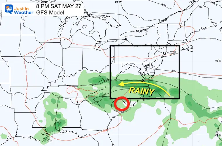
Saturday Night
The storm will be moving slowly, and IS NOT HERE YET! However, the winds from the ocean may add enough moisture to produce a mist or some light showers along the coast.
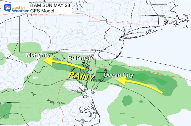
Sunday Morning
This appears to be a consistent time the models have been pushing for the rain to be in place. This will be the day with the strongest winds, coolest temperatures, and best chance for rain.
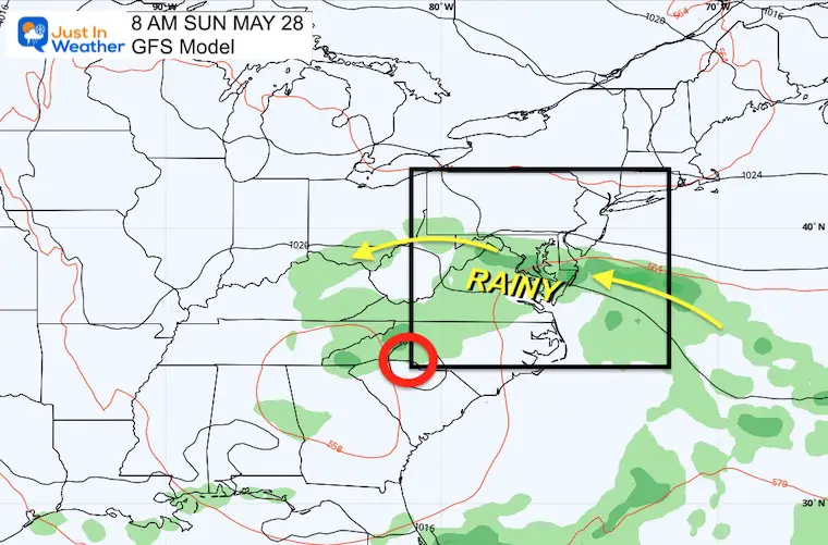
Close Up
A band of rain will push inland through metro areas and into the mountains. This band of rain will slowly build north, but more showers surrounding this focused line are likely not showing up on this model.
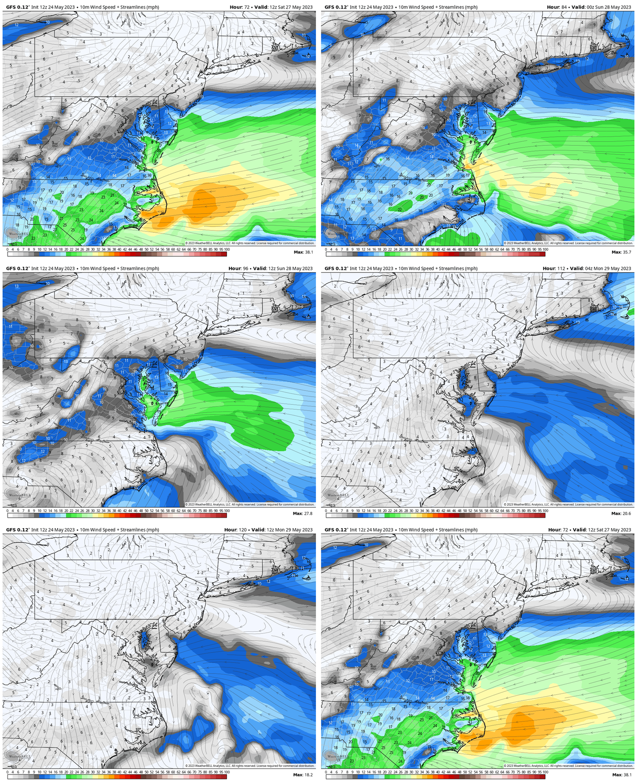
Wind Forecast: Saturday To Monday
A chilly and damp Easterly wind will build Saturday and max out Sunday. Then ease on Monday.
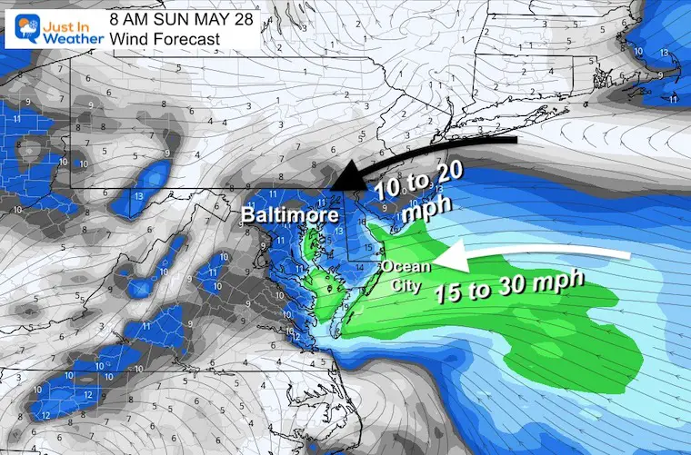
Snapshot Sunday Morning
Winds will average 10 to 20 mph inland, with a push up to 30 mph along the beaches. This will keep the chill in place along with periods of steady rain, showers, and spray in between.
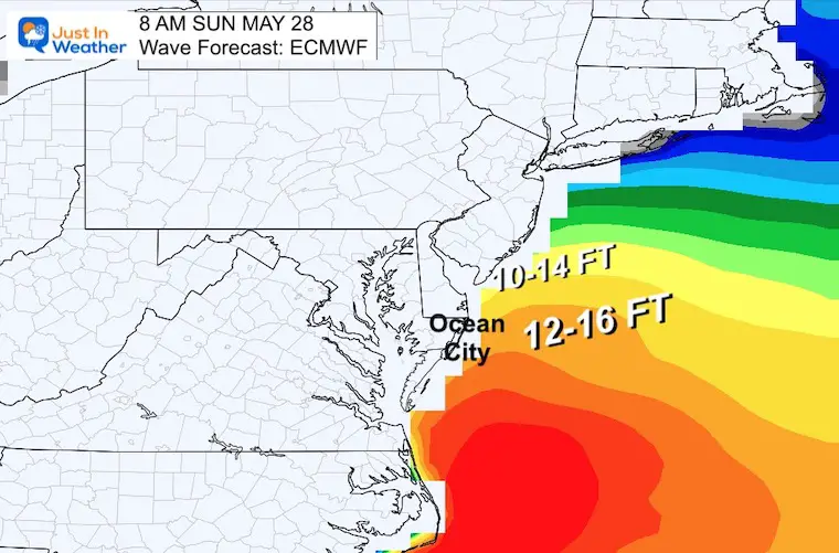
Forecast Waves
The offshore wave height will range between 8 and 14 Feet east of Rehoboth and Ocean City.
Shoreline waves should be up in the 4 to 6-foot range. This may get local surfers out, but dangerous rip currents along with the chill will keep most out of the water.
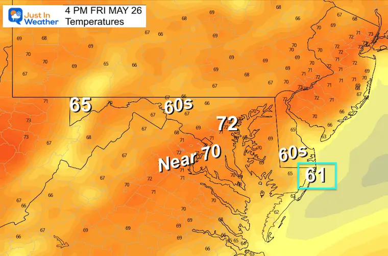
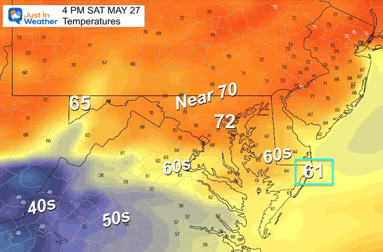
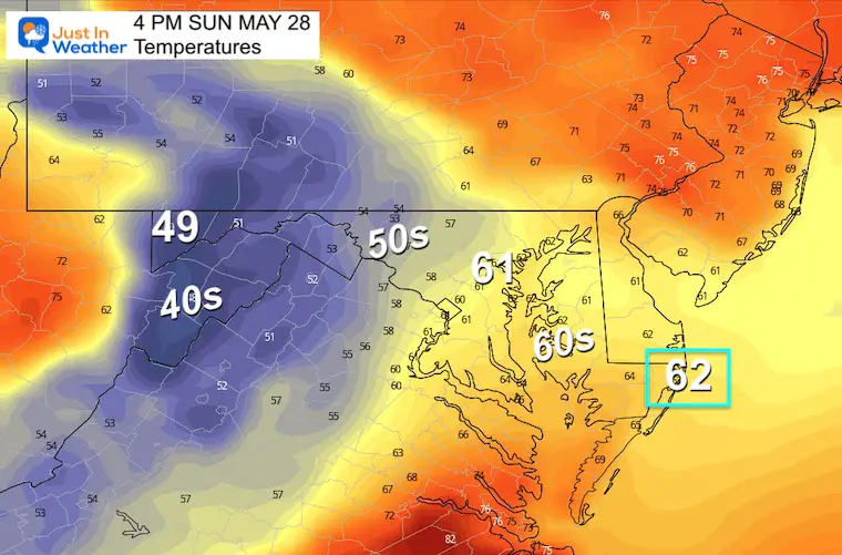
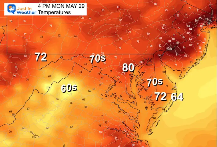
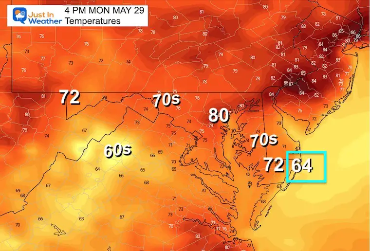
Weekend Afternoon Temperatures
Ocean City, Maryland is highlighted in the blue box.
Friday
Saturday
Sunday
Monday
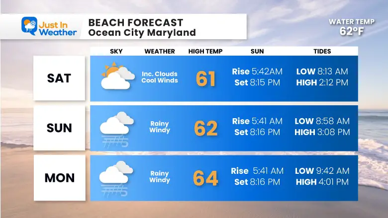
Beach Forecast: Ocean City
Weather, high temperature, sun times, and tides.
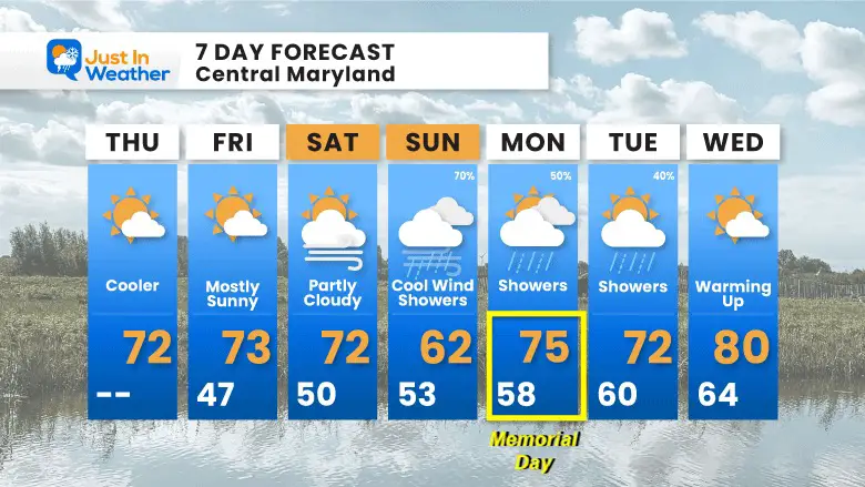
7-Day Forecast: Central Maryland
I have adjusted the Memorial Monday temperature to be a blend of the last two days of model output. There is still low confidence in the track and influence of that coastal storm and wind. The latest model output warmed up a bit, but I cannot fully bite on that yet.
OTHER REPORTS:
NEW:
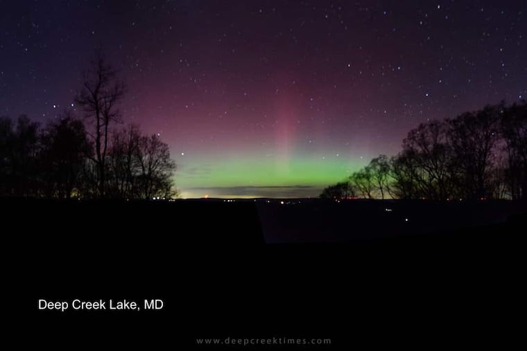
Aurora Photos From Maryland, Delaware, and Virginia
April Heat Wave History
Winter 2023 Recap: My BUSTED Snow Outlook
La Niña Has Ended. El Niño May Return By Fall
STEM Assemblies/In School Fields Trips Are Back
Click to see more and ‘Book’ a visit to your school
Please share your thoughts, best weather pics/videos, or just keep in touch via social media
-
Facebook: Justin Berk, Meteorologist
-
Twitter
-
Instagram
RESTATING MY MESSAGE ABOUT DYSLEXIA
I am aware there are some spelling and grammar typos, and occasional other glitches. I take responsibility for my mistakes, and even the computer glitches I may miss. I have made a few public statements over the years, but if you are new here you may have missed it: I have dyslexia, and found out during my second year at Cornell University. It didn’t stop me from getting my meteorology degree, and being first to get the AMS CBM in the Baltimore/Washington region. One of my professors told me that I had made it that far without knowing, and to not let it be a crutch going forward. That was Mark Wysocki and he was absolutely correct! I do miss my mistakes in my own proofreading. The autocorrect spell check on my computer sometimes does an injustice to make it worse. I also can make mistakes in forecasting. No one is perfect predicting the future. All of the maps and information are accurate. The ‘wordy’ stuff can get sticky. There has been no editor that can check my work when I needed it and have it ready to send out in a newsworthy timeline. Barbara Werner is a member of the web team that helps me maintain this site. She has taken it upon herself to edit typos, when she is able. That could be AFTER you read this. I accept this and perhaps proves what you read is really from me… It’s part of my charm.
#FITF
Subscribe for eMail Alerts
Weather posts straight to your inbox
Sign up and be the first to know!


