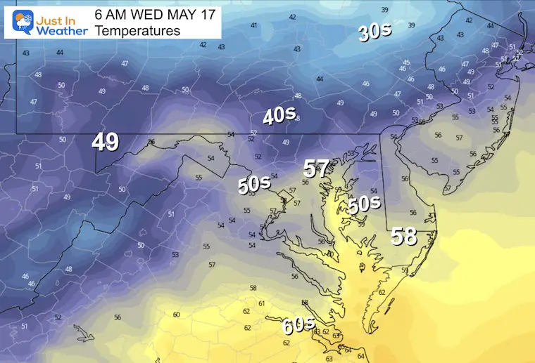
May 16 Rain Tracking South With A Warmer Day Then A Frost To Follow
May 16, 2023
Tuesday Morning Update
The good news at first glance is that the rain expected today looks less impressive. That is good news if you are not hurting for rain, however, I realize some would like to see more. Today will end up warmer than I thought as rain will be later and more likely farther south.
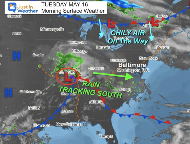
A chilly air mass will build in for a few days, which may very well include the last frost of the season… Inland and away from the water of course.
Then we will track the next chance for rain on Preakness Saturday.
Morning Surface Weather
After this little weather system tracks through tonight, it will be followed by chilly air from the north.
Radar Simulation: Noon to 8 AM Wednesday
The rain looks less impressive on this model run. While I am keeping the chance of showers in the mix, the better chance will be closer to Annapolis and south.
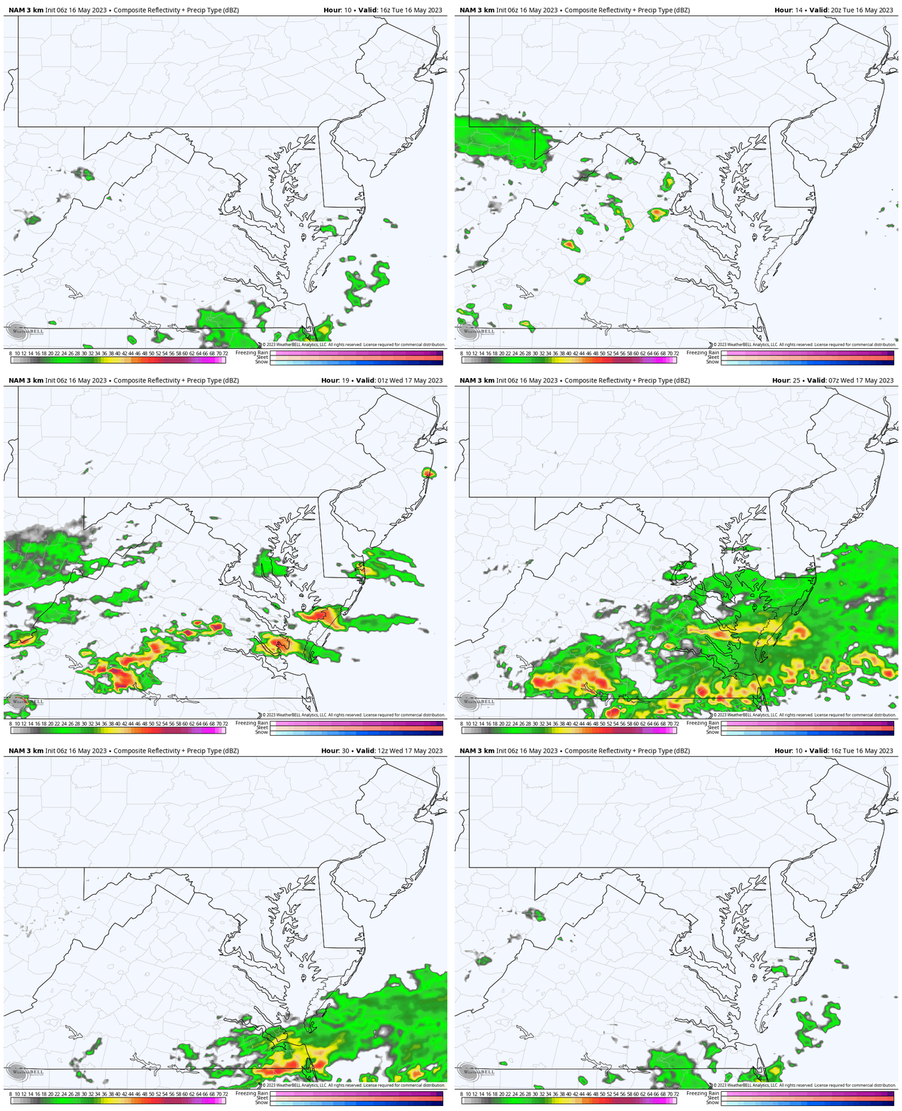
Snapshots
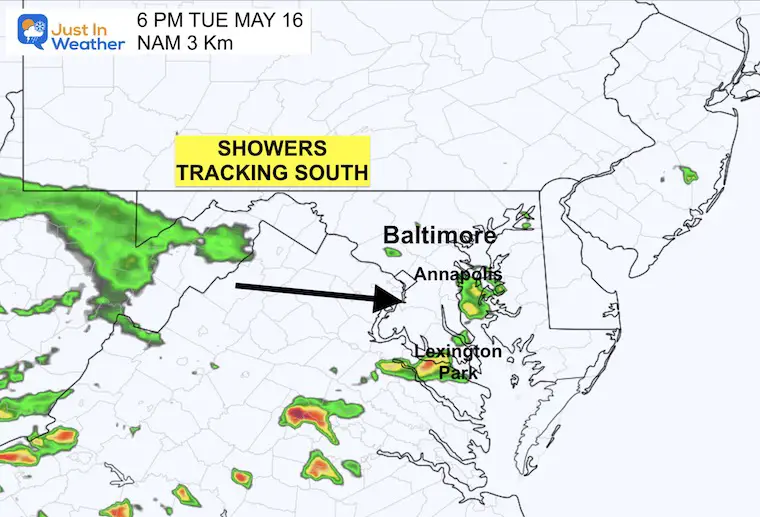
6 PM
Only spotty showers. This product can miss out on more activity, but this still looks less impressive than yesterday.
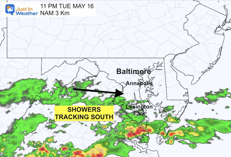
11 PM
The bulk of the rain will pass through tonight skimming southern Maryland and expanding with T’storms into Virginia.
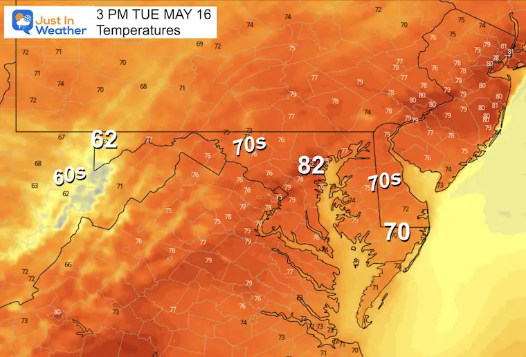
Afternoon Temperatures
With the rain passing south and less expansive, temps will end up warmer than I first thought.
Subscribe for eMail Alerts
Weather posts straight to your inbox
Sign up and be the first to know!
CLIMATE DATA
TODAY May 16
Normal Low in Baltimore: 53ºF
Record 37ºF in 2016
Normal High in Baltimore: 75ºF
Record 92ºF 1998
Wednesday Weather
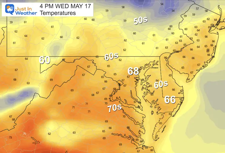
With the cooler breeze, we may develop instability clouds from north and west expanding across metro areas during the day. Temps will be cooler.
Temperatures
Morning
Afternoon
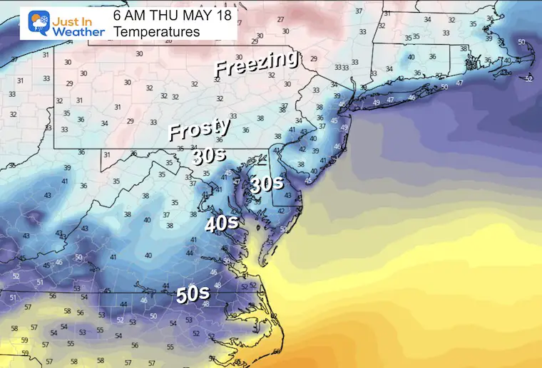
THURSDAY MORNING: INLAND FROST
The core of the next chilly air mass will settle in at this time. This is when we will likely have temperatures drop into the mid and lower 30s for both inland areas to the west AND interior Delmarva. This could be our final frost of the season.
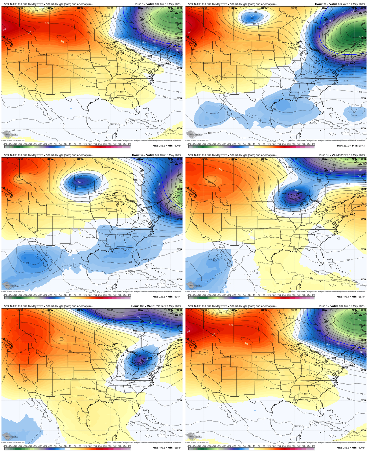
Jet Stream: Tuesday to Saturday
Here we can see the colored air mass (blue) that will settle in and likely bring an inland frost Thursday morning. Then a little shortwave on Saturday is what will bring us the next chance for rain.
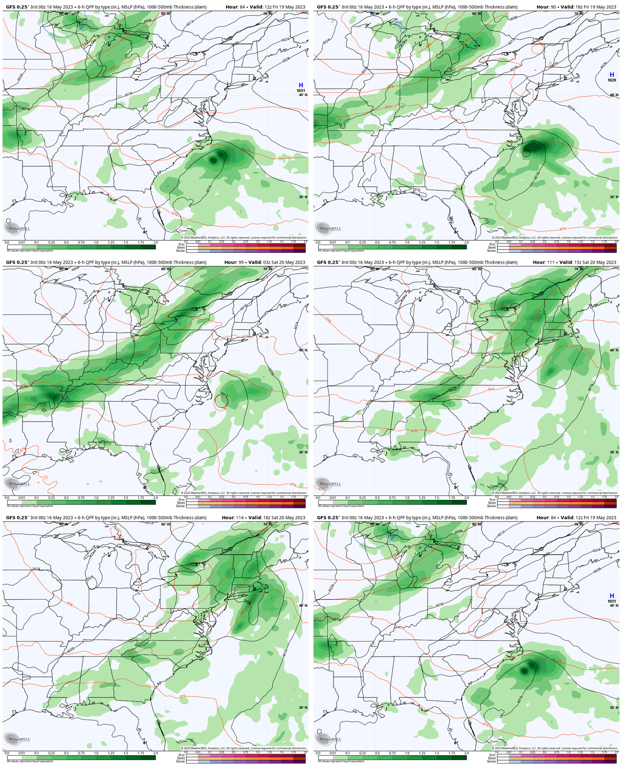
Wet Weekend?
Not entirely, however we will see showers on Saturday. As I mentioned yesterday, the timing has sped up and may arrive in the morning… still affecting Preakness. As of now, Sunday is looking dry.
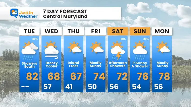
7 Day Forecast
The focus for now will be on the inland frost Thursday morning, then the showers Saturday which may affect Preakness events.
OTHER REPORTS:
NEW:
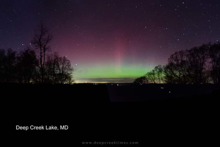
Aurora Photos From Maryland, Delaware, and Virginia
April Heat Wave History
Winter 2023 Recap: My BUSTED Snow Outlook
La Niña Has Ended. El Niño May Return By Fall
STEM Assemblies/In School Fields Trips Are Back
Click to see more and ‘Book’ a visit to your school
Please share your thoughts, best weather pics/videos, or just keep in touch via social media
-
Facebook: Justin Berk, Meteorologist
-
Twitter
-
Instagram
RESTATING MY MESSAGE ABOUT DYSLEXIA
I am aware there are some spelling and grammar typos, and occasional other glitches. I take responsibility for my mistakes, and even the computer glitches I may miss. I have made a few public statements over the years, but if you are new here you may have missed it: I have dyslexia, and found out during my second year at Cornell University. It didn’t stop me from getting my meteorology degree, and being first to get the AMS CBM in the Baltimore/Washington region. One of my professors told me that I had made it that far without knowing, and to not let it be a crutch going forward. That was Mark Wysocki and he was absolutely correct! I do miss my mistakes in my own proofreading. The autocorrect spell check on my computer sometimes does an injustice to make it worse. I also can make mistakes in forecasting. No one is perfect predicting the future. All of the maps and information are accurate. The ‘wordy’ stuff can get sticky. There has been no editor that can check my work when I needed it and have it ready to send out in a newsworthy timeline. Barbara Werner is a member of the web team that helps me maintain this site. She has taken it upon herself to edit typos, when she is able. That could be AFTER you read this. I accept this and perhaps proves what you read is really from me… It’s part of my charm.
#FITF
Subscribe for eMail Alerts
Weather posts straight to your inbox
Sign up and be the first to know!


