May 2 Chilly And Wet With A Mountain Snow Storm
May 2, 2023
Tuesday Morning Update
If you like cloudy, chilly, and wet weather, you are going to love this. If you felt like we missed out on March, it’s Back! This is a weather pattern and temperatures we would have expected two months ago. The net result of a large block and locked in cold core Low in the Great Lakes is producing this unusual pattern for a few days. There may be record snow in the mountains as well.
I want to start with the snow because, well, it’s my obsession. But also because it is so rare. This will include ways you can track the snow today, then our regular weather report below.
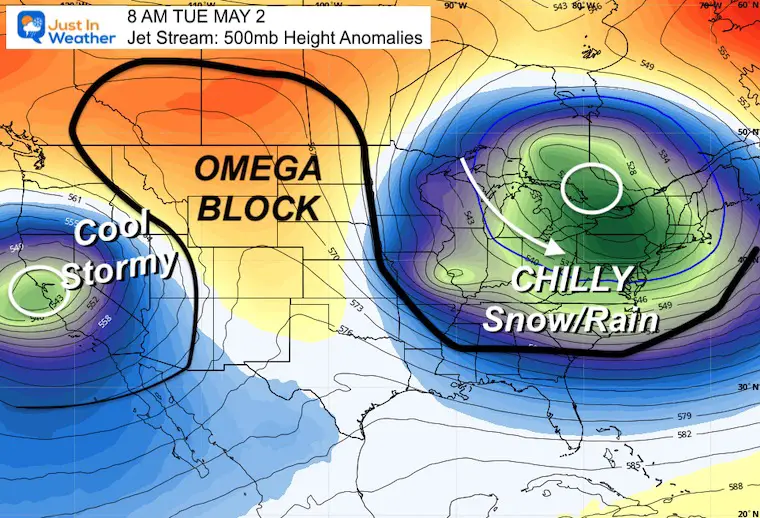
Set Up In The Jet Stream
This is an Omega Block across North America. It looks like the Greek letter Omega with two deep or closed troughs on the West and Eastern US, with a large Ridge in the middle.
This keeps our region very chilly and will be responsible for the mountain snow.
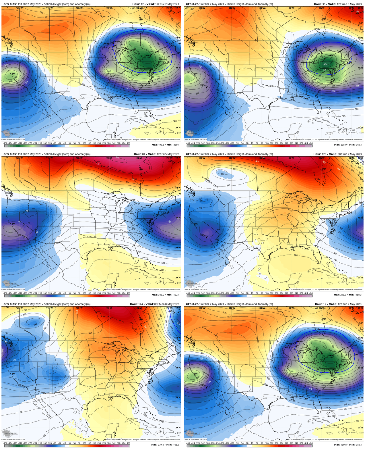
Jet Stream Animation:
Tuesday Through Sunday
This pattern will be stuck for a few more days. It will gradually break as we head into the weekend.
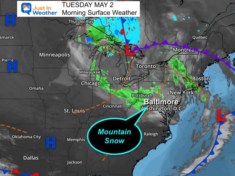
Morning Surface Weather
A large pinwheel of showers is pivoting around the Upper Level Low. The mountain snow is not showing well on radar now, but it’s there and will be expanding today.
Rain showers will be on tap for the rest of us.
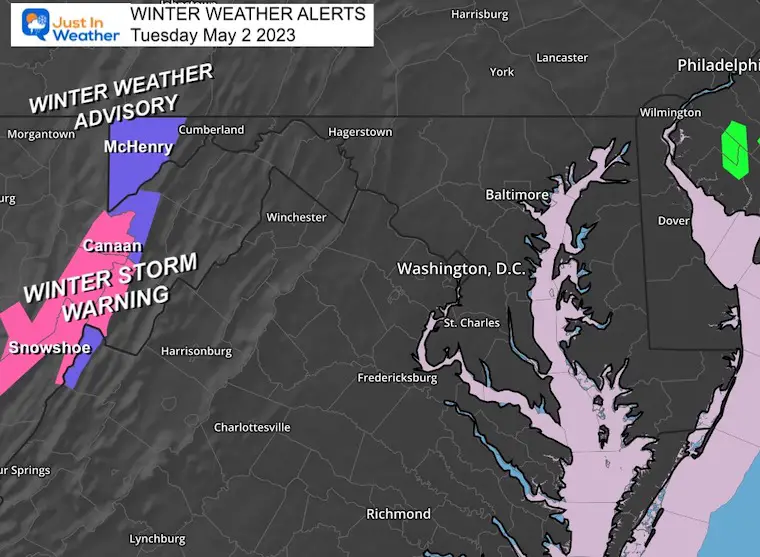
Winter Storm Warning/Winter Weather Advisory
Winter Weather Advisory
Garrett County, MD
Above 2,000 Ft: 1 to 3 inches
Winter Storm Warning
Total Snow: 4 to 6 inches, between 8 to 12+ on higher elevations. Winds gust to 45 mph.
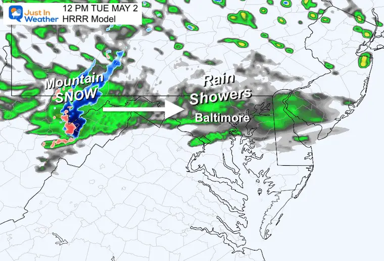
Snapshot at Noon
Snow will be in full form in the mountains, while a large field of rain showers will expand into metro areas.
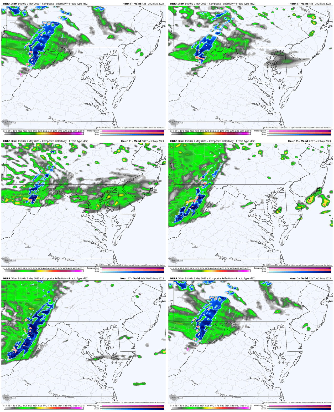
Radar Simulation
8 AM to 8 PM
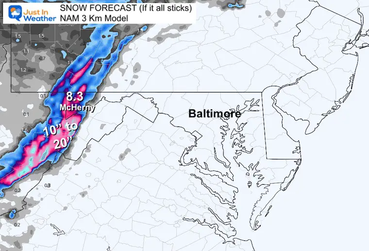
Snow Forecast:
This model assumes all snow will stick through Wednesday. I believe if we consider melting and compaction, we can cut this in 1/2 as a top expectation.
Ways to Track The Snow
Peter Forister is at Snowshoe, WV. The elevation is 4,848 Ft and he could see a foot of snow. Here is his Twitter Account:
I’m in Snowshoe, West Virginia for a potentially historic May snowstorm.
The forecast is calling for snow amounts not seen in May since 1923. More video and photos to follow! #wvwx pic.twitter.com/hNbtx691NG
— Peter Forister ⚡️🌪️⚡️ (@forecaster25) May 2, 2023
Live Web Cam: Deep Creek Lake MD
Note that the lake itself may warm the surrounding areas, but you may see snow stick on the slopes of Wisp.
This webcam is positioned at The Greene Turtle Deep Creek Lake and shows Wisp Resort, including a zoomed-in view of Squirrel Cage, The Face, the terrain park, Boulder, the mountain coaster, the tubing park and a shot of McHenry Cove at Deep Creek Lake!
Click here for More Snow Focus
Forecast Snapshot 8 AM
Snow will become more prominent today, while rain showers expand farther east. Most of us will have periodic showers today.

Radar Simulation
HRRR Model: 8 AM to 8 PM
Rain showers for most, but snow in Garrett County and West Virginia, mainly above 2,500 Ft elevation.

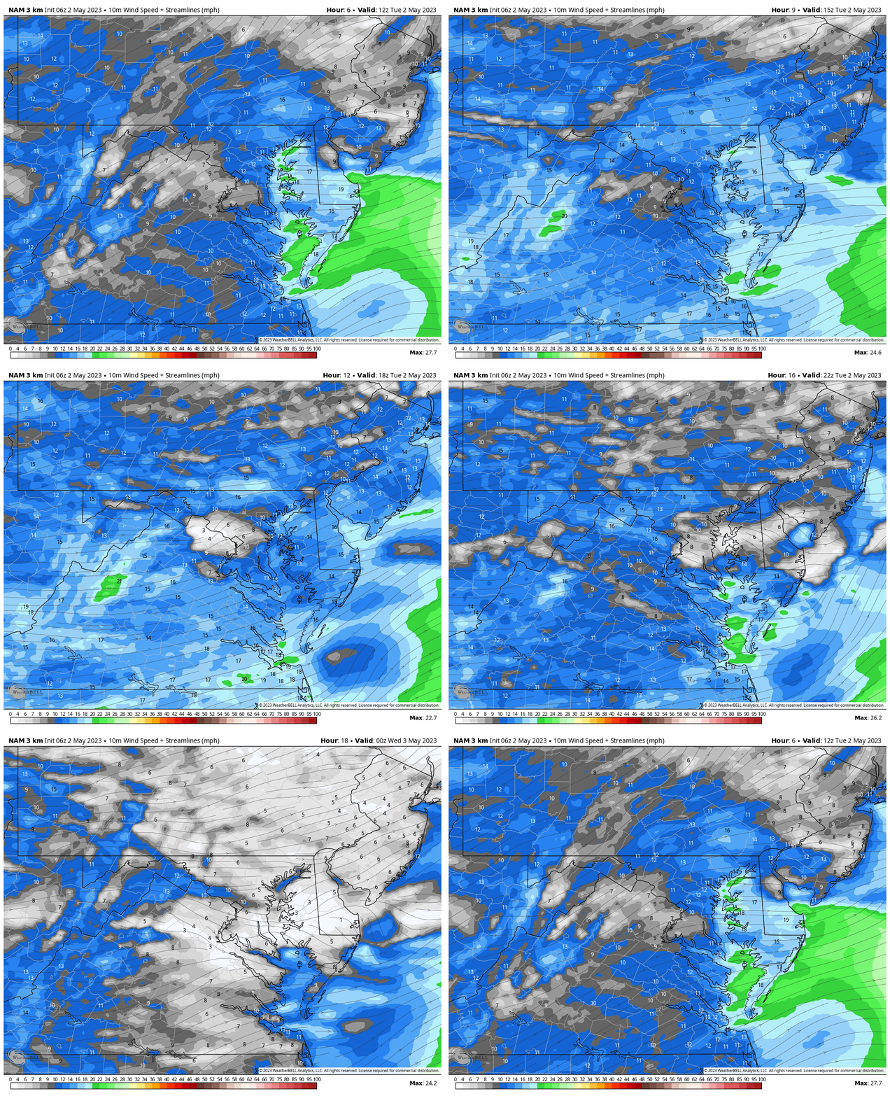
Wind Forecast
The westerly wind will continue with an average of 10 to 20 mph. A few gusts may push up close to 30 mph again.
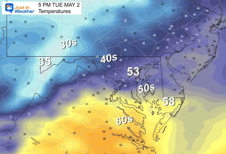
Afternoon Temperatures
With the wind and rain showers, even if you get close to 60ºF it will be chilly. Many areas stay in the 50s.
Subscribe for eMail Alerts
Weather posts straight to your inbox
Sign up and be the first to know!
CLIMATE DATA
TODAY May 2
Normal Low in Baltimore: 49ºF
Record 36ºF in 1878
Normal High in Baltimore: 72ºF
Record 90ºF 2018
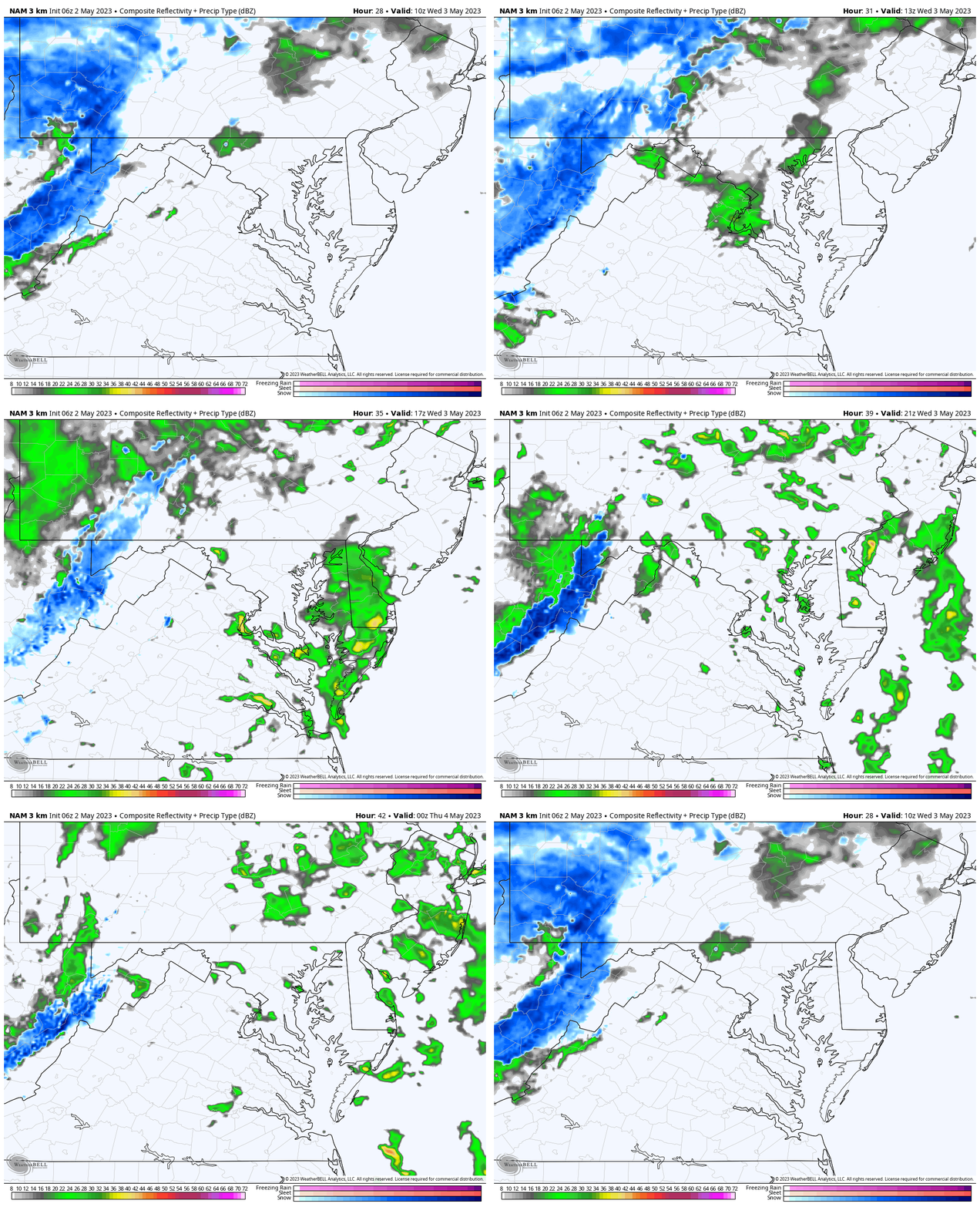
Radar Simulation 6 AM to 8 PM
Rain showers for most of us with mountain snow continuing.
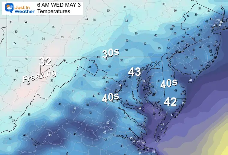
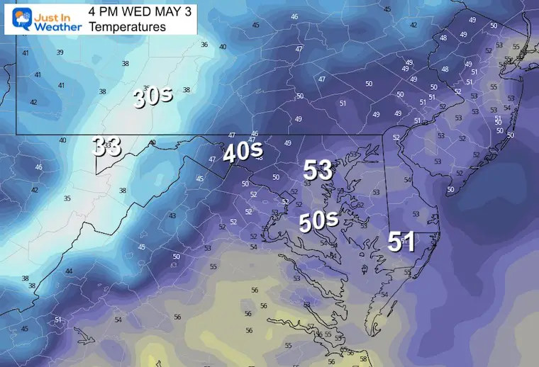
Temperatures
Wednesday Morning
Wednesday Afternoon
These numbers are still almost 20 degrees below average for May 3.
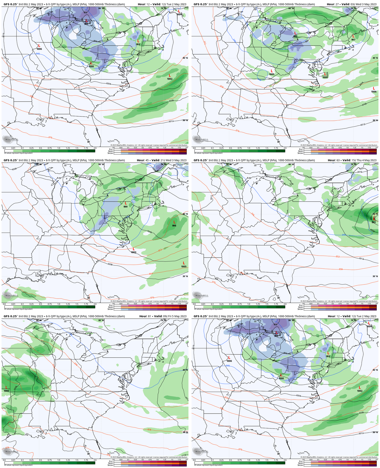
Storm Animation: Tuesday Morning To Friday Morning
The rain showers and mountain snow will gradually break up by Thursday and Friday.
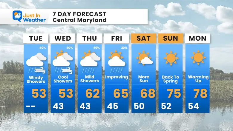
7 Day Forecast
This March weather will begin to break later in the week. While we may continue to see isolated showers at the end of the week, we will gradually get more sun and warmer temps. At this point the weekend looks better and back to spring.
OTHER REPORTS:
NEW:
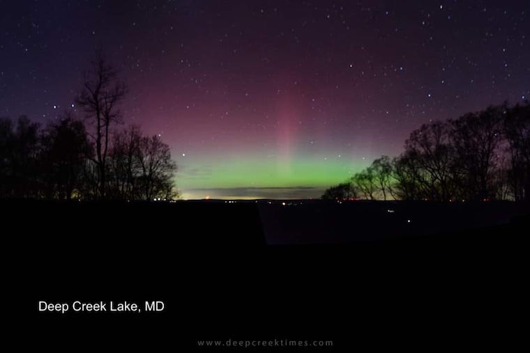
Aurora Photos From Maryland, Delaware, and Virginia
April Heat Wave History
Winter 2023 Recap: My BUSTED Snow Outlook
La Niña Has Ended. El Niño May Return By Fall
STEM Assemblies/In School Fields Trips Are Back
Click to see more and ‘Book’ a visit to your school
Please share your thoughts, best weather pics/videos, or just keep in touch via social media
-
Facebook: Justin Berk, Meteorologist
-
Twitter
-
Instagram
RESTATING MY MESSAGE ABOUT DYSLEXIA
I am aware there are some spelling and grammar typos, and occasional other glitches. I take responsibility for my mistakes, and even the computer glitches I may miss. I have made a few public statements over the years, but if you are new here you may have missed it: I have dyslexia, and found out during my second year at Cornell University. It didn’t stop me from getting my meteorology degree, and being first to get the AMS CBM in the Baltimore/Washington region. One of my professors told me that I had made it that far without knowing, and to not let it be a crutch going forward. That was Mark Wysocki and he was absolutely correct! I do miss my mistakes in my own proofreading. The autocorrect spell check on my computer sometimes does an injustice to make it worse. I also can make mistakes in forecasting. No one is perfect predicting the future. All of the maps and information are accurate. The ‘wordy’ stuff can get sticky. There has been no editor that can check my work when I needed it and have it ready to send out in a newsworthy timeline. Barbara Werner is a member of the web team that helps me maintain this site. She has taken it upon herself to edit typos, when she is able. That could be AFTER you read this. I accept this and perhaps proves what you read is really from me… It’s part of my charm.
#FITF
Subscribe for eMail Alerts
Weather posts straight to your inbox
Sign up and be the first to know!


