February 7 Warming Up To Rain Events And Open Mind For This Weekend
February 7, 2023
Tuesday Morning
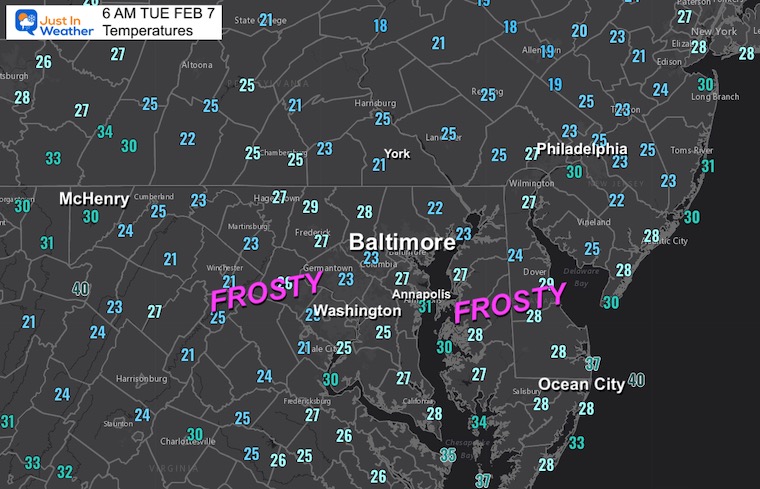
We are turning the corner again and shifting the winds from the south. While we wake up with cold air and widespread frost, winds from the south will bring back above-average temperatures.
The theme of the week, and next week for that matter, will be warmer than average. Winter does seem to be missing. There is one blip with the upper-level pattern that keeps this weekend in play for a brief coastal event. The modeling has been poor in handling most weather events lately. The European and GFS appear to be on a daily handoff between which one tries to produce snow. All I can suggest is to keep an open mind for the weekend.
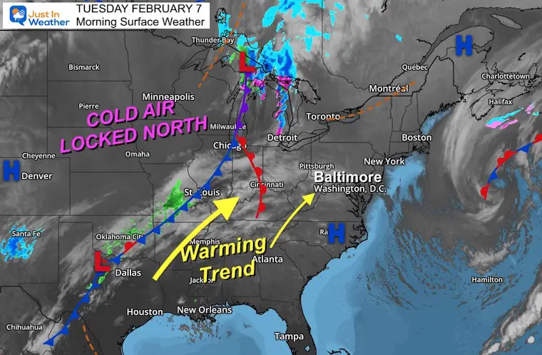
Morning Surface Weather
We have a dirty High in the Eastern US. This simply means plenty of cloud cover within the dry air mass. Winds will pivot to the south today, starting the warming trend.
Morning Temperatures
Frost may be a little extra thick this morning, so consider some extra time to warm up your vehicle to thaw or time to scrape.
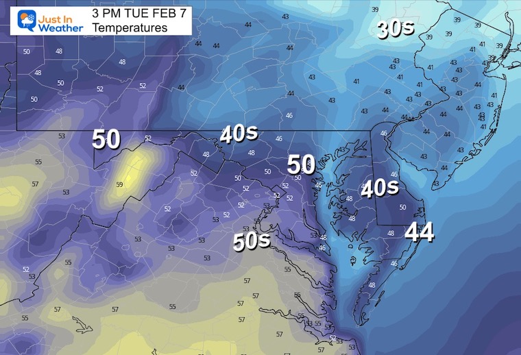
Afternoon Temperatures
Near to slightly above average. However, there will be a noticeable wind to keep some chill in the air.
Subscribe for eMail Alerts
Weather posts straight to your inbox
Sign up and be the first to know!
CLIMATE DATA
TODAY February 7
Normal Low in Baltimore: 26ºF
Record 6ºF in 1895
SNOW: 6.3” 1974
Normal High in Baltimore: 45ºF
Record 72ºF 2017
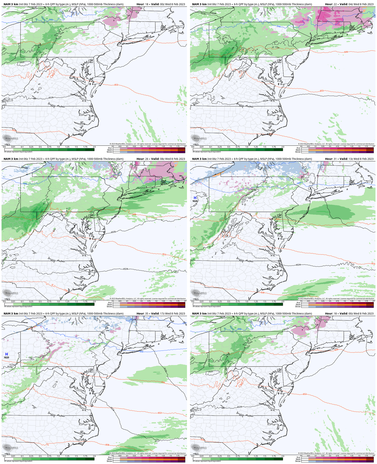
Tuesday Night To Wednesday Afternoon
This cold front will be falling apart. We may see some rain showers, but more likely on the north side of Baltimore.
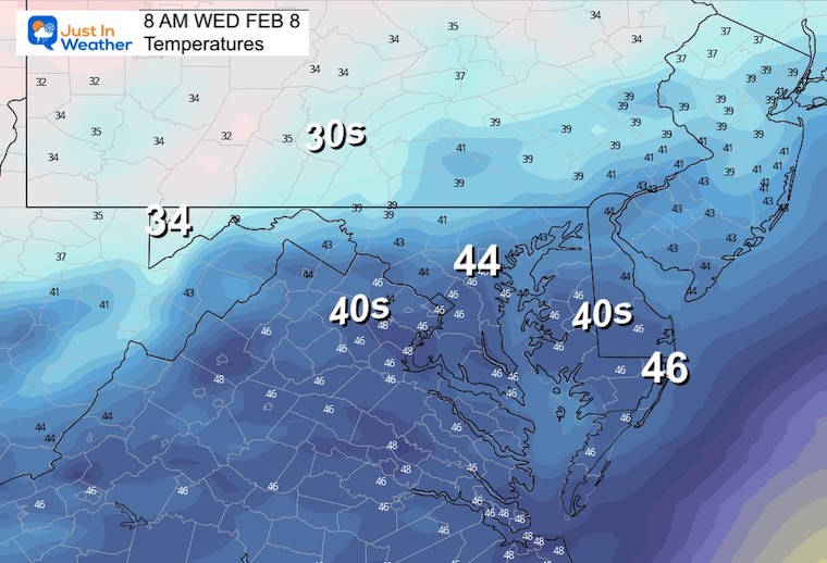
Wednesday Morning Temperatures
Not as cold.
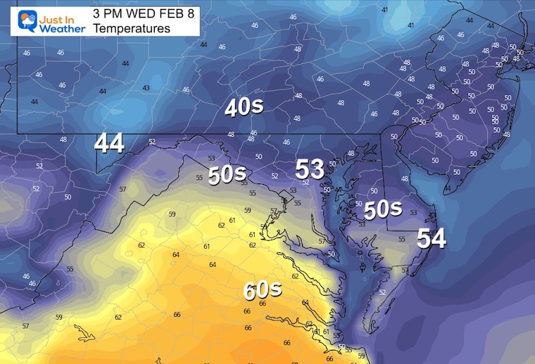
Wednesday Afternoon Temperatures
Many will aim for the lower 50s. The 60s will be on display in central Virginia.
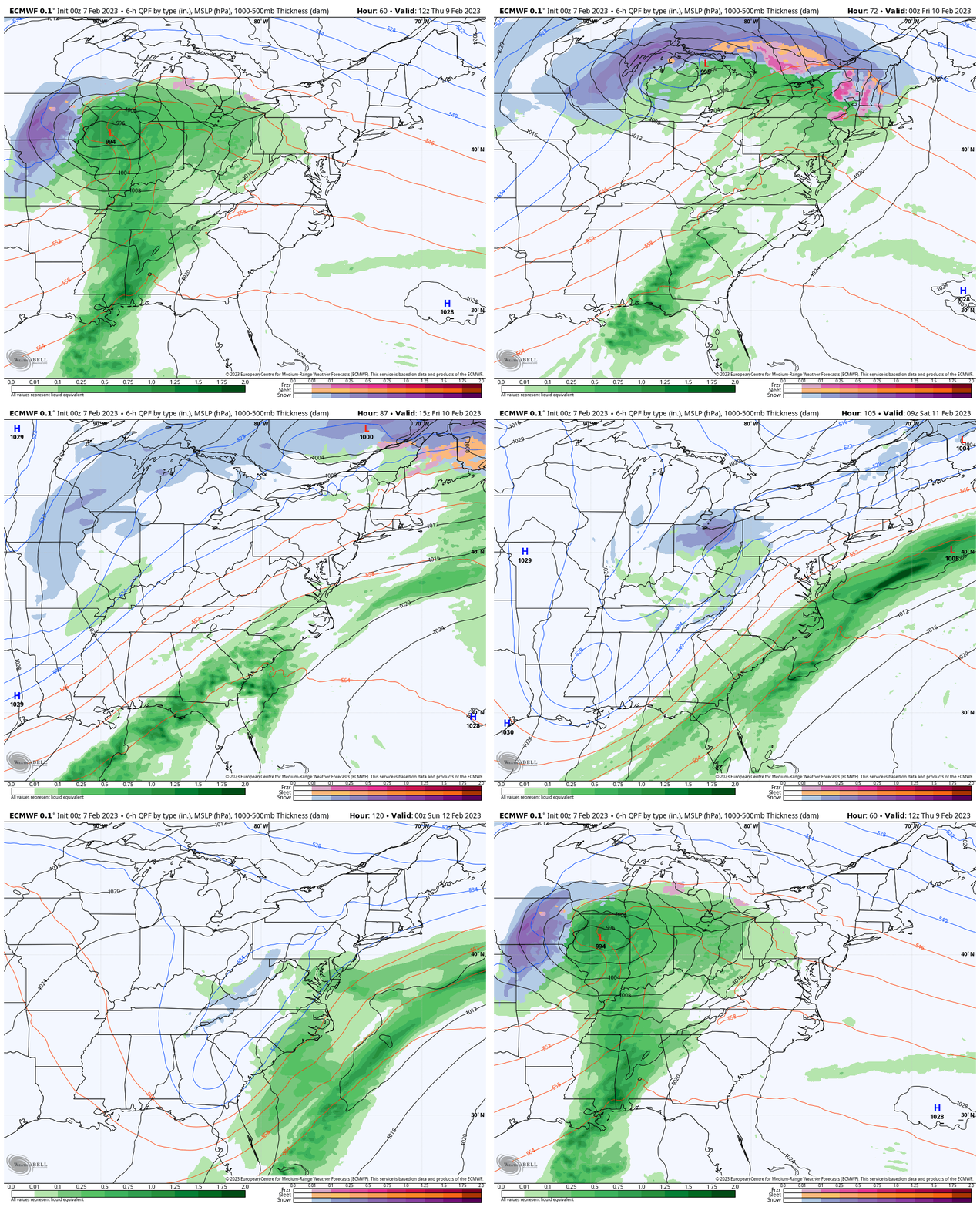
Rain Events: Thursday Through Saturday
ECWMF Model
This shows the split of rain showers breaking up on Thursday, then more focused on Friday. This second system will be mainly in our southern areas. Then the questionable weekend weather. At this point, we see this model fading away that upper-level energy.
Snow? Weekend Snapshot
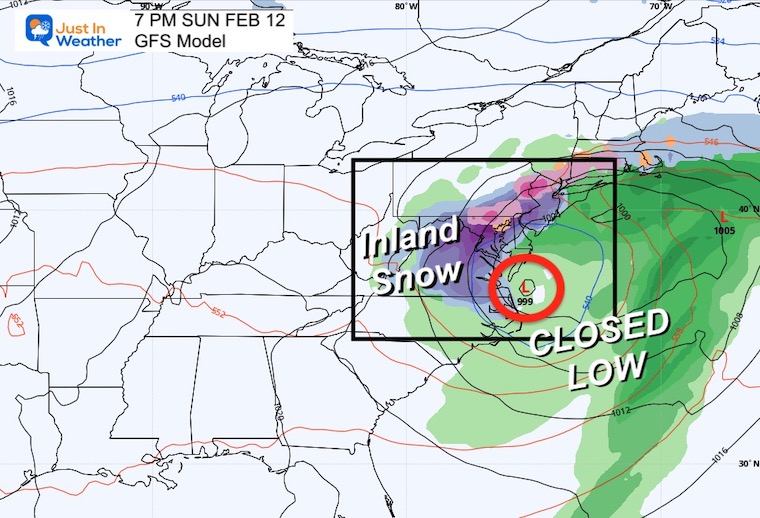
The tradeoff continues, this time with the GFS Model taking the baton.
Close Up (GFS)
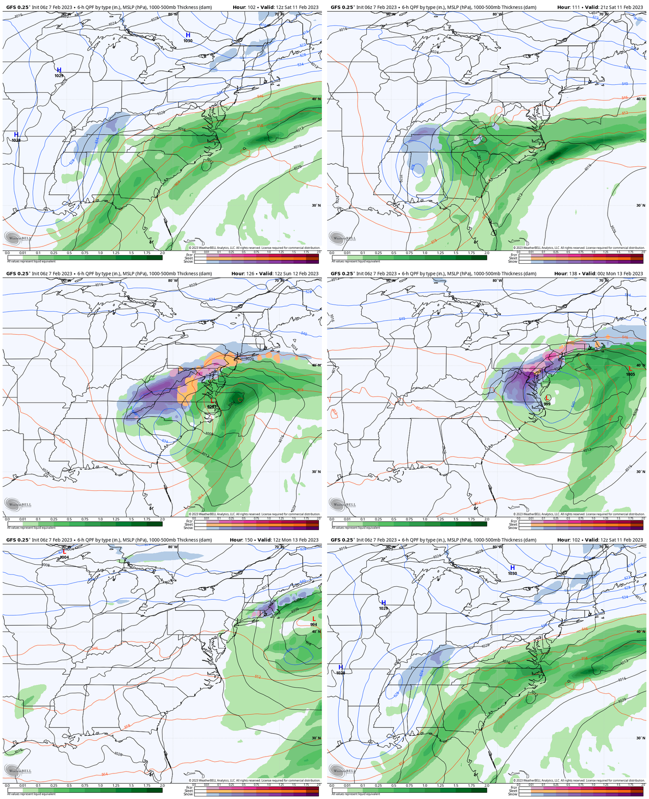
Storm Animation Saturday Morning to Monday Morning
This close up of the GFS Model shows the developing Low producing its own cold air. This is that upper-level Low helping to enhance the precipitation and transition rain to a wet snow.
Considering that the main models have been showing something for more than four straight days, I ask you to keep an open mind. The models have not been handling this winter well, and can’t seem to agree, but the signal is there, and the specifics get refined as we get closer.
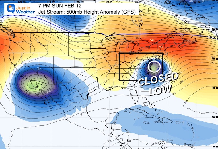
Jet Stream Saturday
This upper-level air flow shows a closed Low over the Mid-Atlantic coast within a warm pattern. This is the reason why one little system can generate its own cold air.
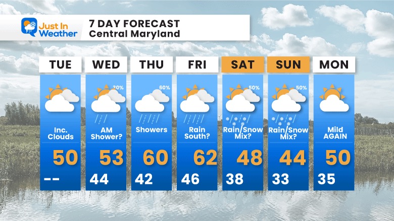
7 Day Forecast
Overall we have a mild weather pattern. But it is possible to get snow, if that upper-level closed Low plays out. It is also possible to get snow even if the daily high is above freezing. That is what we see here, and what you may be seeing on your weather app.
Also See:
Winter History: Low Snow And Late Starts
See my research based on Baltimore data since 1883.
STEM Assemblies/In School Fields Trips Are Back
Click to see more and ‘Book’ a visit to your school
My Winter Outlook: Not A Typical La Niña!
I see many factors to support colder influence with multiple systems. Early and later in winter. Check it out.
Also See The Winter Outlook Series:
Winter Weather Folklore Top 20 And More Outlook Signals From Nature For Cold And Snow
Farmer’s Almanac Comparison
September Starts Meteorological Autumn: Weather Climate Stats For Maryland at Baltimore
Triple Dip La Niña Winter
https://justinweather.com/2022/09/09/winter-outlook-2023-la-nina-triple-dip-expectations/
CONNECTION TO WINTER?
If you want a snowy winter, this is what you might want to look for in the rest of the tropical season.
Rainbow Ice Cave In Mt. Rainier A Very Rare Find: Photos And Video
Wooly Bear Caterpillars
https://justinweather.com/2022/10/25/winter-weather-outlook-from-the-wooly-bear-caterpillar/
Persimmon Seeds
Click to see Top 20 and MORE
Winter Weather Folklore Top 20 And More Outlook Signals From Nature For Cold And Snow
Normals And Records: Maryland and Baltimore Climate History
Please share your thoughts, best weather pics/videos, or just keep in touch via social media
-
-
Facebook: Justin Berk, Meteorologist
-
Twitter: @JustinWeather
-
Instagram: justinweather
-


