October 10 More Frost This Morning And A Few Warmer Days
October 10 2022
Monday Morning Update
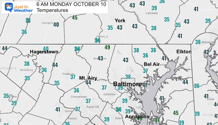
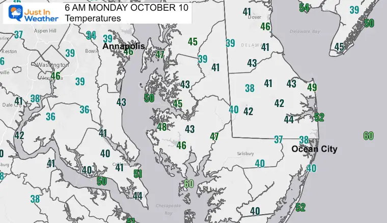
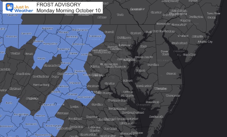
Good morning and welcome back to the work week. If you slept in on Sunday, you may have missed the frost. This morning, there is another round, but not for everyone. Temps have dropped into the 30s and lower 40s. While the latest Frost Advisory only includes Frederick County and farther west in Maryland (and the mountains), there are pockets of colder air and patchy frost farther east. Local temperature maps show that below.
If you don’t have frost, but your vehicle was parked outside, there may be a heavy layer of dew on it. Simply put, allow a few extra minutes to warm it up and put the front window defroster/heater on.
Today, much like yesterday, we will have sunshine and warm up. It will be a great weather day in Mount Airy for our Charity Golf Tournament. I’m looking forward to seeing everyone participating.
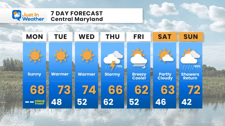
The warming trend will continue through mid week as we climb back to the 70s. The next change in weather will be a strong cold front bringing thunderstorms on Thursday.
SNOW TRIVIA: 100th Anniversary!
On this date, October 10 in 1922 Baltimore received the earliest measurable snow on record with 0.3” falling. It was measured in downtown Baltimore at the time.
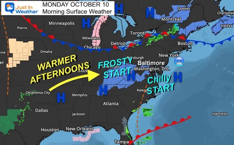
Morning Surface Weather
Widespread Frost inland as High Pressure provided the perfect set up with light winds to allow temps to tank. This will also help us recover for a mild afternoon.
Frost Advisory This Morning
Reminder: There may be more frost outside of the advisory area.
Morning Temperatures
Official weather stations at area airports.
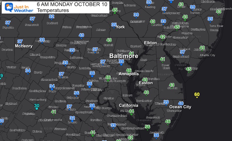
Local Temps
EXPLORE MORE: WHEN IS THE FIRST FROST?
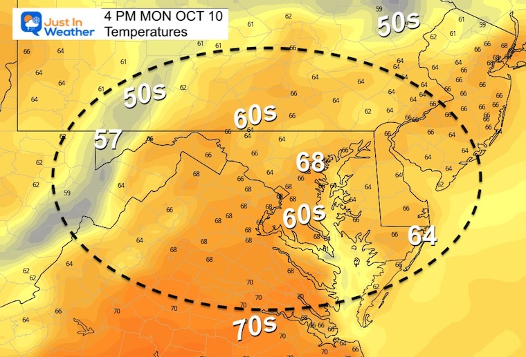
Afternoon Temperatures
A little milder than this weekend.
CLIMATE DATA
TODAY October 10
Normal Low in Baltimore: 49ºF
Record 34ºF in 1979
SNOW: 0.3” in 1922
Normal High in Baltimore: 70ºF
Record 93ºF 1939
Weather posts straight to your inbox
Sign up and be the first to know!
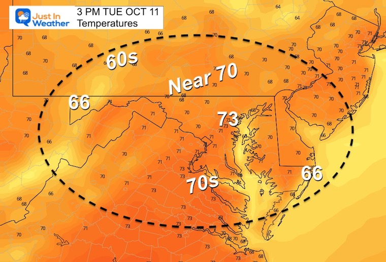
Temperatures Tuesday
Morning
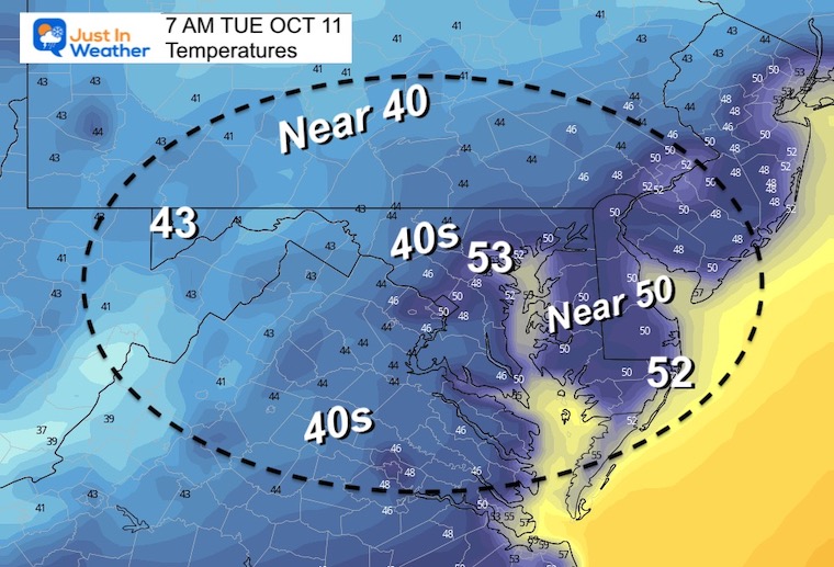
Afternoon
Week Ahead:
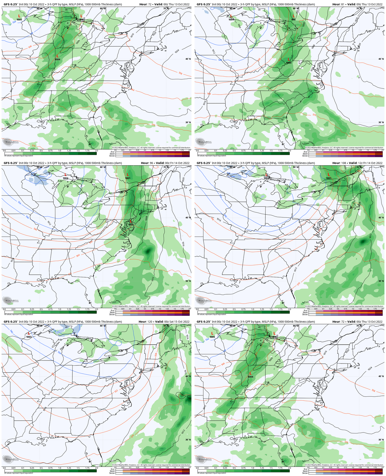
We will have a warming trend back to the 70s… Until the next cold front arrives later Thursday with rain/storms.
Storm Animation: 8 PM Wed to 8 PM Fri
The focus will be on Thursday for periods of rain and strong thunderstorms.
7 Day Forecast
STEM Assemblies/In School Fields Trips Are Back
Click to see more and ‘Book’ a visit to your school
Please share your thoughts, best weather pics/videos, or just keep in touch via social media
-
Facebook: Justin Berk, Meteorologist
-
Twitter: @JustinWeather
-
Instagram: justinweather
PATTERN CHANGER?
CONNECTION TO WINTER?
If you want a snowy winter, this is what you might want to look for in the rest of the tropical season.
Rainbow Ice Cave In Mt. Rainier A Very Rare Find: Photos And Video
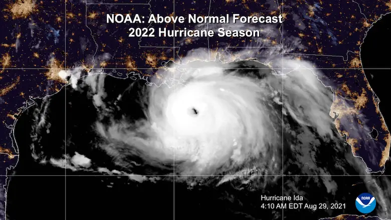
Hurricane Season Forecast: June 1 Through November 30
NOAA 2022 Hurricane Forecast- Above Normal Again
Related Posts
NOAA Study: Reducing Air Pollution INCREASED Tropical Storms
Atlantic Tropical History: Maps of Origin Regions Every 10 Days


