


Soggy Saturday Update: Rain Timeline Through Preakness In Baltimore
Friday, May 17, 2024 As we approach another weekend, we have yet another weather system bringing us rain. This will make 16 of 20 weekends this year with some wet…
October 9 2022
Sunday Morning Update
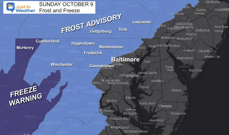
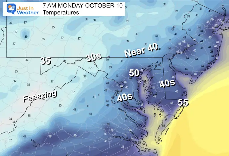
It is OK to say it feels chilly. The temperatures this morning have dropped into the 30s and 40s, with widespread frost inland. This is the coolest morning since April 30th, at least for Baltimore’s BWI.
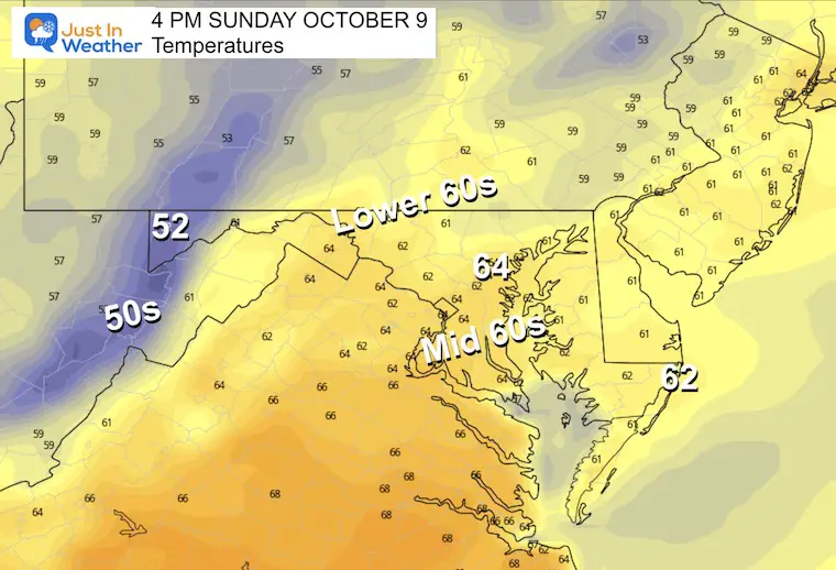
After we have chance to thaw inland, the sun and less wind should allow temps to recover. It will remain below average, but feel a lot better with less wind.
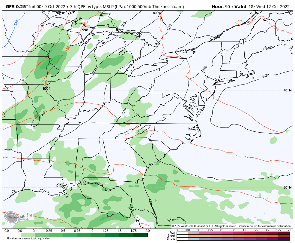
That improvement will continue through the first half of the work week as a warming trend gets us to the 70s. The next rain in sight will be late Wednesday into Thursday when Fall FIGHTS BACK.
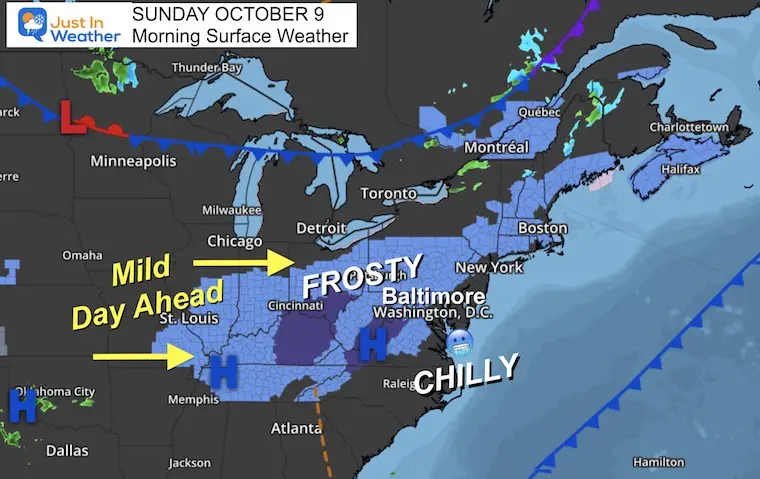
Widespread Frost inland as High Pressure provided the perfect set up with light winds to allow temps to tank. This will also help us recover for a mild afternoon.
This included the typical counties west and north of Baltimore.
More seasonable, even mild compared to what is on the way.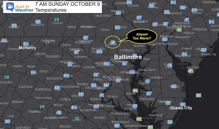
EXPLORE MORE:
The numbers still 5 to 10 degrees below average.
Fall Foliage October 7 Weekend: Update Map Reports Photos And Outlook
CLIMATE DATA
TODAY October 9
Normal Low in Baltimore: 49ºF
Record 28ºF in 2001
Normal High in Baltimore: 71ºF
Record 94ºF 2007

We will have a warming trend back to the 70s… Until the next cold front arrives later Thursday into Friday with rain/storms.
We may get some inland showers Wednesday, but Thursday looks like our stormy day with the next cold front.

Click to see more and ‘Book’ a visit to your school

Hurricane Ian May Help Cooler Pattern Change: Monitor For Atmospheric Memory This Winter
If you want a snowy winter, this is what you might want to look for in the rest of the tropical season.
Record August For No Named Tropical Storms: Closer Look At Snow Following
NOAA 2022 Hurricane Forecast- Above Normal Again

NOAA Study: Reducing Air Pollution INCREASED Tropical Storms

Atlantic Tropical History: Maps of Origin Regions Every 10 Days
