October 7 Weather Warm Today Then Windy And Colder Weekend
October 7, 2022
Friday Morning Update
If you enjoyed yesterday, we’ve got one more warm one on tap. The high temperature on Thursday at Baltimore’s BWI was 79ºF. This afternoon will be close, but a cold front will arrive with clouds, gusty winds, and a few late-day showers.
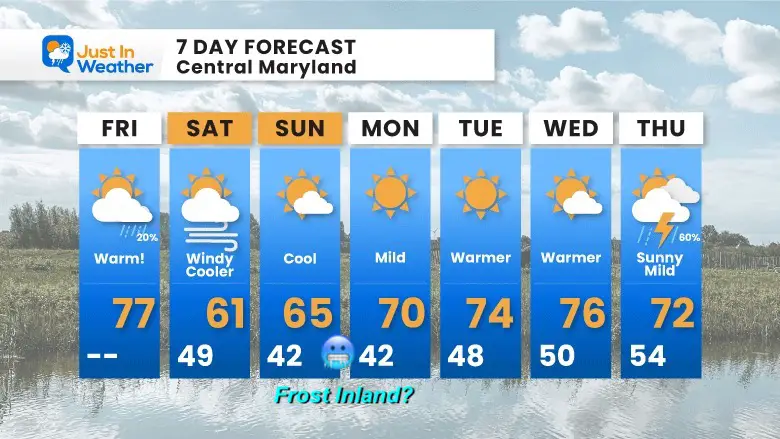
So while we reach deep into the 70s again this afternoon, the weekend will struggle to get to 60ºF. By Sunday morning, the new air mass may also bring in the first frost of the season for our inland suburbs.
Next week we will get another warm-up, so we are not completely done yet.
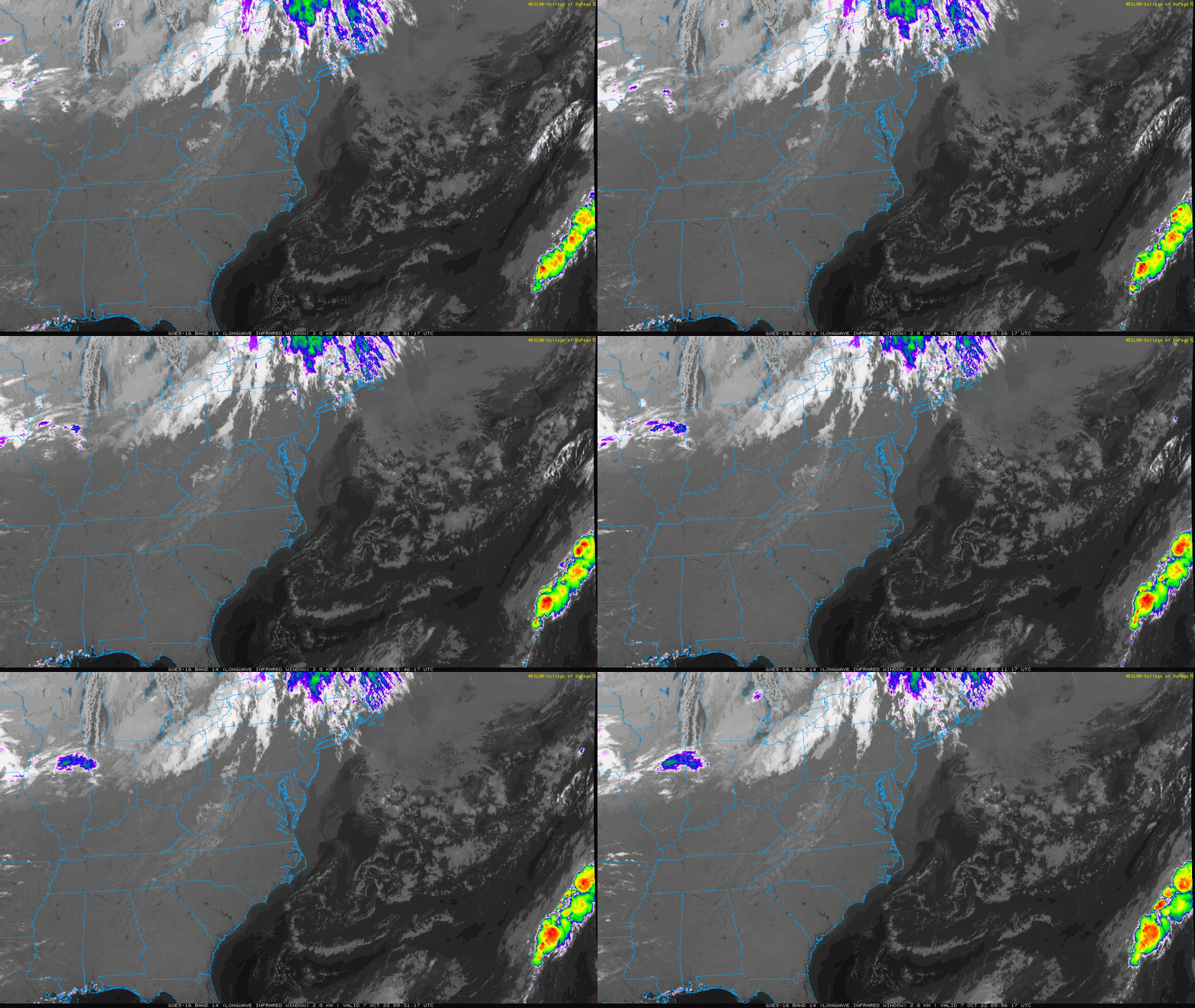
Satellite Loop: Friday Morning
Today will start mostly sunny but expect clouds to increase this afternoon with a cold front approaching.
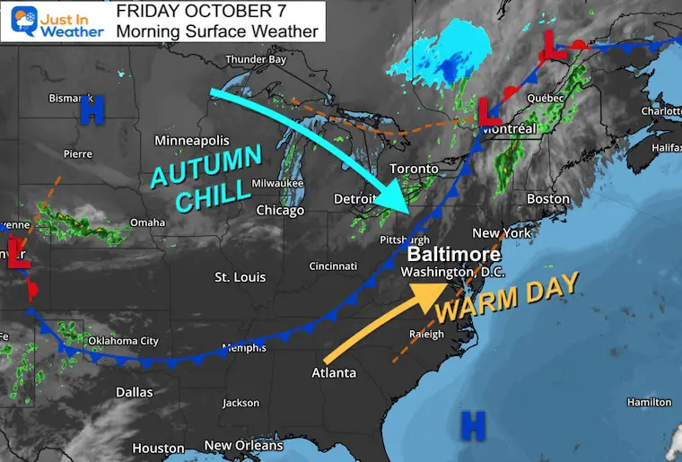
Morning Surface Weather
The cold front will arrive mid to late afternoon. Behind it is a new air mass that will bring in noticeably colder winds by this evening.
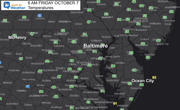
Temperatures
Morning Temperatures
More seasonable, even mild compared to what is on the way.
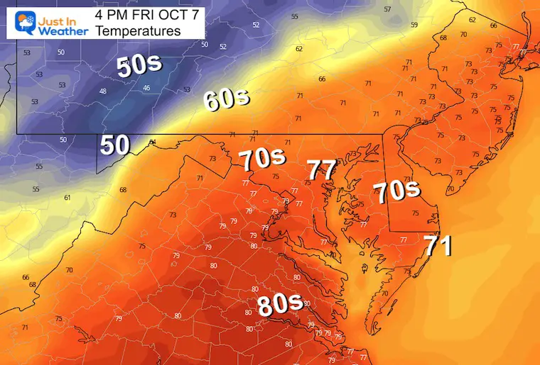
4 PM
Warm, until the cold front arrives. We should notice that entering western Maryland during the day….
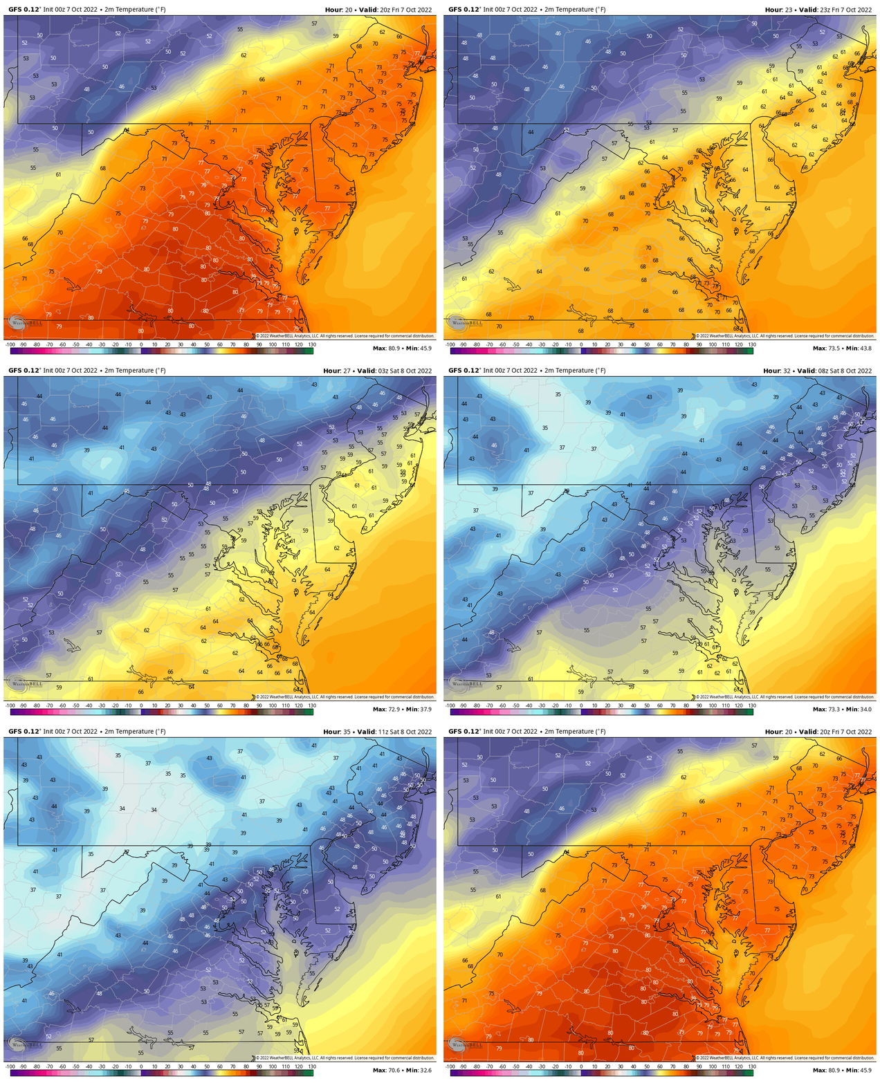
Temperature Animation: 4 PM Fri to 7 AM Sat
Here we can see the big drop in temps for the evening and overnight.
Some inland areas will go from the 70s to 30s!
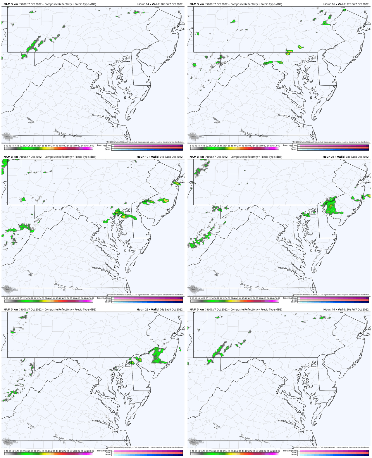
Rain: Radar Simulation 4 PM to Midnight
There is about a 20% chance for showers in central Maryland. The best timing will be AFTER 5 PM.
CLIMATE DATA
TODAY October 7
Normal Low in Baltimore: 50ºF
Record 35ºF in 2001
Normal High in Baltimore: 72ºF
Record 96ºF 1941
Weather posts straight to your inbox
Sign up and be the first to know!
IN CASE YOU MISSED THIS FALL FOLIAGE REPORT
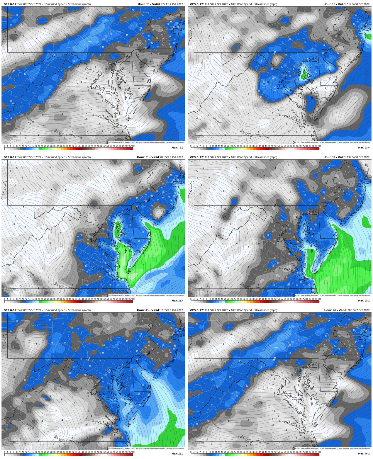
Wind Forecast Animation
4 PM Fri to 4 PM Sat
This is worth paying attention to with the arrival of that new air mass. Also, if you are riding in the Seagull Century in Salisbury… I will be with you. The front will still be pushing through in the morning. Those winds will be noticeable, especially the last 50 miles heading to Assateague Island and back to Salisbury.
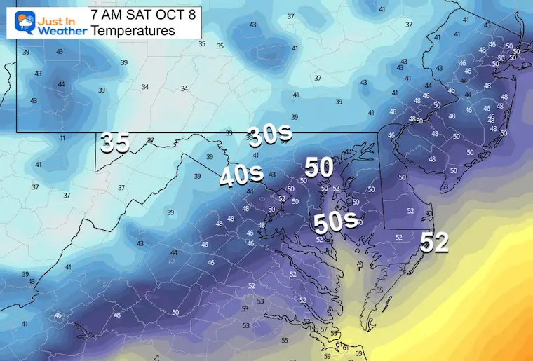
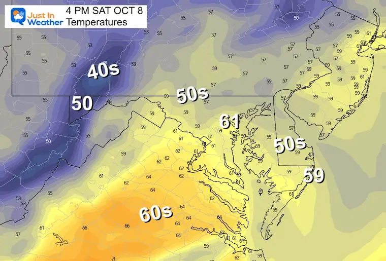
Temperatures Saturday
Morning
Afternoon
FIRST FROST?
7 Day Forecast
The first frost of the season might develop inland on Sunday morning.
Next week will bring another warm up to the 70s. This is the typical up and down we get in Fall… Then temps will FALL again into next weekend.
STEM Assemblies/In School Fields Trips Are Back
Click to see more and ‘Book’ a visit to your school
Please share your thoughts, best weather pics/videos, or just keep in touch via social media
-
Facebook: Justin Berk, Meteorologist
-
Twitter: @JustinWeather
-
Instagram: justinweather
Join Us Next Monday October 10 For Our Golf Tournament
Brought In Part By JP’s Custom Home Painting
The weather WILL BE BETTER THEN!
PATTERN CHANGER?
CONNECTION TO WINTER?
If you want a snowy winter, this is what you might want to look for in the rest of the tropical season.
Rainbow Ice Cave In Mt. Rainier A Very Rare Find: Photos And Video
Hurricane Season Forecast: June 1 Through November 30
NOAA 2022 Hurricane Forecast- Above Normal Again
Related Posts
NOAA Study: Reducing Air Pollution INCREASED Tropical Storms
Atlantic Tropical History: Maps of Origin Regions Every 10 Days


