Watch The Core Of The Ian Nor’easter Spin Just East Of Ocean City MD
Noon Tuesday, October 4, 2022
It’s been another rainy morning in the Mid-Atlantic, making for 5 days in a row with rain. This has all be credited to former Hurricane Ian, which found a new life as a Nor’easter off the Mid-Atlantic coast. I and a few others have been calling it the Ghost of Ian, while Delmarva (Delaware and Maryland Eastern Shore) residents have named it Nor’Ian. Regardless, the core circulation is just east of Ocean City.
In this post, we will see the late morning analysis, radar, satellite, and live tracking into the afternoon.
Record Weather Day?
One other thing to note is the cooler air: At noon, Baltimore’s BWI reported a temperature of 51ºF.
- 54ºF – If the high remains at or below this mark, it will set the record for the coolest October 4th afternoon on record.
- 51ºF – The ‘normal’ Low Temperature for this date.
- 73ºF – The ‘normal’ High Temperature for this date.
You can check the Current Tab on the right of this page for updates reported every 10 minutes.
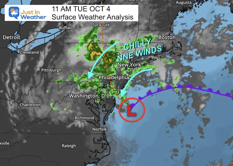
11 AM Surface Weather
11 AM Mesoscale Analysis From NOAA
The central Low Pressure is around 1006 mb. Not terribly deep, however, this closed circulation cut off from the jet stream has found a happy home with warm Gulf Stream water underneath and chilly air inland to help feed into the ongoing spin. Yes, the contrast does help a lot.
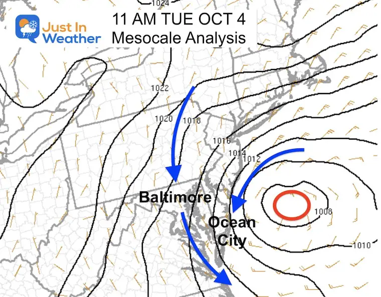
Visible Satellite Loop
2 Hours Ending at 11:45 AM
Wind Snapshot
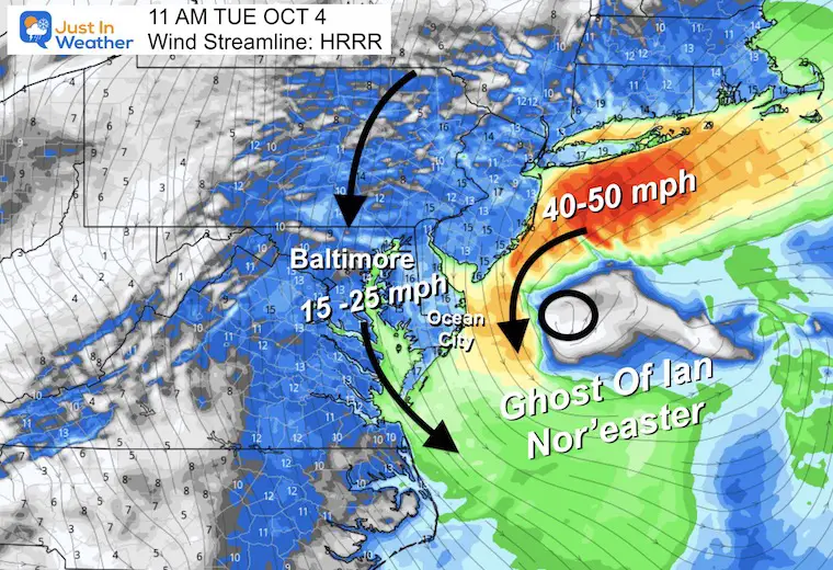
Wind Forecast
Noon to Midnight: NAM 3 Km Model
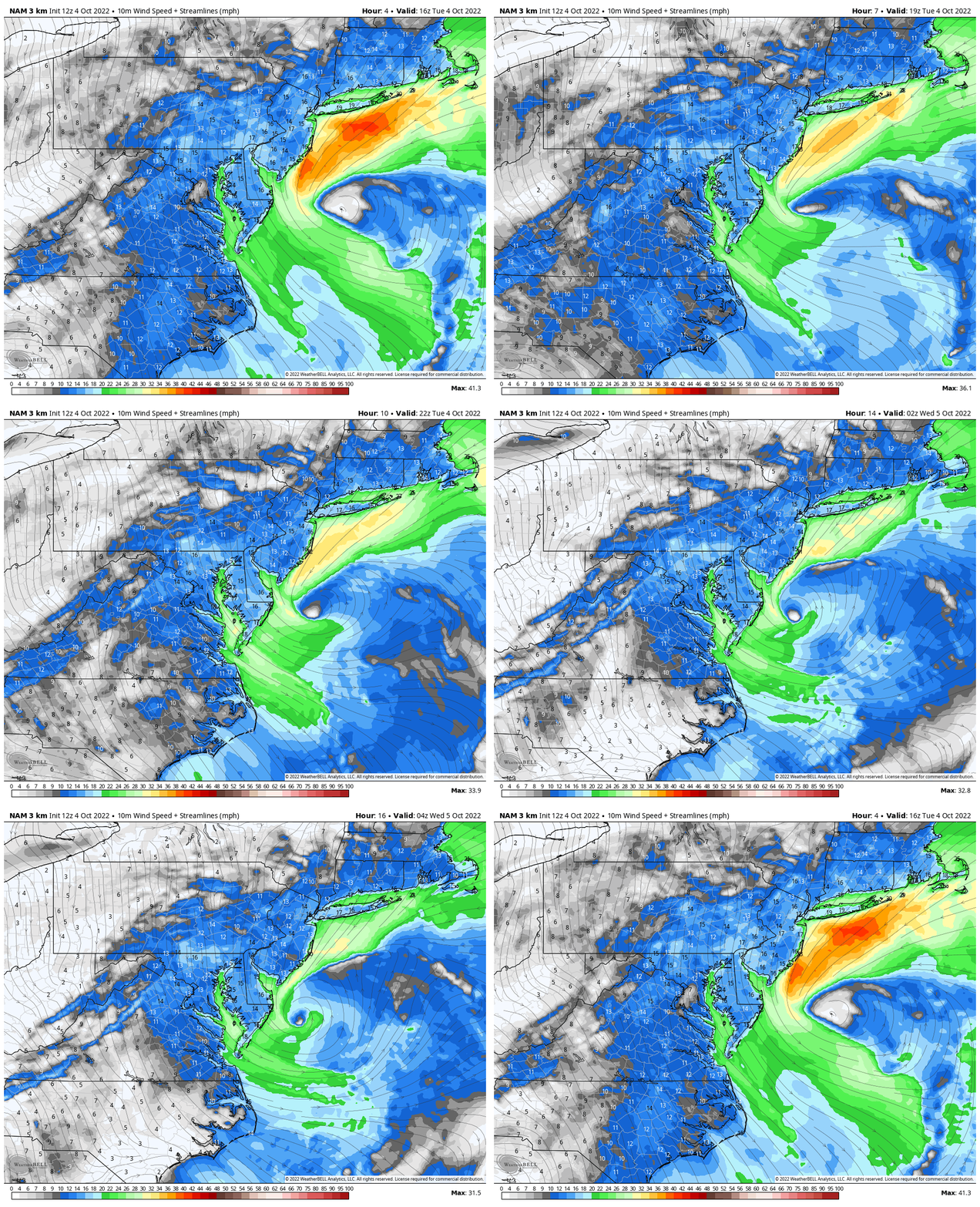
WIND WIDGET: INTERACTIVE
The steady onshore flow has brought multiple rounds of flooding at each high tide cycle, in addition to beach erosion. Here is NEW VIDEO I shared on my Facebook page from Cindy Kelly. This was at Edgewater Avenue in Ocean City, Maryland.
Flooding In Ocean City Maryland
Radar Loop
Watching the rain pump from East to West is like a pipe has been connected to the Atlantic Ocean and funneled inland.
This is why we expect rain to continue this afternoon.
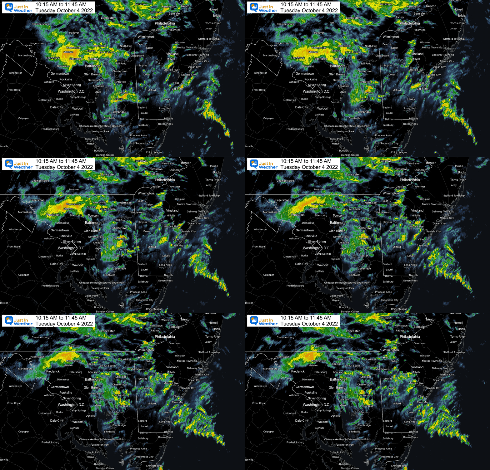
LIVE RADAR WIDGET
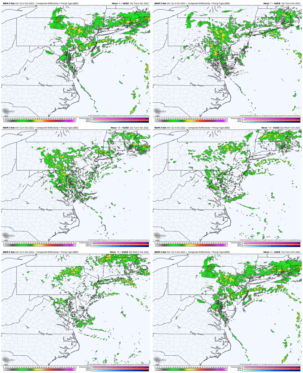
Radar Simulation Noon to Midnight
While we can see sustained bands of rain with moderate cells all afternoon spinning around that Low off the coast, it is expected to fade tonight.
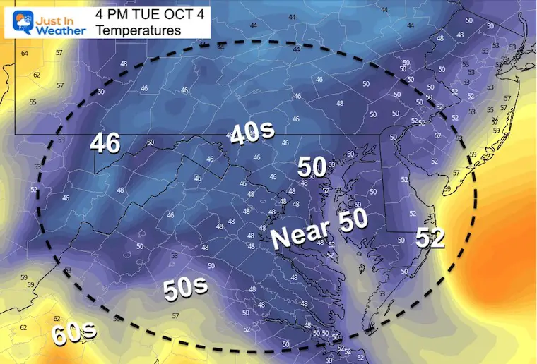
Temperature Forecast at 4 PM
Remaining steady or cooling with the rain and wind.
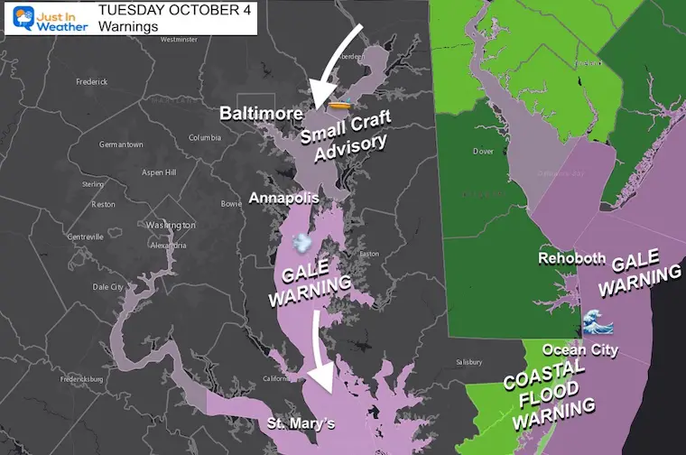
Wind and WaterWarnings and Advisories
The focus today will be mostly about the water.
- Small Craft Advisory for the northern Chesapeake Bay
- Gale Warning for the southern Chesapeake Bay and Ocean Coast
- Coastal Flooding: Beach Areas on both Atlantic and Bay sides through Maryland, Delaware, and southern New Jersey.
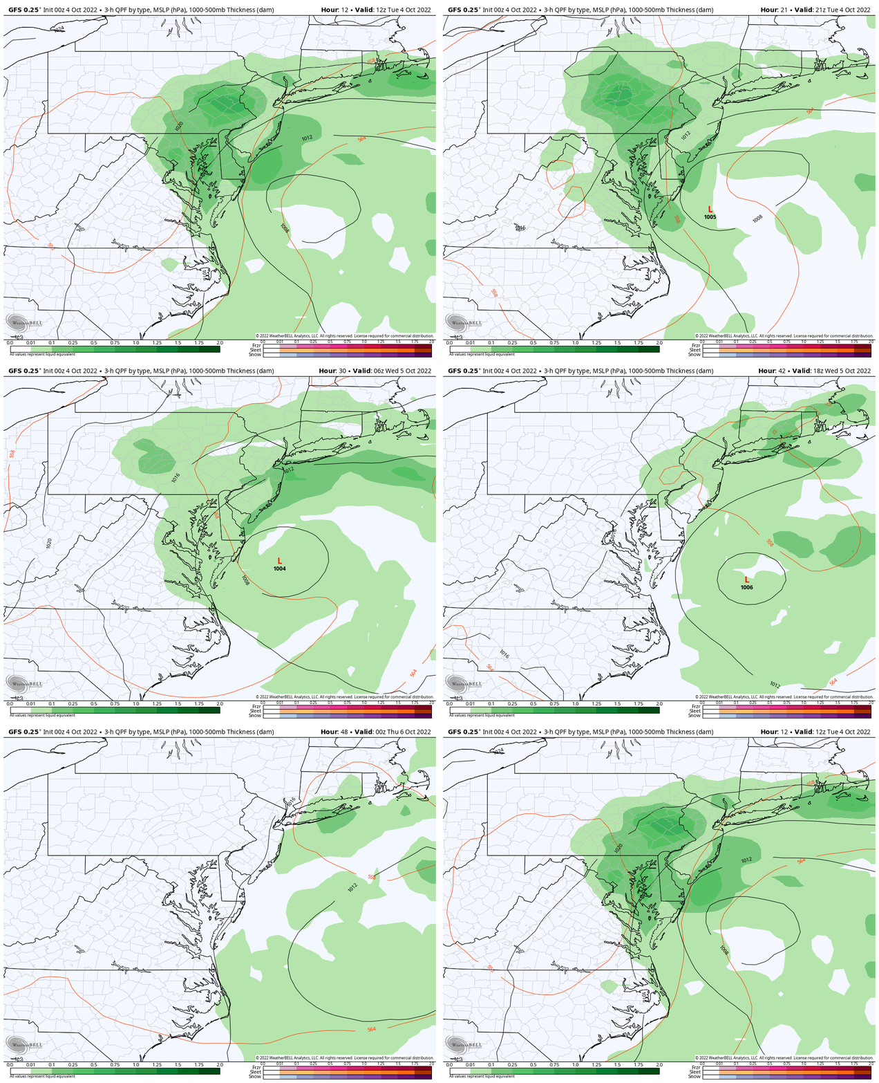
STORM EVOLUTION: GFS Model
8 AM Tue to 8 PM Wed
After skirting the coast today, the Low Pressure will finally break down and move away tomorrow.
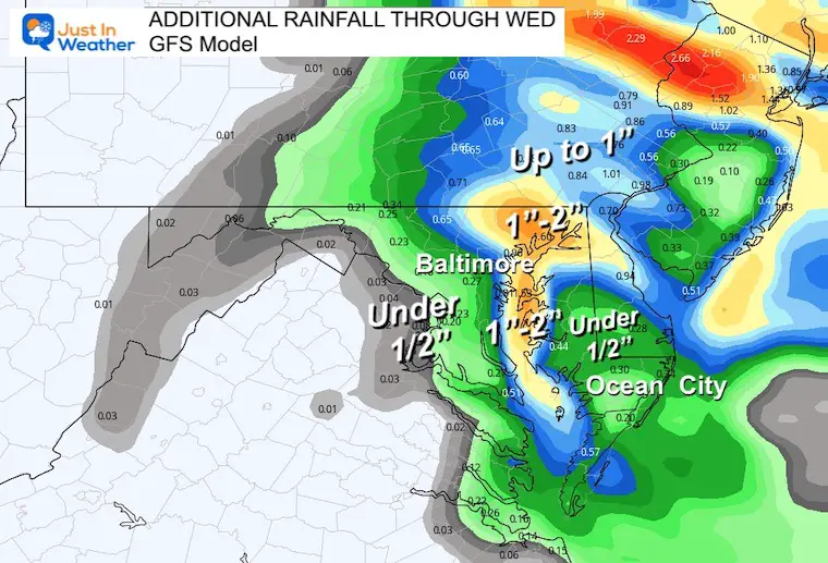
Additional Rainfall Through Wednesday
A few pockets may still receive another 1 to 2 inches all depending on how these bands of rain set up around the Chesapeake Bay.
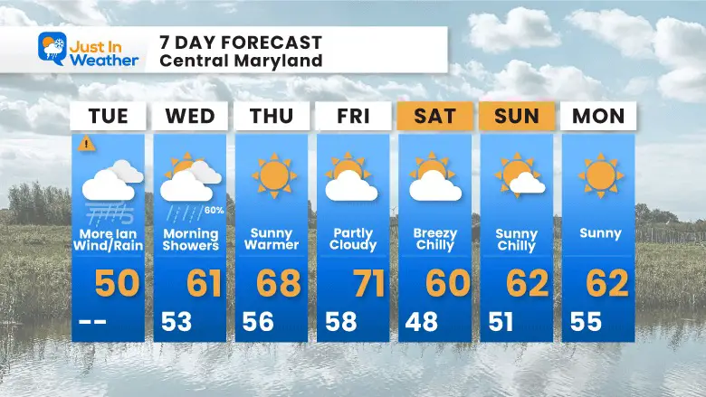
7 Day Forecast
After the Nor’easter moves away, we will get at least two warmer days. However, a new cold front will arrive later Friday, resulting in a chilly (but dry) weekend. If you are riding in the Seagull Century at Salisbury, it will be windy at times.
Weather posts straight to your inbox
Sign up and be the first to know!
Join Us Next Monday, October 10 For Our Golf Tournament
Brought In Part By JP’s Custom Home Painting
The weather WILL BE BETTER THEN!
PATTERN CHANGER?
CONNECTION TO WINTER?
If you want a snowy winter, this is what you might want to look for in the rest of the tropical season.
Rainbow Ice Cave In Mt. Rainier A Very Rare Find: Photos And Video
Hurricane Season Forecast: June 1 Through November 30
NOAA 2022 Hurricane Forecast- Above Normal Again
Related Posts
NOAA Study: Reducing Air Pollution INCREASED Tropical Storms
Atlantic Tropical History: Maps of Origin Regions Every 10 Days
Please share your thoughts, best weather pics/videos, or just keep in touch via social media
-
Facebook: Justin Berk, Meteorologist
-
Twitter: @JustinWeather
-
Instagram: justinweather


