I Expect More Rain And Storms Sunday Afternoon Than These Models Suggest
August 20 2022
Saturday Evening Update
Have you heard this before? Compared model guidance is underperforming. Yes, once again I do believe we are at the limitation of the visual display that may be underwhelming and underselling the weather for Sunday into Monday.
My secret is that I have a personal stake in this. My son and I have scheduled a round of golf with Tony Pann on Sunday. I want to get this in as much as you may want your plans to hold on… But I must be a little extra pessimistic about the rain into the afternoon. Here is why:
The problems I have seen (and shown you) for many months is that rain has been arriving earlier and storms have been more widespread than on display with the short range modeling. The two models I often show you are the HRRR (which I only can show out to 18 hours) and the NAM 3 Km (which goes out to 60 hours but has been underplaying many events).
The deteriorating weather is likely to cover more areas earlier in the afternoon than what I can show you now. Please keep that in mind as we take a look.
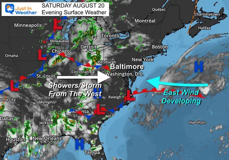
Saturday Evening Set Up
High Pressure is moving off the coast. This will be responsible for the East Wind we get on Sunday
To our West AND South are waves of Low Pressure with increasing the moisture. All will converge on the Mid Atlantic during Sunday.
Sunday Morning Simulations
Dilemma 1
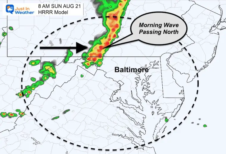
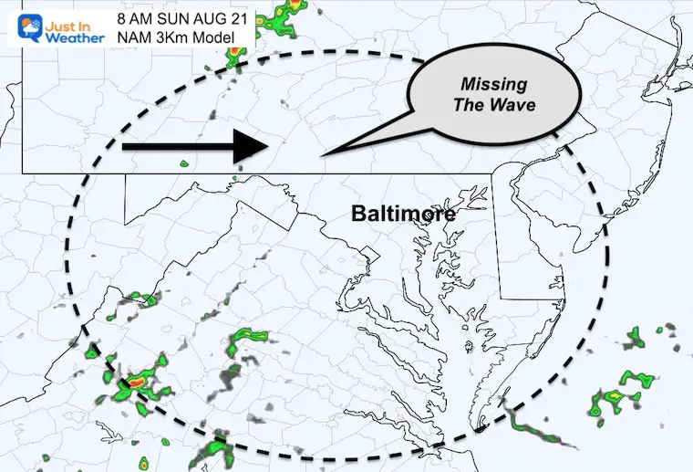
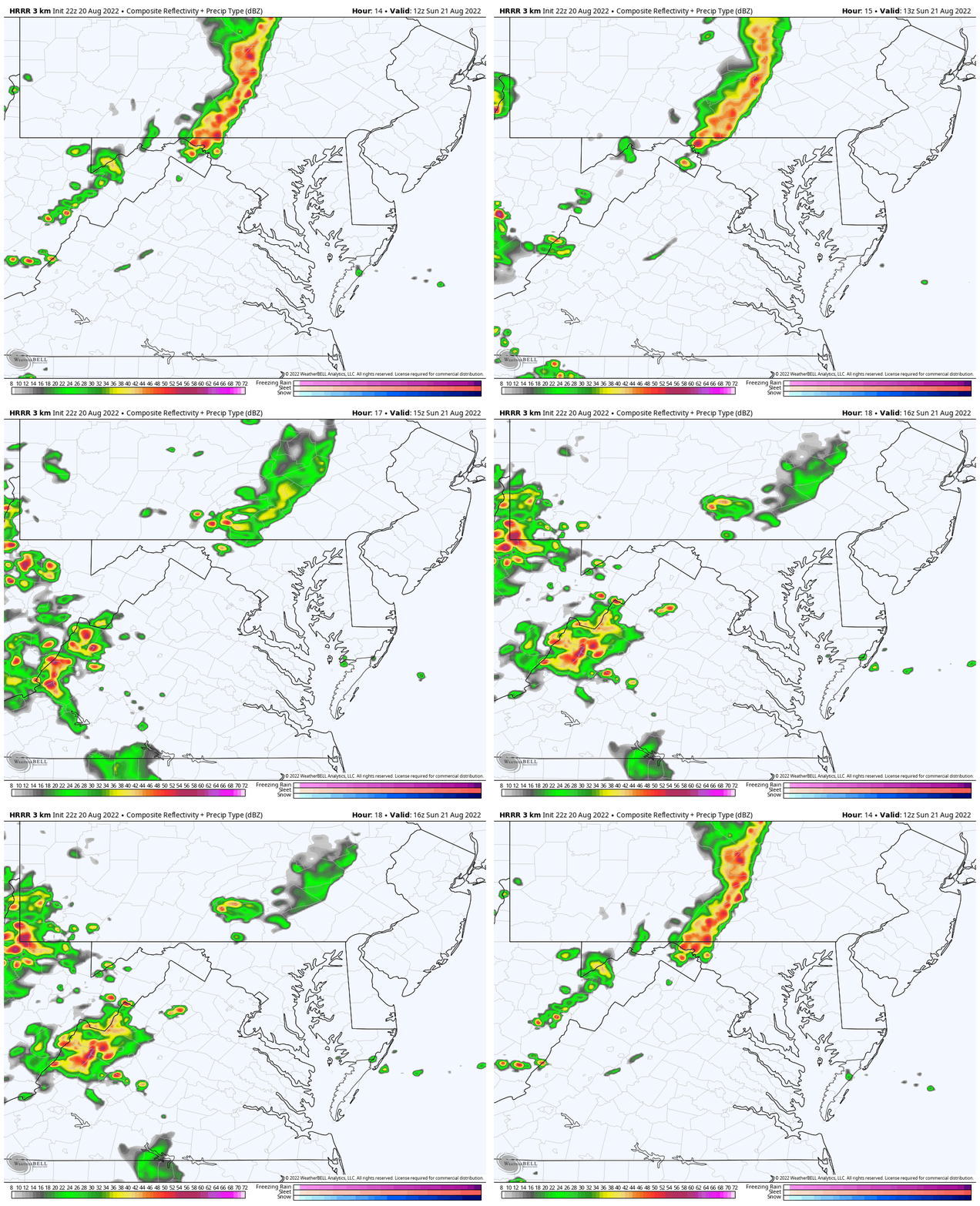
Compare the HRRR Model to the NAM 3 Km at 8 AM
The HRRR Model is showing a solid line of moderate to heavy rain crossing I-81, including Hagerstown to Harrisburg.
The NAM 3 Km is missing this completely. I don’t buy that.
HRRR Model Animation:
The problem is that as of post time the display I have for you only goes out to noon.
Yes, this line will fade, but there is more heavy rain in the mountains moving in quickly.
NAM 3 Km
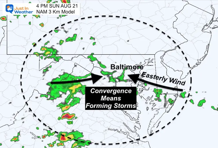
4 PM Snapshots
Wind Forecast
The Winds will be increasing FROM THE EAST between 10 to to 20 mph. That itself will bring in moisture (and cooler temps).

Radar Simulation
This is underplaying the rain… I am very confident of that! In addition to highlighting that, I want to point out the other factor:
CONVERGENCE
The East Wind will bring in showers across Delmarva, while meeting up with some showers and storms from the mountains…
This will DEVELOP NEW SHOWERS AND STORMS over central Maryland and southern PA.
I believe this will happen earlier than this time frame AND cover more of the region than shown.
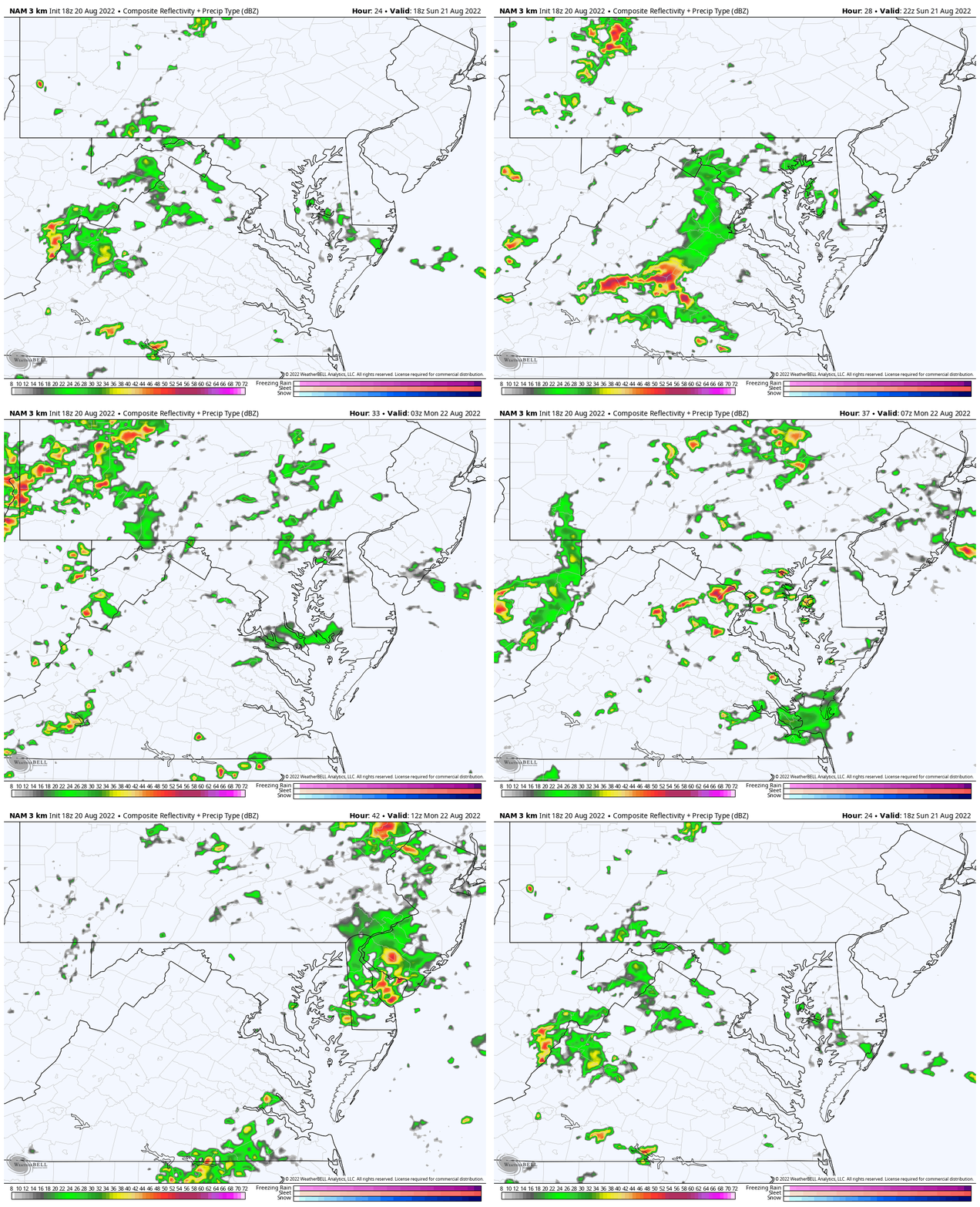
Animation
2 PM Sunday to 8 AM Monday
As I show you this, you should be able to spot the convergence and developing showers. Also the surge of heavier storms Sunday night into early Monday.
Dilemma 2 Please keep in mind that Sunday afternoon is likely to be wet for more of the region. I would suggest that your outdoor plans may get rained on. Plan for rain expanding between noon and 2 PM.
Monday Morning
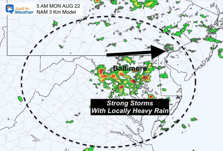
This cluster of storms early Monday may pass through earlier than 5 AM. Overnight boomers are possible, but this activity may also move out sooner.
Total Rainfall
The one take away I do support is we may see pulsing storms that can drop between 1 to 3 inches of rain.
I do NOT support this being the locked in path. Just that who gets in on it will get a lot of rain and some local flooding.
Then again, some areas are pushing drought conditions can use a good soaker for sure.

I will have a higher resolution support in my full Sunday morning report.
Weather posts straight to your inbox
Sign up and be the first to know!
Cancer Can Succit- THE SHIRT
By Popular Demand and Supporting Just In Power Kids
This is the shirt that Power Kid James and his family has embraced… They even surprised us with this sign during our Kids Trek Too event.
It is now available!
Hurricane Season Forecast: June 1 Through November 30
NOAA 2022 Hurricane Forecast- Above Normal Again
Forecast From Colorado State University
Related Posts
NOAA Study: Reducing Air Pollution INCREASED Tropical Storms
Atlantic Tropical History: Maps of Origin Regions Every 10 Days
Recent Storm Reports
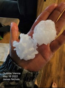
May 16 Large Hail Videos And Storm Tracking Map
Please share your thoughts, best weather pics/videos, or just keep in touch via social media
Facebook: Justin Berk, Meteorologist
Twitter: @JustinWeather
Instagram: justinweather
Connect With A Health Coach
From My Maryland Trek Team
Click the image or here for more info
*Disclaimer due to frequent questions:
I am aware there are some spelling and grammar typos. I have made a few public statements over the years, but if you are new here you may have missed it:
I have dyslexia, and found out at my second year at Cornell. It didn’t stop me from getting my meteorology degree, and being first to get the AMS CBM in the Baltimore/Washington region.
I do miss mistakes in my own proofreading. The autocorrect spell check on my computer sometimes does an injustice to make it worse.
All of the maps and information are accurate. The ‘wordy’ stuff can get sticky.
There is no editor that can check my work when I need it and have it ready to send out in a newsworthy timeline.
I accept this and perhaps proves what you read is really from me…
It’s part of my charm.


