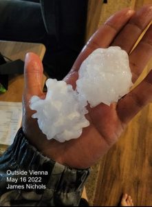
Wednesday June 8 Evening Update
This is a quick post as I am playing catch up on a few other things today… But it appears the same with the weather flare up.
Thunderstorms were expected, but what developed over central Maryland was a few hours earlier and more intense than the simulations showed this morning.
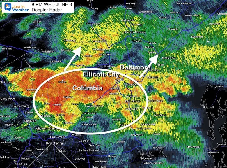
Now the flooding rain is entering the sensitive areas of Ellicott City…
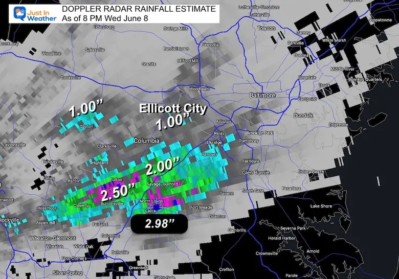
Case in Point: Laurel, MD has a Radar Estimate of nearly 3” of rain so far.
Doppler Radar Rain Estimate
As of 8 PM, there was a wide range of 1 to 3 inches of rain between Washington and Baltimore.
The 2.50”+ and higher has been between Fulton and Laurel. There is flooding happened there.
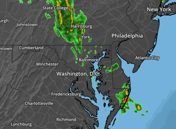
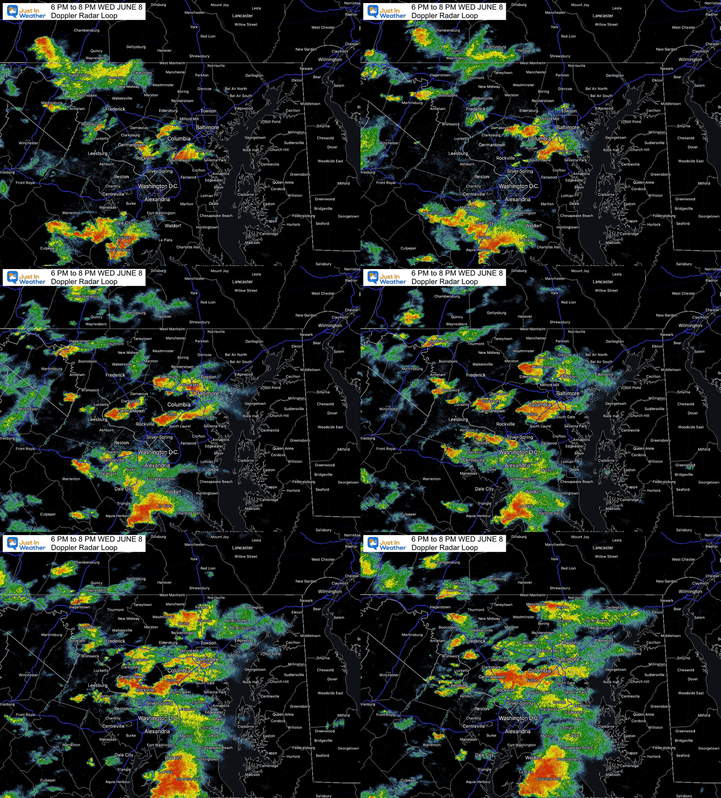
Radar Recap: Loop 6 PM to 8 PM
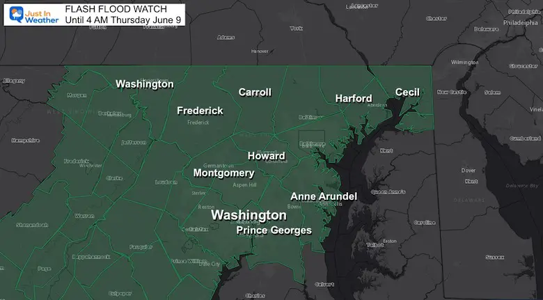
Flash Flood Watch
This is in effect until 4 AM, so there is more on the way. However, it does NOT stop at the PA line. That region is under the guidance of a different NWS Office the has not suggested the issue will push north… Or will it?
WATCH: Means Potential
WARNING: If Issued means it IS HAPPENING NOW. Then towns affected will be listed.
Radar Snapshots
The Fulton and Laurel areas have had redevelopment of the storm cell over them. This will gradually lift north over the next hour.
This brings now brings Columbia, Ellicott City, and Baltimore into the potation to crack 3 inches of rain… It may test the new flood drainage in Ellicott City.
The wider view highlights the problem with forecasting heavy rain cells. They are scattered/ hit or miss. They can dump on some, and two towns over barely dampen or miss at all.
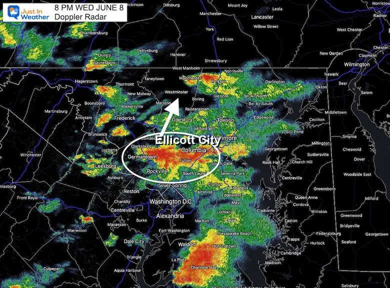
So the short rang remodels are NOT perfect. Only a suggestion…
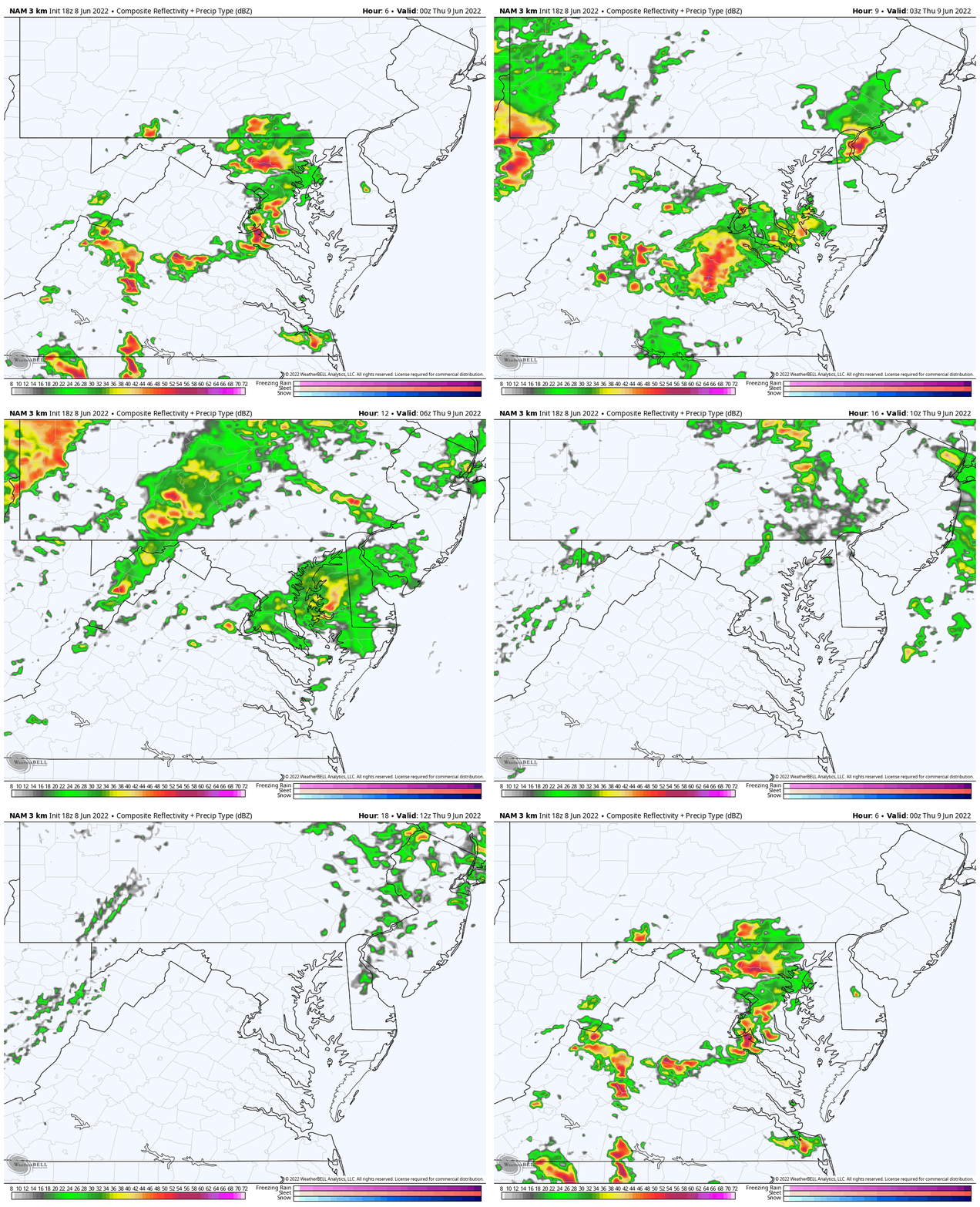
Radar Simulation: HRRR Model
8 PM to 8 AM Thursday
The heaviest rain will ease after sunset, but a few more bands are on the way, but it looks like the next way will be more impactful across southern Maryland….
How Much Rain?
Again, here is the limitation of the modeling…
The HRRR is closest, but still not fully accounting for the coverage of the storms.
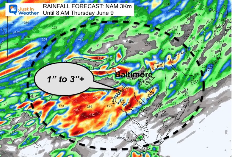
The GFS Model has missed the mark all together. This shows total rain by tomorrow already under what has fallen, and that band too far north.
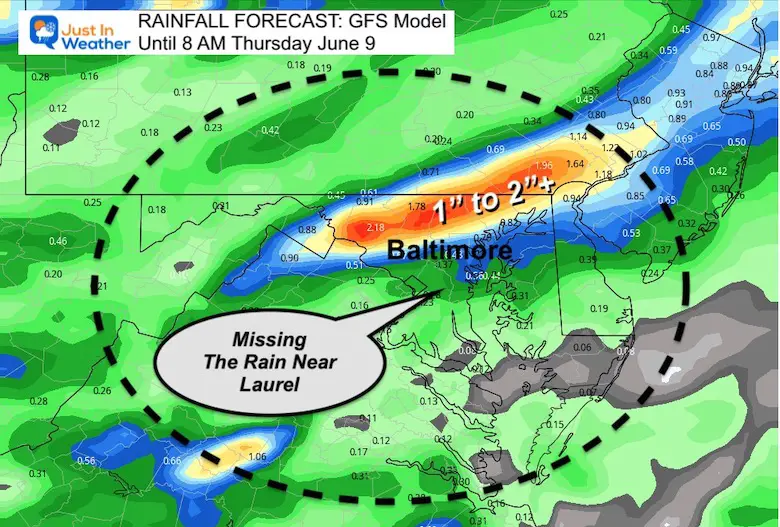
Compare To:
Radar Loop: Last 2 Hours (updated)
Showing Last 2 Radar map data
As for the weekend event, I still see some limitations on the precise timing. But there will be rain. I will dig into that further with my morning report.
Weather posts straight to your inbox
Sign up and be the first to know!
7 Day Forecast
Paddling Pick Of The Week
FRIDAY
Book Your Kayak or Paddle Boat Adventure On The North Chesapeake Bay
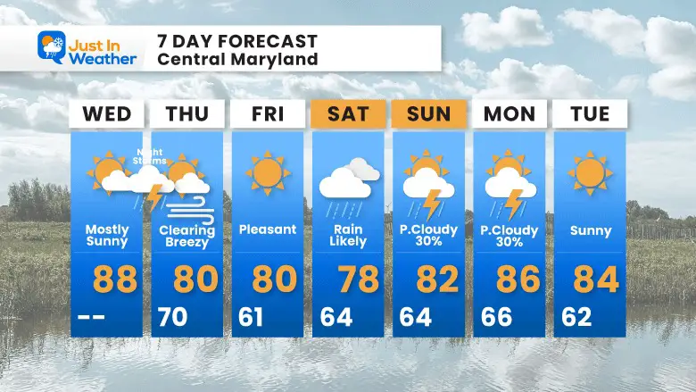
Thursday will be breezy; Friday will be pleasant…
Saturday is our rain day. Optimistically the bulk will be in the morning then break to showers after-noon. Then sunny on Sunday, with only scattered afternoon showers.
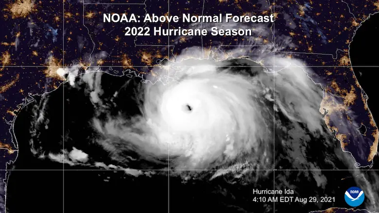
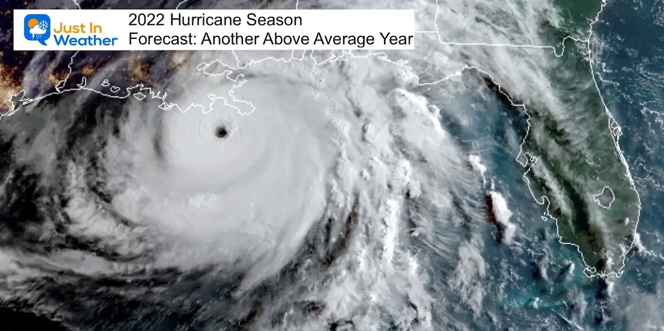
Hurricane Season Forecast: June 1 Through November 30
NOAA 2022 Hurricane Forecast- Above Normal Again
Forecast From Colorado State University
Related Posts
NOAA Study: Reducing Air Pollution INCREASED Tropical Storms
Atlantic Tropical History: Maps of Origin Regions Every 10 Days
Recent Storm Reports
May 16 Large Hail Videos And Storm Tracking Map
Please share your thoughts, best weather pics/video, or just keep in touch via social media
Facebook: Justin Berk, Meteorologist
Twitter: @JustinWeather
Instagram: justinweather
*Disclaimer due to frequent questions:
I am aware there are some spelling and grammar typos. I have made a few public statements over the years, but if you are new here you may have missed it:
I have dyslexia, and found out at my second year at Cornell. I didn’t stop me from getting my meteorology degree, and being first to get the AMS CBM in the Baltimore/Washington region.
I do miss my mistakes in my own proofreading. The autocorrect spell check on my computer sometimes does an injustice to make it worse.
All of the maps and information are accurate. The ‘wordy’ stuff can get sticky.
There is no editor that can check my work when I need it and have it ready to send out in a newsworthy timeline.
I accept this and perhaps proves what you read is really from me…
It’s part of my charm.


