Tuesday Will Be Soggy For Some And Chilly For Most Of Our Region
May 23 2022
Monday Evening Update
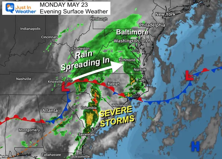
A potent storm is moving up the eastern US and has already produce widespread severe weather in North and South Carolina. This is a signal of lots of energy, but not all of our region will see it.
Surface Map
While the evening weather map shows a wide shield of rain moving in, the northern edge is really light.
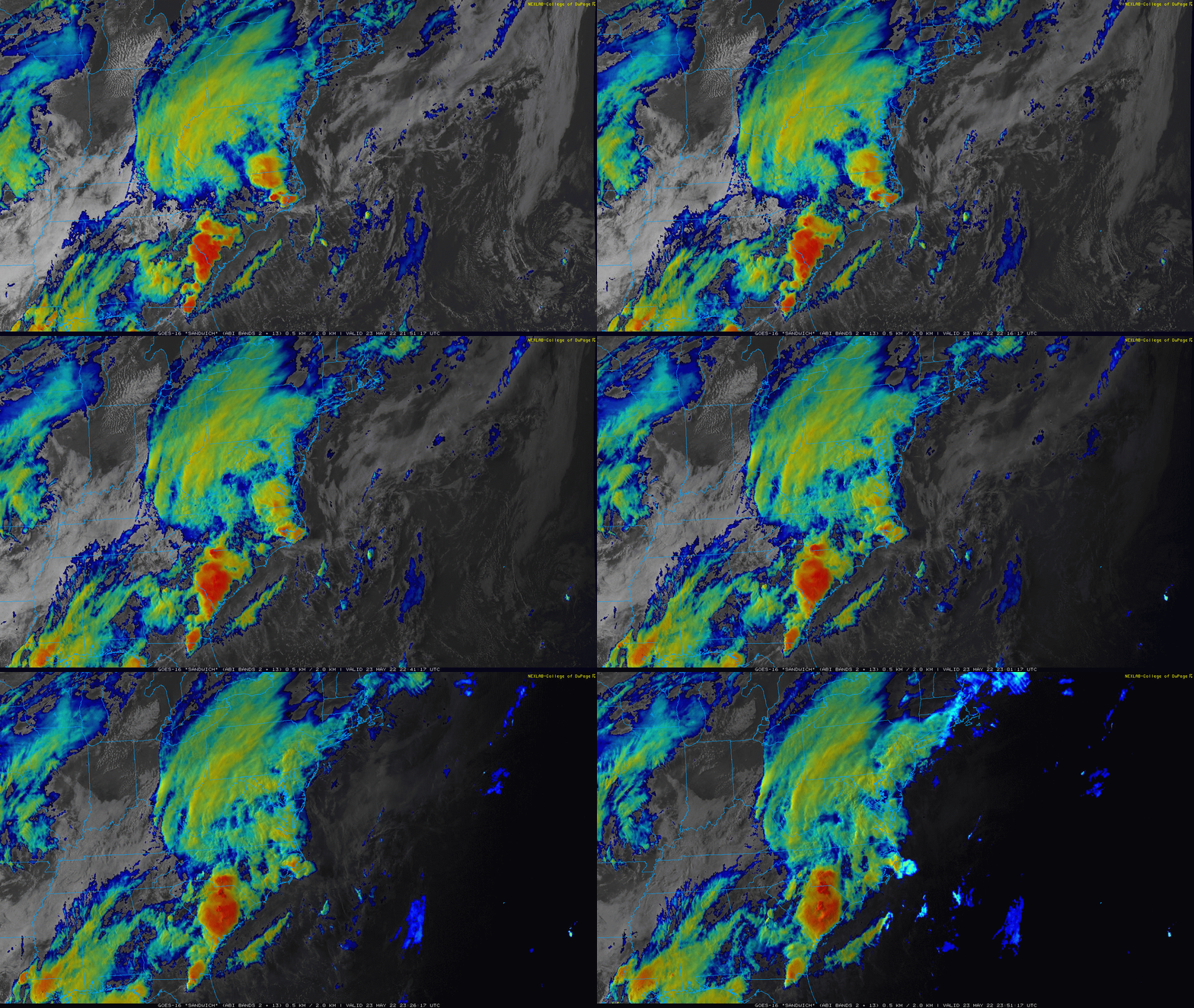
Satellite Loop 6 PM to 8 PM
Radar Loop 6 PM to 8 PM
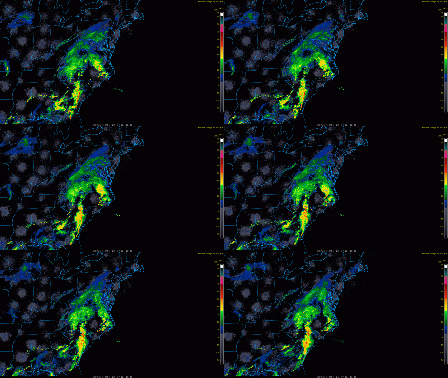
Radar Simulation
Here is a look at 8 PM Monday to Tuesday Night/12 AM Wednesday
Rain tonight spread in. For most of our region this will be an overnight event, into Tuesday morning. Then the bulk of Tuesday’s rain will be south of Baltimore.. with only light showers near the city. Farther north may simply have a chilly day with sprinkles or even dry after the morning commute.
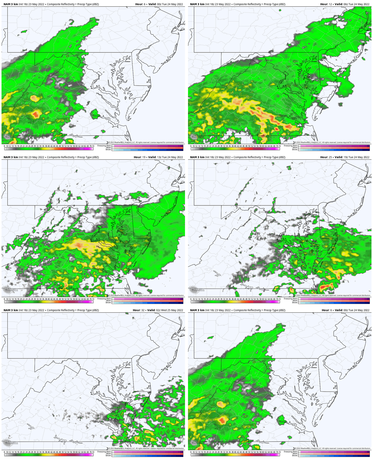
This may be a case when you hear 50% chance of rain that is means the southern 50% of our region will get soaked, while farther north may end up with just a few light showers. However, in the typical spring and summer forecast, that ‘chance’ also applies to odds of a storm forming over any location in the region.
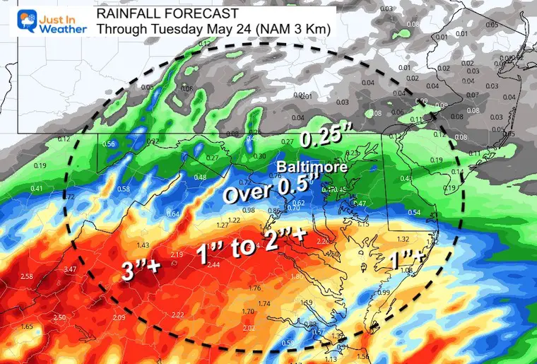
How Much Rain?
- At this point it looks like 1/4 inch or less north of Baltimore.
- From BWI to Washington and Annapolis close to 1/2 inch of rain.
- Central Virginia to Southern Maryland over 1 inch of rain, with heavier amounts farther inland.
Chilly Day Ahead
This will be a far cry from the 90s this past weekend.
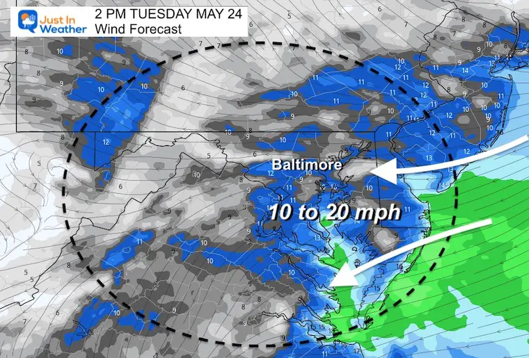
Wind Forecast
Animation 6 AM to 4 PM
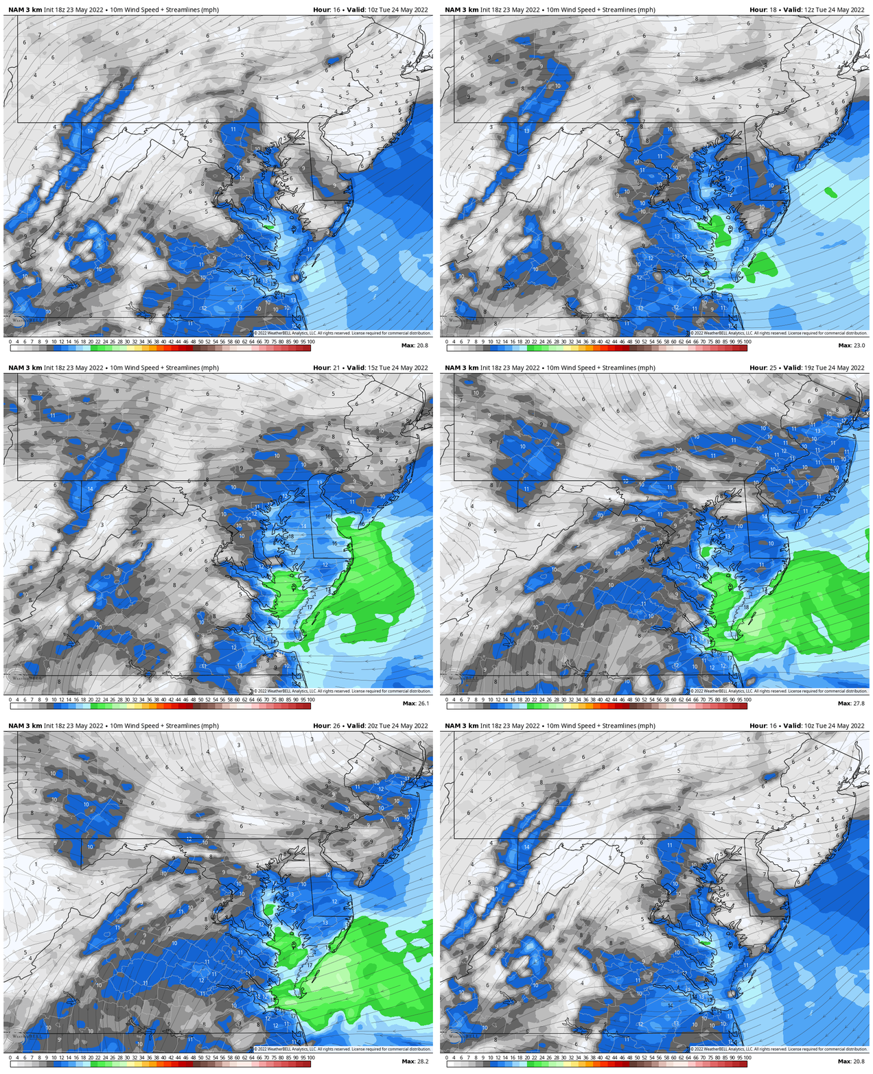
Snapshot
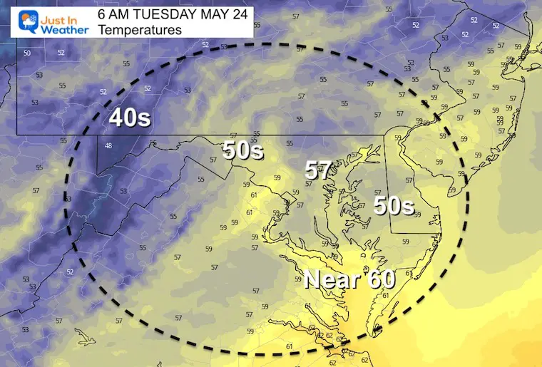
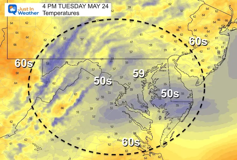
Temperatures
We may briefly see the lower 60s mid day, but the bookends will be chilly. It may feel even cooler compared with the 90s and near record heat we had over this last weekend.
Morning
Afternoon
I will be back with a full forecast in my Tuesday morning report. I am to get that published by 6:30 AM. See you then
Weather posts straight to your inbox
Sign up and be the first to know!
VOTE: Best ‘Meteorologist’
Of Baltimore (Reader’s Poll)
Through May 29 at 5 PM
Click here to access The Baltimore Sun
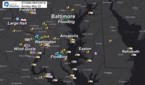
Storm Reports
May 16 Large Hail Videos And Storm Tracking Map
Tropical Season Begins June 1
Related Posts
NOAA Study: Reducing Air Pollution INCREASED Tropical Storms
Atlantic Tropical History: Maps of Origin Regions Every 10 Days
Please share your thoughts, best weather pics/video, or just keep in touch via social media
Facebook: Justin Berk, Meteorologist
Twitter: @JustinWeather
Instagram: justinweather
*Disclaimer due to frequent questions:
I am aware there are some spelling and grammar typos. I have made a few public statements over the years, but if you are new here you may have missed it:
I have dyslexia, and found out at my second year at Cornell. I didn’t stop me from getting my meteorology degree, and being first to get the AMS CBM in the Baltimore/Washington region.
I do miss my mistakes in my own proofreading. The autocorrect spell check on my computer sometimes does an injustice to make it worse.
All of the maps and information are accurate. The ‘wordy’ stuff can get sticky.
There is no editor that can check my work when I need it and have it ready to send out in a newsworthy timeline.
I accept this and perhaps proves what you read is really from me…
It’s part of my charm.


