April 30 Breaking Record Heat With Some Storms And More Rain This Weekend
Tuesday, April 30 Morning Report Baltimore set a new record on Monday with a High Temperature of 92ºF at BWI. This broke the old mark set in 1974 of 91ºF.…
Monday April 15
Morning Report
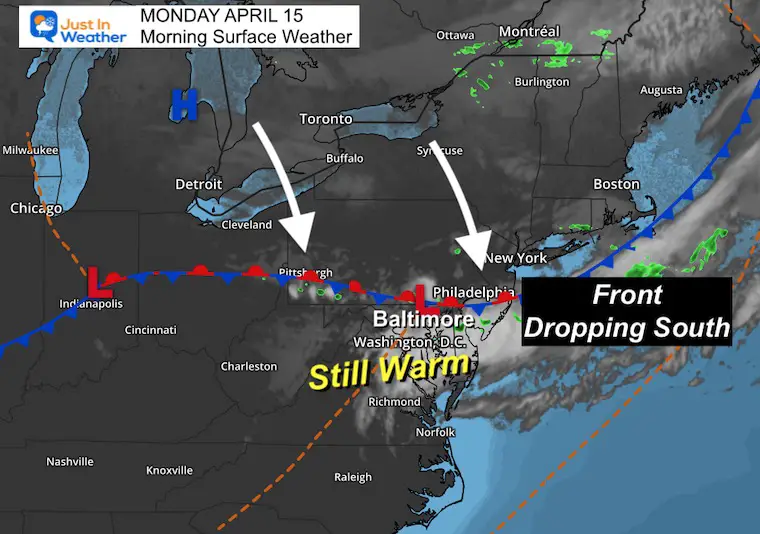
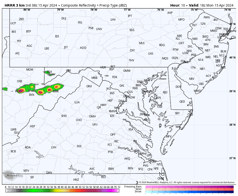
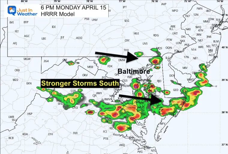
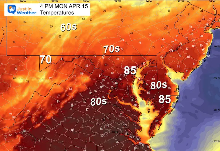
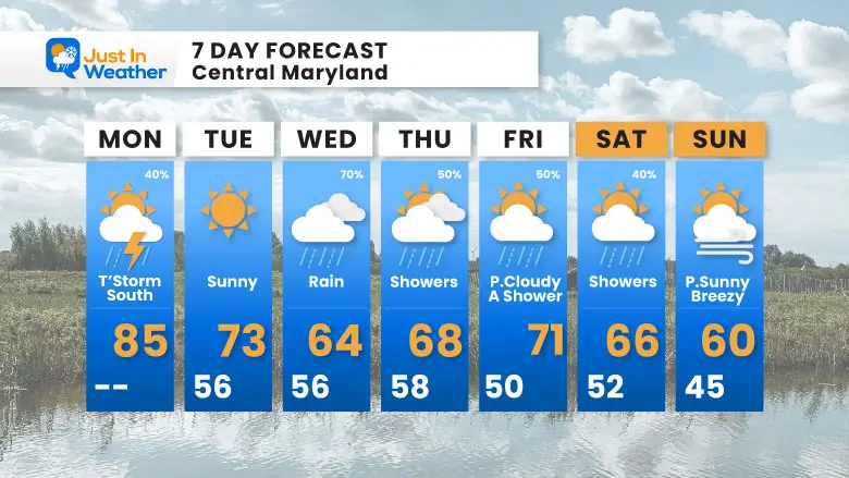
After a glorious Sunday, the weather remains warm this morning in the 60s. There were some showers overnight, and there might be another sprinkle this morning. There is a chance the old front will produce more thunderstorms this afternoon and evening. The better chance for stronger or even severe storms will be across our southern areas south of Annapolis.
Then, on Wednesday, we will look for the next weather system to bring more rain and cooler temperatures.
There is a quasi-stationary front near the Maryland and Pennsylvania line. This will continue to slowly drop south during the day. It has a history of severe storms in Pennsylvania on Sunday and may produce strong or severe storms in Southern Maryland later today.
A storm is considered severe if it contains:
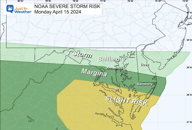
There may be some strong thundershowers across central Maryland.
There will be more energy and stronger storm cells near and south of Rt. 50/Annapolis.
TODAY April 15
Sunrise at 6:31 AM
Sunset at 7:44 PM
Normal Low in Baltimore: 43ºF
Record 31ºF in 1950; 1957; 1973
Normal High in Baltimore: 67ºF
Record 88ºF 1941
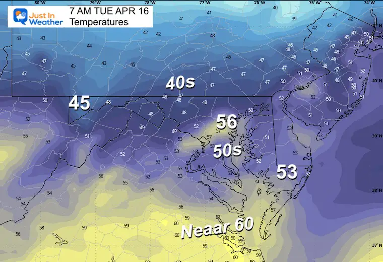
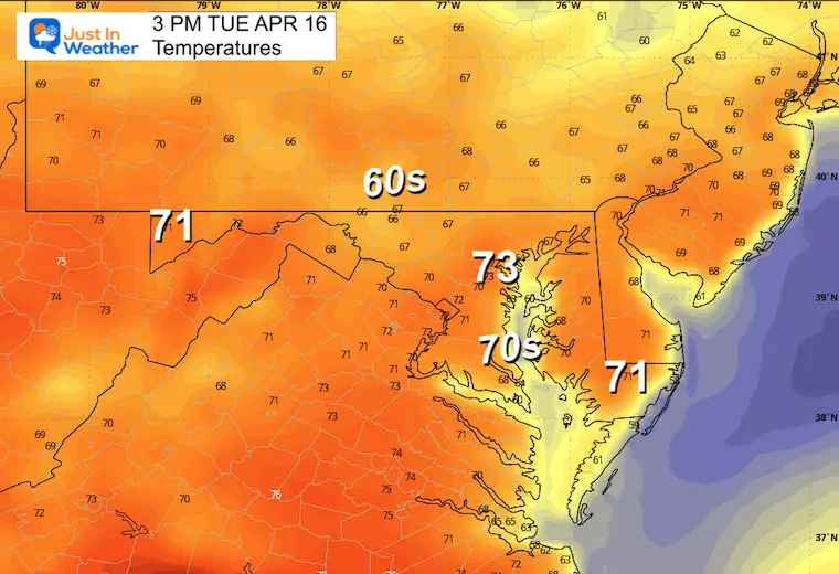
The next weather system will bring rain and cooler temperatures on Wednesday and Thursday.
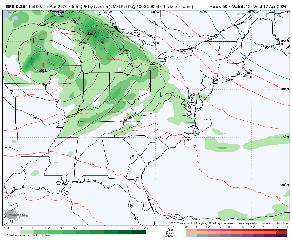
The week will start off very warm, then turn a little rainy and cooler.
Click to see more and ‘Book’ a visit to your school

I am aware there are some spelling and grammar typos and occasional other glitches. I take responsibility for my mistakes and even the computer glitches I may miss. I have made a few public statements over the years, but if you are new here, you may have missed it: I have dyslexia and found out during my second year at Cornell University. It didn’t stop me from getting my meteorology degree and being the first to get the AMS CBM in the Baltimore/Washington region.
One of my professors told me that I had made it that far without knowing and to not let it be a crutch going forward. That was Mark Wysocki, and he was absolutely correct! I do miss my mistakes in my own proofreading. The autocorrect spell check on my computer sometimes does an injustice to make it worse. I also can make mistakes in forecasting. No one is perfect at predicting the future. All of the maps and information are accurate. The ‘wordy’ stuff can get sticky.
There has been no editor who can check my work while writing and to have it ready to send out in a newsworthy timeline. Barbara Werner is a member of the web team that helps me maintain this site. She has taken it upon herself to edit typos when she is available. That could be AFTER you read this. I accept this and perhaps proves what you read is really from me… It’s part of my charm. #FITF
Click each map for the maps and snow spotter lists.
Click here for the maps and full report
Click here or the map to see: The Snow Report Ending Jan 16