May 1 Weather Gradual Cooling Trend Will Bring Rain Into The Weekend
Wednesday, May 1 Morning Report One of the marks of May Day is an ancient European holiday celebrating the start of summer. It feels like we have had our taste…
Saturday, April 13
Morning Report
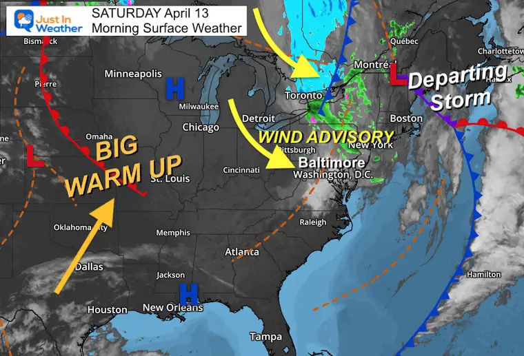
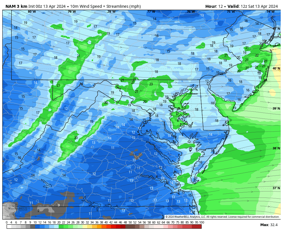
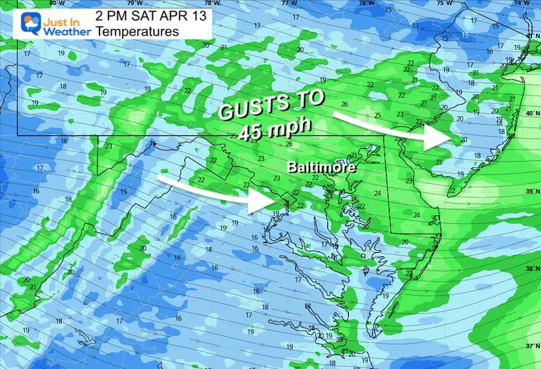
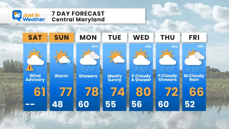
We are in transition this weekend before the big warm-up. As a result, strong winds today have prompted advisories. Gusts may reach 45 mph in many spots.
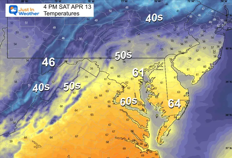
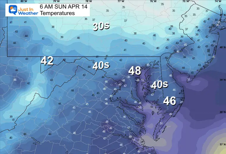
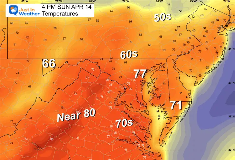
The quick pattern will allow temps to jump to the 70s tomorrow, then bring some rain showers Sunday night into Monday. This will be followed by a warm week ahead!
Much of the region north and west of the Chesapeake Bay will have strong winds gusting to 45 mph. This may be enough to move lawn furniture and snap branches or small trees.
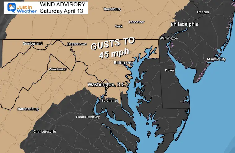
The old storm is slowly departing through New England. However, it is the gift that keeps on giving! Strong winds continue to whip around it, which is why we expect to continue to get gusts to 45 mph today.
As High Pressure crosses the nation and reaches us in the next few days, it will push the big warm-up here as well.
Sunrise at 6:32 AM
Sunset at 7:43 PM
Normal Low in Baltimore: 43ºF
Record 26ºF in 1874
Normal High in Baltimore: 66ºF
Record 89ºF 1977
The sky should be mostly sunny, but clouds will filter in from the north later. Showers are likely to hold off until after dark.
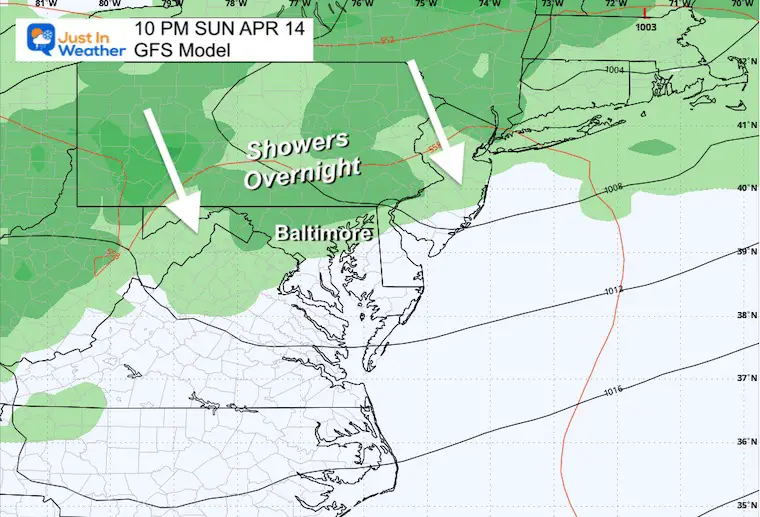
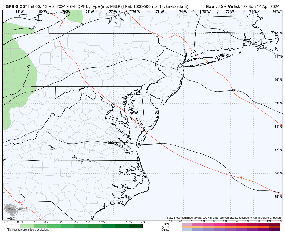

After the wind today and rain showers Sunday night into Monday, the general idea of the weather pattern will be warm!
Click to see more and ‘Book’ a visit to your school

I am aware there are some spelling and grammar typos and occasional other glitches. I take responsibility for my mistakes and even the computer glitches I may miss. I have made a few public statements over the years, but if you are new here, you may have missed it: I have dyslexia and found out during my second year at Cornell University. It didn’t stop me from getting my meteorology degree and being the first to get the AMS CBM in the Baltimore/Washington region.
One of my professors told me that I had made it that far without knowing and to not let it be a crutch going forward. That was Mark Wysocki, and he was absolutely correct! I do miss my mistakes in my own proofreading. The autocorrect spell check on my computer sometimes does an injustice to make it worse. I also can make mistakes in forecasting. No one is perfect at predicting the future. All of the maps and information are accurate. The ‘wordy’ stuff can get sticky.
There has been no editor who can check my work while writing and to have it ready to send out in a newsworthy timeline. Barbara Werner is a member of the web team that helps me maintain this site. She has taken it upon herself to edit typos when she is available. That could be AFTER you read this. I accept this and perhaps proves what you read is really from me… It’s part of my charm. #FITF
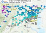
Click each map for the maps and snow spotter lists.
Click here for the maps and full report
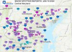
Click here or the map to see: The Snow Report Ending Jan 16