May 8 After Morning Storms Summer Heat This Afternoon
Wednesday, May 8 Morning Report This morning, a line of thunderstorms developed across central Pennsylvania to parts of north central Maryland. This is part of a trough in the atmosphere,…
Friday, April 12
Morning Report
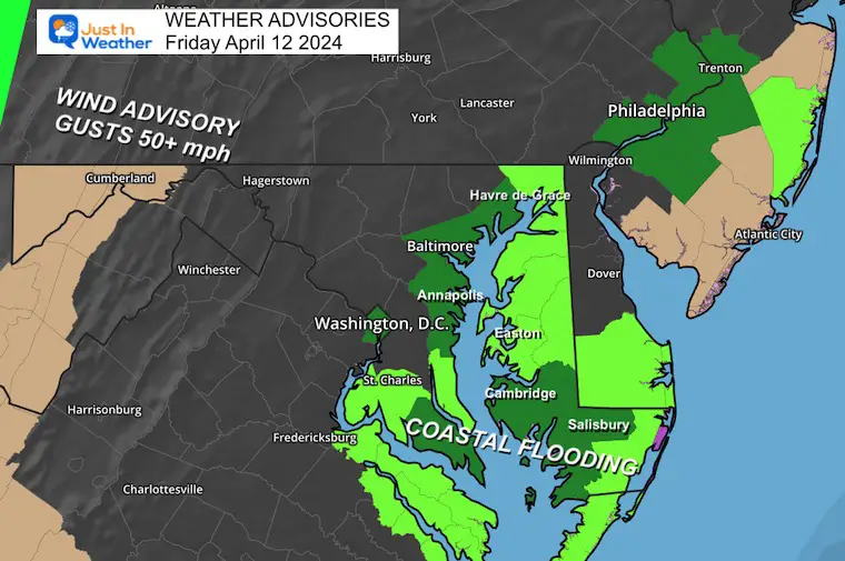
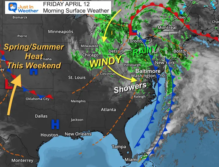
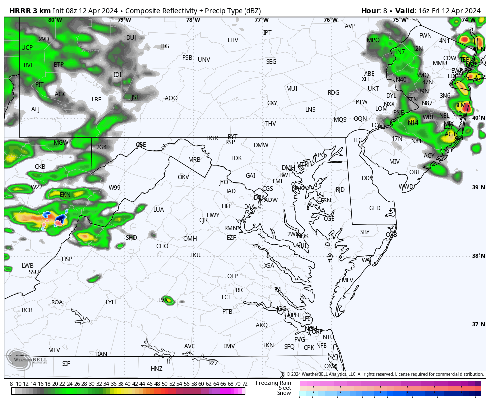
A series of strong storms passed through our region overnight, including a few with tornado warnings in the mountains. The bands of heavy rain and strong winds were associated with a larger storm that will continue to affect us for a few days.
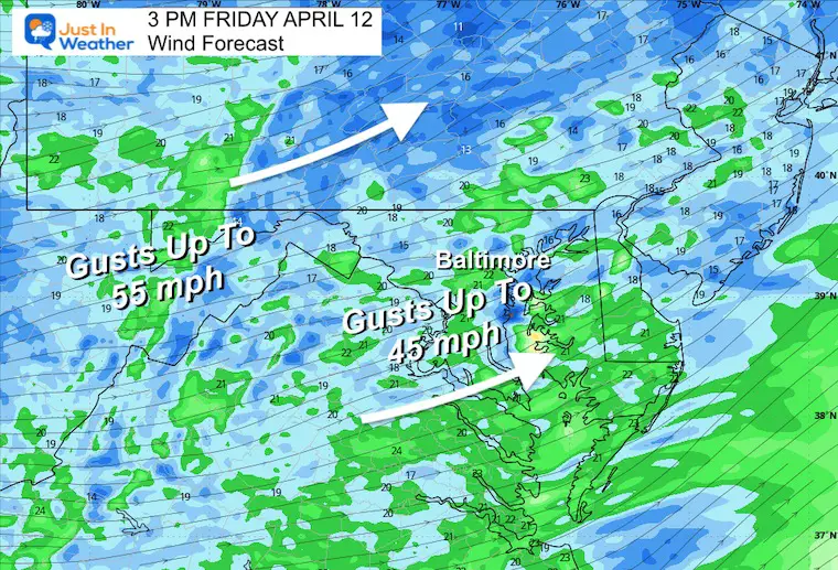
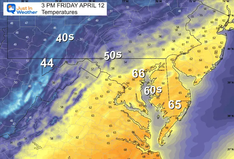
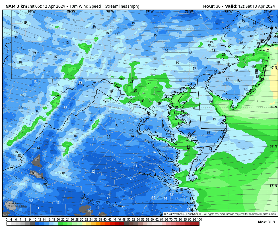
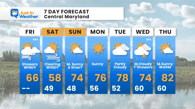
The rain risk will be lower today. However, some showers may pop up this afternoon, and we’ll see one more band of rain overnight. The main issue will be the strong winds! We can expect gusts to 45 mph today and remaining windy on Saturday. Then, we will ease into a spring pattern with temperatures into the 70s next week.
Strong winds have been from the south, pushing water up the Chesapeake Bay and preventing the tides from draining out. This is why high water has been expected at the Annapolis City Docks and other coastal areas.
This complex storm system has shifted the heavy rain to our north, but the atmosphere remains unsettled. Colder air aloft will allow more showers and even a thunderstorm to pop up this afternoon.
The larger story is the wind rotating around the larger Low Pressure center in Ontario, Canada.
Behind the storm in the central plains, a major warm-up is expected this weekend. This will be a preview of what may shift our way beginning on Sunday (70s).
Gusts to 45 mph from the west/south will shift the water on the Bay to the Eastern Shore, helping alleviate any flooding between Annapolis and Havre de Grace.
HRRR Model Noon to 10 PM
TODAY April 12
Sunrise at 6:33 AM
Sunset at 7:42 PM
Normal Low in Baltimore: 42ºF
Record 27ºF in 1874
Normal High in Baltimore: 65ºF
Record 88ºF 1977
A burst of showers overnight should move out by sunrise.
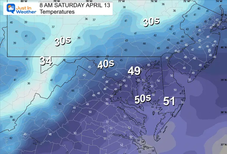
There will be a few hours of snow showers in the high mountains of western Maryland.
Gusts to 30+ mph
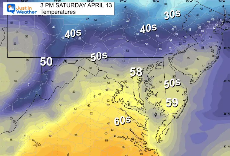
Get through the next two days, and spring will fully settle in! Temperatures are expected to jump into the 70s by Sunday and stay there or warmer into next week.
Click to see more and ‘Book’ a visit to your school

I am aware there are some spelling and grammar typos and occasional other glitches. I take responsibility for my mistakes and even the computer glitches I may miss. I have made a few public statements over the years, but if you are new here, you may have missed it: I have dyslexia and found out during my second year at Cornell University. It didn’t stop me from getting my meteorology degree and being the first to get the AMS CBM in the Baltimore/Washington region.
One of my professors told me that I had made it that far without knowing and to not let it be a crutch going forward. That was Mark Wysocki, and he was absolutely correct! I do miss my mistakes in my own proofreading. The autocorrect spell check on my computer sometimes does an injustice to make it worse. I also can make mistakes in forecasting. No one is perfect at predicting the future. All of the maps and information are accurate. The ‘wordy’ stuff can get sticky.
There has been no editor who can check my work while writing and to have it ready to send out in a newsworthy timeline. Barbara Werner is a member of the web team that helps me maintain this site. She has taken it upon herself to edit typos when she is available. That could be AFTER you read this. I accept this and perhaps proves what you read is really from me… It’s part of my charm. #FITF
Click each map for the maps and snow spotter lists.
Click here for the maps and full report
Click here or the map to see: The Snow Report Ending Jan 16