May 8 After Morning Storms Summer Heat This Afternoon
Wednesday, May 8 Morning Report This morning, a line of thunderstorms developed across central Pennsylvania to parts of north central Maryland. This is part of a trough in the atmosphere,…
Thursday, April 11
Morning Report
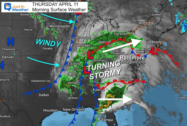
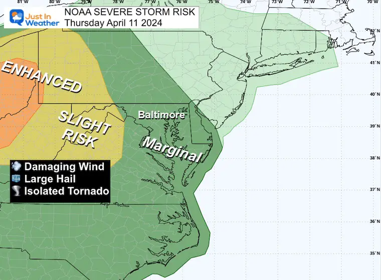
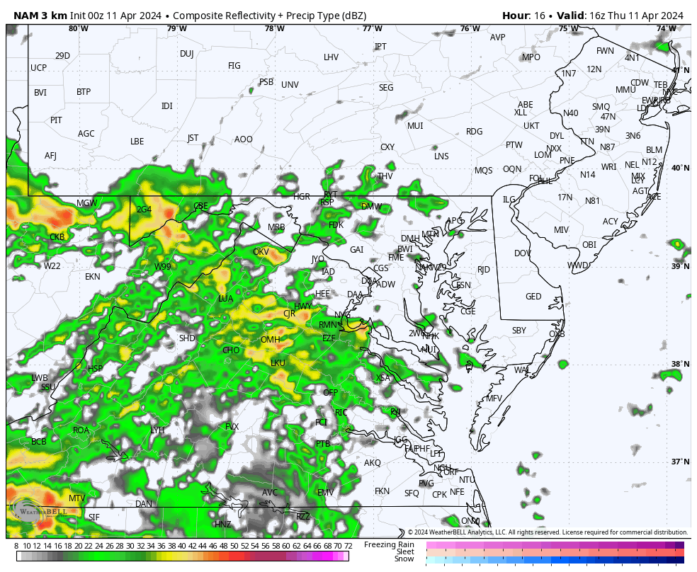
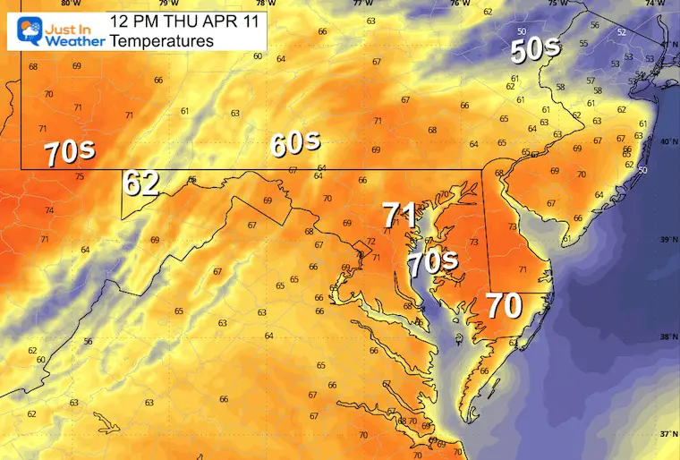
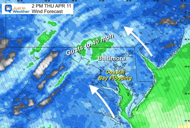
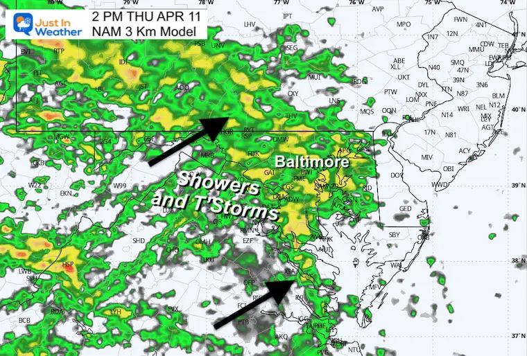
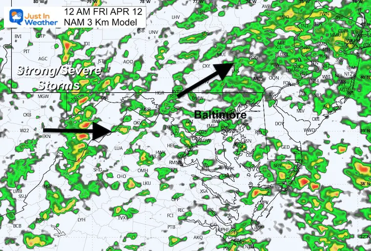
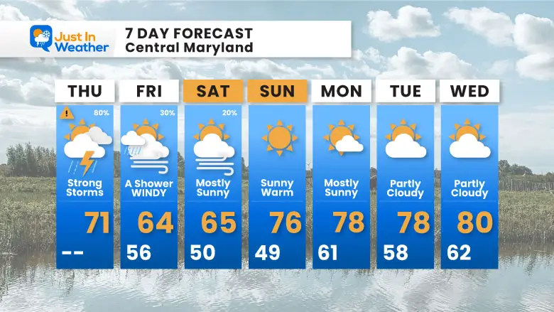
Today is the day we get the impact from this large storm complex. The three main issues to be concerned with are: First, some strong thunderstorms this afternoon and evening. A marginal risk for severe weather, with a greater likelihood to our west. Secondly, the wind flow will push water up the Chesapeake Bay, so coastal areas like Annapolis have a Flood Risk. Third, strong winds will build up today and into Friday.
The prime area for damaging storms will be across eastern Ohio into parts of West Virginia and western Pennsylvania.
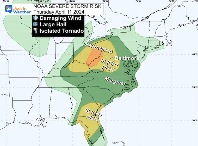
This complex storm system is affecting the Eastern Third of the nation, likely impacting flights and travel.
Storm Forecast: Thursday Morning to Saturday Afternoon
Sunrise at 6:35 AM
Sunset at 7:41 PM
Normal Low in Baltimore: 42ºF
Record 26ºF in 1960
Normal High in Baltimore: 65ºF
Record 87ºF 2013
The final line of showers with some thunder is expected to cross the Chesapeake Bay.
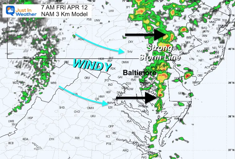
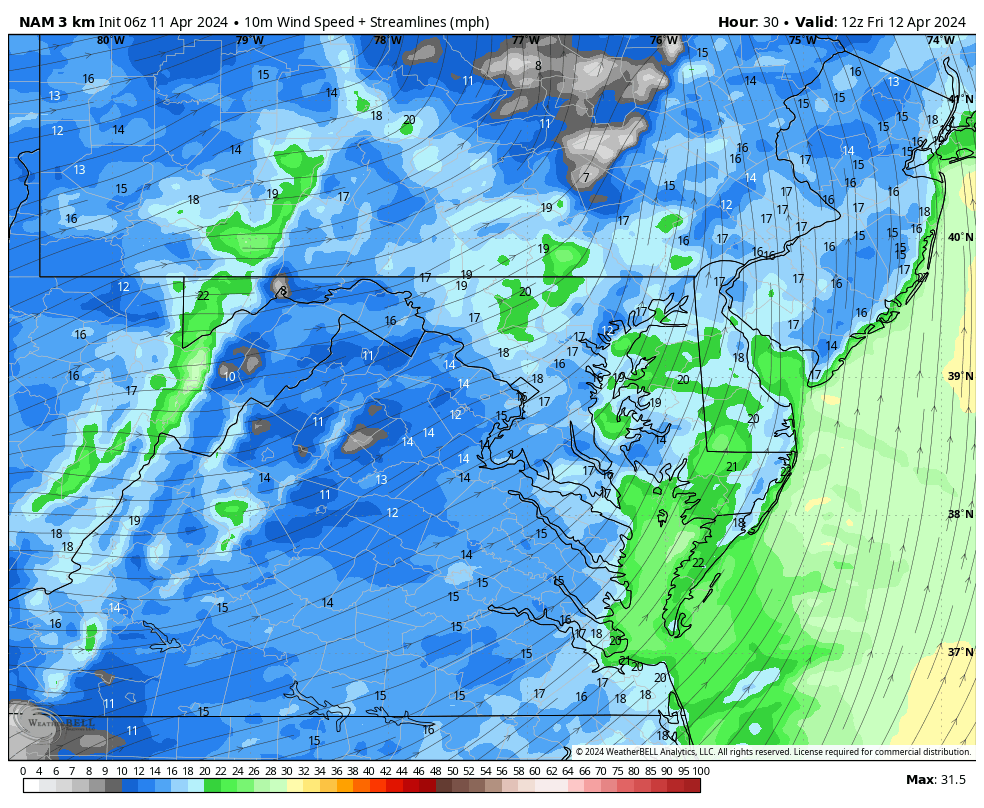
Gusts to 45 mph
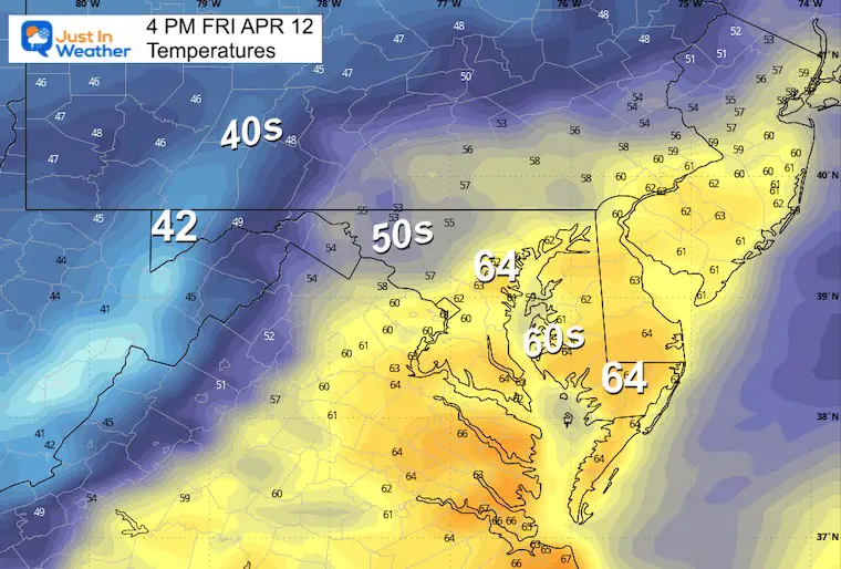
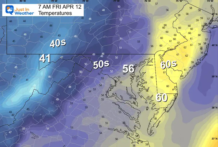
The take away here is that after this storm passes and the wind subsides, temps will jump to the 70s by Sunday and remain warm into next week.
Click to see more and ‘Book’ a visit to your school

I am aware there are some spelling and grammar typos and occasional other glitches. I take responsibility for my mistakes and even the computer glitches I may miss. I have made a few public statements over the years, but if you are new here, you may have missed it: I have dyslexia and found out during my second year at Cornell University. It didn’t stop me from getting my meteorology degree and being the first to get the AMS CBM in the Baltimore/Washington region.
One of my professors told me that I had made it that far without knowing and to not let it be a crutch going forward. That was Mark Wysocki, and he was absolutely correct! I do miss my mistakes in my own proofreading. The autocorrect spell check on my computer sometimes does an injustice to make it worse. I also can make mistakes in forecasting. No one is perfect at predicting the future. All of the maps and information are accurate. The ‘wordy’ stuff can get sticky.
There has been no editor who can check my work while writing and to have it ready to send out in a newsworthy timeline. Barbara Werner is a member of the web team that helps me maintain this site. She has taken it upon herself to edit typos when she is available. That could be AFTER you read this. I accept this and perhaps proves what you read is really from me… It’s part of my charm. #FITF
Click each map for the maps and snow spotter lists.
Click here for the maps and full report
Click here or the map to see: The Snow Report Ending Jan 16