May 1 Weather Gradual Cooling Trend Will Bring Rain Into The Weekend
Wednesday, May 1 Morning Report One of the marks of May Day is an ancient European holiday celebrating the start of summer. It feels like we have had our taste…
Wednesday April 10
Morning Report
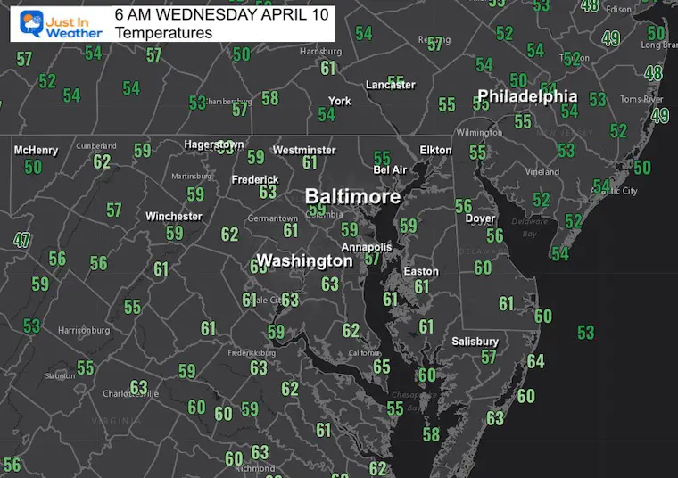
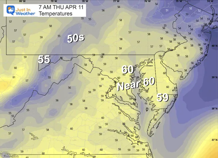
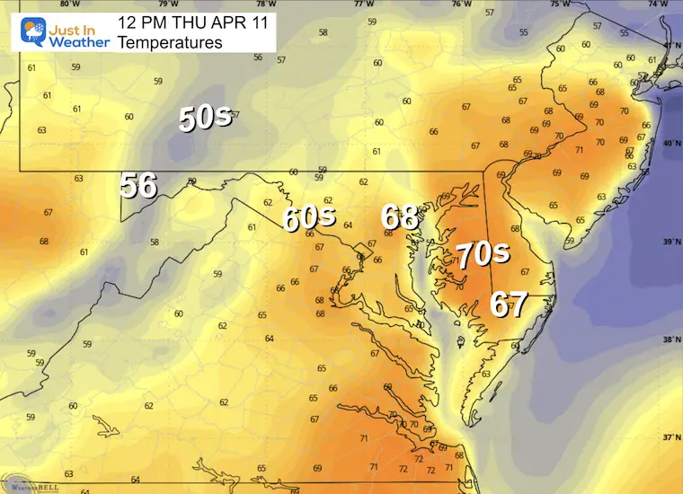
After a sunny and warm day, where many reached the 70s to near 80ºF, the air remains mild this morning. With that has also come a boost of moisture in the form of clouds and rain showers.
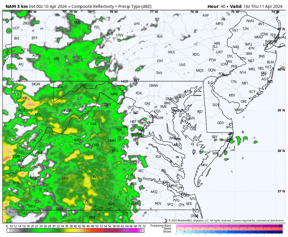
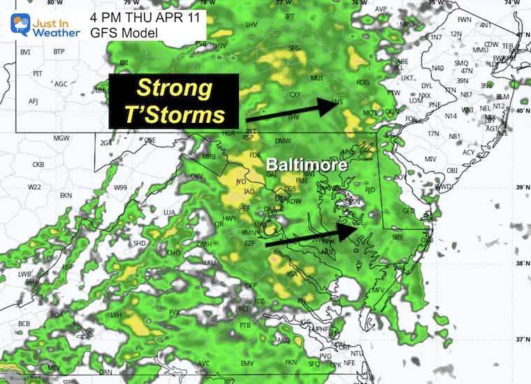
These showers will be scattered throughout the day, which essentially means hit or miss. I am leaning towards more of the ‘miss’ time. Tomorrow, however, will be a different storm. The bulk of the rain and potential for some thunderstorms that might turn severe will dominate the afternoon and evening.
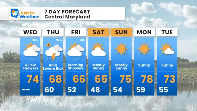
Personally, I think the wind will be the most prominent factor over the next few days. It will start warmer with moisture and rain, and then colder and dry air will come in to start the weekend.
This weekend does look promising, with dry weather and an eventual warm-up back to the 70s into next week.
We start with some showers, and a few more may pop up during the day.
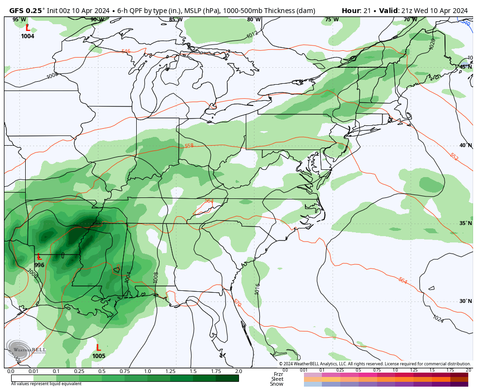
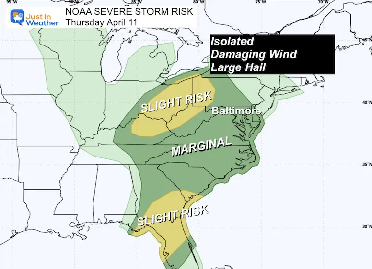
The most active weather will be in the Deep South and along the Gulf Coast, where a severe storm outbreak is expected. This energy will try to carry east (but weaken) tomorrow.
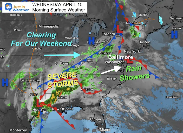
Note the larger storm pivoting through with heavier rain on Thursday, then moving out Friday.
There will be two ‘Slight Risk’ areas, including the Ohio Valley and Southeast US. Here in the Mid-Atlantic, the risk will be ‘marginal’, meaning most storms will NOT be severe. However, it is worth watching for the potential for one or two that might push the limit.
Note: I think our cooler temperatures in the 60s will mitigate the chance for us with less energy available. But still worth paying attention to.
Sunrise at 6:36 AM
Sunset at 7:40 PM
Normal Low in Baltimore: 42ºF
Record 22ºF in 1985
Normal High in Baltimore: 65ºF
Record 91ºF 2013
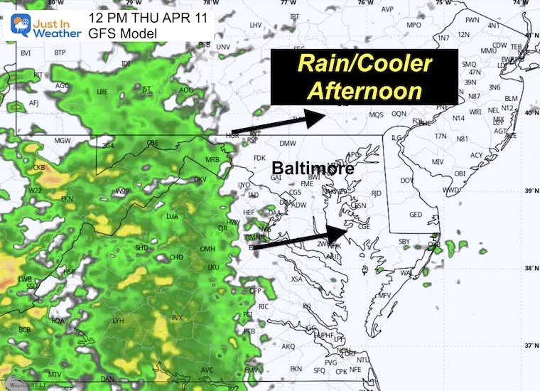
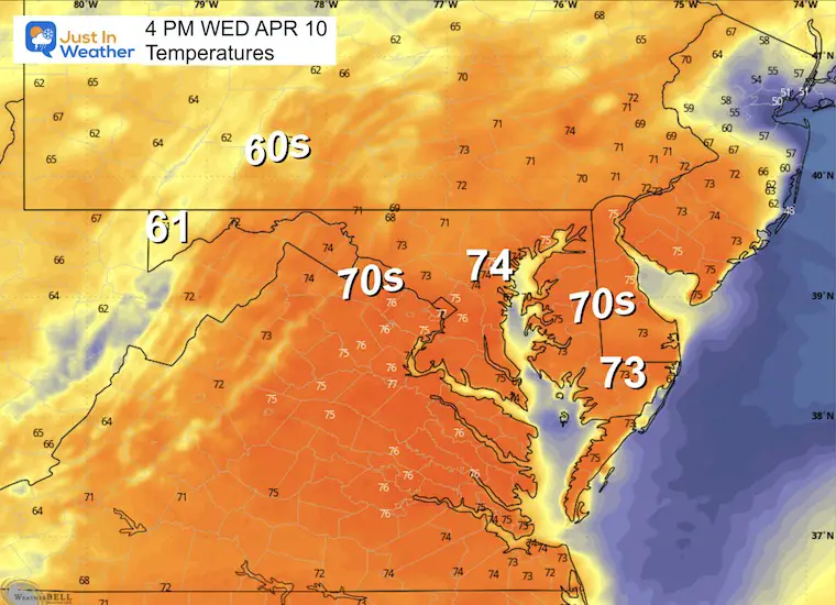
With the rain moving in, this may be the warmest time of the day then turning cooler.
The back edge of this system may swing through with morning showers or evening a thunderstorm. Then strong winds and improving sky coverage will take us into the afternoon and weekend.
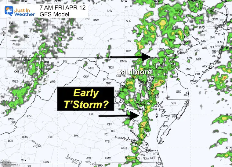
The active weather will be on Thursday, then moving out Friday.
At this point, the weekend does look to clear out, but there might be a little disturbance on the north side by Sunday worth watching for extra clouds or a shower.
Next week seems like spring will be in full swing.
Click to see more and ‘Book’ a visit to your school

I am aware there are some spelling and grammar typos and occasional other glitches. I take responsibility for my mistakes and even the computer glitches I may miss. I have made a few public statements over the years, but if you are new here, you may have missed it: I have dyslexia and found out during my second year at Cornell University. It didn’t stop me from getting my meteorology degree and being the first to get the AMS CBM in the Baltimore/Washington region.
One of my professors told me that I had made it that far without knowing and to not let it be a crutch going forward. That was Mark Wysocki, and he was absolutely correct! I do miss my mistakes in my own proofreading. The autocorrect spell check on my computer sometimes does an injustice to make it worse. I also can make mistakes in forecasting. No one is perfect at predicting the future. All of the maps and information are accurate. The ‘wordy’ stuff can get sticky.
There has been no editor who can check my work while writing and to have it ready to send out in a newsworthy timeline. Barbara Werner is a member of the web team that helps me maintain this site. She has taken it upon herself to edit typos when she is available. That could be AFTER you read this. I accept this and perhaps proves what you read is really from me… It’s part of my charm. #FITF
Click each map for the maps and snow spotter lists.

Click here for the maps and full report

Click here or the map to see: The Snow Report Ending Jan 16