Wednesday January 17 2024
The good news is that the arctic air is in place and we still see a system. I say good because that limits the questions with the system, but a few remain.
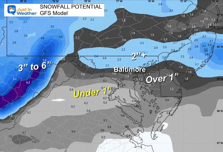
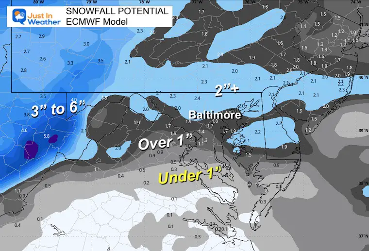
While this looks similar to the Tuesday event, it is not exactly the same AND the modeling pulled back a little this afternoon. I am not completely sold on that and think it is safe to stay with a general 1 to 3 inch expectation.
- Lower amounts may be along Rt 50 between Washington and Annapolis and southward.
- Metro areas will get an impact of snow developing within an hour or two of sunrise. So the school issue remains on the table but worth waiting.
- More snow will fall along the PA line and back west into the mountains.
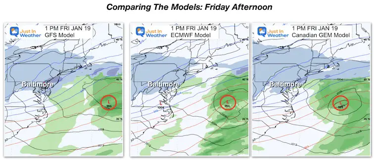
Model Comparison Friday Afternoon
Storm Animation: Friday morning to Saturday Afternoon
This will be a one day event for most. On Saturday the snow will continue in the mountains as cold winds filter everywhere. It will be cold for the Ravens playoff game.
Close Snapshot Friday Afternoon
Storm Note:
This is similar to the last set up, and as we will see below, there are different results among the three main models.
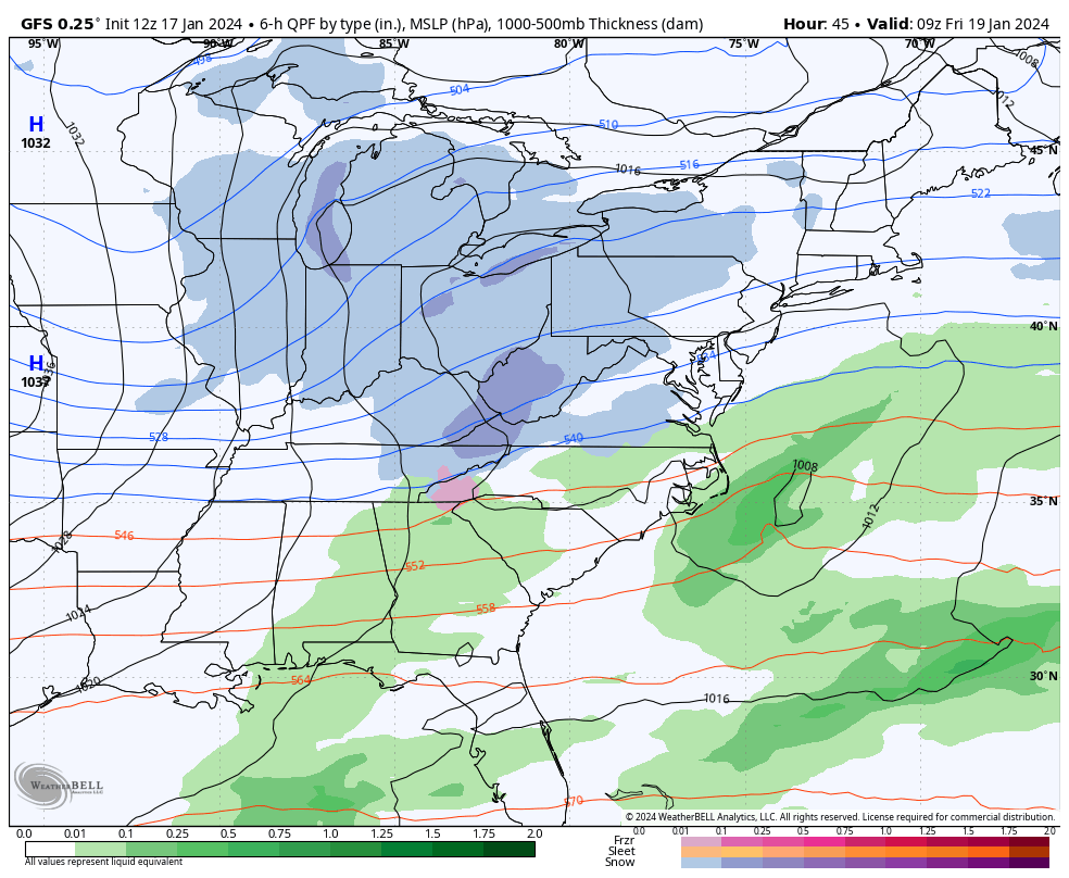
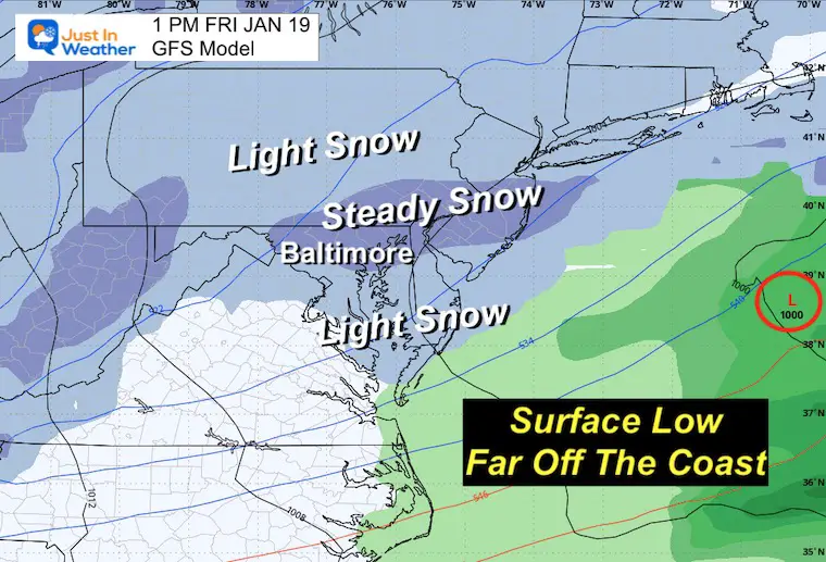
The energy is still split with the Surface Low well off the coast and the upper-level energy aloft producing our snow.
Any pulsing of heavier snow may need a Meso Low to form near I-95 to provide brief enhancement. We see a hint of that with the GFS Model.
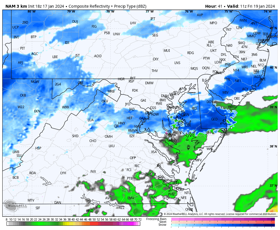
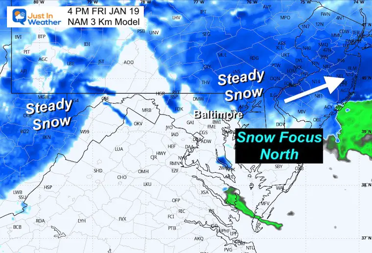
NAM 3 Km Model
Friday 6 AM to 10 PM
Snapshots
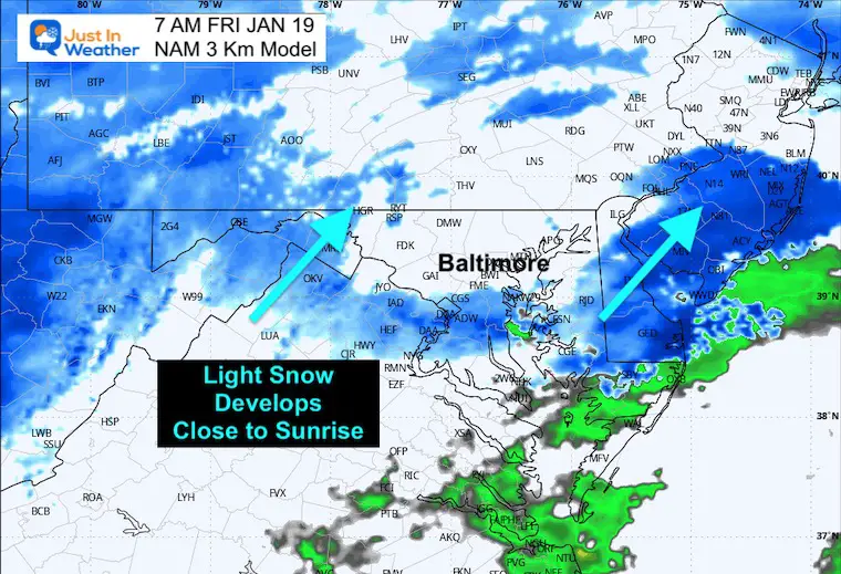
7 AM
Developing Snow close to sunrise.
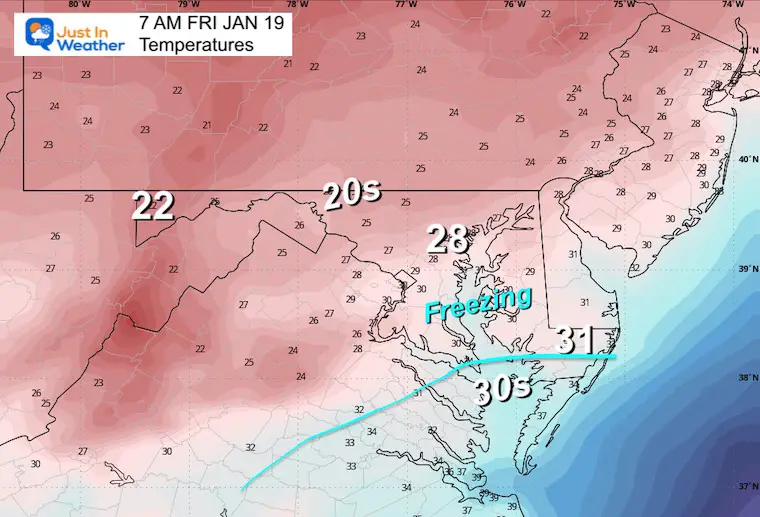
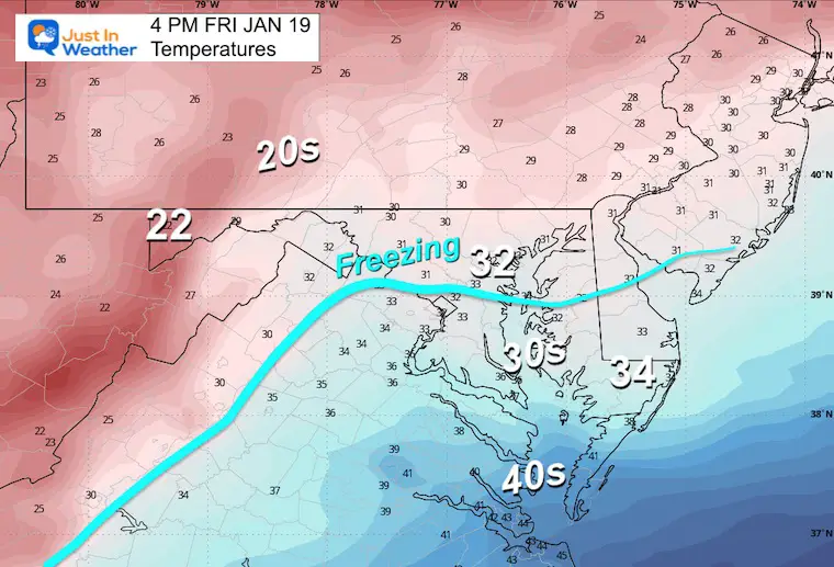
Temperatures
Most below freezing.
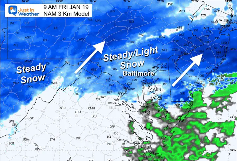
9 AM
Steady snow should be falling across most of Central Maryland and Southern PA.
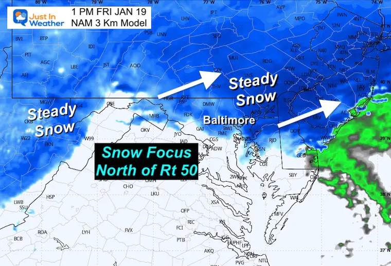
1 PM
4 PM
Temperatures
The Freezing Line will come close to Baltimore.
POTENTIAL SNOWFALL
Here is a look at the model products AND National Weather Service Forecasts… They may show a wider range depending on your area.
I am still sticking with a general 1 to 3 inches. I will aim to make a new map for my morning report.
GFS Model
European Model
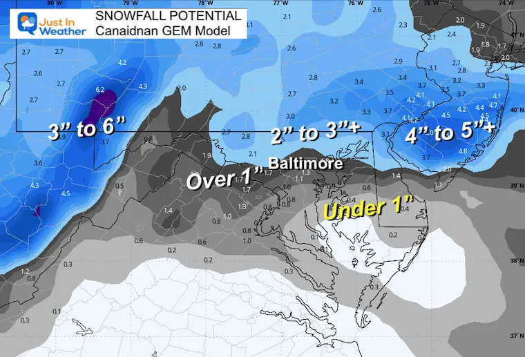
Canadian GEM Model
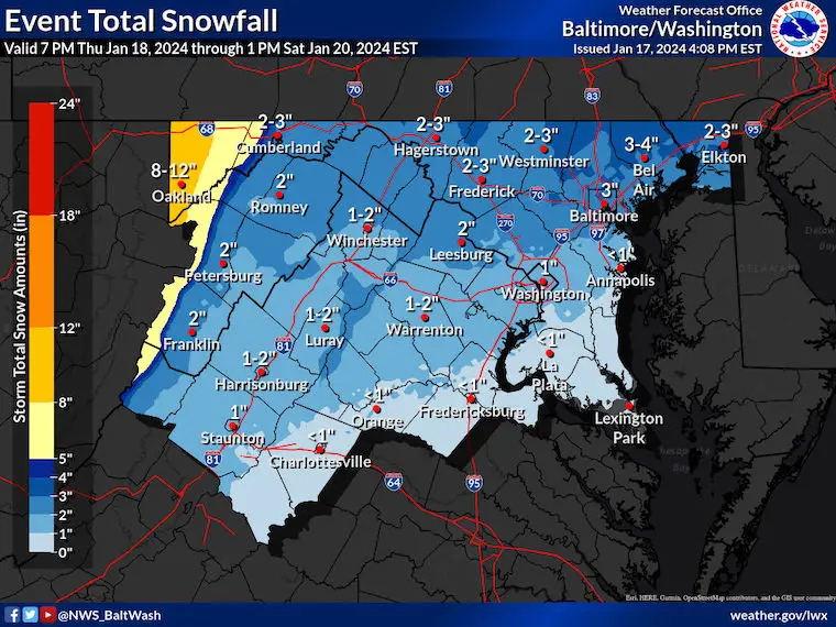
National Weather Service
Maryland/Virginia
NWS Sterling seems to be holding on the higher side of 2 to 3 inches across northern MD.
Washington to Annapolis may be closer to 1 inch.
Mountains – This burst will be due to colder temps/higher ratios and longer duration snow into Saturday.
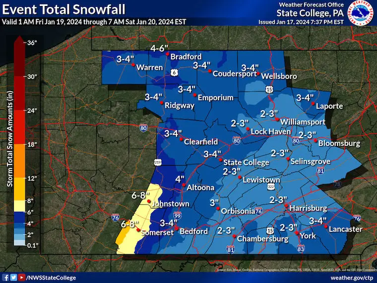
Pennsylvania
State College PA
Looks like a repeat of 2 to 4 inches across Adams, York, and Lancaster Counties.
In case you missed it…
Click here or the map to see: The Snow Report Ending Jan 16

Subscribe for eMail Alerts
RECENT Winter Outlook Reports:

El Niño Winter Updates

Computer Models Support East Coast Storm Track

El Niño Advisory
The latest NOAA report is confident in a Very Strong event. Possibly HISTORIC! This refers to the temperatures in the Pacific, with impacts on the US Winter Storm Track.

Winter Weather Folklore: Top 20 and more signals from nature for snow.
NOAA’s Winter Outlook 2024
Winter Outlook 2024 From Two Farmers Almanacs Return to Cold and Snow
Explore More
Maryland Snow Climate History And Other Winter Pages

Faith in the Flakes Gear

STEM Assemblies/In School Fields Trips Are Back
Click to see more and ‘Book’ a visit to your school 
Please share your thoughts and best weather pics/videos, or just keep in touch via social media
RESTATING MY MESSAGE ABOUT DYSLEXIA
I am aware there are some spelling and grammar typos and occasional other glitches. I take responsibility for my mistakes and even the computer glitches I may miss. I have made a few public statements over the years, but if you are new here, you may have missed it: I have dyslexia and found out during my second year at Cornell University. It didn’t stop me from getting my meteorology degree and being the first to get the AMS CBM in the Baltimore/Washington region. One of my professors told me that I had made it that far without knowing and to not let it be a crutch going forward. That was Mark Wysocki, and he was absolutely correct! I do miss my mistakes in my own proofreading. The autocorrect spell check on my computer sometimes does an injustice to make it worse. I also can make mistakes in forecasting. No one is perfect at predicting the future. All of the maps and information are accurate. The ‘wordy’ stuff can get sticky. There has been no editor who can check my work when I need it and have it ready to send out in a newsworthy timeline. Barbara Werner is a member of the web team that helps me maintain this site. She has taken it upon herself to edit typos when she is available. That could be AFTER you read this. I accept this and perhaps proves what you read is really from me… It’s part of my charm. #FITF


