Thanksgiving Travel Day Storm Outlook: One Week Away
November 15, 2023
Wednesday Night Update
DISCLAIMER
I want to start this report with clarity that this is NOT a forecast. It is an outlook based on a long-range analysis of computer model guidance. I am posting this for two reasons. First, to show that long-range storm forecasting beyond 1 week away is flawed. Second, to start paying attention to the storm that may affect holiday travel next Tuesday or Wednesday.
It does look like our weather pattern is about to change and hopefully help our drought.
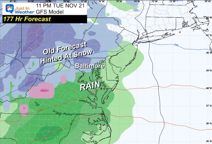
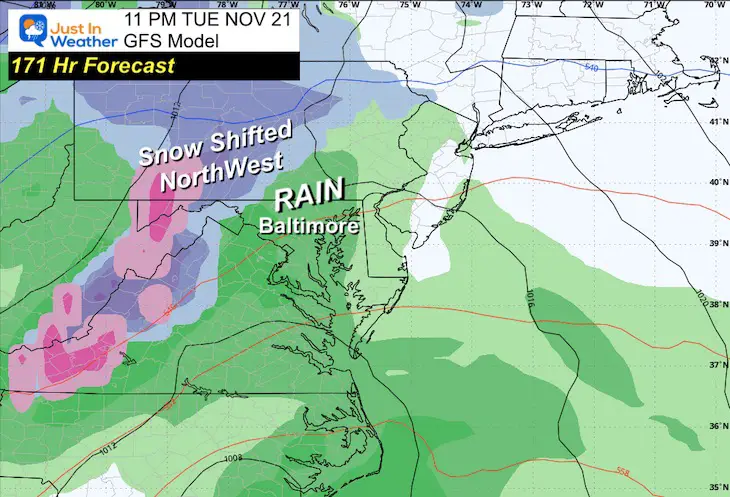
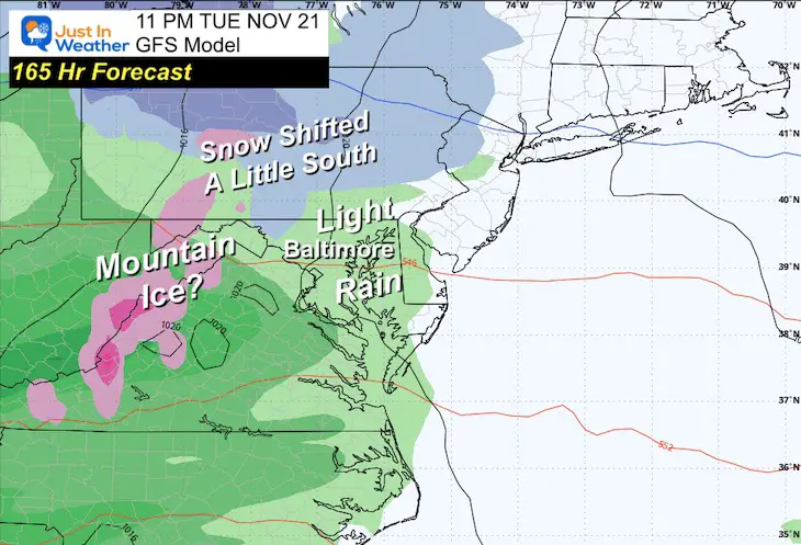
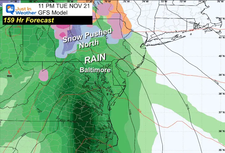
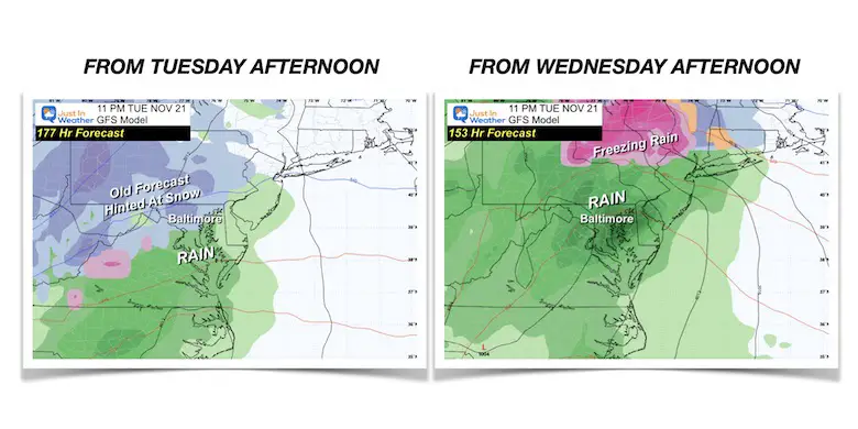
Did you see a post only about snow next week?
It wasn’t from me AND it was more likely yesterday (Tuesday). However, with this GFS Model updating every 6 hours, check out the slider to see how quickly that snow retreated north.
Note the Forecast Hours on each map….
Simplified:
Wednesday Update
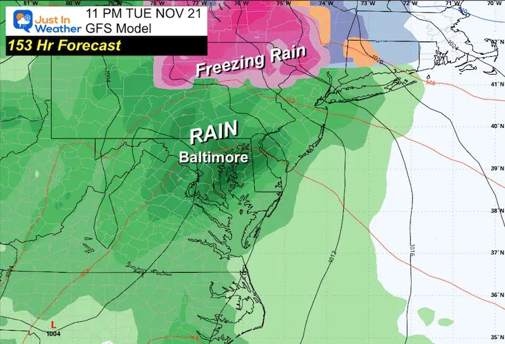
This morning’s run of the GFS model seemed more likely to happen. Note that I expect some adjustments to the storm development. I will track the trend over the next few days and refer back to this report.
Any hint of winter precipitation might be brief in the mountains at the start, but I see a rain event.
10 AM Tuesday, November 21
Low Pressure in Tennessee will start this off, but then shift energy to a new storm near the coast.
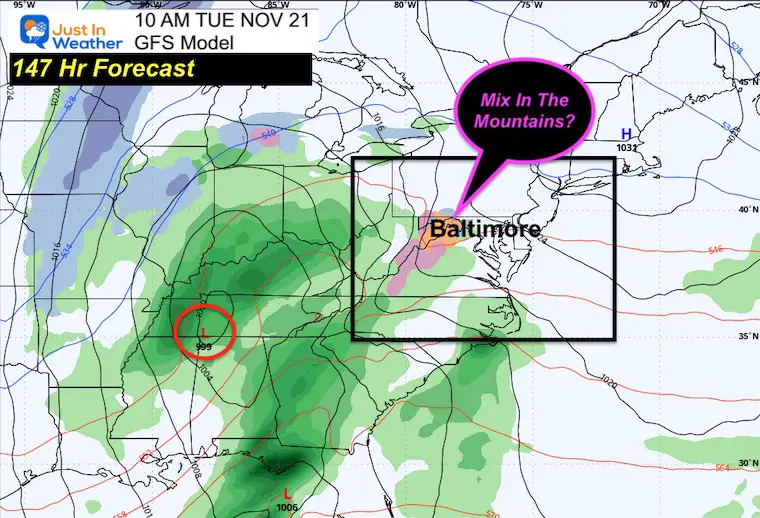
Animation Tuesday Morning to Thanksgiving Thursday
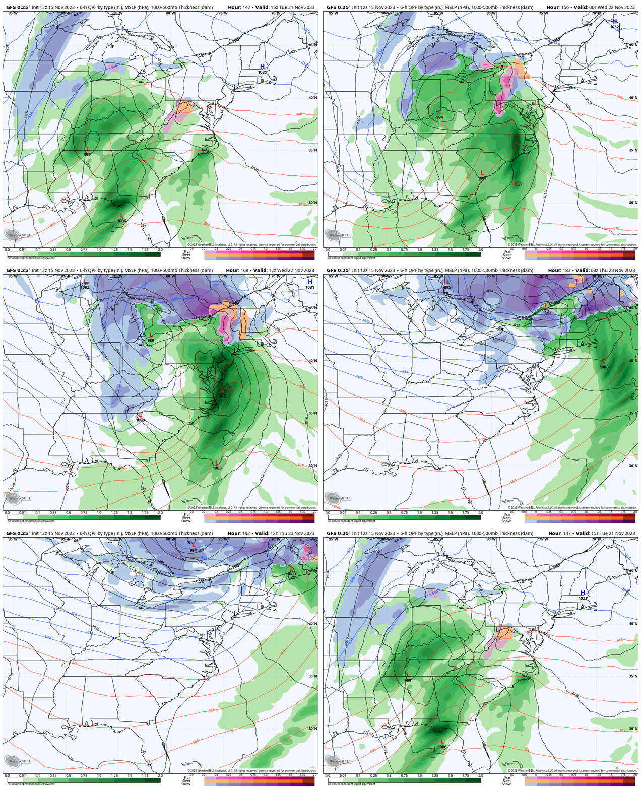
Snapshots
Thanksgiving Travel Wednesday
Morning: Moderate to Heavy Rain with a coastal Low Pressure.
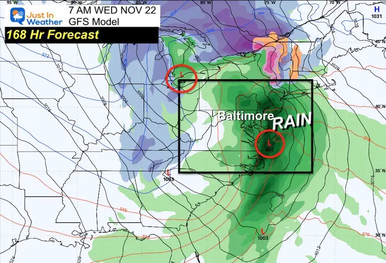
Evening
Rain will be departing up to New England. I-95 does look like it will be soggy all day!
Snow may be developing in the mountains of western MD and PA.
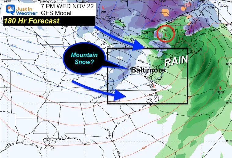
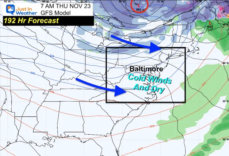
Thanksgiving Morning
The storm will be over for us, however, a chilly wind will make for some frigid Turkey Trots. It may also be a day that stays in the 40s, even for Baltimore and the Eastern Shore.
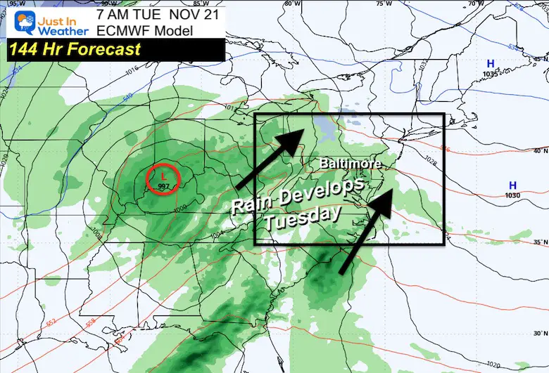
European Model
This backs up the support for a storm. However, it will be a faster event.
Tuesday Morning
Rain developing.
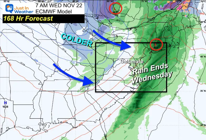
Wednesday Morning
Rain ending. If this verifies, it would make for improved travel during the day on Wednesday.
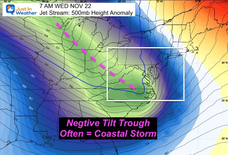
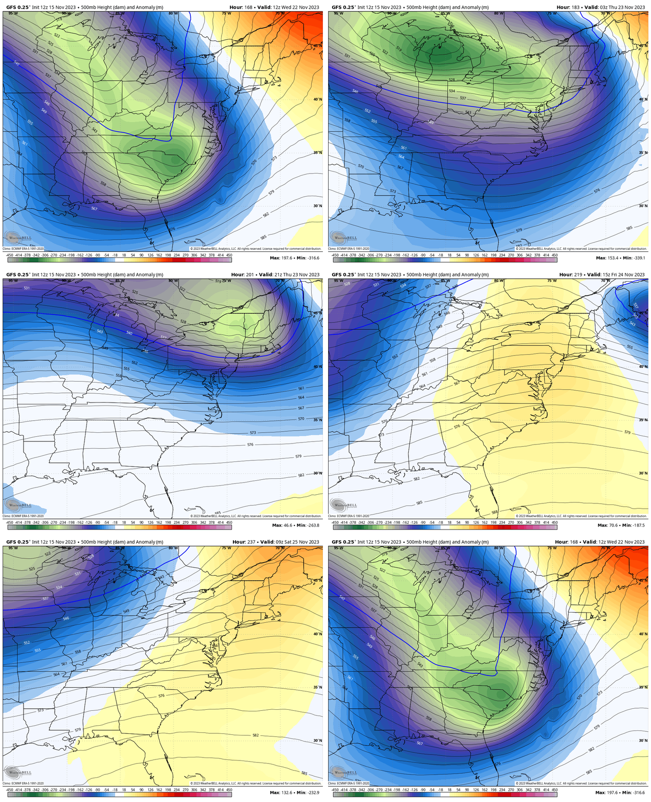
Jet Stream
While the details of the storm are still uncertain, the likelihood of a storm is based on the jet stream.
Here we see a Deep Negative Tilted Trough extending to the East Coast. This supports a strong coastal storm scenario.
Wednesday Morning
Animation Wednesday Morning To Saturday Morning (Thanksgiving Weekend)
While the storm pulls out, the pattern will relax. However, we will be left with a chilly airmass.
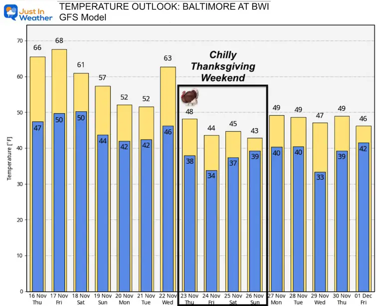
Temperature Outlook: 10 Days
This model supports a warm-up with the rain, then a collapse on the thermometer by Thanksgiving. Highs remain in the 40s through the holiday weekend.
Reminder:
This is the likely scenario now but the timeline could shift as the ingredients to form this storm come together. I will refer back to this report to spot any trends.
Subscribe for eMail Alerts
Weather posts straight to your inbox
Sign up and be the first to know!Winter Outlook Reports:
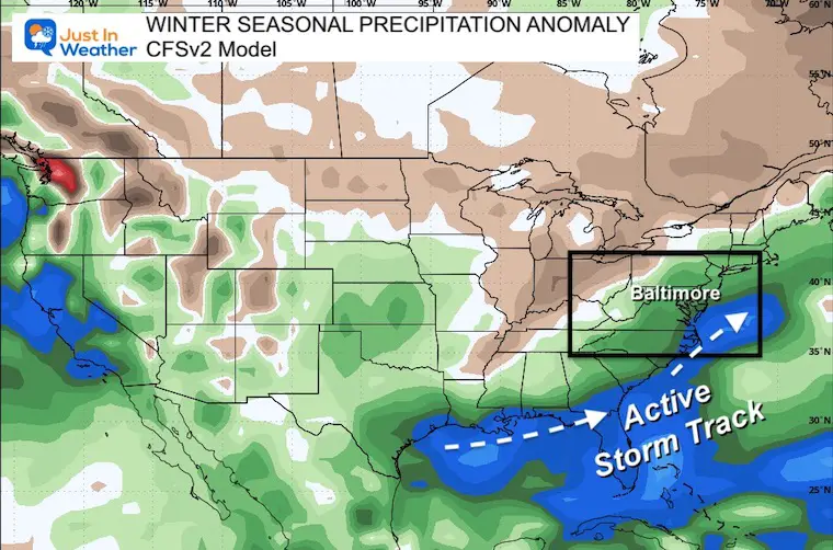
El Niño Winter Updates
Computer Models Support East Coast Storm Track
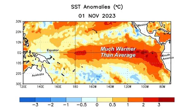
The latest NOAA report is confident in a Very Strong event. Possibly HISTORIC! This refers to the temperatures in the Pacific, with impact on the US Winter Storm Track.
Winter Weather Folklore: Top 20 and more signals from nature for snow.
Winter Outlook 2024 From Two Farmers Almanacs Return to Cold and Snow
Explore More
Maryland Snow Climate History And Other Winter Pages
Faith in the Flakes Gear
STEM Assemblies/In School Fields Trips Are Back
Click to see more and ‘Book’ a visit to your school
Please share your thoughts and best weather pics/videos, or just keep in touch via social media
-
Facebook: Justin Berk, Meteorologist
-
Twitter
-
Instagram
RESTATING MY MESSAGE ABOUT DYSLEXIA
I am aware there are some spelling and grammar typos and occasional other glitches. I take responsibility for my mistakes and even the computer glitches I may miss. I have made a few public statements over the years, but if you are new here, you may have missed it: I have dyslexia and found out during my second year at Cornell University. It didn’t stop me from getting my meteorology degree and being the first to get the AMS CBM in the Baltimore/Washington region. One of my professors told me that I had made it that far without knowing and to not let it be a crutch going forward. That was Mark Wysocki, and he was absolutely correct! I do miss my mistakes in my own proofreading. The autocorrect spell check on my computer sometimes does an injustice to make it worse. I also can make mistakes in forecasting. No one is perfect at predicting the future. All of the maps and information are accurate. The ‘wordy’ stuff can get sticky. There has been no editor who can check my work when I need it and have it ready to send out in a newsworthy timeline. Barbara Werner is a member of the web team that helps me maintain this site. She has taken it upon herself to edit typos when she is available. That could be AFTER you read this. I accept this and perhaps proves what you read is really from me… It’s part of my charm.
#FITF


