November 6 Top Aurora Photos And Warm Week Ahead
November 6, 2023
Monday Morning Update
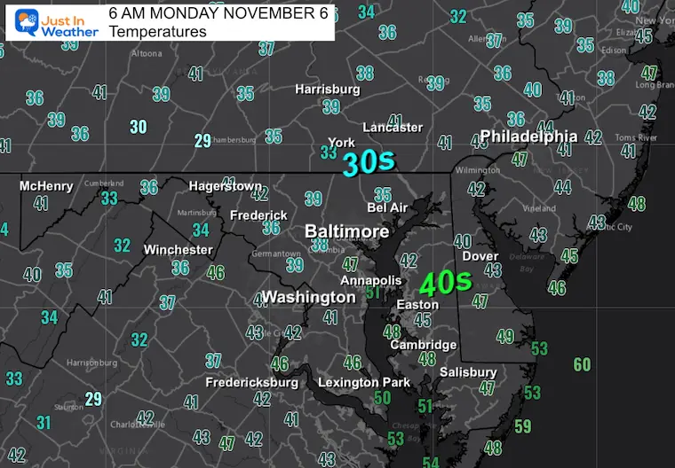
After our warm weekend, there is a brief cool-down today, only to be followed by another warm-up. Baltimore reached 71ºF on Saturday and 74ºF on Sunday. This has been more than 10 degrees above average.
This pattern has been stuck for a while and will continue this week: Dry in the east with mild to above average temperatures. Meanwhile, a cold storm track persists to the north across the Great Lakes.
I do not see this as a winter preview, which I will explain later today. However, for the time being, we have abnormally dry to drought conditions across our region in danger of expanding.
The next rain chance will be at the end of the work week.
STANDARD TIME REALITY
More light in the morning, but you will surely notice it at the end of the work day!
Sunrise Today = 6:40 AM
Sunset Today = 5:00 PM
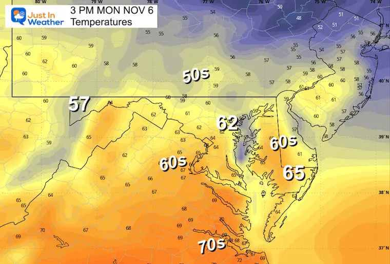
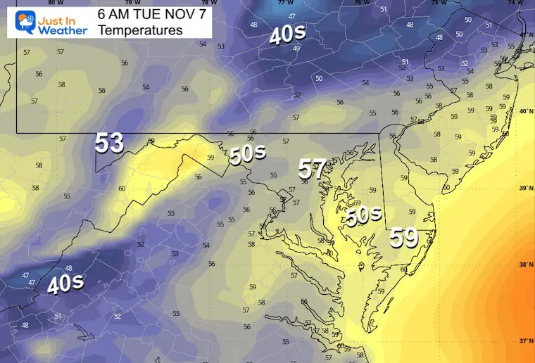
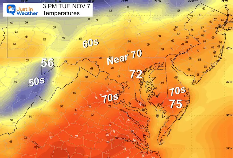
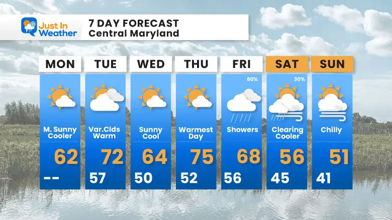
Temperatures will remain warmer than normal for most of the week ahead. In fact, there is little shift in our weather pattern. This may be highlighted by the reduction of our rain chance to one day at the end of the work week.
Morning Temperatures
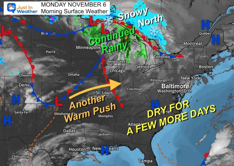
Morning Surface Weather
We continue to watch an active storm track across the Great Lakes with the first signals of winter snow in Canada.
High Pressure remains in control across the Eastern US, which will keep us dry this week. There will be impulses to swing the temps, but warmer days are ahead.
Afternoon Temperatures
Aurora Sunday Night
A Solar Storm last week reached Earth over the weekend. The key measure of the Planetary K index peaked between Kp 5 to 7. We usually need an 8 or higher to be seen in the mid-latitudes. However, a rare SAR ARC outer ionosphere display as a red smudge was seen. Check out the best photos I received.
Earlier Photos
New Report:
Winter Weather Folklore: Top 20 and more signals from nature for snow.
CLIMATE DATA: Baltimore
TODAY November 6
Sunrise at 6:40 AM
Sunset at 5:00 PM
Normal Low in Baltimore: 39ºF
Record 22ºF in 1991
Normal High in Baltimore: 61ºF
Record 80ºF 2015
New Reports:
NEW: NOAA’s Winter Outlook 2024
Other Reports:
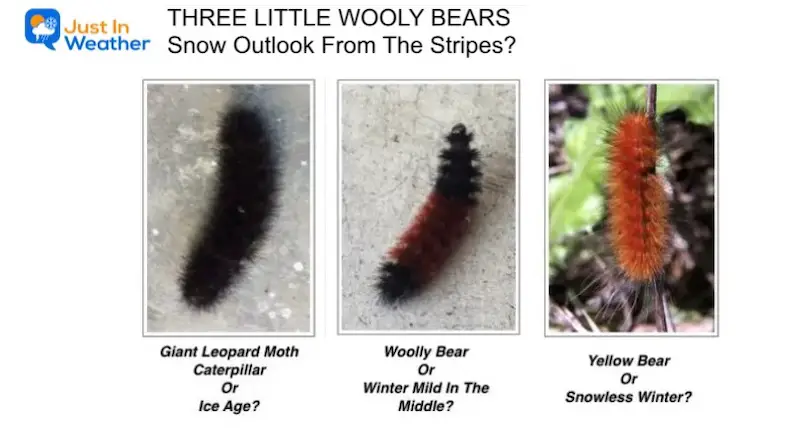
Winter Weather: Can Woolly Bear Caterpillar Stripes Really Foretell Snow?
El Niño Advisory: First Look At NOAA’s Winter Outlook Expectations
Winter Outlook 2024 From Two Farmers Almanacs Return to Cold and Snow
Subscribe for eMail Alerts
Weather posts straight to your inbox
Sign up and be the first to know!
Temperatures
Tuesday Morning
Tuesday Afternoon
Looking Ahead
Storm Forecast: Thursday to Saturday
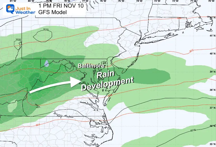
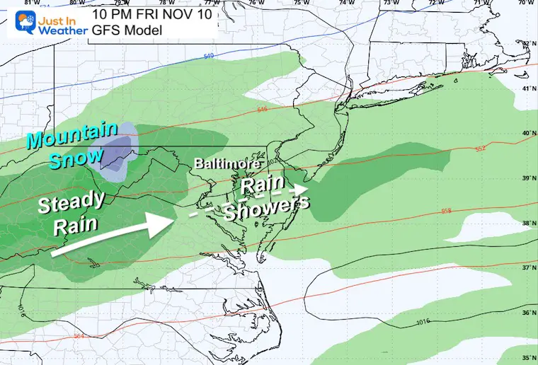
The updated forecast shows a cold wintry storm in Northern New England rising our temps Thursday. Then we get the cold front on Friday with a surge of rain. This may be met with snow in the mountains over 2,000 Ft in Western Maryland to West Virginia.
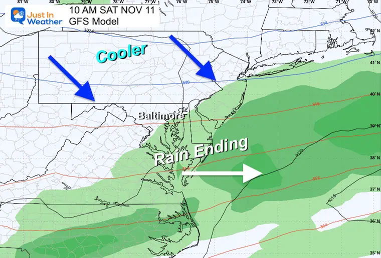
The system will move off the coast Saturday morning, setting up a colder and dry weekend.
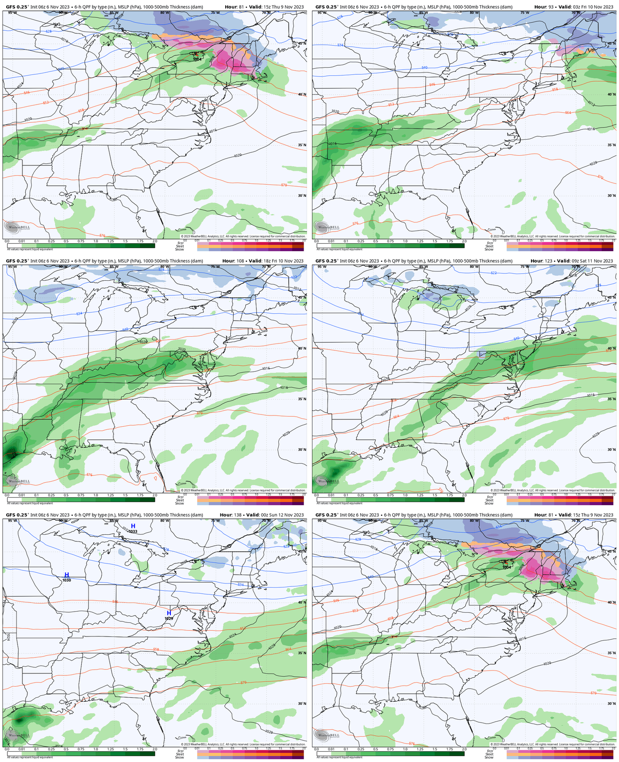
Snapshot Friday
Rain may expand out of the mountains across the rest of the Mid-Atlantic during the morning into the afternoon.
Snapshot Friday Night
Steady rain in the mountains with high mountains slushy snow.
Most of the metro and central areas may end up with scattered showers instead of the needed rain.
Saturday
This weather system will move off the coast leading to clearing and cooler weather for the rest of the weekend.
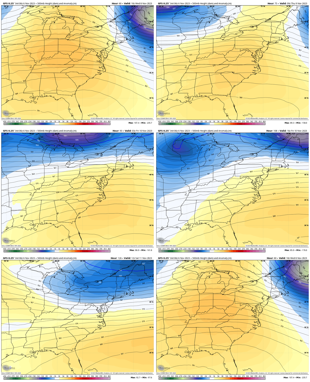
Jet Stream
Animation Wednesday to Saturday
The dominant airflow will be mild. The intrusions of colder air will be marginal and brief.
7 Day Forecast
The up and down temps this week should peak Thursday. Then our best chance of rain will be Friday into Saturday morning… marking colder air.
Subscribe for eMail Alerts
Weather posts straight to your inbox
Sign up and be the first to know!
Faith in the Flakes Gear
STEM Assemblies/In School Fields Trips Are Back
Click to see more and ‘Book’ a visit to your school
Please share your thoughts and best weather pics/videos, or just keep in touch via social media
-
Facebook: Justin Berk, Meteorologist
-
Twitter
-
Instagram
RESTATING MY MESSAGE ABOUT DYSLEXIA
I am aware there are some spelling and grammar typos and occasional other glitches. I take responsibility for my mistakes and even the computer glitches I may miss. I have made a few public statements over the years, but if you are new here, you may have missed it: I have dyslexia and found out during my second year at Cornell University. It didn’t stop me from getting my meteorology degree and being the first to get the AMS CBM in the Baltimore/Washington region. One of my professors told me that I had made it that far without knowing and to not let it be a crutch going forward. That was Mark Wysocki, and he was absolutely correct! I do miss my mistakes in my own proofreading. The autocorrect spell check on my computer sometimes does an injustice to make it worse. I also can make mistakes in forecasting. No one is perfect at predicting the future. All of the maps and information are accurate. The ‘wordy’ stuff can get sticky. There has been no editor who can check my work when I need it and have it ready to send out in a newsworthy timeline. Barbara Werner is a member of the web team that helps me maintain this site. She has taken it upon herself to edit typos when she is available. That could be AFTER you read this. I accept this and perhaps proves what you read is really from me… It’s part of my charm.
#FITF


