Oceans Calling Festival Weather This Weekend With The Ghost Of Ophelia Wind And Rain
Forecast for Friday, September 29 to Sunday, October 1 2023
Maryland and the Mid-Atlantic region is filled with a lot of activities including many professional sports. But the concert this weekend in Ocean City, Maryland may be the biggest event of the year. Oceans Calling is a three-day music festival with three different venues in a place that is known for having an extended summer.
This year I am not only sad I will not be attending, but the weather will not be optimal. That is the most positive way I can say this since the first two days will have wind and rain.
On the bright side, literally, there is a good chance the sun will come out on Sunday. So even with the persistent wind, it should be the best weather day!
I put together some highlight weather maps in this report. At the bottom, I included the Windy Live Radar Widget along with a spot hourly forecast that will update if you keep checking back.
Set-Up
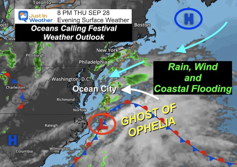
The remains of Tropical Storm Ophelia we dealt with last weekend has continued to plague the Mid-Atlantic. This circulation we have been calling the Ghost of Ophelia has drifted off the coast and is now getting a little resurgence.
The combination of High Pressure in New England is helping to funnel stronger winds to Ocean City and up the coast.
We add in the Super Harvest Moon on Friday morning, and we get abnormal high tides as well. So there may be flooding at the Ocean City Inlet Parking lot and more erosion on the beaches.
It will not turn tropical again but may be considered a Nor’easter for the simplicity of broadcasting the weather event.
Surface Map From Thursday Night
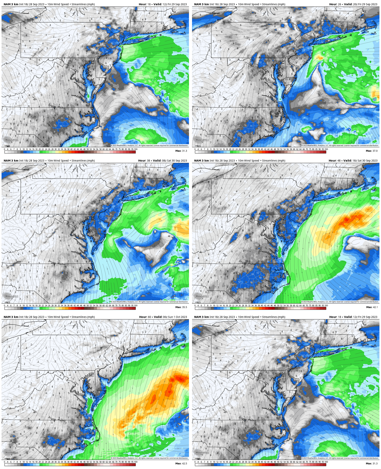
Wind Forecast
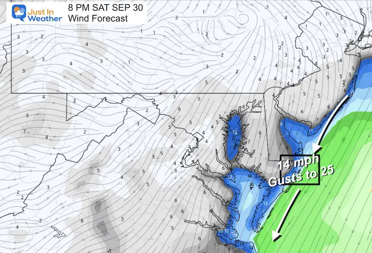
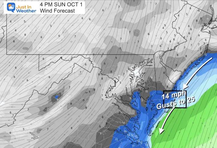
This is the more confident part of the forecast. Winds will increase with that storm offshore and will generally be FROM THE NORTH OR NORTHEAST all weekend.
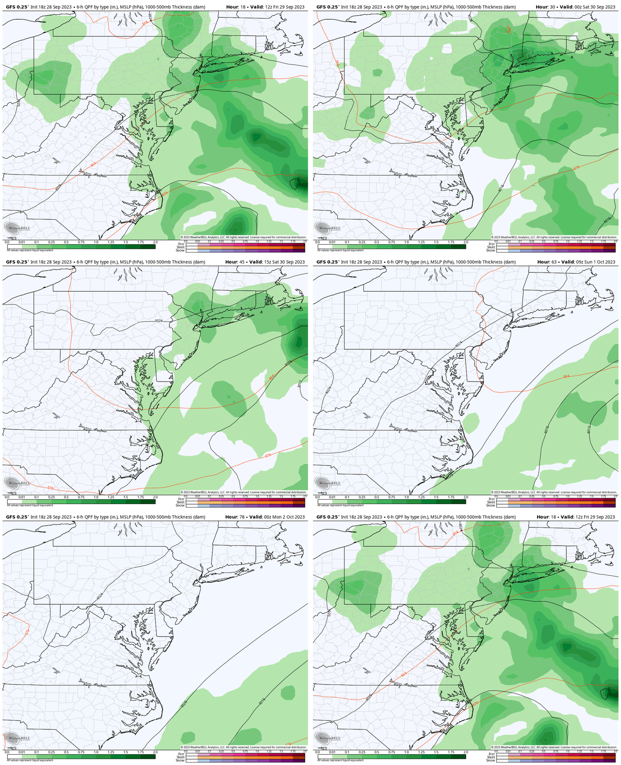
GFS Forecast Surface Weather
Friday: Best chance for rain.
Saturday: Morning rain then hit-and-miss bands of showers in the afternoon.
Sunday: (Best Weather) The storm should move away. If there is a break from the clouds with the sun, this would be the best chance. But the chilly wind will remain persistent.
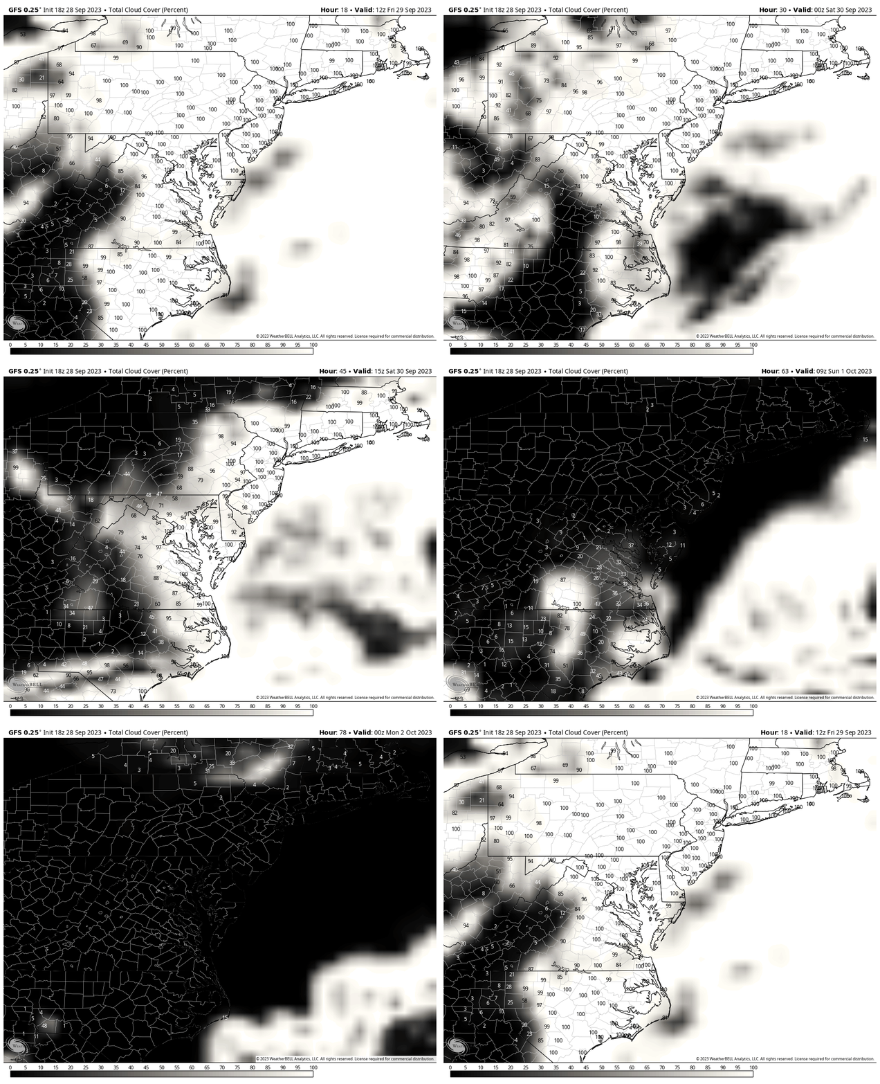
Cloud Forecast
White represents cloud cover, and there are percentages annotated. The black or dark areas represent the clearing. We can see a dominant clearing suggestion by Saturday night and definitely on Sunday.
Daily Highlights
Friday
There are so many good artists spread across the three days.
The shows begin on Friday afternoon, with the later afternoon and evening shows building crowds. They will include Toad The Wet Sprocket, Third Eye Blind, Alanis Morrisette, OAR, and ending with Jack Johnson from 9:30 to 11 PM.
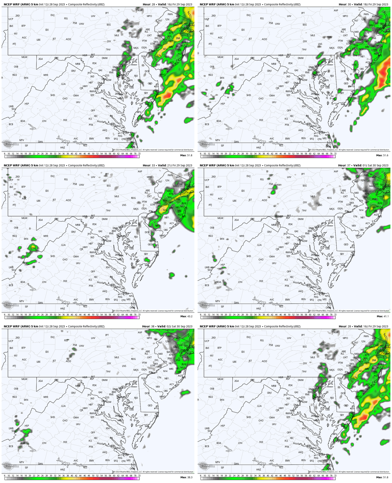
Radar Simulation Noon to 10 PM
Steady bands of rain, tapering to showers. This product does not show sea spray or mist, but I would plan for a cool and damp feel to continue.
Dress with layers. Long sleeves or a hoodie and a light water-resistant jacket over it.
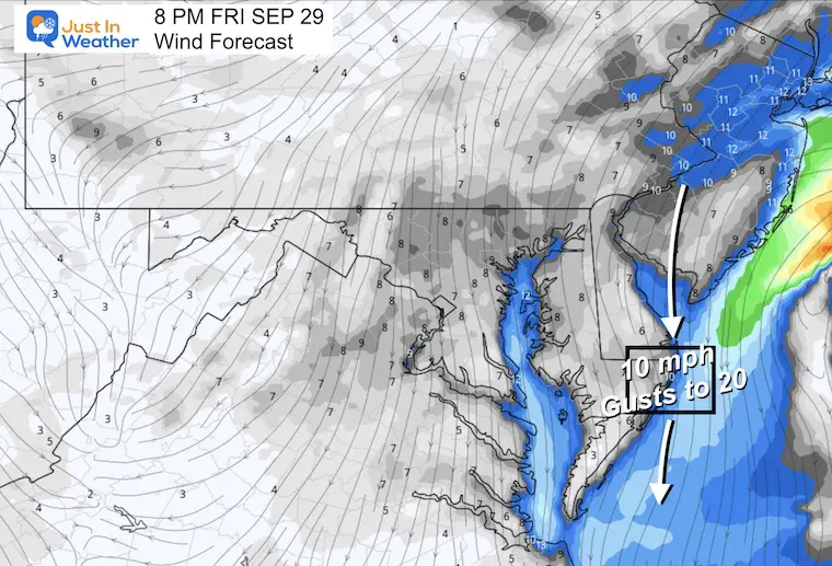
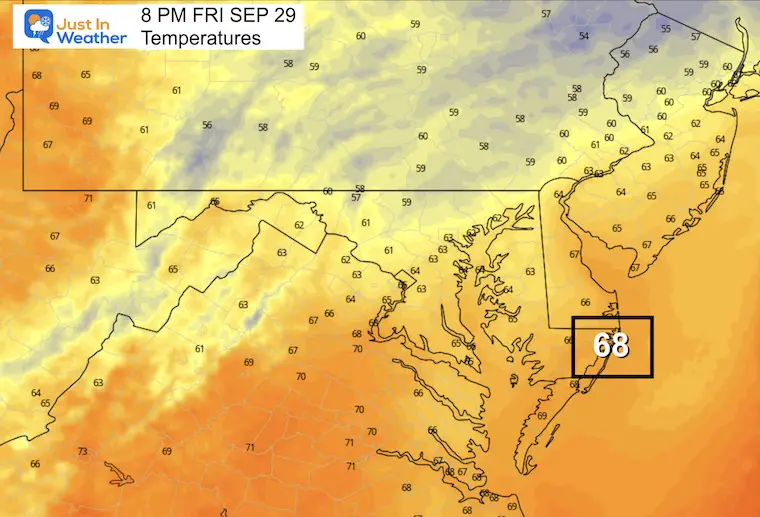
8 PM Snapshot
Wind Forecast
Average FROM the north at 10 to 20 mph.
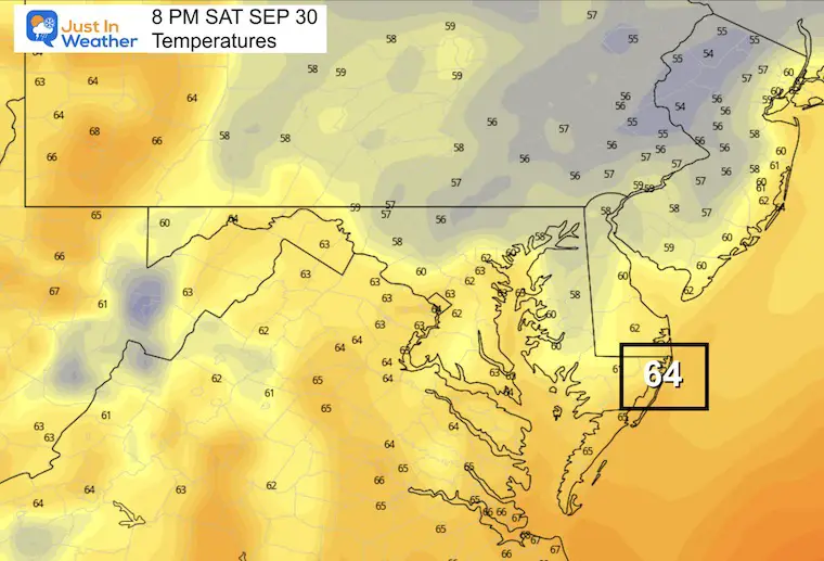
Temperatures
Upper 60s may seem OK but with the breeze, mist, spray, or rain showers… I would recommend long sleeves and a light rain jacket or hoodie.
Saturday
Shows also begin after 12 PM. They feature Gin Blossoms, Dispatch, and Sheryl Crow. Then at night Incubus and John Mayer.
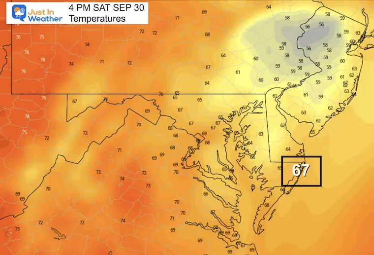
4 PM Snapshot
Wind Forecast

Temperatures
8 PM Snapshot
Wind Forecast
Temperatures
Sunday
Another afternoon to nighttime full docket. I imagine many are taking off work Monday because of this:
ALO, G Love and Special Sauce, The Wallflowers, Weezer, and The Lumineers.
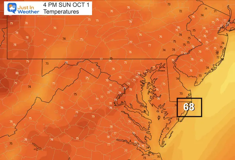
Mid Afternoon Weather
It looks like the rain should move away, but the wind and chill will remain.
If there is a break of sun, this is when it is most likely to happen.
4 PM Snapshot
Wind Forecast
Temperatures
ALSO SEE: Drought Report September 28
Live Radar Widget and Spot Forecast
New Reports:
El Niño Advisory: First Look At NOAA’s Winter Outlook Expectations
Winter Outlook 2024 From Two Farmers Almanacs
Return to Cold and Snow
Subscribe for eMail Alerts
Weather posts straight to your inbox
Sign up and be the first to know!
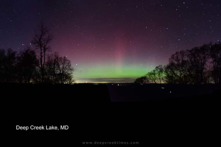
Aurora Photos From Maryland, Delaware, and Virginia
Please share your thoughts and best weather pics/videos, or just keep in touch via social media
-
Facebook: Justin Berk, Meteorologist
-
Twitter
-
Instagram
RESTATING MY MESSAGE ABOUT DYSLEXIA
I am aware there are some spelling and grammar typos and occasional other glitches. I take responsibility for my mistakes and even the computer glitches I may miss. I have made a few public statements over the years, but if you are new here, you may have missed it: I have dyslexia and found out during my second year at Cornell University. It didn’t stop me from getting my meteorology degree and being the first to get the AMS CBM in the Baltimore/Washington region. One of my professors told me that I had made it that far without knowing and to not let it be a crutch going forward. That was Mark Wysocki, and he was absolutely correct! I do miss my mistakes in my own proofreading. The autocorrect spell check on my computer sometimes does an injustice to make it worse. I also can make mistakes in forecasting. No one is perfect at predicting the future. All of the maps and information are accurate. The ‘wordy’ stuff can get sticky. There has been no editor who can check my work when I need it and have it ready to send out in a newsworthy timeline. Barbara Werner is a member of the web team that helps me maintain this site. She has taken it upon herself to edit typos when she is available. That could be AFTER you read this. I accept this and perhaps proves what you read is really from me… It’s part of my charm.
#FITF


