Weekend Coastal Storm Update Shows A Wide Range From Computer Models
September 20, 2023
Wednesday Night Update
After a few days of speculation, it is nice to finally report confirmation that the National Hurricane Center has identified the region over the Bahamas as a Tropical Interest. The chances are low that it will fully develop, but does support the reports I’ve been sharing that a storm with tropical characteristics is trying to form. The next phase is the bump to the north and how it will impact our weekend.
UPDATE THURSDAY: Click for the new report
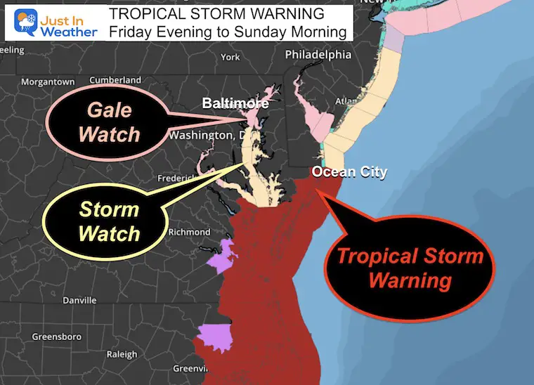
TROPICAL STORM WARNING INCLUDES OCEAN CITY MARYLAND
So at this time, it is safe to simply call this a Coastal Storm with tropical moisture that will essentially be a Nor’easter. I still believe it is safe to expect a Soggy Saturday and plan for it to possibly continue into Sunday. It may impact the Ravens game. It will be worse south and east, especially by the beaches. If you missed my afternoon report I will explain below with a timeline, wind, and rainfall maps.
Have you ever had a friend you trust tell you something you don’t think you should believe?
I have three computer models to compare for you. If this was a winter storm we might be pulling our hair out given the wide range. Two are similar with a potent storm, and the other is that friend who is telling a much different story.
I know some of your weekend plans are very important. I also will use this as an exercise in gaining data for computer guidance viability and see if the future storms will build evidence for who is stronger.
National Hurricane Center Update
Here is the Wednesday Evening Map from NHC. They have suggested only a 10% chance for development and getting a name in the next 48 hours. They have interestingly upped it to 40% over the next 7 days, however, whatever forms is most likely to be on land by day 3. Most likely because one of three models I will show below jumps this out to sea.
Note: Hurricane Nigel has 90 mph winds and will continue to move away.
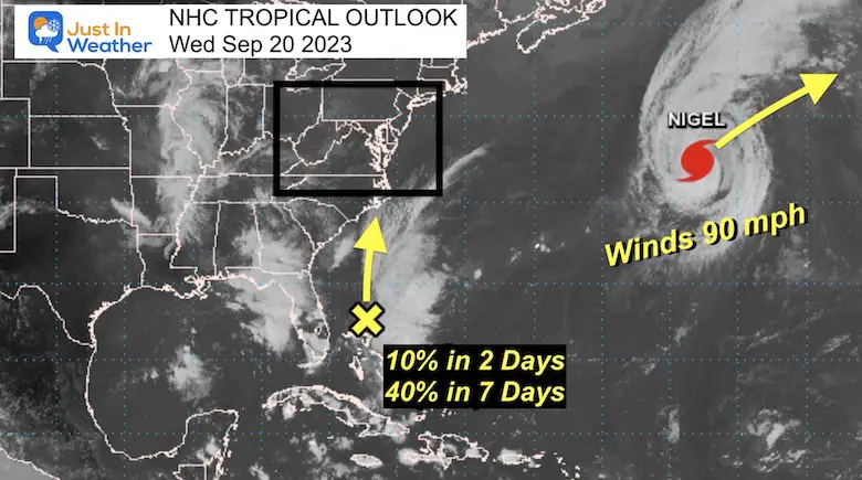
Wednesday Evening Weather Map
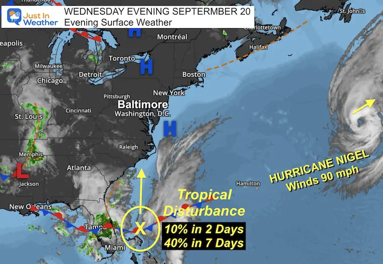
Here is another look at the Tropical weather plots and our surface weather.
High Pressure over the Mid-Atlantic is what has brought us the past few nice days.
As this moves off the coast, the return flow will allow the Disturbance to move North AND also increase our winds from the ocean.
Model Comparisons
One of these things doesn’t look like the other. Either the outlier is the only one on to something or is completely missing the mark.
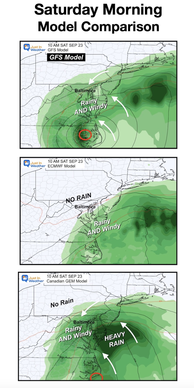
In my prior reports, I have been focused on the GFS Model. Here is the latest model run compared to the European ECWMF Model in the middle map, and the Canadian GEM Model on the bottom.
In this case, the European Model is the outlier. This is that friend I trust but I’m not so sure this time.
Saturday Morning
The top (GFS) and bottom (GEM) Models both bring in the storm with rain and wind for most of our region. The GEM is much stronger with much heavier rain (see the totals below)
The middle map (ECMWF) is the outlier pushing the storm much farther south and east. In this case, the rain doesn’t seem to reach Annapolis and hugs the coast.
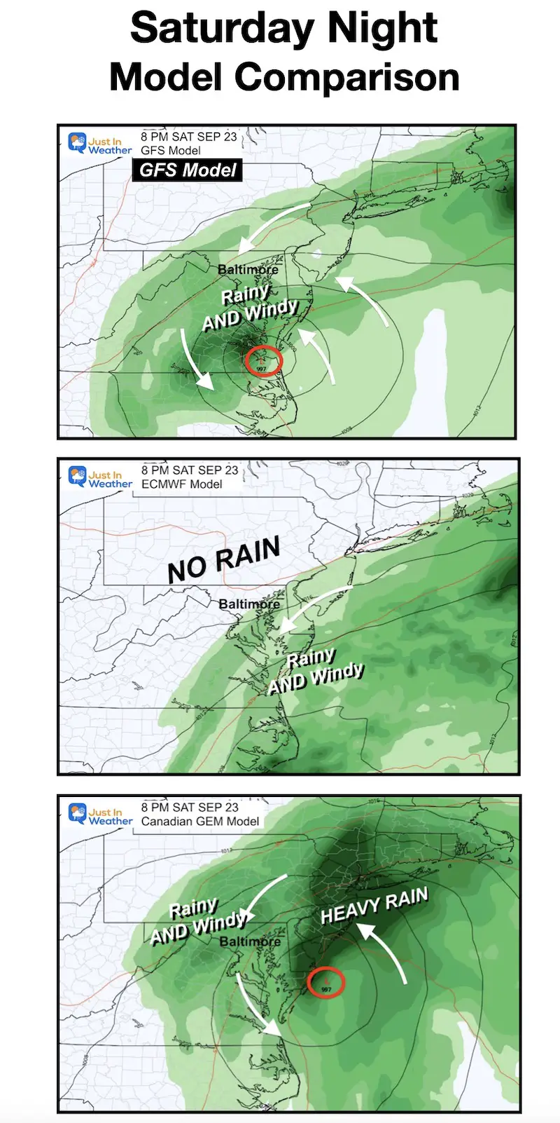
Saturday Night
Once again the GFS is the most reasonable while the GEM shows a much stronger storm with heavier rain. Part of the reason is it keeps the surface Low along the coast allowing it to generate and pump in more moisture.
The ECMWF is still a miss for metro areas, with maybe a clip near Annapolis, but not Baltimore.
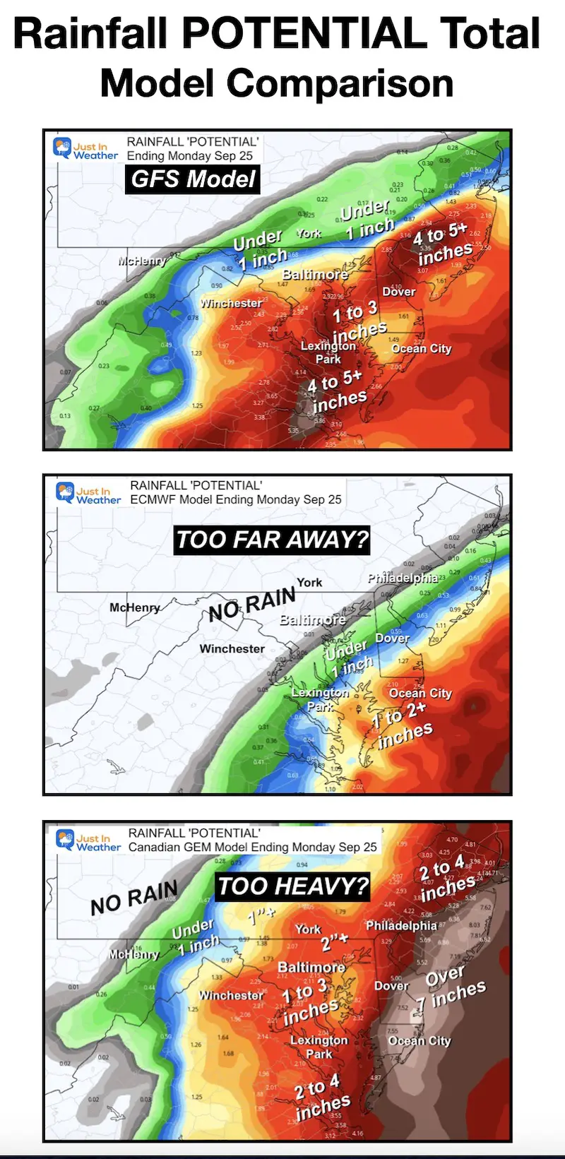
Potential Rainfall
- This ‘result’ of the rain blatantly points out how dramatically different these models are.
- The range from Baltimore to York PA is from ZERO to over 2 inches.
- The cut-off is dramatically different.
- In my humble opinion, the European Model is too far away AND the Canadian is too strong with too much rain.
- This is why I am leaning on the GFS in the middle of the pack. This has been most consistent and I believe it outperformed the European with Lee and Idalia.
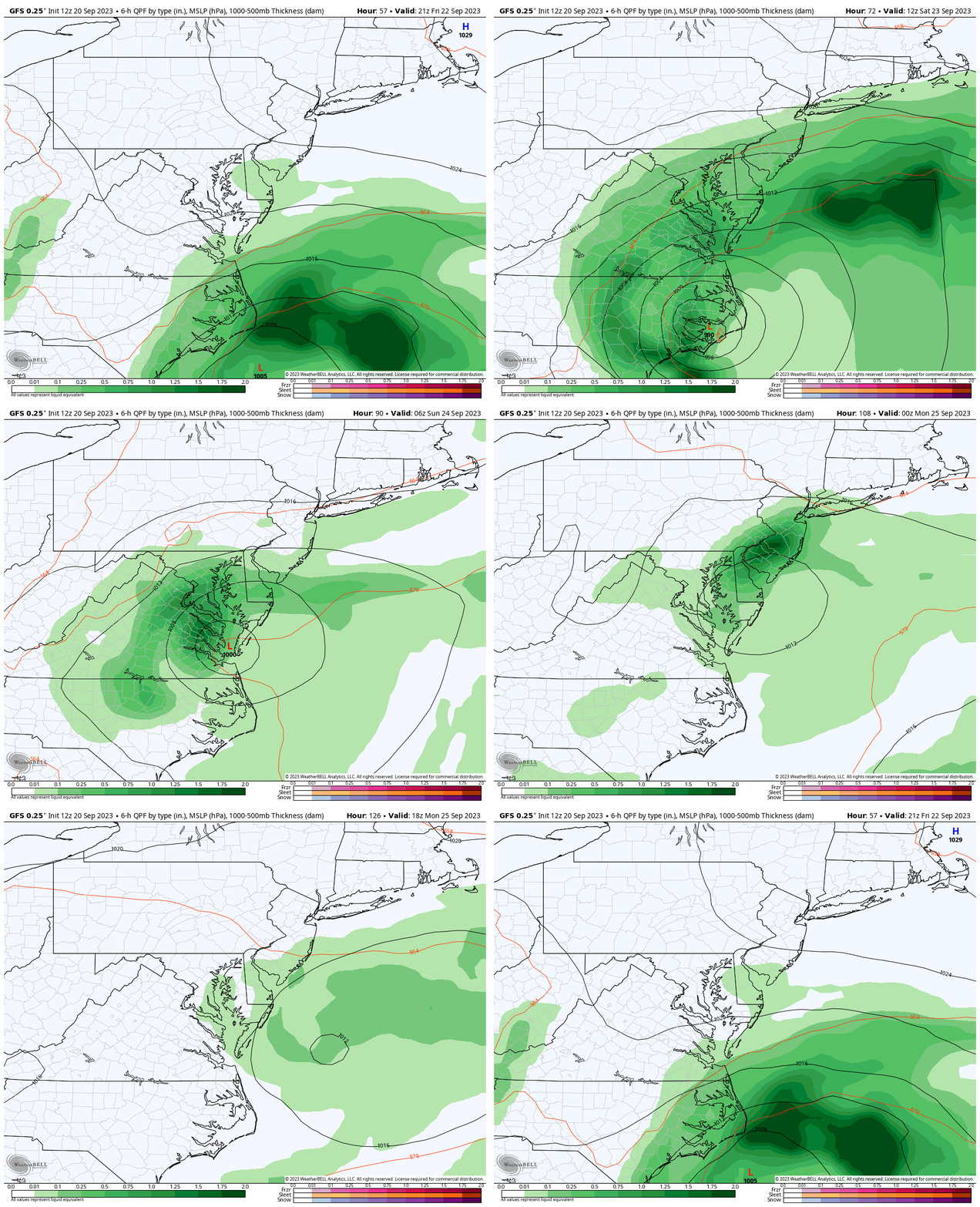
Since I am putting my trust in the GFS Model at this time, here is another look at the full breakdown. At this time the one change with this model has been a flip between stalling the storm or moving it out to sea. In the latest run, it once again stalls it and keeps it around through Sunday. Here’s a look:
Storm Animation: Thursday Morning to Sunday Morning
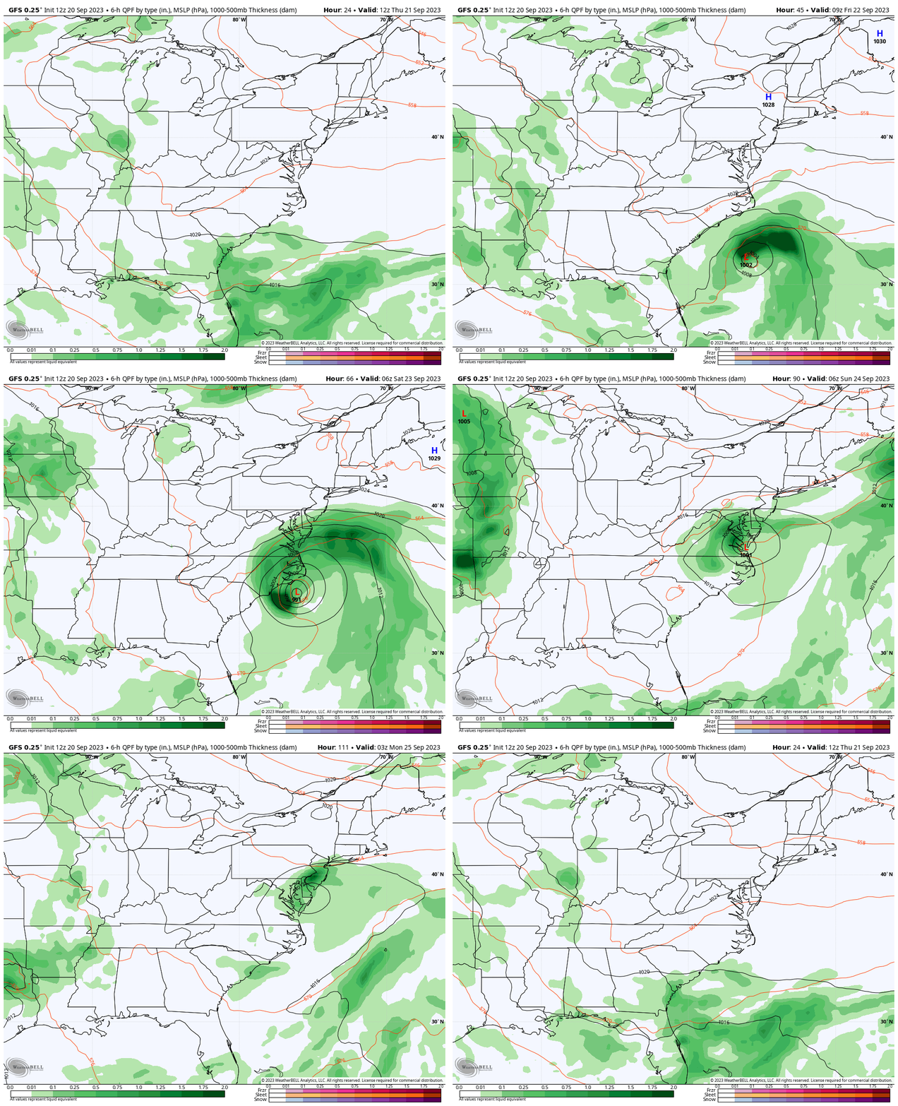
Closer Look Snapshots
The animation for this view is below.
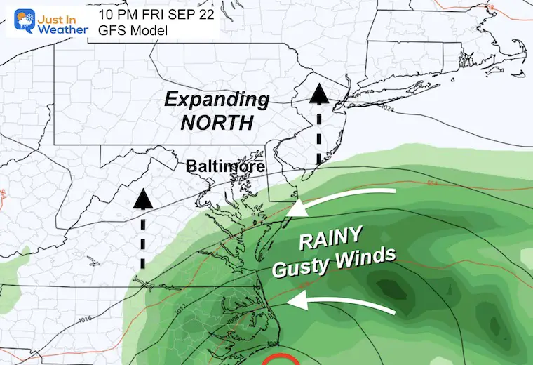
Friday Night
Rain reaches Southern Maryland by sunset and will continue to spread north overnight. The winds will be breezy all day bringing in clouds and keeping us chilly.
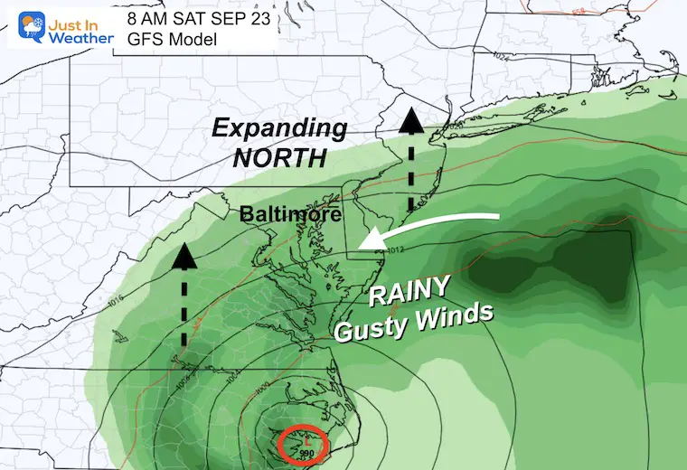
Saturday Morning
Steady rain will be falling in most of Maryland, and the northern edge may still be stuck near Hagerstown. In southern PA, there is a better chance for rain in York, and the MD line with less rain farther north near Harrisburg.
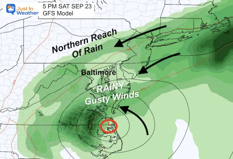
Saturday Afternoon
This may be the northernmost reach of the rain into central PA and western Maryland.
It will be a rainy, windy, blustery day in the rest of the Mid-Atlantic.
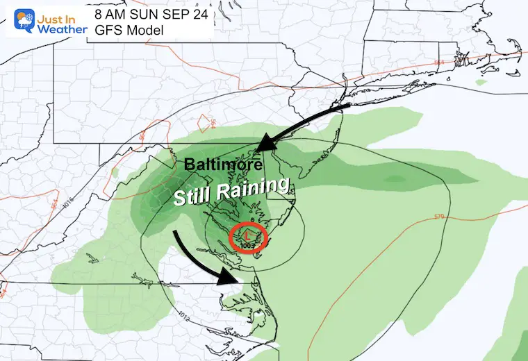
Sunday Morning
The suggestion here is that the stalling Low will confine the steady rain in Central Maryland, Delaware, and Eastern Virginia.
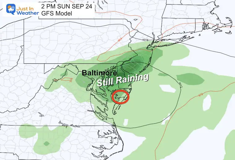
Sunday Afternoon
This is why we may need to keep the rain in the Ravens Game Day Forecast.
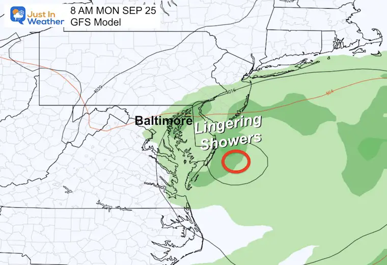
Monday Morning
This shows the storm finally fading and moving off the coast. This is a day later than the previous run I showed in my morning report.
Storm Animation: Friday Afternoon to Monday Afternoon
Surface Winds Forecast: Friday Morning To Sunday Night
This shows the core of Low Pressure in Southern Maryland.
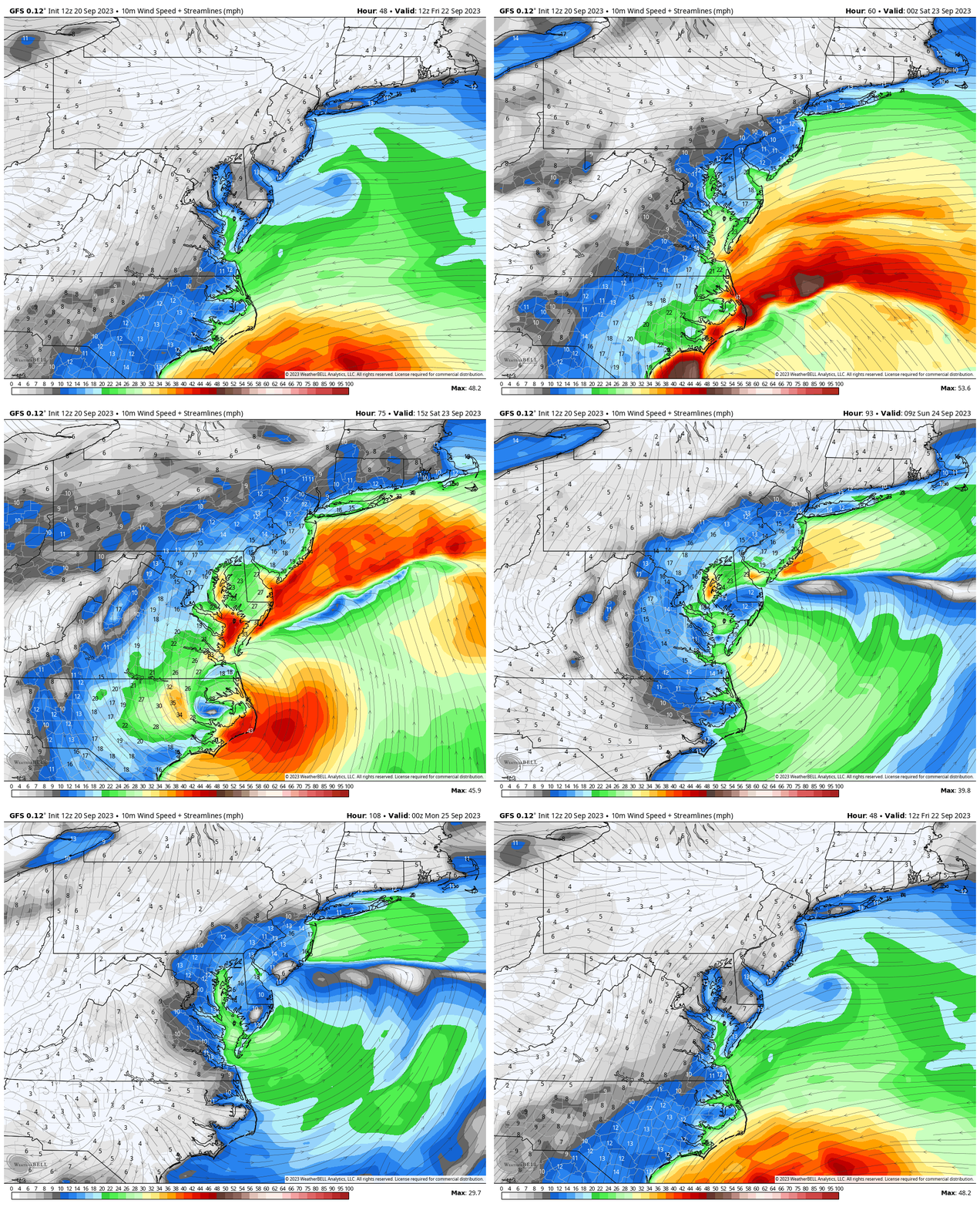
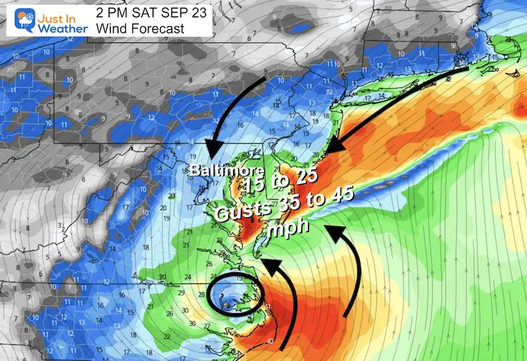
Saturday Afternoon Snapshot
Most areas in central Maryland to the coast will average 15 to 25 mph winds.
Peak GUSTS may be 35 to 45 mph… higher by the water.
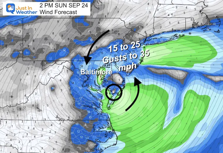
Sunday Afternoon Snapshot
Even if the rain tapers to showers or stops, the North wind will be chilly (for September), keeping us in the 60s. The winds may still gust to 35 mph.
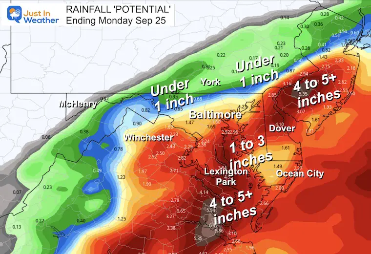
Potential Rainfall
A sharp cutoff with less rain west and north of Baltimore.
The heavier rain will be south and east, with up to 5 inches or more in spots. This may lead to local flooding in Southeast VA and Southern Maryland to the Beaches.
Central areas will be in the 1 to 3-inch range. This also may produce some local flooding.
New Reports:
El Niño Advisory: First Look At NOAA’s Winter Outlook Expectations
Winter Outlook 2024 From Two Farmers Almanacs
Return to Cold and Snow
Subscribe for eMail Alerts
Weather posts straight to your inbox
Sign up and be the first to know!
EARLIER IN AUGUST: Maryland Trek 10 For These Kids
I will have a follow-up and recap on our amazing week shortly.
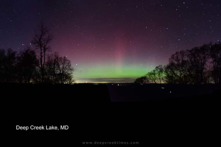
Aurora Photos From Maryland, Delaware, and Virginia
Please share your thoughts and best weather pics/videos, or just keep in touch via social media
-
Facebook: Justin Berk, Meteorologist
-
Twitter
-
Instagram
RESTATING MY MESSAGE ABOUT DYSLEXIA
I am aware there are some spelling and grammar typos and occasional other glitches. I take responsibility for my mistakes and even the computer glitches I may miss. I have made a few public statements over the years, but if you are new here, you may have missed it: I have dyslexia and found out during my second year at Cornell University. It didn’t stop me from getting my meteorology degree and being the first to get the AMS CBM in the Baltimore/Washington region. One of my professors told me that I had made it that far without knowing and to not let it be a crutch going forward. That was Mark Wysocki, and he was absolutely correct! I do miss my mistakes in my own proofreading. The autocorrect spell check on my computer sometimes does an injustice to make it worse. I also can make mistakes in forecasting. No one is perfect at predicting the future. All of the maps and information are accurate. The ‘wordy’ stuff can get sticky. There has been no editor who can check my work when I need it and have it ready to send out in a newsworthy timeline. Barbara Werner is a member of the web team that helps me maintain this site. She has taken it upon herself to edit typos when she is available. That could be AFTER you read this. I accept this and perhaps proves what you read is really from me… It’s part of my charm.
#FITF


