July 30 Storm Reports and Now Cooler More Quiet Weather In Place
July 30, 2023
Sunday Morning Update
As expected, the heat wave broke with a burst of strong and severe storms. The surge of strong winds led to a second day of destructive weather and this time it turned deadly.
Below is a brief look at the storm reports, then the focus on cooler and quiet weather for much of the week ahead.
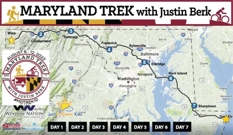
There is a suggestion of a rainy pattern at the end of the week and weekend that you may have seen on your weather app. I am hesitant to trust the modeling that far out. My Maryland Trek begins in one week, so I will be paying close attention to that and the potential impact on our team.
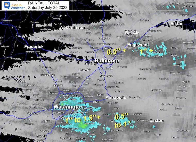
Radar Recap Rainfall
The cluster of heavy rain was found around Washington DC and south of Rt 50 where over an inch fell. There was another cluster of heavier rain in coastal Harford County.
Wind Damage Report
182 reports of wind damage between just Virginia and Maryland.
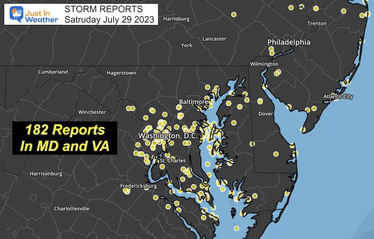
Storm Report
Considering the numerous reports of damage cluttered in and around Washington, DC I wanted to share the report from Capital Weather Gang here.
It looks like National Zoo will be closed due to clean up and there was at least one fatality from falling trees.
Phew! Except for parts of Southern Maryland, we’re out of the woods for storms.
200K customers lost power in DC region w/ winds up to 60-85 mph.
Here’s our storm-wrap article:https://t.co/sVW5fEPgNQ
1/4(Photo by Ian Livington from Cleveland Park) pic.twitter.com/MgMpoibqHZ
— Capital Weather Gang (@capitalweather) July 29, 2023
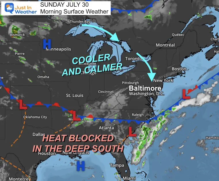
Morning Surface Weather
A fresh air mass is establishing itself across the Eastern US. It is bringing in the cooler breeze this morning and will set up temps near or below average all week.
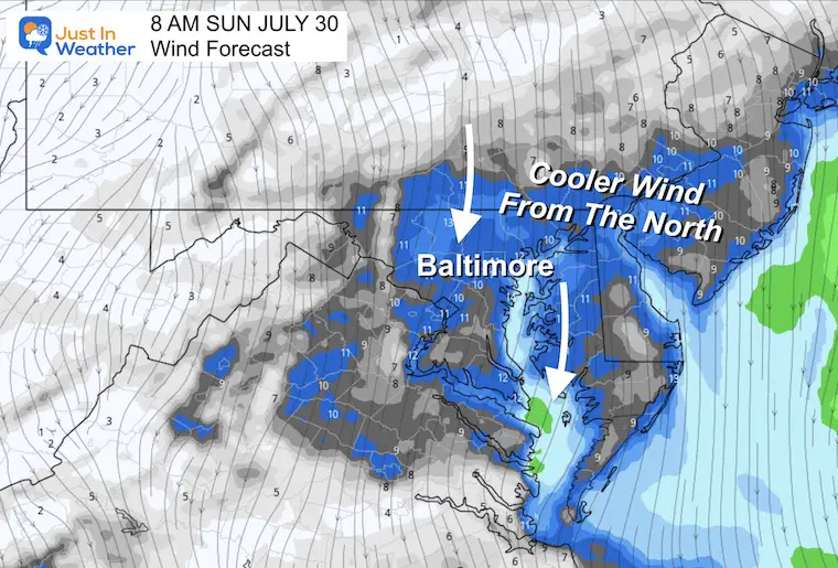
Morning Wind Forecast
A cool breeze this morning from the north at 10 to 20 mph has been helping to bring in the new air mass with cooler air and lower humidity.
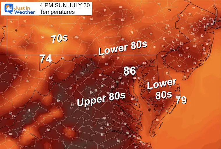
Afternoon Temperatures
Noticeably cooler and closer to average expectations.
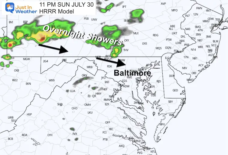
Overnight Showers
11 PM HRRR Model
A disturbance will bring showers and some thunder from western PA into central Maryland after dark. We may begin to see this before midnight.
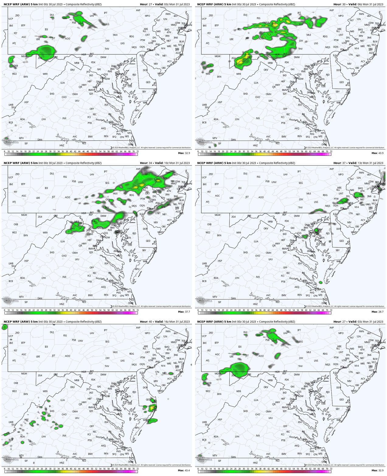
WRF Forecast Radar
11 PM SUN to 8 AM MON
This model is slower to bring the rain in but shows the showers passing through overnight into daybreak.
EXPLORE MORE
2023 Hurricane Season Forecast With An El Niño Watch
Drought Report
Subscribe for eMail Alerts
Weather posts straight to your inbox
Sign up and be the first to know!
CLIMATE DATA
TODAY July 30
Normal Low in Baltimore: 68ºF
Record 55ºF in 2014 (5th record low that month)
Normal High in Baltimore: 88ºF
Record 98ºF 2019
Monday Weather
Calm and pleasant!
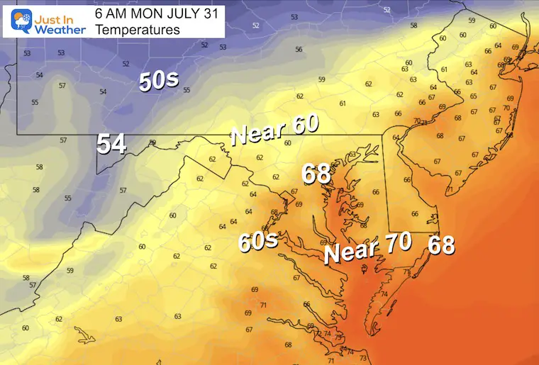
Morning Temperatures
While seasonable upper 60s in metro Baltimore and around the Bay. Look at the cooler 50s inland.
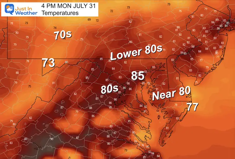
Afternoon Temperatures
Closer to seasonable norms.
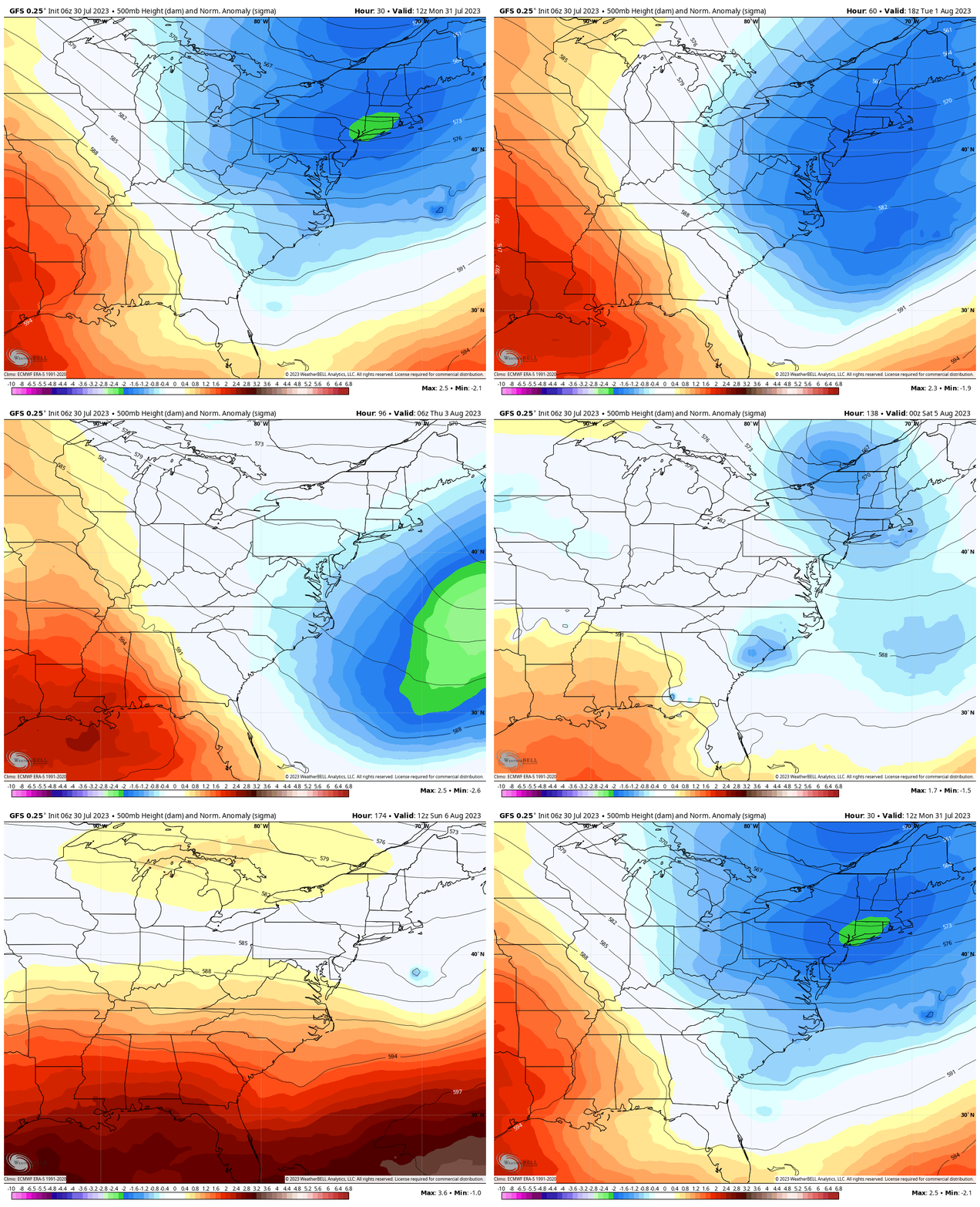
Jet Stream Animation Monday Through Sunday
Cool airflow dominates the week, then may modify as a potential rain system moves in next weekend.
One Week From Today!
The 10th Maryland Trek starts Sunday, August 6. I will be hiking and biking 329 miles with my team during a 7-day stretch to honor kids in cancer treatment. I will be forecasting daily but in a limited scope.
I hope you will consider supporting our mission and holistic programs at Just In Power Kids.
Click on any of these images to see more and support our mission.
100% of the donations go to our programs. I NEVER get a penny and never will!
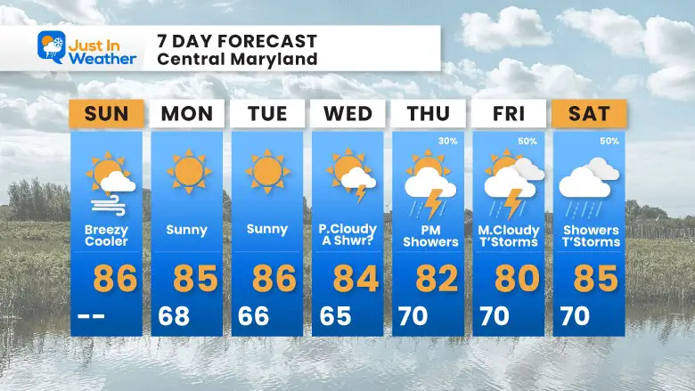
7 Day Forecast
August is going to begin with temperatures near or below average. While much of the week will be quiet, there is a suggestion of a slow-moving storm system next weekend. I have low confidence in computer modeling AND concern for The Maryland Trek that begins next Sunday.
Subscribe for eMail Alerts
Weather posts straight to your inbox
Sign up and be the first to know!
EXPLORE MORE
2023 Hurricane Season Forecast With An El Niño Watch
La Niña Has Ended. El Niño May Return By Fall
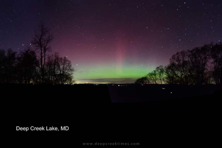
Aurora Photos From Maryland, Delaware, and Virginia
Please share your thoughts, and best weather pics/videos, or just keep in touch via social media
-
Facebook: Justin Berk, Meteorologist
-
Twitter
-
Instagram
RESTATING MY MESSAGE ABOUT DYSLEXIA
I am aware there are some spelling and grammar typos and occasional other glitches. I take responsibility for my mistakes, and even the computer glitches I may miss. I have made a few public statements over the years, but if you are new here you may have missed it: I have dyslexia, and found out during my second year at Cornell University. It didn’t stop me from getting my meteorology degree, and being the first to get the AMS CBM in the Baltimore/Washington region. One of my professors told me that I had made it that far without knowing, and to not let it be a crutch going forward. That was Mark Wysocki and he was absolutely correct! I do miss my mistakes in my own proofreading. The autocorrect spell check on my computer sometimes does an injustice to make it worse. I also can make mistakes in forecasting. No one is perfect predicting the future. All of the maps and information are accurate. The ‘wordy’ stuff can get sticky. There has been no editor that can check my work when I needed it and have it ready to send out in a newsworthy timeline. Barbara Werner is a member of the web team that helps me maintain this site. She has taken it upon herself to edit typos, when she is able. That could be AFTER you read this. I accept this and perhaps proves what you read is really from me… It’s part of my charm.
#FITF


