July 29 Excessive Heat Warning Then Storms Break Pattern Tomorrow
July 29, 2023
Saturday Morning Update
We have two alerts today that will signal the end of this weather pattern. Another Excessive Heat Warning AND NOAA has issued a Slight Risk for Severe Storms.
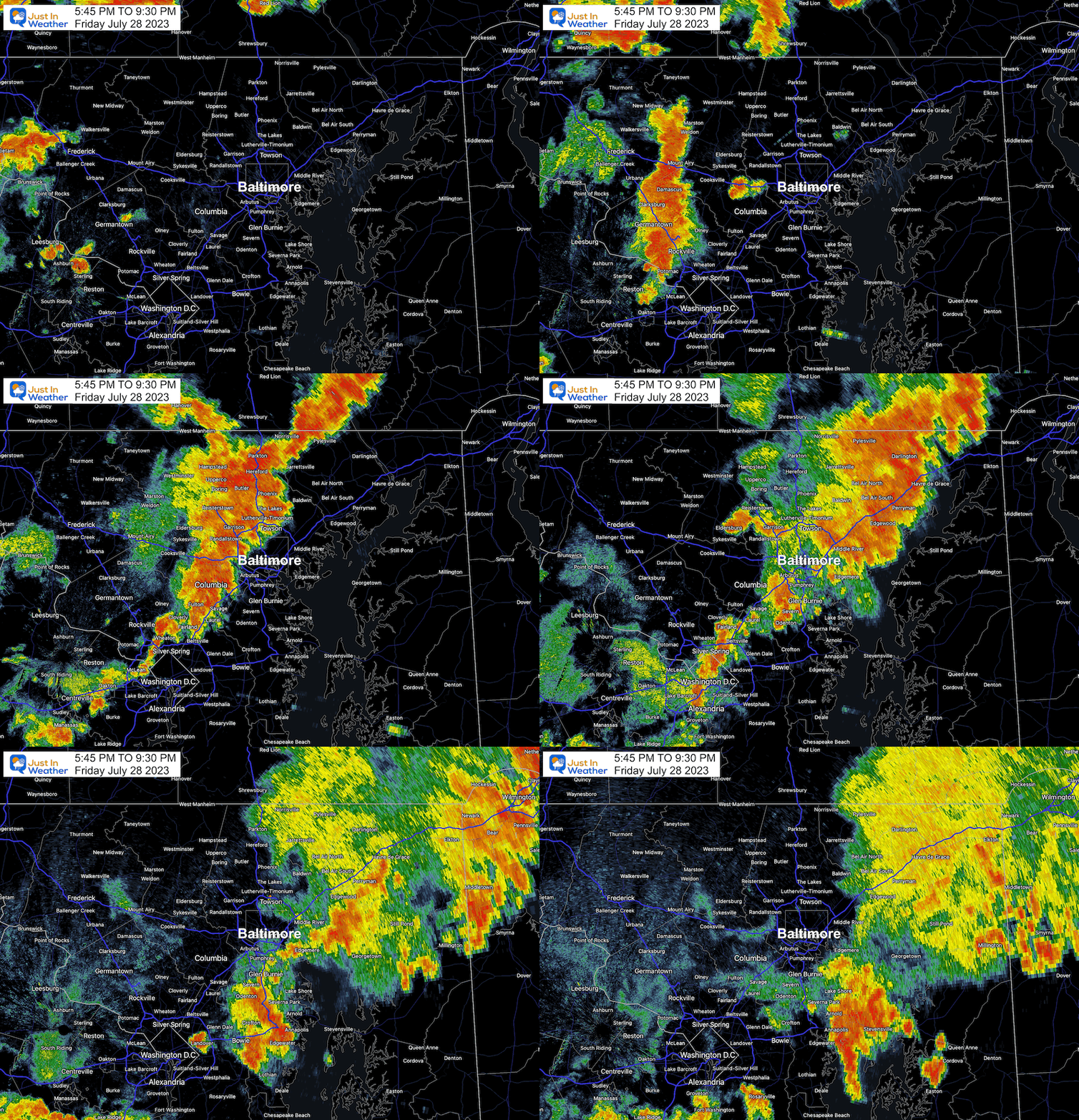
Before we get to that, I want to briefly touch on the storm line last night. We had a low chance of storms, and we see how that turned out. A large strong line of storms blew through central Maryland and led to dozens of wind damage reports. There were some lightning strikes that led to fires and a possible tornado.
Radar Recap: 5:45 PM to 9:30 PM Friday
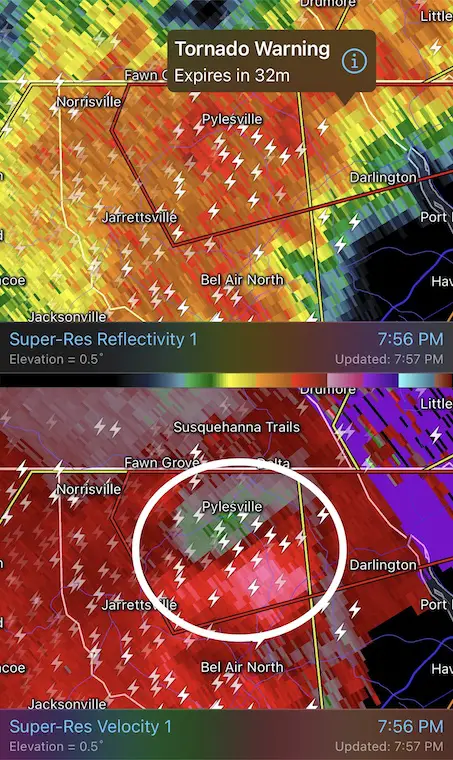
Tornado Warning: Northern Harford County
There is no confirmation yet, but this cell near Pylesville did produce local rain close to 3 inches AND numerous downed trees.
The warning was between 7:52 PM and 8:30 PM
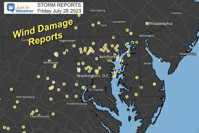
Wind Damage Report
A solid line of severe storms brought winds between 60 and 80 mph. This left a path of destruction in its wake.
Photos
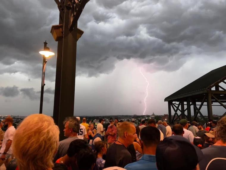
A large crowd in Baltimore waited 2 hours and 32 minutes for the start of the Orioles Game with the visiting Yankees.
Lightning
During the delay, there were many lightning strikes before the first drop of rain. This justified the safety call.
Credit to Doug Drummonds for this photo.
Pic Of The Day
This was the most dramatic display of the storm on the way… Melanie Newman from MASN captured this view that made its way to ESPN.
Weather Alerts
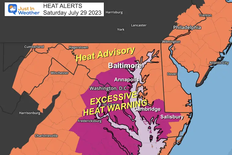
Excessive Heat Warning
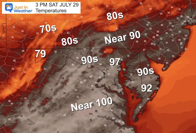
Temperatures appear to max out in the upper 90s for most of our region, with some areas near 100ºF farther inland and across northern Virginia.
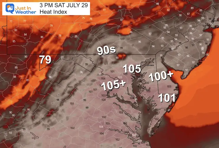
However, the humidity will make it FEEL LIKE over 105ºF where the ‘warning’ is in place.
This includes much of metro Baltimore, Annapolis, Washington, and the lower Eastern Shore of Maryland.
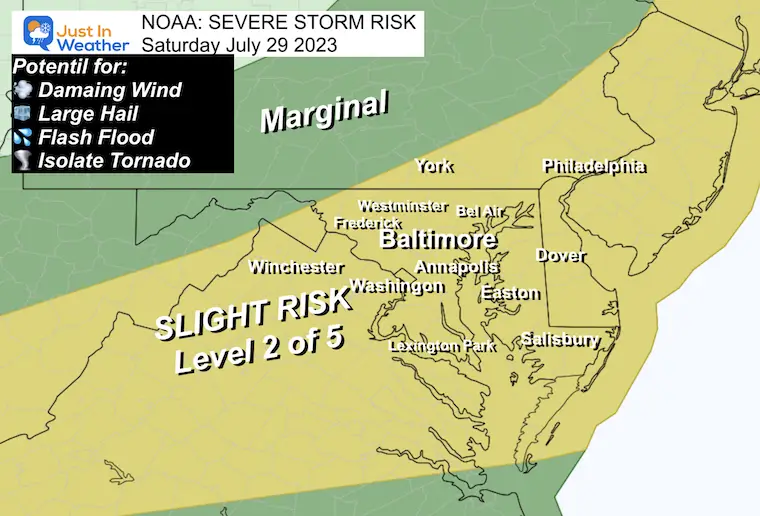
NOAA Severe Storm Risk
The boundary that will bring in a new, cooler air mass may come with a bang! There is the potential once again for storms to produce:
- Winds over 60 mph
- Hail over 1” diameter
- Flash Flooding
- Isolated Tornados
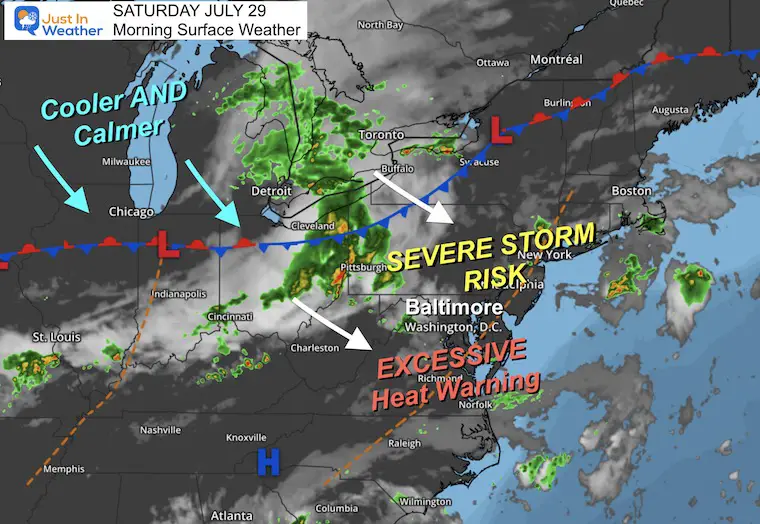
Morning Surface Weather
One last day of excessive heat and mugginess. A strong cold front will spark the potential for severe storms in the afternoon and evening. Much cooler and calmer air on the other side will reach us tomorrow.
Afternoon Temperatures
Last day of the high heat.
Heat Index
The combination of heat and humidity will make it feel like 105ºF or hotter in those areas under the ‘warning’.
Storm Forecast
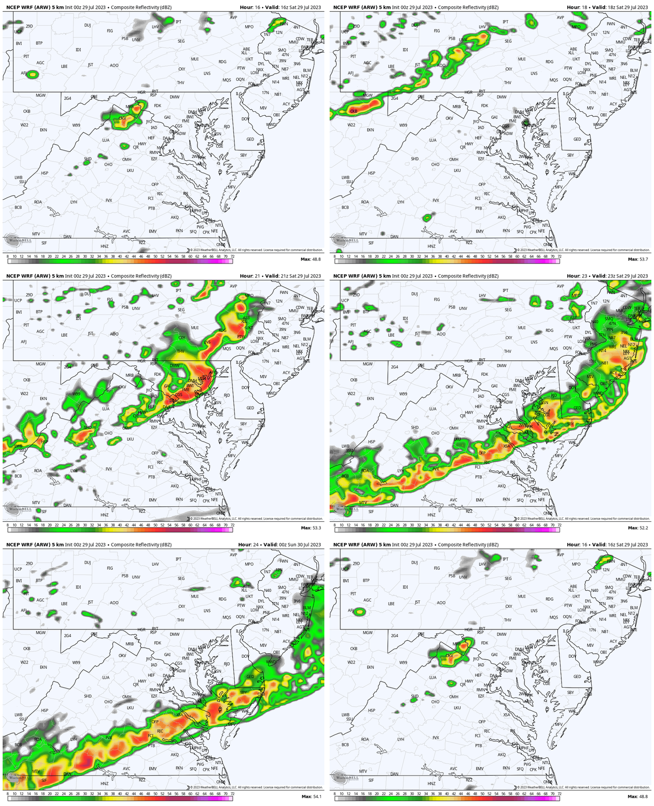
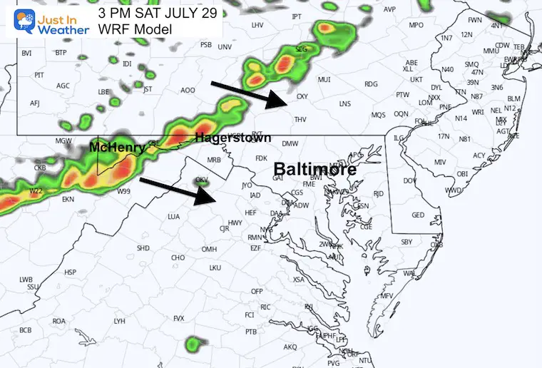
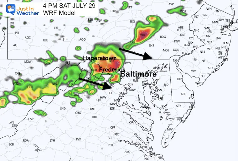
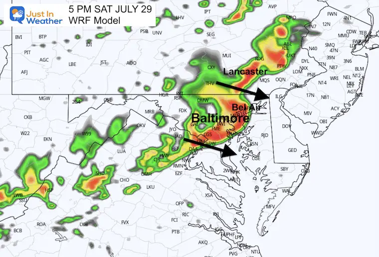
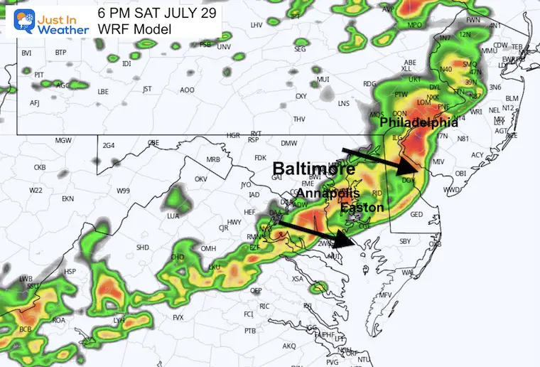
This model plot is the most likely of the short-range modeling but it is still a suggestion. I have noticed recently that we have seen activity more often, so it is worth keeping a close eye on. I have the Live Radar Widget below for comparison.
Plan for the first sightings mid-day, then early afternoon to enter central Maryland… With the line reaching southern Maryland and Beaches before sunset.
WRF Forecast Radar: Noon to 8 PM
Snapshot/Suggestions
3 PM
4 PM
5 PM
6 PM
Live Radar and Lightning Widget
EXPLORE MORE
2023 Hurricane Season Forecast With An El Niño Watch
Drought Report
Subscribe for eMail Alerts
Weather posts straight to your inbox
Sign up and be the first to know!
CLIMATE DATA
TODAY July 29
Normal Low in Baltimore: 68ºF
Record 59ºF in 2014 (3rd record low set that month/year)
Normal High in Baltimore: 88ºF
Record 101ºF 2011
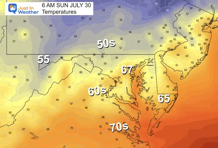
Sunday Weather
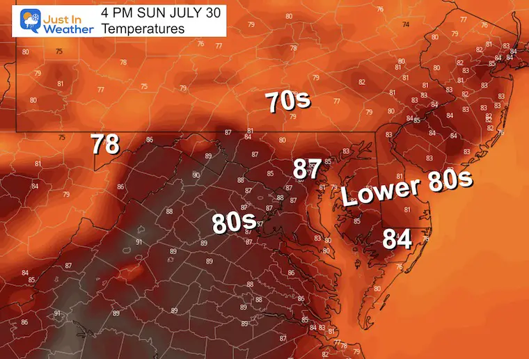
Noticeably cooler.
Morning Temperatures
Afternoon Temperatures
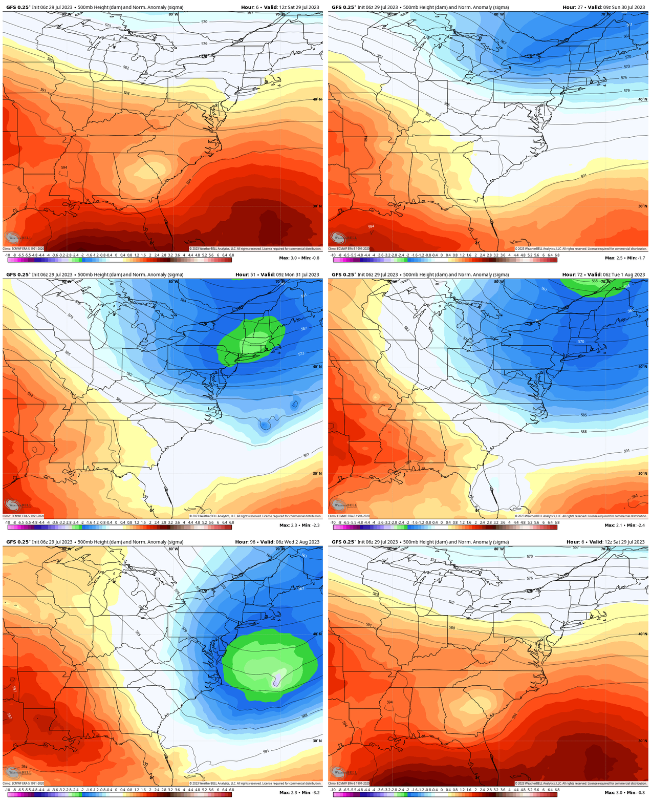
Jet Stream Animation Through Wednesday
A shift in air flow brings in a cooler air mass from Canada and sets up a new pattern next week… bringing an end to the excessive heat in the east.
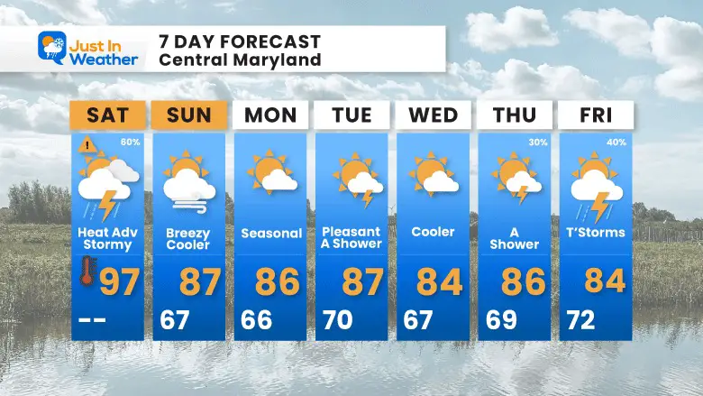
7 Day Forecast
A noticeable change to the weather pattern as temps are more likely to remain in the 80s each afternoon starting tomorrow.
Subscribe for eMail Alerts
Weather posts straight to your inbox
Sign up and be the first to know!
EXPLORE MORE
2023 Hurricane Season Forecast With An El Niño Watch
La Niña Has Ended. El Niño May Return By Fall
Aurora Photos From Maryland, Delaware, and Virginia
Please share your thoughts, and best weather pics/videos, or just keep in touch via social media
-
Facebook: Justin Berk, Meteorologist
-
Twitter
-
Instagram
RESTATING MY MESSAGE ABOUT DYSLEXIA
I am aware there are some spelling and grammar typos and occasional other glitches. I take responsibility for my mistakes, and even the computer glitches I may miss. I have made a few public statements over the years, but if you are new here you may have missed it: I have dyslexia, and found out during my second year at Cornell University. It didn’t stop me from getting my meteorology degree, and being the first to get the AMS CBM in the Baltimore/Washington region. One of my professors told me that I had made it that far without knowing, and to not let it be a crutch going forward. That was Mark Wysocki and he was absolutely correct! I do miss my mistakes in my own proofreading. The autocorrect spell check on my computer sometimes does an injustice to make it worse. I also can make mistakes in forecasting. No one is perfect predicting the future. All of the maps and information are accurate. The ‘wordy’ stuff can get sticky. There has been no editor that can check my work when I needed it and have it ready to send out in a newsworthy timeline. Barbara Werner is a member of the web team that helps me maintain this site. She has taken it upon herself to edit typos, when she is able. That could be AFTER you read this. I accept this and perhaps proves what you read is really from me… It’s part of my charm.
#FITF


