Tuesday Afternoon Severe Thunderstorm Warning Tracking
June 27, 2023
Tuesday Afternoon Update
More thunderstorms will develop today as a cold front is crossing the region. There is less heat than yesterday, so there is a lower potential for high-intensity events. However, more of the area may get in on some needed rain and storms worth respecting.
Any storm can produce dangerous lightning. But some of these may have strong winds of 50 to 60 mph, large hail, and an isolated tornado.
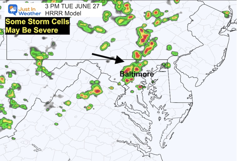
The radar simulation below suggests after 3 PM to watch in Central Maryland South Southern PA. Compare the forecast maps to the Live Radar.
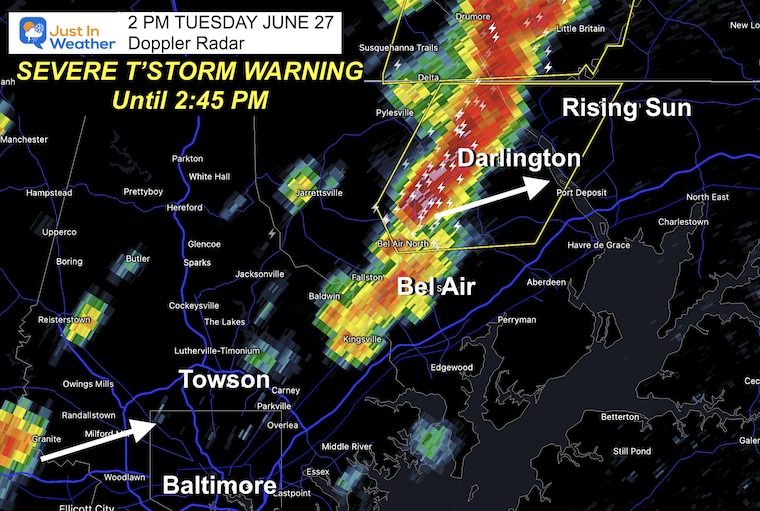
At 2 PM, some Severe Thunderstorm Warnings have been issued. This is already exceeding the short-range forecast models.
Severe Thunderstorm Warning
Until 2:45 PM to include parts of Harford and Cecil counties in Maryland.
Winds may reach 60 mph in addition to locally heavy downpours and frequent lightning.
IMPACT…Damaging winds will cause some trees and large branches to fall. This could injure those outdoors, as well as damage homes and vehicles. Roadways may become blocked by
downed trees. Localized power outages are possible. Unsecured light objects may become projectiles.
* Locations impacted include…
Bel Air South, Bel Air North, Rising Sun, Richardsmere, Octoraro,
Conowingo, Rock Springs, Darlington, Churchville, Scarboro, Forest
Hill, Bynum and Hickory.
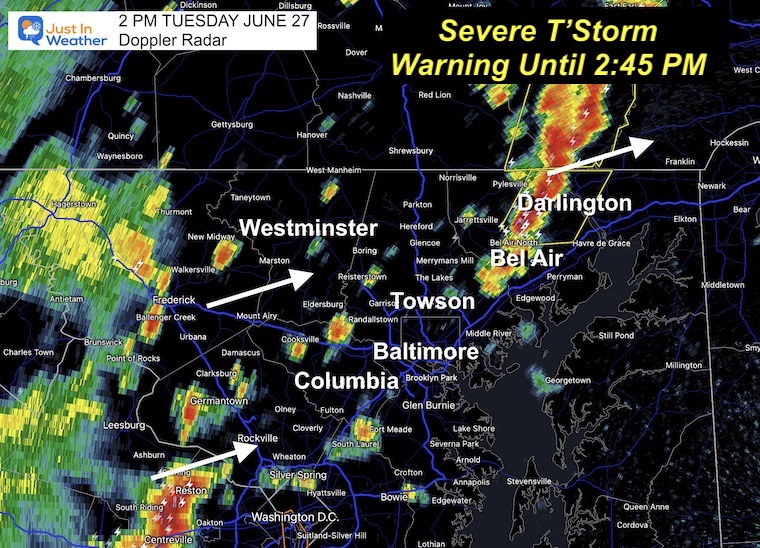
Wider View
This is much more activity than the modeling shown below. It will be a busy afternoon across central Maryland, Pennsylvania, and Delaware.
New cells popping up are moving to the East/Northeast.
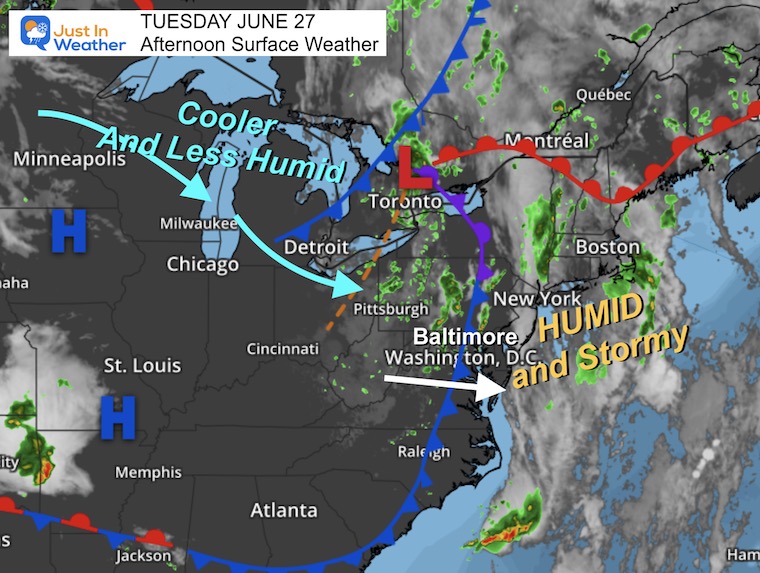
Afternoon Surface Weather
A strong cold front is moving through, and there is enough instability aloft to trigger more storms that can turn severe during the afternoon and evening.
Much calmer weather is on the way tomorrow.
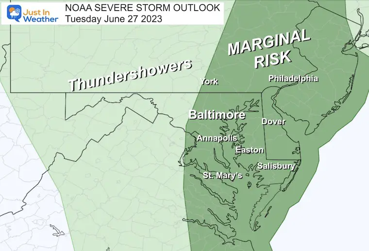
NOAA Severe Storm Outlook
This is Marginal from Central Maryland to the coast, which is a low-level threat. But a couple of storm cells could reach the threshold.
Storm Parameters
- Flash Flooding
- Dangerous Lightning
- Wind Gusts over 60 mph
- Large Hail to Quarter Size
- Isolated Tornado
Live Radar and Lightning
Use the controls to pan, zoom, and animate.
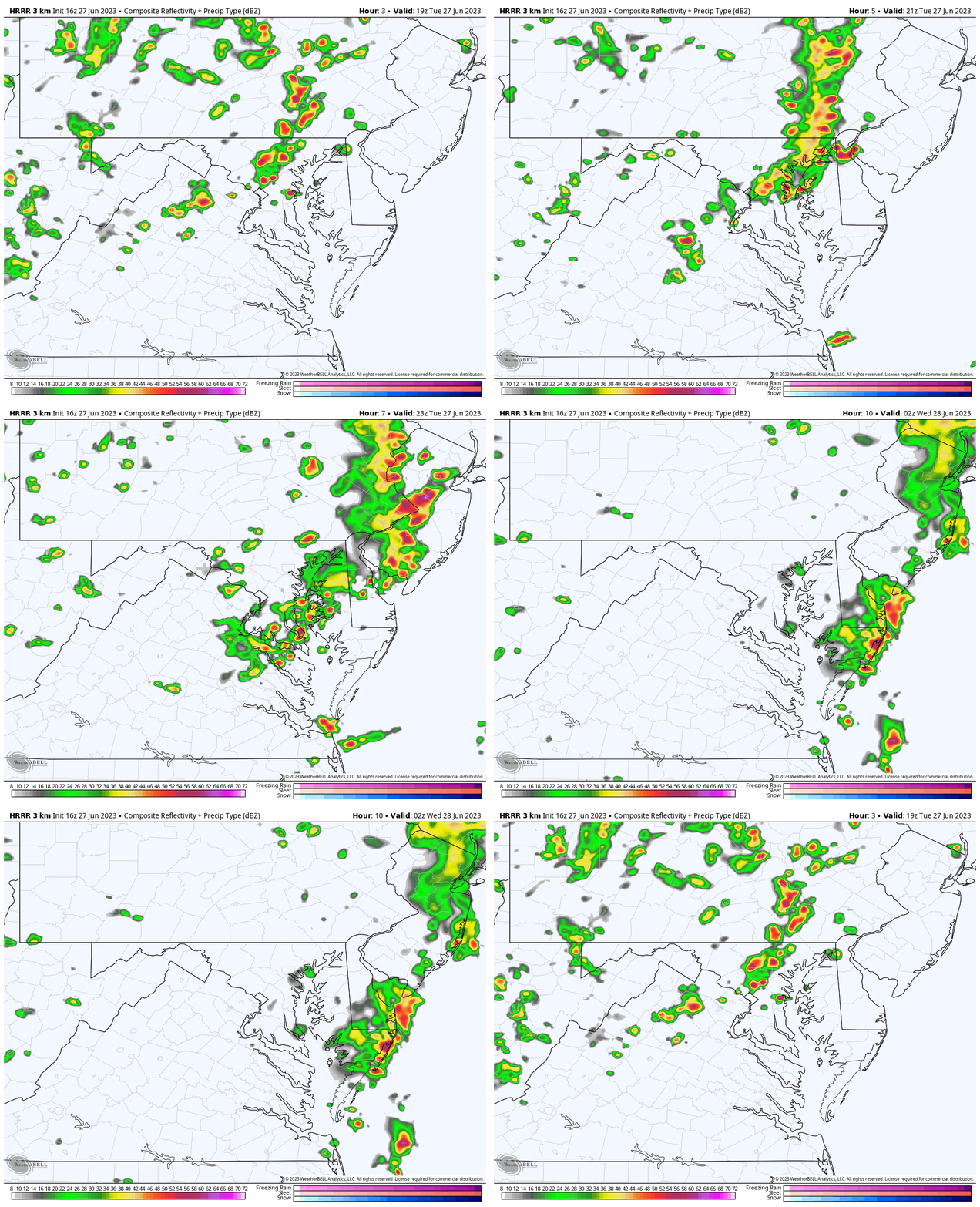
Radar Simulation: HRRR Model 3 PM to 10 PM
This product is a suggestion and NOT perfect. Use this with the live radar to see how the afternoon is progressing.
Snapshot 3 PM
The development of storms across the inland suburbs may affect Frederick, Carroll, and Howard Counties in Maryland.
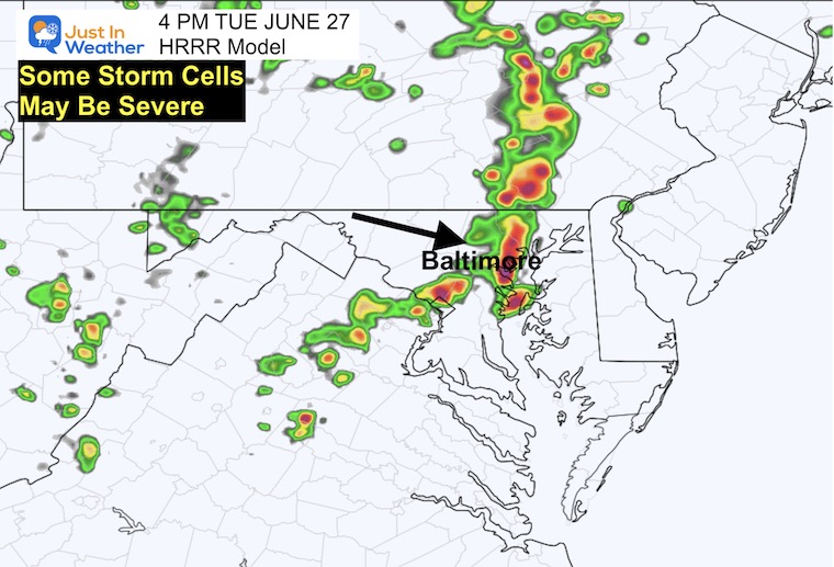
Snapshot 4 PM
The highest risk for severe weather in metro Baltimore will be within an hour of 4 PM.
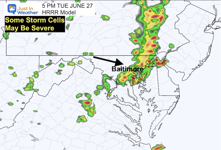
Snapshot 5 PM
Metro Baltimore, Annapolis, up towards Bel Air in the mix.
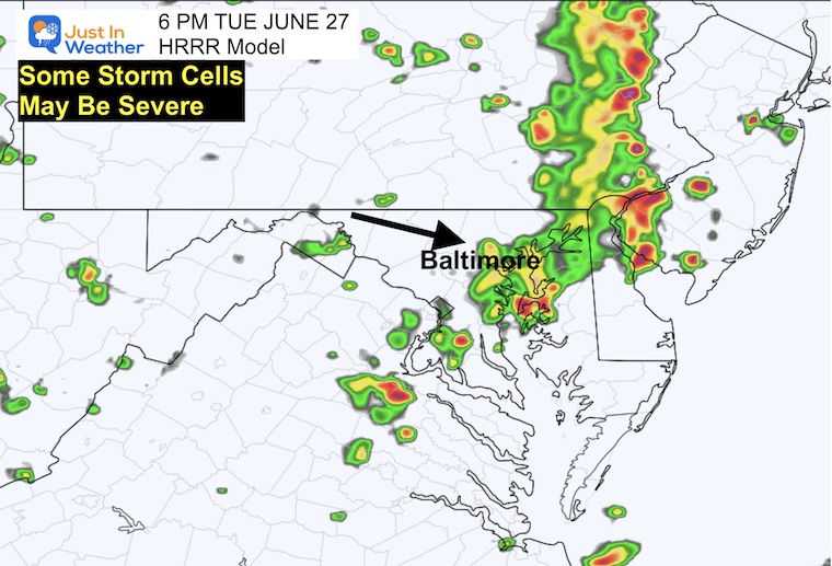
Snapshot 6 PM
The threat shifts to Kent Island and Northeastern Maryland up north on I-95.
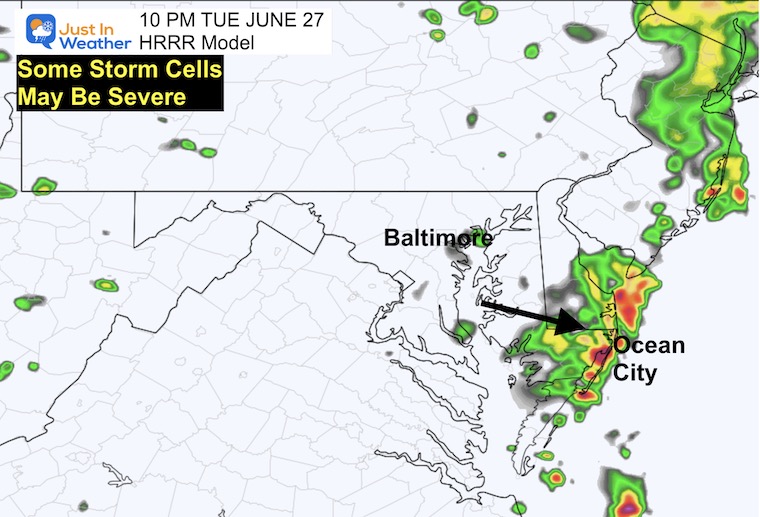
Snapshot 10 PM
The storm risk will reach the beaches between 9 PM and 10 PM.
CLIMATE DATA
TODAY June 27
Normal Low in Baltimore: 66ºF
Record 50ºF in 1979
Normal High in Baltimore: 88ºF
Record 100ºF 2010
Wednesday Weather
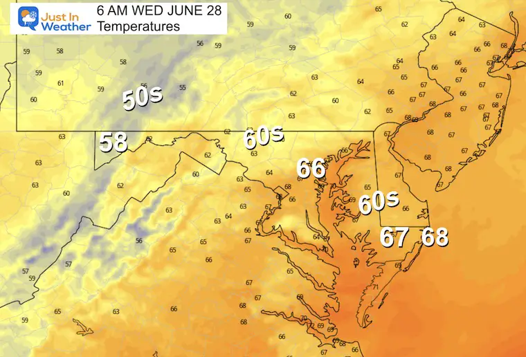
Morning Temperatures
Still warm and humid.
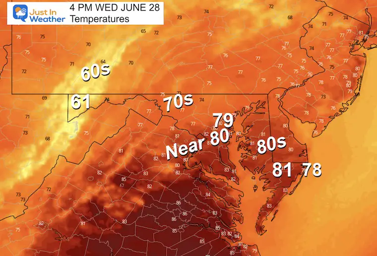
Afternoon Temperatures
Cooler, with a breeze and drop in humidity.
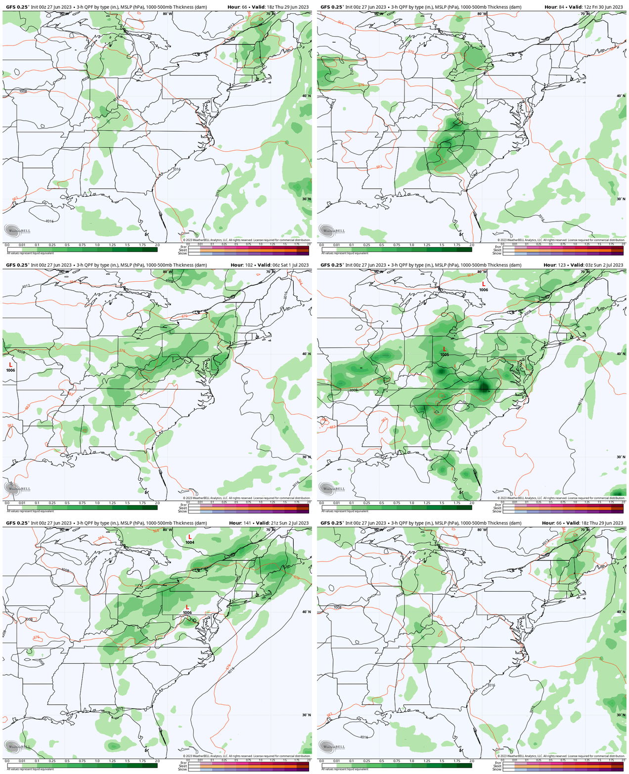
Rain Forecast Thursday to Sunday
The return of rain and storms on Friday afternoon, then more likely over the weekend. These will mainly be in the afternoon and evenings.
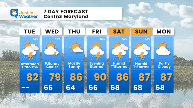
7 Day Forecast
This pattern will break for a few days. When you look at this graphic and think of your plans… YES there is a greater risk of weekend storms. However, they will be mainly later in the day. Those days will also have plenty of dry hours to be outside.
Subscribe for eMail Alerts
Weather posts straight to your inbox
Sign up and be the first to know!
EXPLORE MORE
2023 Hurricane Season Forecast With An El Niño Watch
La Niña Has Ended. El Niño May Return By Fall
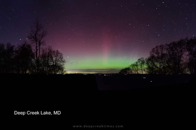
Aurora Photos From Maryland, Delaware, and Virginia
Please share your thoughts, and best weather pics/videos, or just keep in touch via social media
-
Facebook: Justin Berk, Meteorologist
-
Twitter
-
Instagram
RESTATING MY MESSAGE ABOUT DYSLEXIA
I am aware there are some spelling and grammar typos, and occasional other glitches. I take responsibility for my mistakes, and even the computer glitches I may miss. I have made a few public statements over the years, but if you are new here you may have missed it: I have dyslexia, and found out during my second year at Cornell University. It didn’t stop me from getting my meteorology degree, and being first to get the AMS CBM in the Baltimore/Washington region. One of my professors told me that I had made it that far without knowing, and to not let it be a crutch going forward. That was Mark Wysocki and he was absolutely correct! I do miss my mistakes in my own proofreading. The autocorrect spell check on my computer sometimes does an injustice to make it worse. I also can make mistakes in forecasting. No one is perfect predicting the future. All of the maps and information are accurate. The ‘wordy’ stuff can get sticky. There has been no editor that can check my work when I needed it and have it ready to send out in a newsworthy timeline. Barbara Werner is a member of the web team that helps me maintain this site. She has taken it upon herself to edit typos, when she is able. That could be AFTER you read this. I accept this and perhaps proves what you read is really from me… It’s part of my charm.
#FITF


