June 22 Cool Day Warming With More Rain And TS Bret Update
June 22, 2023
Thursday Morning Update
Yesterday was quite the surprise to many as summer began, but after getting to nearly 70ºF, temperatures dropped into the mid and lower 60s during the afternoon. The rain was persistent and BWI measured 0.34” to represent much of the region. Some spots on Delmarva did get over 1 inch. More rain is on the way for days.
Today, we begin with a few showers. It will remain cool and damp, but the rain should break during much of the daylight hours. However, the next wave of steady rain will be tonight. This is a suggestion to follow for most of the next week. While we may have more rain during the day tomorrow, the weekend and next week will turn humid with most rain and storms pulsing during the afternoons and evenings.
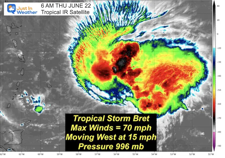
Also below, is the quick update on Tropical Storm Bret that has winds up to 70 mph, but may have maxed out. The National Hurricane Center keeps this status, but there is one Hurricane Watch issued for the potential for it to get a little stronger.
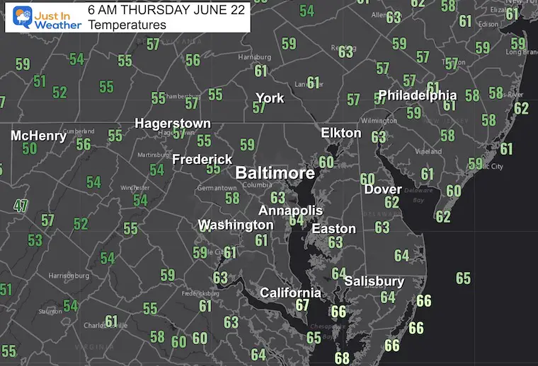
Morning Temperatures
This is quite chilly for the first morning of summer. These are similar to temps late yesterday and will be slow to rise today. Many areas will stay close to 20 degrees BELOW average today.
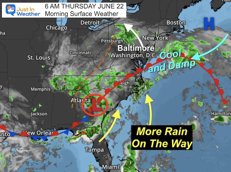
Morning Surface Weather
We continue to be under the influence of cool winds from the Northeast around High Pressure. The storm/Low Pressure in Georgia will shift north and pump in a wind shift by tonight and tomorrow. This will bring in more moisture making it feel more humid as we warm up. The result will bring in rain tonight and Friday, followed by days with mainly afternoon and evening thunderstorms.
Live Radar Widget
Use the controls to pan or zoom the map.
Rain Forecast Simulation
Animation 8 AM to 8 PM
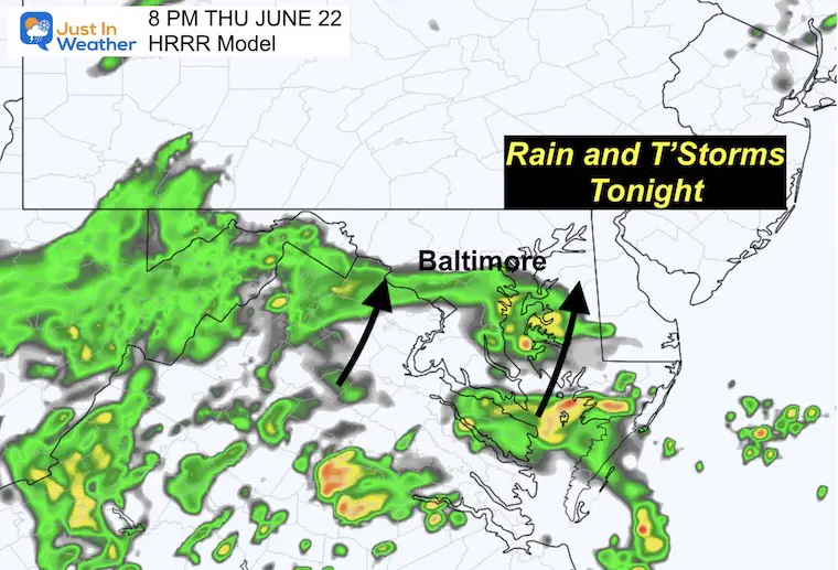
There may be some spotty showers or drizzle at times, but the steady rain will return from the south this evening and tonight.
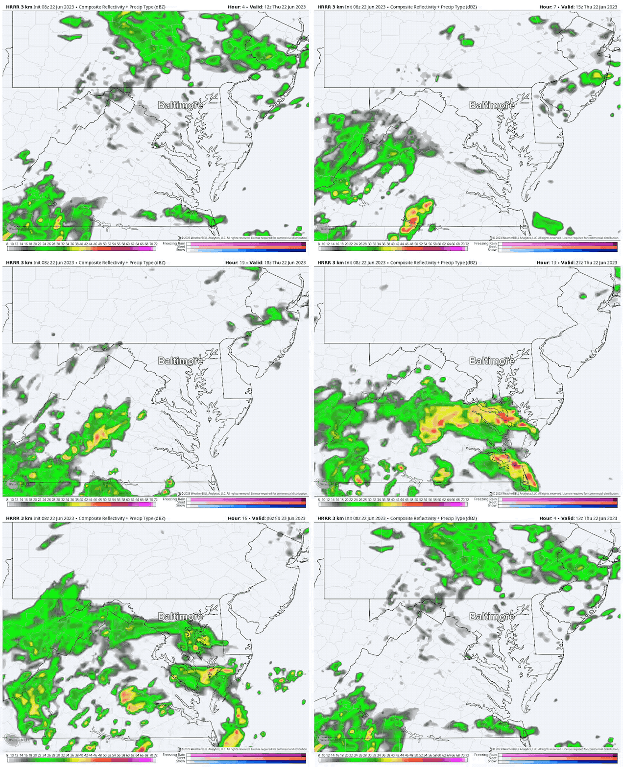
8 PM Snapshot
Tracking the band of rain arriving from the south by sunset into central Maryland and continuing overnight.
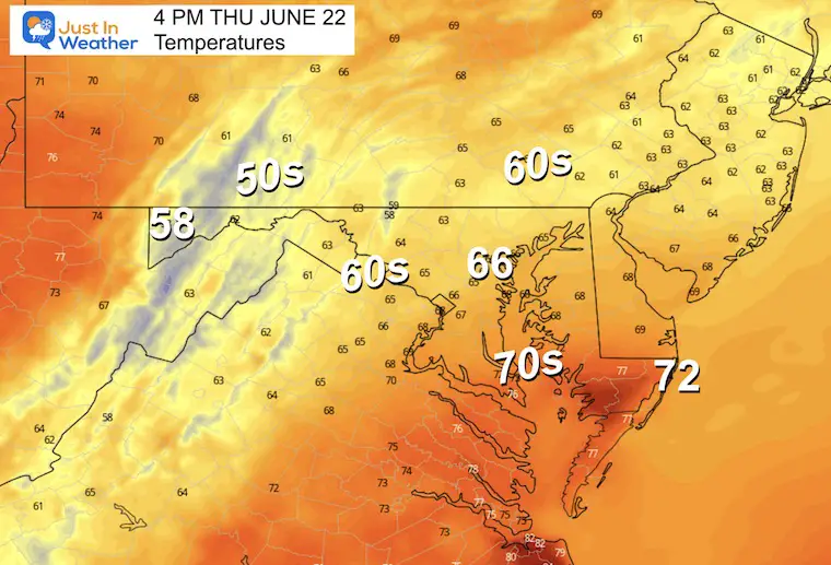
4 PM Temperatures
Remaining chilly, damp, and humid.
Tropical Storm Bret
IR Satellite Loop
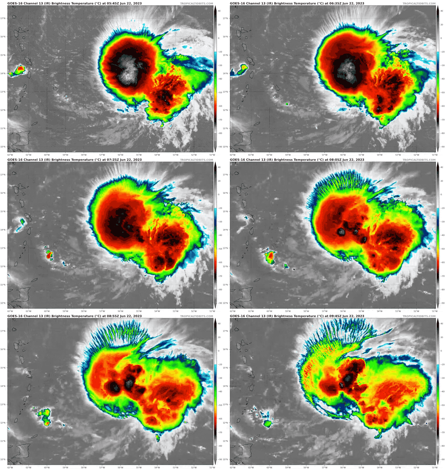
Snapshot
Winds are at the top of the Tropical Storm scale at 70 mph. The wind field extends 115 miles from the center, so it has grown larger.
5 AM Thu June 22 Update From The National Hurricane Center
- LOCATION…13.7N 56.6W
- ABOUT 200 MI…320 KM E OF BARBADOS
- MAXIMUM SUSTAINED WINDS…70 MPH…110 KM/H
- PRESENT MOVEMENT…W OR 280 DEGREES AT 15 MPH…24 KM/H
- MINIMUM CENTRAL PRESSURE…996 MB…29.42 INCHES
National Hurricane Center Forecast Map
This continues to move West but is encountering wind shear. So it is expected to remain a Tropical Storm.
SUMMARY OF WATCHES AND WARNINGS IN EFFECT:
A Hurricane Watch is in effect for…
* St. Lucia
This is for the potential to overachieve even though NHC does not forecast it to become a hurricane.
A Tropical Storm Warning is in effect for…
* Dominica
* St. Lucia
* Martinique
A Tropical Storm Watch is in effect for...
* Barbados
* St. Vincent and the Grenadines
EXPLORE MORE
2023 Hurricane Season Forecast With An El Niño Watch
Drought Watch Updated June 15
Subscribe for eMail Alerts
Weather posts straight to your inbox
Sign up and be the first to know!
CLIMATE DATA
TODAY June 22
Normal Low in Baltimore: 65ºF
Record 46ºF in 1992
Normal High in Baltimore: 87ºF
Record 100ºF 1988
Friday Weather
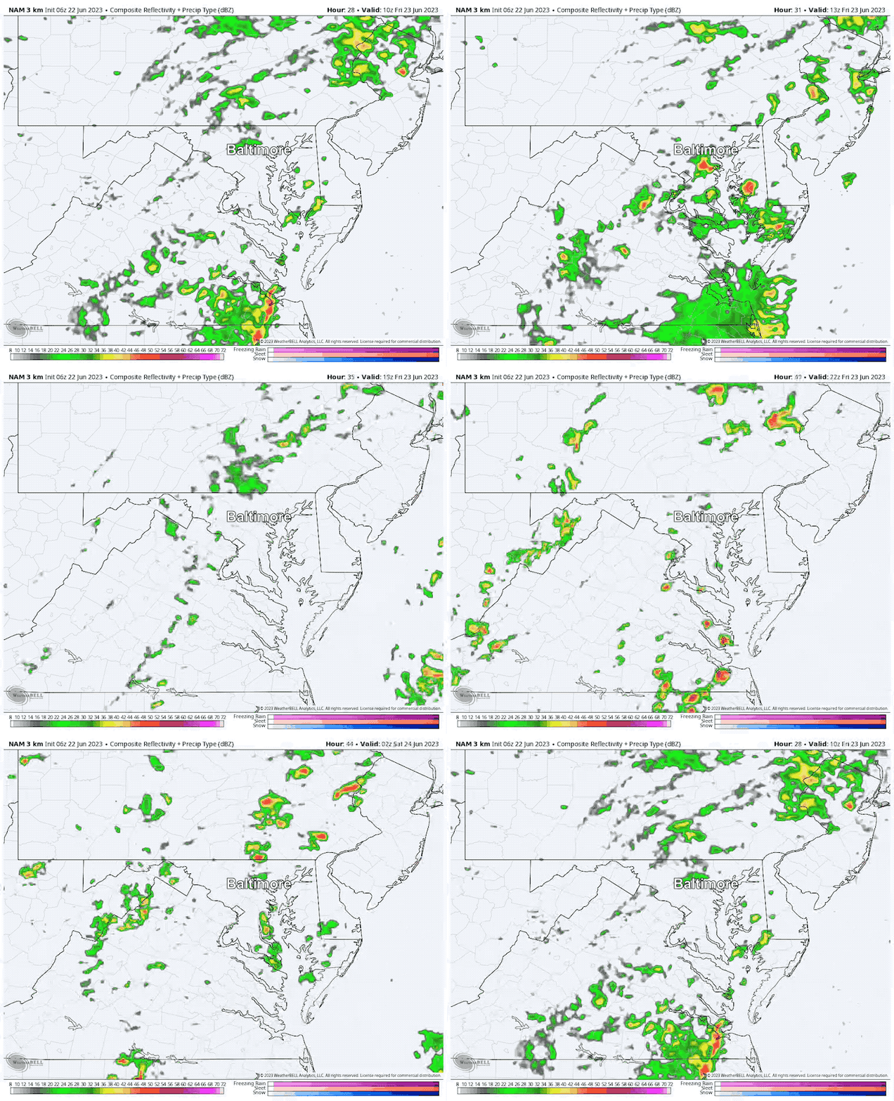
Radar Simulation 6 AM to 10 PM
There will be more daytime rain tomorrow than today. But the best expectation is for periodic showers, not a full washout! So it is impossible to lock in on one location and time. Just have a plan B for indoors.
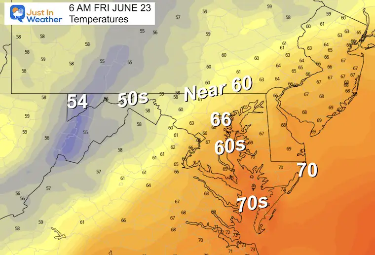
Morning Temperatures
Similar numbers to the afternoon today.
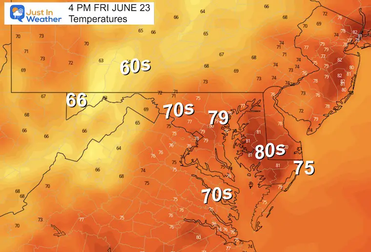
Afternoon Temperatures
Warmer and more humid, but still below average.
LOOKING AHEAD
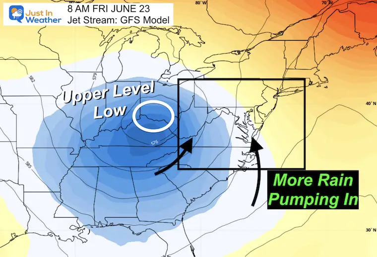
Jet Stream Snapshot
The large Upper-Level Low in the Ohio Valley will be dominating the flow, continuing to pump in moisture from the South and Southeast. This is what will make us warmer and more humid through the weekend.
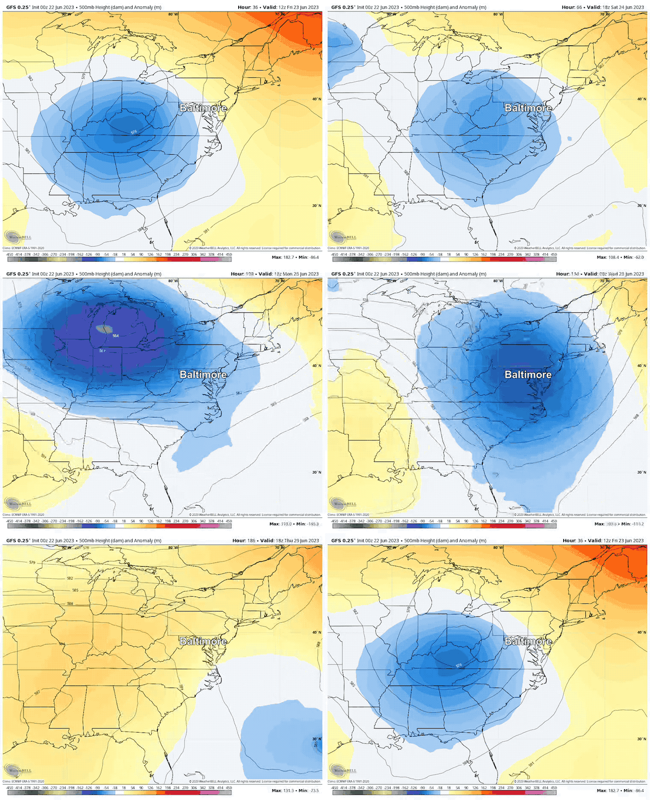
Jet Stream Animation: Friday through Next Thursday
A reinforcing push of instability will arrive from The Great Lakes early next week. This will keep us in the risk of rain each day through Wednesday, then a chance to break the cycle and dry out later next week.
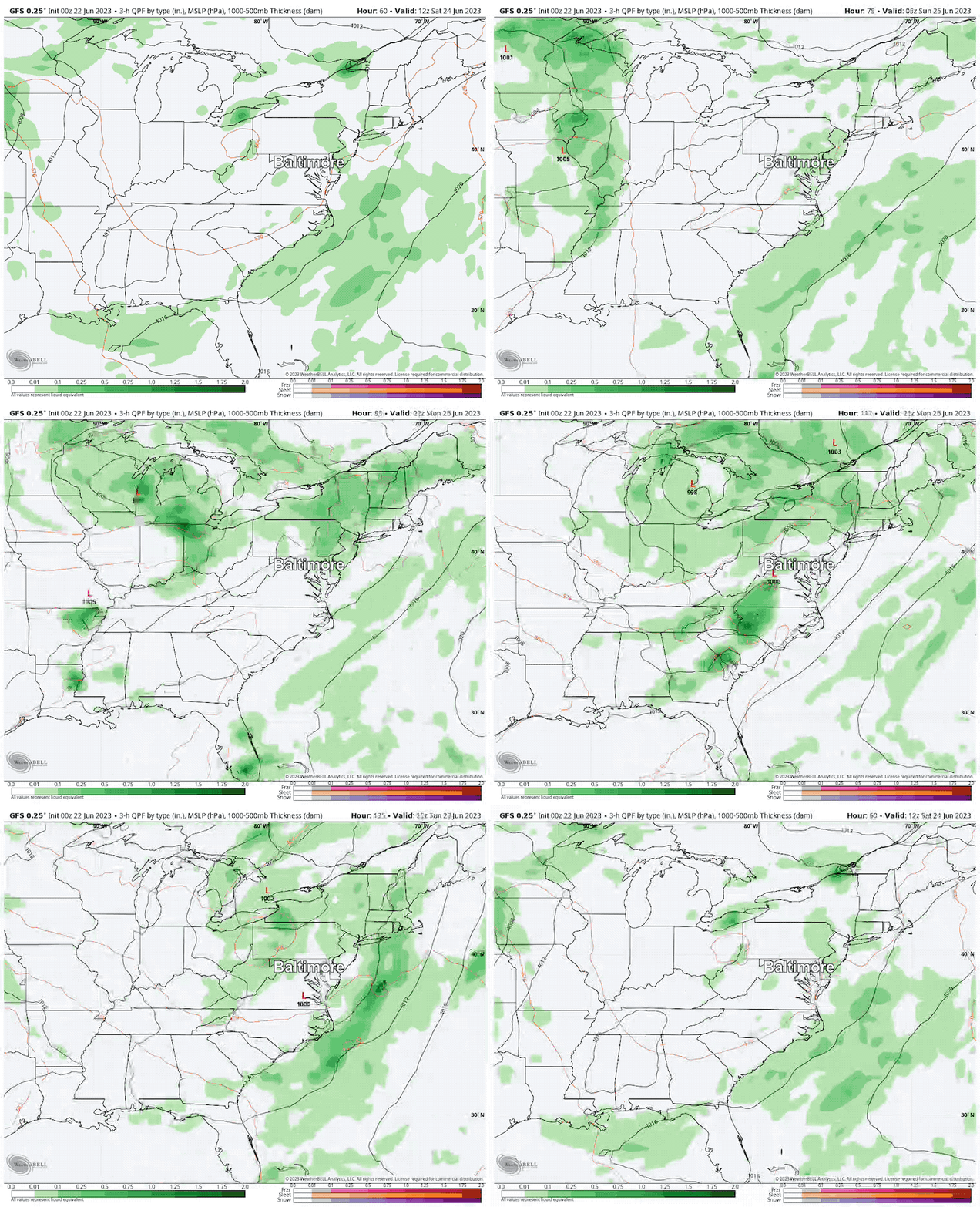
Rain Forecast Saturday Through Tuesday
It looks wet AND I know this moves fast. I am showing this for the purpose of watching the pattern. Rain and storms will pulse each afternoon and evening with daily heating. Then settle down overnight and mornings.
NOT all-day washouts, but a risk for rain with a more humid feel to the air each day.
Rain Potential:
I am not showing this graphic because the amount of rain will truly depend on the individual tracks of storm cells. Some local downpours can produce up to 1 inch at a time, but overall we still have the potential for 2 to 3 inches of rain through next week.
7 Day Forecast
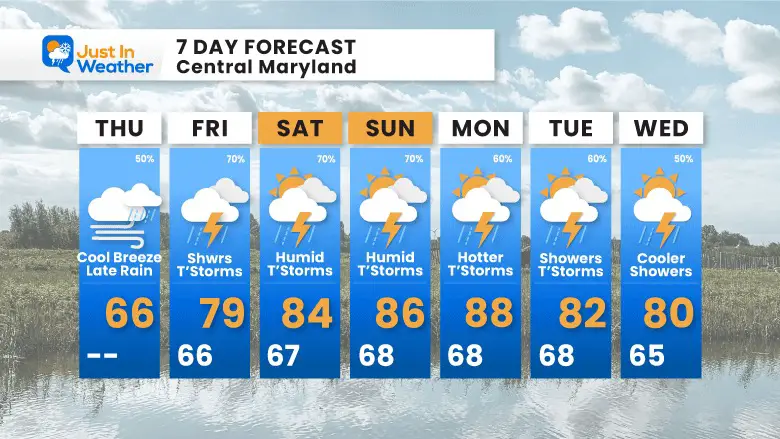
We will warm back up and turn quite muggy/humid this weekend. The risk of rain almost every day does not mean all-day washouts.
I cannot suggest how to prepare for your plans. This pattern will mean mostly afternoon and evening storms, but they will be scattered. I do not trust any model to be precise with tracking the location of storm cells that far away.
Again, please just have a plan B for indoor options of your plans.
Subscribe for eMail Alerts
Weather posts straight to your inbox
Sign up and be the first to know!
EXPLORE MORE
2023 Hurricane Season Forecast With An El Niño Watch
La Niña Has Ended. El Niño May Return By Fall
Aurora Photos From Maryland, Delaware, and Virginia
Please share your thoughts, and best weather pics/videos, or just keep in touch via social media
-
Facebook: Justin Berk, Meteorologist
-
Twitter
-
Instagram
RESTATING MY MESSAGE ABOUT DYSLEXIA
I am aware there are some spelling and grammar typos, and occasional other glitches. I take responsibility for my mistakes, and even the computer glitches I may miss. I have made a few public statements over the years, but if you are new here you may have missed it: I have dyslexia, and found out during my second year at Cornell University. It didn’t stop me from getting my meteorology degree, and being first to get the AMS CBM in the Baltimore/Washington region. One of my professors told me that I had made it that far without knowing, and to not let it be a crutch going forward. That was Mark Wysocki and he was absolutely correct! I do miss my mistakes in my own proofreading. The autocorrect spell check on my computer sometimes does an injustice to make it worse. I also can make mistakes in forecasting. No one is perfect predicting the future. All of the maps and information are accurate. The ‘wordy’ stuff can get sticky. There has been no editor that can check my work when I needed it and have it ready to send out in a newsworthy timeline. Barbara Werner is a member of the web team that helps me maintain this site. She has taken it upon herself to edit typos, when she is able. That could be AFTER you read this. I accept this and perhaps proves what you read is really from me… It’s part of my charm.
#FITF


