


May 10 Chilly With More Rain Showers Today And Into Mothers Day Weekend
Friday May 10 Morning Report Today is the second day of the year, with sunrise before 6 AM in Baltimore, but like yesterday, we won’t see it. After a high…
Monday Afternoon, June 12
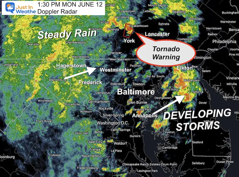
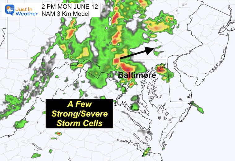
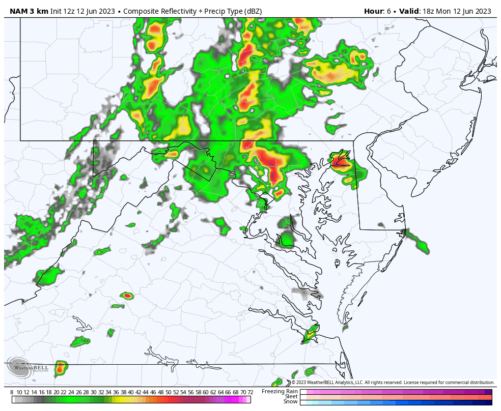
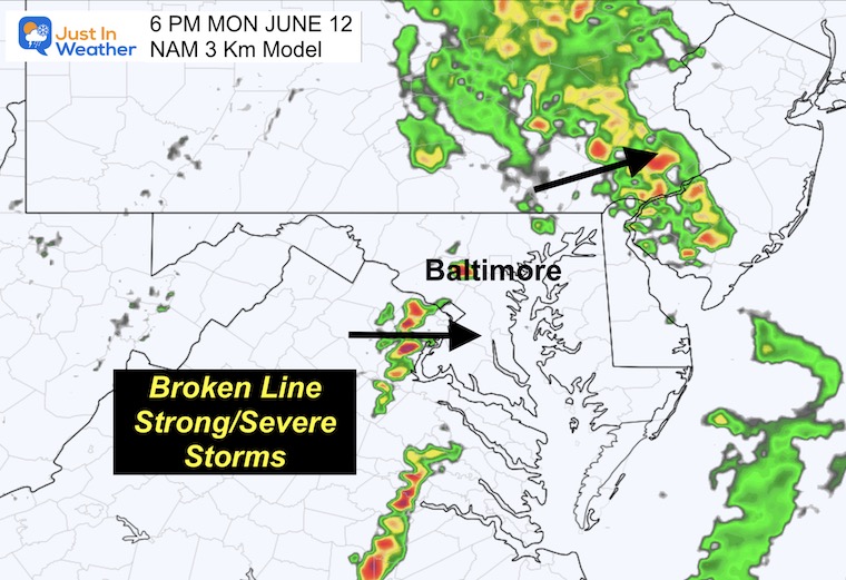
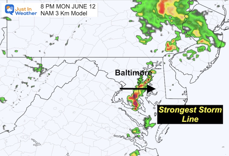
I want to start off by saying that the observed rain is more active on the radar than the short-range model simulations. I have two to compare because it has been so long since we have had a stormy day. There are different solutions for timing and plotting storm cells. So if nothing else, we can compare to the live radar and see which is performing better.
At 1 PM, Doppler Radar showed the Tornado Warning in north-central York County in PA. This was moving north at around 30 mph. It was located along I-83 between mile markers 25 to 34. Including the towns of Manchester, Goldsboro, and Newberrytown.
While this may expire by the time you read this, it is important to note more are possible and the direction they may be traveling (to the North).
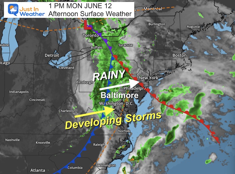
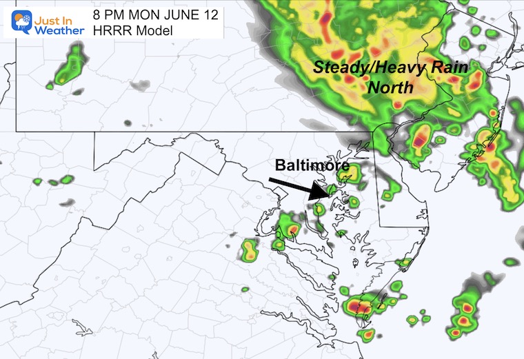
Low Pressure and the core of the steady rain is mainly north in Pennsylvania and New York. However, there has been a wide shield of rain in western Maryland. That is the part that is more impressive than the models have shown. This suggests we really do have a good chance for most areas to get above the 1/2″ rain mark.
A storm is considered severe when winds are over 58 mph, hail is larger than 1 inch diameter, flash flooding, or isolated tornados.
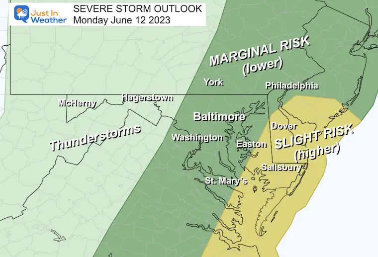
The reason for the increased severe storm risk on Delmarva has been due to the warmer temperatures, where they have reached the 80s.
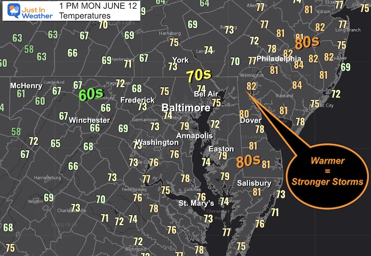
Where the rain has been falling, temps have dropped into the 60s. The transition through the 70s is what most metro areas will experience this afternoon.
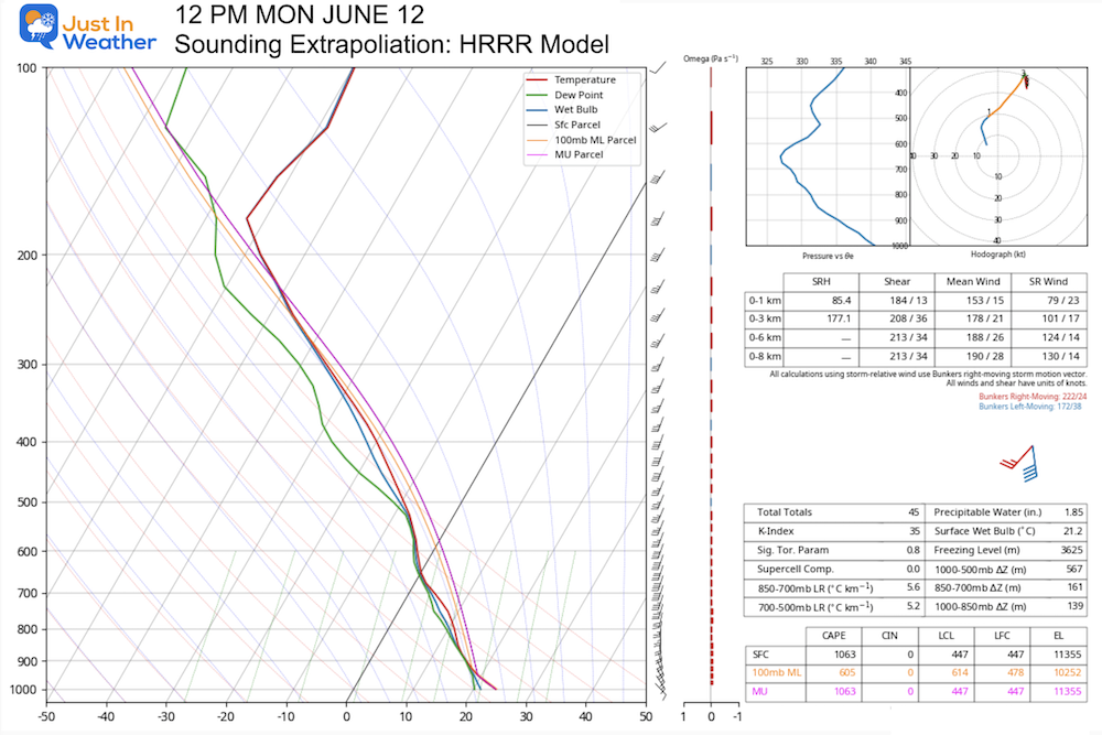
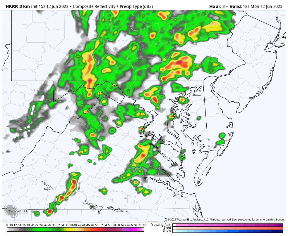
This is a product of the weather balloon launch this morning and was updated by the HRRR Model at Noon.
This may be hard to view, so I will point out some key factors.
The K-Index = 35 which is solid for thunderstorms.
The tornado parameter was 0.8, which is not very suggestive. More of the risk will be north and east of Baltimore.
Precipitable Water = 1.85”. That is the MOST we could squeeze out of a strong storm. I think it is safer to expect between 0.50” and 1.00” rain, with some locally higher amounts.
Some storms can produce flash flooding.
Freezing Level = 3,625 meters. That is is around 10,800 Ft meaning the chance for hail will not take much force. Large hail between pea and quarter size is possible in stronger storm cells.
At this time there was a tornado warning in York County PA.
Please compare this to the Live Radar at the bottom of this section.
The image above is already much more impressive than this forecast plot. So we can infer that we will continue to get more rain and storms than shown here.
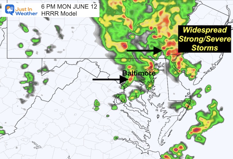
This is simply a suggestion for activity and timing.
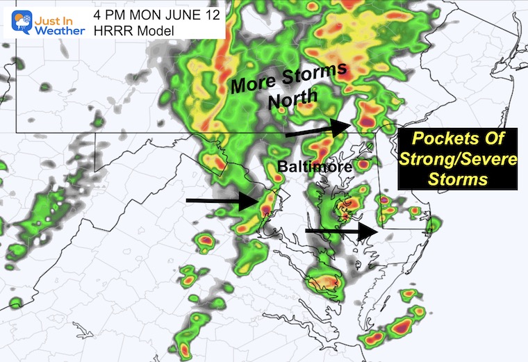
Lighting Tracking is included.
Zoom the map and play the loop. If there is lighting it will display.

I am aware there are some spelling and grammar typos, and occasional other glitches. I take responsibility for my mistakes, and even the computer glitches I may miss. I have made a few public statements over the years, but if you are new here you may have missed it: I have dyslexia, and found out during my second year at Cornell University. It didn’t stop me from getting my meteorology degree, and being first to get the AMS CBM in the Baltimore/Washington region. One of my professors told me that I had made it that far without knowing, and to not let it be a crutch going forward. That was Mark Wysocki and he was absolutely correct! I do miss my mistakes in my own proofreading. The autocorrect spell check on my computer sometimes does an injustice to make it worse. I also can make mistakes in forecasting. No one is perfect predicting the future. All of the maps and information are accurate. The ‘wordy’ stuff can get sticky. There has been no editor that can check my work when I needed it and have it ready to send out in a newsworthy timeline. Barbara Werner is a member of the web team that helps me maintain this site. She has taken it upon herself to edit typos, when she is able. That could be AFTER you read this. I accept this and perhaps proves what you read is really from me… It’s part of my charm.
#FITF