A New Tropical Storm In The Gulf Upgraded To A 70% Chance
Thursday, June 1, 2023
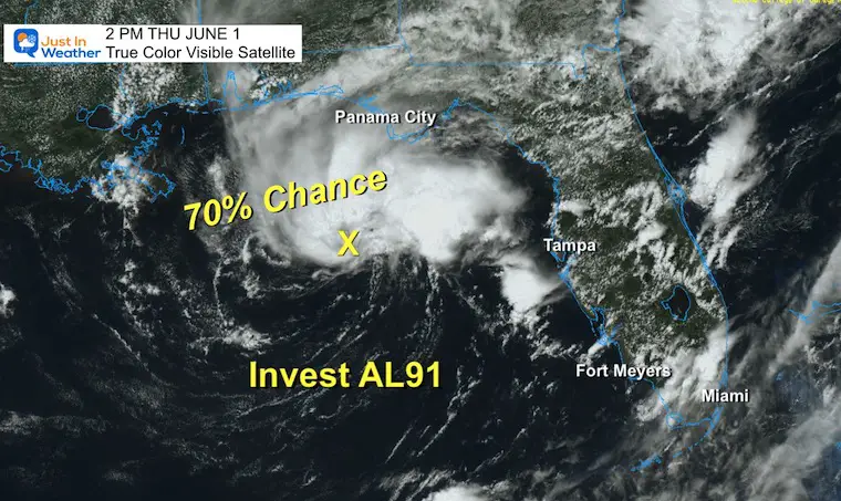
On this first day of Hurricane Season, there is a storm trying to form in the Northeastern Gulf of Mexico. This cyclone has been initially labeled Invest 91L, and an Air Force Reconnaissance flight has recently determined better organization. There is a 70% chance this becomes a Tropical Storm in the next 48 hours. However, it will really need to happen by tomorrow given the outlook.
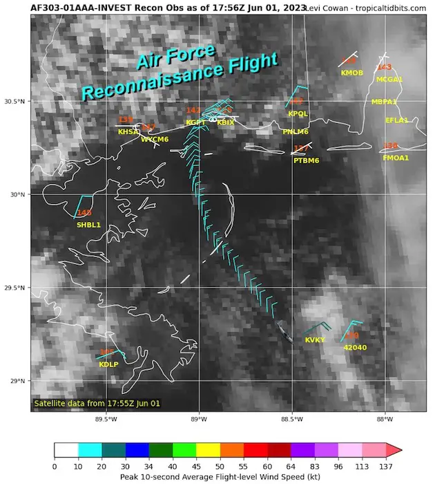
Air Force Reconnaissance Flight
The cross-section along with satellite, buoy, and ship observations, have determined a large but defined circulation with sustained winds of 35 mph. This needs to increase above 39 mph to be classified as a Tropical Storm.
The next Hurricane Hunter flight is scheduled for later this afternoon.
Satellite Loop
12 PM to 2 PM EST
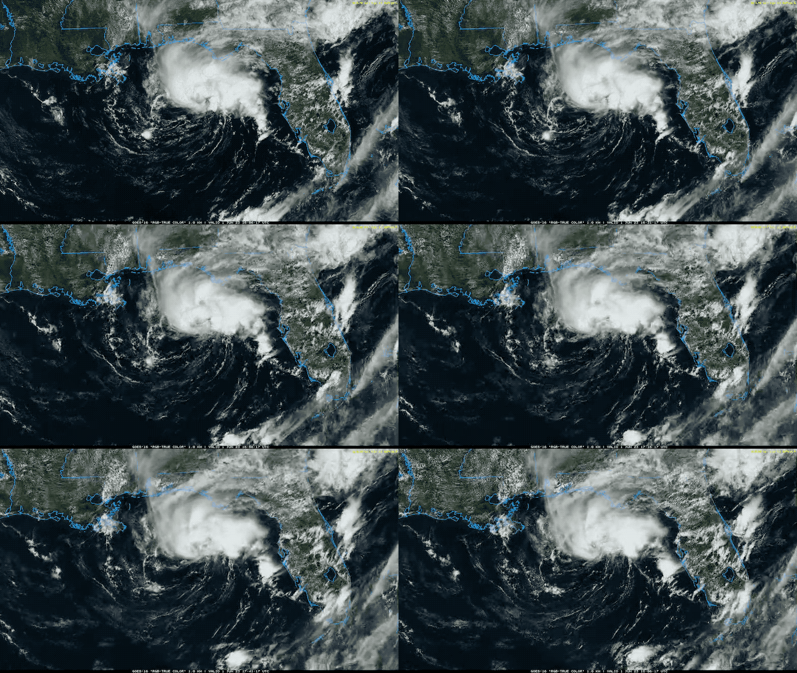
The National Hurricane Center has upgraded this system to having a 70% chance of developing into a Tropical Storm in the next 48 hours. That would be with winds up to 39 mph. If so, it would get named Arlene, the first on the list for this season.
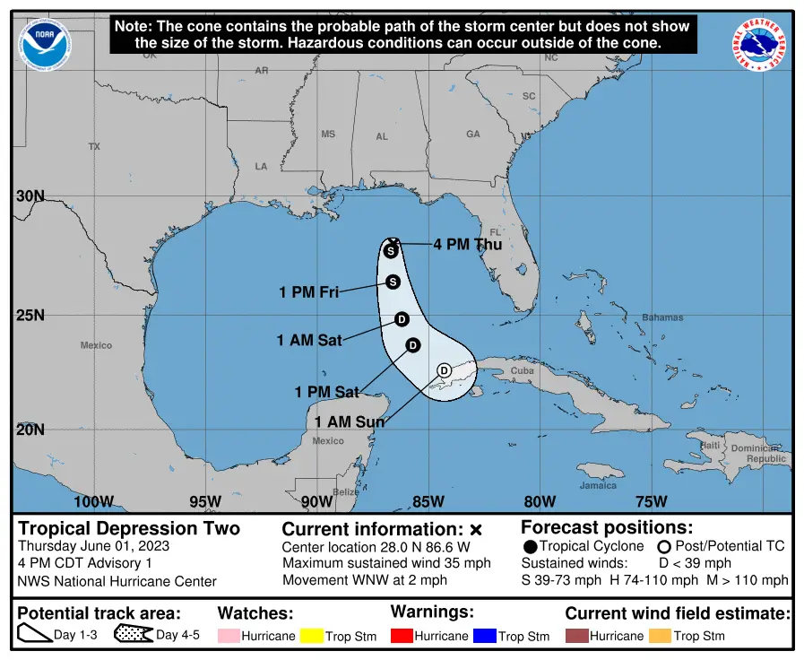
UPDATE FROM 5 PM EDT
The National Hurricane Center has upgraded this to Tropical Depression Two or T.D. 2
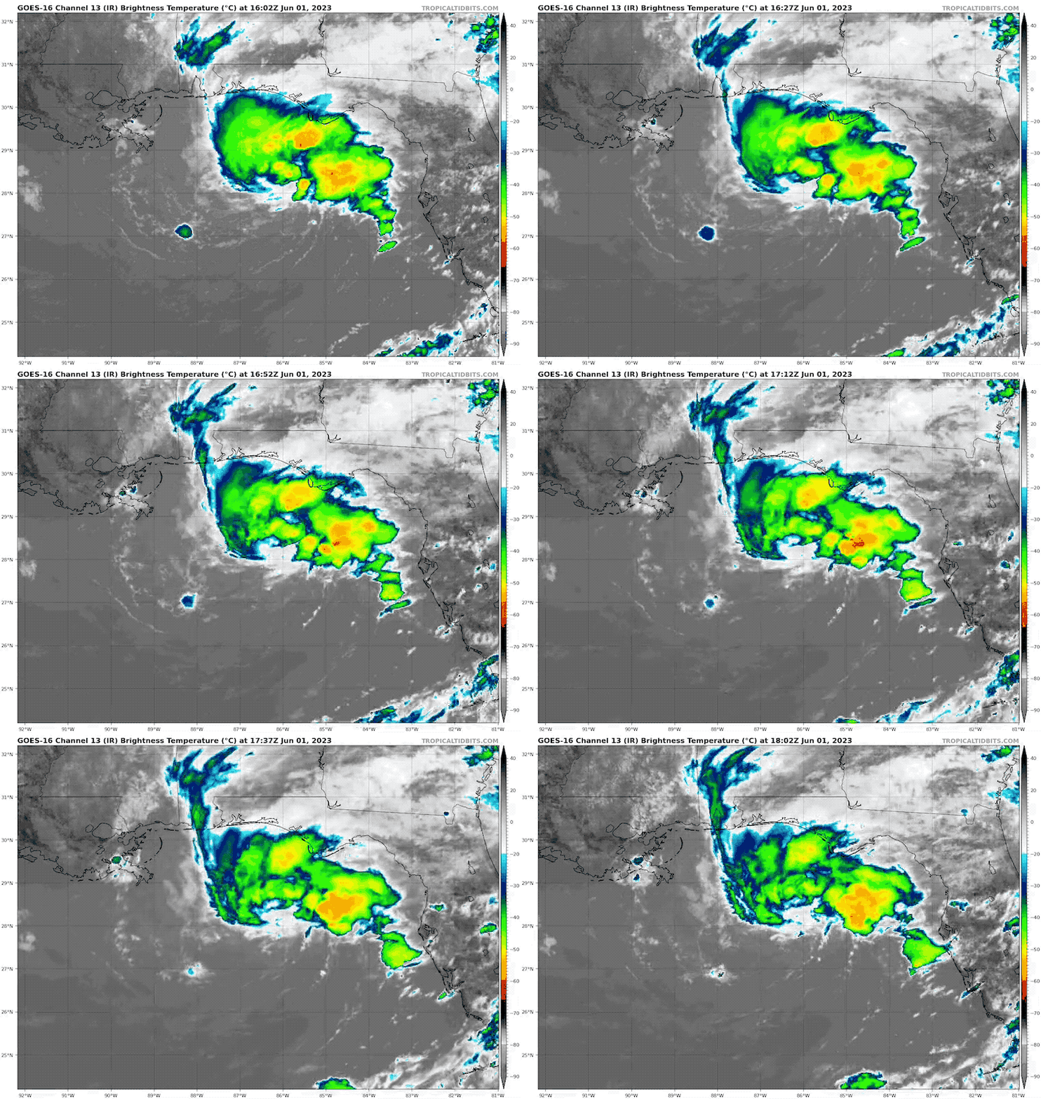
Infrared Satellite Loop
Enhanced cloud tops.
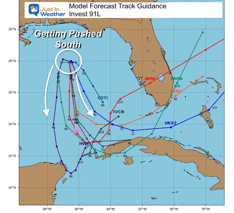
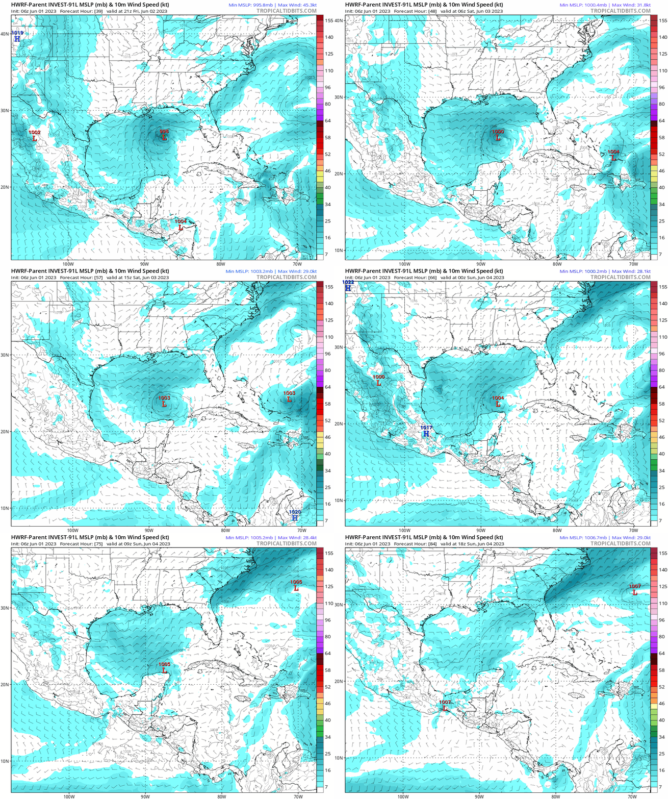
Forecast Model Guidance
The collection of model forecast plots do diverge, but all agree on the push to the south. The importance of this is that there is more wind sheer farther south. So after Friday, the upper level winds will become more hostile and likely tear the storm circulation apart.
Forecast Animation: HWRF Model
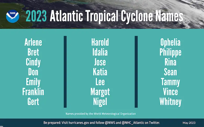
2023 Atlantic Tropical Storm Name List
Names are in alphabetical order.
- Arlene
- Bret
- Cindy
- Don
- Emily
- Franklin
- Gert
- Harold
- Idalia
- Jose
- Katia
- Lee
- Margot
- Nigel
- Ophelia
- Phillipe
- Rina
- Sean
- Tammy
- Vince
- Whitney
Also See:
2023 Atlantic Hurricane Season Forecast
Subscribe for eMail Alerts
Weather posts straight to your inbox
Sign up and be the first to know!
La Niña Has Ended. El Niño May Return By Fall
Aurora Photos From Maryland, Delaware, and Virginia
Please share your thoughts, best weather pics/videos, or just keep in touch via social media
-
Facebook: Justin Berk, Meteorologist
-
Twitter
-
Instagram
RESTATING MY MESSAGE ABOUT DYSLEXIA
I am aware there are some spelling and grammar typos, and occasional other glitches. I take responsibility for my mistakes, and even the computer glitches I may miss. I have made a few public statements over the years, but if you are new here you may have missed it: I have dyslexia, and found out during my second year at Cornell University. It didn’t stop me from getting my meteorology degree, and being first to get the AMS CBM in the Baltimore/Washington region. One of my professors told me that I had made it that far without knowing, and to not let it be a crutch going forward. That was Mark Wysocki and he was absolutely correct! I do miss my mistakes in my own proofreading. The autocorrect spell check on my computer sometimes does an injustice to make it worse. I also can make mistakes in forecasting. No one is perfect predicting the future. All of the maps and information are accurate. The ‘wordy’ stuff can get sticky. There has been no editor that can check my work when I needed it and have it ready to send out in a newsworthy timeline. Barbara Werner is a member of the web team that helps me maintain this site. She has taken it upon herself to edit typos, when she is able. That could be AFTER you read this. I accept this and perhaps proves what you read is really from me… It’s part of my charm.
#FITF


